Home › Canada › British Columbia Canada Find your town in British Columbia Vancouver is the biggest place, with 13% of the people. Its 3 big cities count as 78 neighbourhoods here, each with its own page. Among its places are 18 First Nations reserves. Its leader is Oak Bay, placed #45 of the 2,556 ranked nationally. British Columbia has grown 14.0% since the 2021 census. By the latest estimate, 5.62 million people live in the places of British Columbia that have a page.
250 graded towns
355 places with a page
Richmond largest · 239,584
British Columbia at a glance What British Columbia is like Against towns across Canada, the median ranked town in British Columbia does best on health and walkability and least well on cost of living. Choose a subject to find the towns that lead on it.
The median town, subject by subject The median ranked town in British Columbia against Canadian towns · the line marks the median town in Canada
Health A− ahead of 81% Walkability A− ahead of 81% Schools B ahead of 61% Jobs & income B− ahead of 54% Hazard risk B− ahead of 49% Safety C ahead of 29% Cost of living D− ahead of 4% The finder
Find a town that’s… 172 towns · ordered by province rank
#1 in British Columbia A+ Town · 18,626 people · #45 of 2,556 nationally
Strongest A+ HealthA+ SafetyLowest D− Cost of living
#2 in British Columbia A Large town · 97,845 people · #98 of 2,556 nationally
Strongest A+ HealthA WalkabilityLowest D− Cost of living
#3 in British Columbia A Town · 4,501 people · #103 of 2,556 nationally
Strongest A+ SchoolsA+ SafetyLowest D− Cost of living
#4 in British Columbia A Town · 18,184 people · #151 of 2,556 nationally
Strongest A+ Jobs & incomeA+ HealthLowest D− Cost of living
#5 in British Columbia A Town · 15,884 people · #228 of 2,556 nationally
Strongest A SchoolsA WalkabilityLowest D− Cost of living
#6 in British Columbia A Town · 12,429 people · #230 of 2,556 nationally
Strongest A+ Jobs & incomeA+ HealthLowest D Cost of living
#7 in British Columbia A City · 126,011 people · #253 of 2,556 nationally
Strongest A+ HealthA+ WalkabilityLowest D− Cost of living
#8 in British Columbia A− Town · 12,986 people · #349 of 2,556 nationally
Strongest A+ Jobs & incomeA HealthLowest D Cost of living
#9 in British Columbia A− Town · 6,691 people · #360 of 2,556 nationally
Strongest A SafetyA HealthLowest D Cost of living
#10 in British Columbia A− Town · 4,355 people · #370 of 2,556 nationally
Strongest A+ WalkabilityA Jobs & incomeLowest C− Cost of living
#11 in British Columbia A− Town · 7,086 people · #381 of 2,556 nationally
Strongest A+ WalkabilityA Jobs & incomeLowest C Hazard risk
#12 in British Columbia A− Large town · 28,578 people · #395 of 2,556 nationally
Strongest A+ HealthA+ SchoolsLowest D− Cost of living
#13 in British Columbia A− Town · 2,508 people · #403 of 2,556 nationally
Strongest A HealthA SafetyLowest C− Cost of living
#14 in British Columbia A− Town · 11,380 people · #424 of 2,556 nationally
Strongest A Jobs & incomeA SchoolsLowest D− Hazard risk
#15 in British Columbia A− Town · 4,433 people · #483 of 2,556 nationally
Strongest A+ WalkabilityA Jobs & incomeLowest C− Hazard risk
#16 in British Columbia A− Large town · 38,285 people · #491 of 2,556 nationally
Strongest A WalkabilityA HealthLowest D− Cost of living
#17 in British Columbia A− Town · 4,209 people · #509 of 2,556 nationally
Strongest A+ SchoolsA SafetyLowest D Cost of living
#18 in British Columbia B+ Town · 9,037 people · #609 of 2,556 nationally
Strongest A SchoolsA− WalkabilityLowest C− Cost of living
#19 in British Columbia B+ Town · 19,512 people · #614 of 2,556 nationally
Strongest A+ WalkabilityA+ HealthLowest D− Cost of living
#20 in British Columbia B+ Town · 15,090 people · #619 of 2,556 nationally
Strongest A+ SchoolsA HealthLowest D− Cost of living
#21 in British Columbia B+ Large town · 47,929 people · #667 of 2,556 nationally
Strongest A+ HealthA WalkabilityLowest D− Cost of living
#22 in British Columbia B+ Town · 3,030 people · #698 of 2,556 nationally
Strongest A− Cost of livingB+ SafetyLowest C Schools
#23 in British Columbia B+ Town · 4,309 people · #702 of 2,556 nationally
Strongest A+ SchoolsA SafetyLowest D Cost of living
#24 in British Columbia B+ Town · 4,486 people · #704 of 2,556 nationally
Strongest A Jobs & incomeA− Cost of livingLowest C Hazard risk
#25 in British Columbia B+ Large town · 66,624 people · #760 of 2,556 nationally
Strongest A+ HealthA+ WalkabilityLowest D− Cost of living
#26 in British Columbia B+ Town · 13,445 people · #764 of 2,556 nationally
Strongest A+ WalkabilityA HealthLowest D− Cost of living
#28 in British Columbia B+ Town · 12,795 people · #806 of 2,556 nationally
Strongest A+ HealthA Jobs & incomeLowest D− Cost of living
#33 in British Columbia B Large town · 20,892 people · #886 of 2,556 nationally
Strongest A HealthA WalkabilityLowest D− Cost of living
#34 in British Columbia B Town · 5,029 people · #897 of 2,556 nationally
Strongest A Jobs & incomeA− SchoolsLowest C− Cost of living
#35 in British Columbia B Large town · 67,724 people · #925 of 2,556 nationally
Strongest A WalkabilityA HealthLowest D− Cost of living
#36 in British Columbia B Town · 12,126 people · #933 of 2,556 nationally
Strongest A+ WalkabilityA SchoolsLowest D− Cost of living
#37 in British Columbia B Town · 3,779 people · #936 of 2,556 nationally
Strongest A+ HealthA Jobs & incomeLowest D− Cost of living
#38 in British Columbia B Town · 3,570 people · #953 of 2,556 nationally
Strongest A− SchoolsA− HealthLowest C− Cost of living
#40 in British Columbia B Town · 4,144 people · #973 of 2,556 nationally
Strongest A+ Cost of livingA Jobs & incomeLowest D Safety
#42 in British Columbia B Town · 4,308 people · #994 of 2,556 nationally
Strongest A+ WalkabilityA HealthLowest D Cost of living
#43 in British Columbia B Large town · 22,794 people · #997 of 2,556 nationally
Strongest A+ HealthA Jobs & incomeLowest D− Cost of living
#45 in British Columbia B Town · 9,464 people · #1,002 of 2,556 nationally
Strongest A+ Jobs & incomeA WalkabilityLowest D Cost of living
#46 in British Columbia B Town · 3,620 people · #1,005 of 2,556 nationally
Strongest A+ WalkabilityA Jobs & incomeLowest D− Cost of living
#47 in British Columbia B Town · 4,305 people · #1,007 of 2,556 nationally
Strongest A+ Jobs & incomeA+ WalkabilityLowest D Cost of living
#50 in British Columbia B Town · 12,343 people · #1,027 of 2,556 nationally
Strongest A− SchoolsA− WalkabilityLowest D− Hazard risk
#51 in British Columbia B Town · 7,830 people · #1,037 of 2,556 nationally
Strongest A− HealthB+ Jobs & incomeLowest D Cost of living
#52 in British Columbia B City · 124,670 people · #1,041 of 2,556 nationally
Strongest A+ WalkabilityA HealthLowest D− Cost of living
#53 in British Columbia B Town · 5,207 people · #1,060 of 2,556 nationally
Strongest A HealthA− SafetyLowest D− Cost of living
#55 in British Columbia B Town · 5,074 people · #1,070 of 2,556 nationally
Strongest A+ SchoolsB+ Jobs & incomeLowest D− Cost of living
#57 in British Columbia B Town · 5,243 people · #1,082 of 2,556 nationally
Strongest A SafetyB+ SchoolsLowest C− Cost of living
#61 in British Columbia B Town · 9,640 people · #1,097 of 2,556 nationally
Strongest A SchoolsA− WalkabilityLowest D− Cost of living
#62 in British Columbia B Town · 8,412 people · #1,103 of 2,556 nationally
Strongest A− SchoolsA− SafetyLowest D Cost of living
#64 in British Columbia B Town · 9,903 people · #1,135 of 2,556 nationally
Strongest A+ SchoolsB+ SafetyLowest D Cost of living
#70 in British Columbia B− Large town · 25,057 people · #1,170 of 2,556 nationally
Strongest A+ WalkabilityA HealthLowest D− Cost of living
#76 in British Columbia B− Town · 4,276 people · #1,207 of 2,556 nationally
Strongest A Jobs & incomeA− SchoolsLowest D− Cost of living
#78 in British Columbia B− Town · 5,156 people · #1,218 of 2,556 nationally
Strongest A SchoolsB+ SafetyLowest D Cost of living
#79 in British Columbia B− Town · 5,390 people · #1,226 of 2,556 nationally
Strongest A SafetyA SchoolsLowest D− Jobs & income
#82 in British Columbia B− City · 173,599 people · #1,240 of 2,556 nationally
Strongest A+ WalkabilityA HealthLowest D− Cost of living
#83 in British Columbia B− Town · 5,829 people · #1,260 of 2,556 nationally
Strongest A+ Jobs & incomeA Hazard riskLowest D Health
#86 in British Columbia B− Town · 4,974 people · #1,304 of 2,556 nationally
Strongest A Jobs & incomeA− WalkabilityLowest D Cost of living
#87 in British Columbia B− Town · 11,558 people · #1,315 of 2,556 nationally
Strongest A+ HealthA− Jobs & incomeLowest D− Cost of living
#88 in British Columbia B− Large town · 59,664 people · #1,318 of 2,556 nationally
Strongest A+ HealthA Jobs & incomeLowest D− Cost of living
#89 in British Columbia B− Town · 3,893 people · #1,338 of 2,556 nationally
Strongest A Jobs & incomeB WalkabilityLowest C− Hazard risk
#90 in British Columbia B− Town · 5,090 people · #1,345 of 2,556 nationally
Strongest A+ WalkabilityA+ HealthLowest D− Cost of living
#94 in British Columbia B− Town · 3,672 people · #1,385 of 2,556 nationally
Strongest A− SchoolsB+ Jobs & incomeLowest C− Cost of living
#95 in British Columbia B− Town · 3,415 people · #1,392 of 2,556 nationally
Strongest A− SchoolsA− Jobs & incomeLowest D− Hazard risk
#96 in British Columbia B− Town · 4,279 people · #1,393 of 2,556 nationally
Strongest A+ HealthA− Jobs & incomeLowest D− Cost of living
#97 in British Columbia B− Town · 8,415 people · #1,398 of 2,556 nationally
Strongest B+ SafetyB+ HealthLowest D− Cost of living
#101 in British Columbia B− Town · 5,627 people · #1,419 of 2,556 nationally
Strongest A+ Jobs & incomeA+ WalkabilityLowest D Safety
#106 in British Columbia B− Town · 3,069 people · #1,458 of 2,556 nationally
Strongest B+ Jobs & incomeB+ SafetyLowest C− Cost of living
#109 in British Columbia B− City · 103,888 people · #1,507 of 2,556 nationally
Strongest A+ WalkabilityA+ HealthLowest D− Cost of living
#110 in British Columbia C+ City · 163,885 people · #1,519 of 2,556 nationally
Strongest A HealthA− WalkabilityLowest D− Cost of living
#112 in British Columbia C+ Large town · 92,124 people · #1,530 of 2,556 nationally
Strongest A+ WalkabilityA HealthLowest D− Cost of living
#114 in British Columbia C+ Town · 7,006 people · #1,540 of 2,556 nationally
Strongest A− Jobs & incomeB HealthLowest D Walkability
#115 in British Columbia C+ Town · 5,843 people · #1,541 of 2,556 nationally
Strongest B+ Jobs & incomeB+ SafetyLowest D Cost of living
#117 in British Columbia C+ Large town · 32,869 people · #1,546 of 2,556 nationally
Strongest A WalkabilityA− SchoolsLowest D− Cost of living
#119 in British Columbia C+ Town · 3,130 people · #1,567 of 2,556 nationally
Strongest A+ HealthB+ SchoolsLowest D− Cost of living
#120 in British Columbia C+ Town · 8,810 people · #1,569 of 2,556 nationally
Strongest A− SchoolsA− SafetyLowest D Cost of living
#122 in British Columbia C+ Town · 5,643 people · #1,594 of 2,556 nationally
Strongest A− Jobs & incomeB+ WalkabilityLowest D Cost of living
#125 in British Columbia C+ Town · 3,915 people · #1,646 of 2,556 nationally
Strongest A− SafetyB HealthLowest C− Cost of living
#126 in British Columbia C+ Town · 4,545 people · #1,651 of 2,556 nationally
Strongest A Jobs & incomeB+ Cost of livingLowest D Safety
#129 in British Columbia C+ Large town · 24,383 people · #1,673 of 2,556 nationally
Strongest A+ Jobs & incomeA− WalkabilityLowest D Safety
#130 in British Columbia C+ Town · 2,691 people · #1,675 of 2,556 nationally
Strongest A+ HealthB+ WalkabilityLowest D− Cost of living
#132 in British Columbia C+ Town · 5,262 people · #1,693 of 2,556 nationally
Strongest A WalkabilityA− SchoolsLowest D− Hazard risk
#133 in British Columbia C+ Town · 2,737 people · #1,721 of 2,556 nationally
Strongest A− Cost of livingB+ Jobs & incomeLowest D Safety
#134 in British Columbia C+ Town · 5,439 people · #1,724 of 2,556 nationally
Strongest A− HealthB+ SchoolsLowest D− Cost of living
#137 in British Columbia C+ Town · 17,637 people · #1,755 of 2,556 nationally
Strongest A− Jobs & incomeB+ SchoolsLowest D− Hazard risk
#138 in British Columbia C+ Town · 3,811 people · #1,758 of 2,556 nationally
Strongest B+ Jobs & incomeB Hazard riskLowest D− Walkability
#139 in British Columbia C Town · 7,125 people · #1,767 of 2,556 nationally
Strongest A− SafetyB SchoolsLowest D− Cost of living
#140 in British Columbia C Town · 3,189 people · #1,770 of 2,556 nationally
Strongest A Jobs & incomeA− Hazard riskLowest D− Health
#141 in British Columbia C Town · 15,371 people · #1,795 of 2,556 nationally
Strongest A WalkabilityA SchoolsLowest D− Cost of living
#142 in British Columbia C Town · 4,002 people · #1,800 of 2,556 nationally
Strongest A− SchoolsB Jobs & incomeLowest D− Hazard risk
#143 in British Columbia C Town · 4,153 people · #1,805 of 2,556 nationally
Strongest A− Hazard riskA− Jobs & incomeLowest D Health
#144 in British Columbia C Town · 7,093 people · #1,815 of 2,556 nationally
Strongest A− WalkabilityA− SchoolsLowest D Cost of living
#148 in British Columbia C City · 105,925 people · #1,836 of 2,556 nationally
Strongest A HealthA− WalkabilityLowest D− Cost of living
#153 in British Columbia C Town · 6,302 people · #1,867 of 2,556 nationally
Strongest A− SafetyB WalkabilityLowest D− Cost of living
#154 in British Columbia C Large town · 22,703 people · #1,872 of 2,556 nationally
Strongest A− Jobs & incomeA− WalkabilityLowest D Safety
#156 in British Columbia C City · 239,584 people · #1,877 of 2,556 nationally
Strongest A+ WalkabilityA HealthLowest D− Cost of living
#159 in British Columbia C Town · 6,344 people · #1,917 of 2,556 nationally
Strongest A Jobs & incomeB+ Hazard riskLowest D Walkability
#160 in British Columbia C Large town · 39,068 people · #1,919 of 2,556 nationally
Strongest A+ WalkabilityA− SchoolsLowest D− Cost of living
#161 in British Columbia C Town · 3,114 people · #1,922 of 2,556 nationally
Strongest A Hazard riskA− Cost of livingLowest D− Health
#162 in British Columbia C Town · 2,773 people · #1,927 of 2,556 nationally
Strongest A+ SchoolsB− HealthLowest D− Cost of living
#163 in British Columbia C Town · 13,635 people · #1,932 of 2,556 nationally
Strongest A− WalkabilityA− Jobs & incomeLowest D Safety
#165 in British Columbia C Town · 14,947 people · #1,951 of 2,556 nationally
Strongest A+ HealthA− WalkabilityLowest D Cost of living
#167 in British Columbia C Large town · 49,527 people · #1,966 of 2,556 nationally
Strongest A− WalkabilityA− SchoolsLowest D− Hazard risk
#169 in British Columbia C Town · 5,976 people · #1,985 of 2,556 nationally
Strongest A+ WalkabilityB+ HealthLowest D Cost of living
#170 in British Columbia C Town · 12,903 people · #2,001 of 2,556 nationally
Strongest A+ Jobs & incomeA WalkabilityLowest D Safety
#172 in British Columbia C Town · 3,442 people · #2,009 of 2,556 nationally
Strongest A Jobs & incomeA− WalkabilityLowest D Schools
#173 in British Columbia C Town · 5,100 people · #2,016 of 2,556 nationally
Strongest B+ Jobs & incomeB+ Hazard riskLowest D Walkability
#174 in British Columbia C City · 108,793 people · #2,020 of 2,556 nationally
Strongest A WalkabilityA− Hazard riskLowest D Cost of living
#175 in British Columbia C− Town · 2,753 people · #2,035 of 2,556 nationally
Strongest A HealthA Jobs & incomeLowest D Cost of living
#180 in British Columbia C− Town · 3,292 people · #2,066 of 2,556 nationally
Strongest A WalkabilityB HealthLowest D Cost of living
#181 in British Columbia C− Town · 13,648 people · #2,078 of 2,556 nationally
Strongest A+ Jobs & incomeA− WalkabilityLowest D Safety
#183 in British Columbia C− Large town · 20,891 people · #2,083 of 2,556 nationally
Strongest A Hazard riskA− Jobs & incomeLowest D Cost of living
#184 in British Columbia C− Large town · 40,274 people · #2,092 of 2,556 nationally
Strongest A Jobs & incomeB HealthLowest D− Hazard risk
#185 in British Columbia C− Town · 2,663 people · #2,102 of 2,556 nationally
Strongest A Cost of livingA WalkabilityLowest D− Schools
#187 in British Columbia C− Town · 3,057 people · #2,109 of 2,556 nationally
Strongest A Jobs & incomeB+ SafetyLowest D− Hazard risk
#189 in British Columbia C− Large town · 35,444 people · #2,127 of 2,556 nationally
Strongest A WalkabilityA HealthLowest D− Cost of living
#191 in British Columbia C− Town · 10,019 people · #2,139 of 2,556 nationally
Strongest A Jobs & incomeB+ WalkabilityLowest C− Health
#194 in British Columbia C− City · 175,358 people · #2,162 of 2,556 nationally
Strongest A− WalkabilityB Jobs & incomeLowest D Cost of living
#195 in British Columbia C− Town · 4,242 people · #2,178 of 2,556 nationally
Strongest A− Jobs & incomeB+ SafetyLowest D− Hazard risk
#196 in British Columbia C− City · 167,654 people · #2,183 of 2,556 nationally
Strongest A WalkabilityA Jobs & incomeLowest D− Cost of living
#197 in British Columbia C− Town · 3,256 people · #2,184 of 2,556 nationally
Strongest A HealthB WalkabilityLowest D− Cost of living
#198 in British Columbia C− City · 105,520 people · #2,198 of 2,556 nationally
Strongest B+ WalkabilityB SchoolsLowest D Cost of living
#200 in British Columbia C− Town · 5,724 people · #2,227 of 2,556 nationally
Strongest A WalkabilityB SchoolsLowest D− Hazard risk
#201 in British Columbia C− Town · 3,733 people · #2,245 of 2,556 nationally
Strongest B Jobs & incomeB− SafetyLowest D Cost of living
#203 in British Columbia C− Town · 4,784 people · #2,255 of 2,556 nationally
Strongest A− Jobs & incomeB+ SchoolsLowest D− Cost of living
#204 in British Columbia C− Town · 4,802 people · #2,280 of 2,556 nationally
Strongest A− Jobs & incomeB Hazard riskLowest D Schools
#205 in British Columbia C− Town · 17,248 people · #2,281 of 2,556 nationally
Strongest A− HealthB+ WalkabilityLowest D− Cost of living
#206 in British Columbia C− Town · 2,772 people · #2,293 of 2,556 nationally
Strongest A Jobs & incomeA WalkabilityLowest D− Cost of living
#207 in British Columbia C− Town · 3,764 people · #2,303 of 2,556 nationally
Strongest B Hazard riskB− Cost of livingLowest D Health
#210 in British Columbia D Large town · 38,300 people · #2,328 of 2,556 nationally
Strongest A− HealthA− WalkabilityLowest D− Cost of living
#215 in British Columbia D Town · 9,926 people · #2,345 of 2,556 nationally
Strongest A− WalkabilityB HealthLowest D Cost of living
#216 in British Columbia D Town · 3,713 people · #2,359 of 2,556 nationally
Strongest A− Jobs & incomeB− WalkabilityLowest D Cost of living
#217 in British Columbia D Town · 6,172 people · #2,365 of 2,556 nationally
Strongest B+ Hazard riskB− Jobs & incomeLowest D Schools
#219 in British Columbia D City · 111,845 people · #2,373 of 2,556 nationally
Strongest A WalkabilityB Jobs & incomeLowest D− Cost of living
#220 in British Columbia D Large town · 34,525 people · #2,393 of 2,556 nationally
Strongest B+ WalkabilityB Jobs & incomeLowest D− Cost of living
#222 in British Columbia D Town · 3,050 people · #2,404 of 2,556 nationally
Strongest A WalkabilityB+ HealthLowest D Cost of living
#223 in British Columbia D Town · 2,500 people · #2,422 of 2,556 nationally
Strongest A Hazard riskB+ WalkabilityLowest D Schools
#224 in British Columbia D Town · 4,482 people · #2,430 of 2,556 nationally
Strongest B+ Jobs & incomeB− HealthLowest D Cost of living
#225 in British Columbia D Large town · 85,944 people · #2,437 of 2,556 nationally
Strongest A− Jobs & incomeB+ WalkabilityLowest D Safety
#228 in British Columbia D Town · 9,984 people · #2,458 of 2,556 nationally
Strongest A− SafetyC+ WalkabilityLowest D− Hazard risk
#229 in British Columbia D Town · 5,016 people · #2,471 of 2,556 nationally
Strongest A− Hazard riskB+ SafetyLowest D Walkability
#230 in British Columbia D Town · 2,597 people · #2,479 of 2,556 nationally
Strongest B− WalkabilityB− HealthLowest D− Cost of living
#232 in British Columbia D Large town · 47,280 people · #2,487 of 2,556 nationally
Strongest B+ WalkabilityB HealthLowest D Cost of living
#233 in British Columbia D Town · 4,829 people · #2,490 of 2,556 nationally
Strongest A− SafetyC+ WalkabilityLowest D− Hazard risk
#234 in British Columbia D Town · 3,361 people · #2,491 of 2,556 nationally
Strongest B HealthB WalkabilityLowest D Jobs & income
#235 in British Columbia D− Town · 4,702 people · #2,503 of 2,556 nationally
Strongest B WalkabilityB− SafetyLowest D− Cost of living
#236 in British Columbia D− Town · 11,462 people · #2,510 of 2,556 nationally
Strongest A− WalkabilityB+ Jobs & incomeLowest D− Hazard risk
#237 in British Columbia D− Town · 3,543 people · #2,516 of 2,556 nationally
Strongest C+ WalkabilityC+ Jobs & incomeLowest D− Hazard risk
#238 in British Columbia D− Town · 7,825 people · #2,518 of 2,556 nationally
Strongest B Jobs & incomeB− Hazard riskLowest D− Cost of living
#241 in British Columbia D− Town · 3,643 people · #2,531 of 2,556 nationally
Strongest B Hazard riskC+ Cost of livingLowest D Health
#242 in British Columbia D− Town · 3,757 people · #2,532 of 2,556 nationally
Strongest A WalkabilityB− Hazard riskLowest D Jobs & income
#243 in British Columbia D− Town · 2,854 people · #2,533 of 2,556 nationally
Strongest A Hazard riskA− WalkabilityLowest D Safety
#244 in British Columbia D− Town · 4,540 people · #2,538 of 2,556 nationally
Strongest B− SchoolsC+ Jobs & incomeLowest D− Hazard risk
#245 in British Columbia D− Town · 5,745 people · #2,539 of 2,556 nationally
Strongest A+ WalkabilityB HealthLowest D− Cost of living
#245 in British Columbia D− Town · 7,190 people · #2,539 of 2,556 nationally
Strongest A WalkabilityB Hazard riskLowest D− Schools
#247 in British Columbia D− Town · 10,253 people · #2,544 of 2,556 nationally
Strongest B+ WalkabilityB+ Hazard riskLowest D Safety
#248 in British Columbia D− Town · 7,183 people · #2,547 of 2,556 nationally
Strongest A− WalkabilityB+ Hazard riskLowest D− Schools
#249 in British Columbia D− Town · 2,591 people · #2,549 of 2,556 nationally
Strongest A+ WalkabilityC SafetyLowest D− Hazard risk
#250 in British Columbia D− Town · 3,475 people · #2,551 of 2,556 nationally
Strongest C+ WalkabilityC SafetyLowest D− Hazard risk
Show all 172 towns Richmond Abbotsford Coquitlam Kelowna Langley Saanich Delta Nanaimo Kamloops Maple Ridge Chilliwack Victoria North Vancouver New Westminster Prince George Port Coquitlam North Vancouver Langford Vernon West Vancouver Mission West Kelowna Penticton Campbell River Port Moody Langley North Cowichan Courtenay Squamish White Rock Fort St. John Colwood Cranbrook Pitt Meadows Salmon Arm Port Alberni Esquimalt Oak Bay Central Saanich Lake Country Sooke Comox Parksville Whistler Powell River Terrace Dawson Creek Sidney North Saanich Prince Rupert View Royal Saltspring Island Summerland Nelson Sechelt Williams Lake Coldstream Quesnel Kitimat Blind Bay Ladysmith Shawnigan Electoral Area C (Puntledge - Black Creek), Comox Valley Qualicum Beach Castlegar Revelstoke Kimberley Electoral Area F, Nanaimo Trail Electoral Area A, Comox Valley Electoral Area G, Nanaimo Electoral Area B (Lazo North), Comox Valley Electoral Area A, Nanaimo Merritt Hope Fairwinds Kent Fernie Electoral Area C, East Kootenay Southern Gulf Islands Electoral Area C, Peace River Peachland Electoral Area A, Cariboo Creston Spallumcheen Electoral Area A, Bulkley-Nechako Electoral Area B, Peace River Duncan Osoyoos Armstrong Smithers Juan de Fuca (Part 1) Electoral Area H, Central Kootenay Oliver Electoral Area B, Central Kootenay Metchosin Electoral Area A, Cowichan Valley Electoral Area D, Peace River Gibsons Cobble Hill Electoral Area C, North Okanagan Electoral Area F, Cariboo Cumberland Electoral Area F, North Okanagan Electoral Area D, Columbia-Shuswap Electoral Area H, Nanaimo Electoral Area D, Fraser-Fort George Central Okanagan Electoral Area B, Nanaimo Electoral Area D (Oyster Bay - Buttle Lake), Strathcona Vanderhoof Electoral Area P (Rivers and the Peaks), Thompson-Nicola Bowen Island Sparwood Electoral Area E, Cowichan Valley Golden Rossland Electoral Area E, Central Kootenay Grand Forks Invermere Electoral Area E, Sunshine Coast Lantzville Electoral Area E, Cariboo Electoral Area F, Central Kootenay Port Hardy Electoral Area B, Cariboo Electoral Area E, Kitimat-Stikine Fort Nelson Electoral Area C, Okanagan-Similkameen Okanagan Falls Electoral Area J, Central Kootenay Electoral Area F, East Kootenay Electoral Area C, Fraser-Fort George Roberts Creek Electoral Area A, Fraser-Fort George Lake Cowichan Electoral Area C, Nanaimo Cowichan Bay Electoral Area A, Columbia-Shuswap Electoral Area F, Bulkley-Nechako Pemberton Electoral Area D (Rural Grand Forks), Kootenay Boundary Electoral Area L (Grasslands), Thompson-Nicola Electoral Area F, Columbia-Shuswap Mackenzie Electoral Area B, North Okanagan Electoral Area E (West Boundary), Kootenay Boundary Central Okanagan West Enderby Electoral Area A, Sunshine Coast Electoral Area C (Part 1), Kitimat-Stikine Electoral Area D, North Okanagan Welcome Beach Houston Electoral Area E, Alberni-Clayoquot Electoral Area D, Cariboo Princeton Elkford Electoral Area C, Strathcona Sicamous Cultus Lake Tofino Electoral Area H, Cowichan Valley Electoral Area I, Central Kootenay Highlands Electoral Area E, Peace River Electoral Area F, Sunshine Coast Tumbler Ridge Electoral Area G, Cowichan Valley Chase Anmore Clearwater
© OpenStreetMap contributors Dots: each town’s overall grade, sized by population. Labels: the top five.
Cities by neighbourhood The 3 cities in British Columbia graded by neighbourhood Their 78 ranked neighbourhoods are in the province’s ranks and lists; each city’s own page has every one of them, with its grades, a map and a finder.
Rankings British Columbia’s lists Bowen Island is first on 3 of the 26 lists that rank the places in British Columbia.
Every British Columbia list 26 lists Best places to live 250 places · #1 Oak Bay Best big towns 21 places · #1 North Vancouver Best small towns 137 places · #1 Bowen Island Most affordable 253 places · #1 Fort Nelson Safest 251 places · #1 Bowen Island Best schools 253 places · #1 Bowen Island Healthiest 254 places · #1 North Vancouver Jobs & income 254 places · #1 North Saanich Most walkable 254 places · #1 Fairview Lowest hazard risk 254 places · #1 Sicamous Civic life 254 places · #1 Victoria Highest incomes 254 places · #1 Anmore Described, no letters Fastest-growing 158 places · #1 Pemberton Described, no letters Most historic 254 places · #1 Electoral Area A, Columbia-Shuswap Described, no letters Most bilingual 254 places · #1 Pemberton Described, no letters Youngest 254 places · #1 Electoral Area B, Peace River Described, no letters Oldest 254 places · #1 Qualicum Beach Described, no letters Mildest winters 254 places · #1 Tofino Described, no letters Coldest winters 254 places · #1 Fort Nelson Described, no letters Warmest summers 254 places · #1 Oliver Described, no letters Coolest summers 254 places · #1 Prince Rupert Described, no letters Fewest frosts 254 places · #1 Oak Bay Described, no letters Least snow 251 places · #1 Tofino Described, no letters Snowiest 251 places · #1 Clearwater Described, no letters Driest 254 places · #1 Kamloops Described, no letters Wettest 254 places · #1 Tofino Described, no letters No overall grade Towns without an overall grade Each has its page and the subject grades it has; the reason it has no overall grade is beside it.
Electoral Area A, Metro Vancouver 22,031 people · a campus neighbourhood (graded, not ranked). Graded on its page: Safety A+, Cost of living D−, Schools A+, Health A+, Jobs & income D−, Walkability A+, Hazard risk B− Tsinstikeptum 9 10,514 people · a First Nations reserve: subject grades, never an overall grade or a rank. Graded on its page: Schools B+, Health B, Jobs & income C, Walkability B+, Hazard risk D− Mile 108 Recreational Ranch 5,887 people · No Safety Grade. Graded on its page: Cost of living D, Schools D, Health C, Jobs & income C−, Walkability D, Hazard risk D− Electoral Area L, Cariboo 5,358 people · No Safety Grade. Graded on its page: Cost of living D, Schools C−, Health C, Jobs & income D−, Walkability D, Hazard risk D− Tzeachten 13 4,899 people · a First Nations reserve: subject grades, never an overall grade or a rank. Graded on its page: Schools A−, Health B, Jobs & income C−, Walkability A+, Hazard risk C+ Kamloops 1 4,362 people · a First Nations reserve: subject grades, never an overall grade or a rank. Graded on its page: Safety C, Schools B, Health C+, Jobs & income B+, Walkability C, Hazard risk D Okanagan (Part) 1 3,482 people · a First Nations reserve: subject grades, never an overall grade or a rank. Graded on its page: Schools B+, Health B, Jobs & income D, Walkability C−, Hazard risk D− Capilano 5 3,376 people · a First Nations reserve: subject grades, never an overall grade or a rank. Graded on its page: Schools A, Health A+, Jobs & income D−, Walkability A+, Hazard risk C+ Burrard Inlet 3 2,820 people · a First Nations reserve: subject grades, never an overall grade or a rank. Graded on its page: Schools A+, Health A+, Jobs & income A−, Walkability B−, Hazard risk C+ Electoral Area A, Central Kootenay 2,668 people · No Schools Grade. Graded on its page: Safety A, Cost of living D, Health B−, Jobs & income C−, Walkability C−, Hazard risk B− Tsawwassen 2,629 people · No Cost of living Grade; no Safety Grade. Graded on its page: Schools A, Health A, Jobs & income B−, Walkability A−, Hazard risk B Cowichan 2,509 people · a First Nations reserve: subject grades, never an overall grade or a rank. Graded on its page: Schools C+, Health B−, Jobs & income C, Walkability C+, Hazard risk B− Chetwynd 2,484 people · under 2,500 residents: subject grades, no overall grade. Graded on its page: Safety D, Cost of living A−, Schools B+, Health C, Jobs & income A−, Walkability A−, Hazard risk B Ucluelet 2,452 people · under 2,500 residents: subject grades, no overall grade. Graded on its page: Safety C−, Cost of living D−, Schools B+, Health C, Jobs & income A, Walkability A+, Hazard risk B− Electoral Area A, Okanagan-Similkameen 2,429 people · under 2,500 residents: subject grades, no overall grade. Graded on its page: Safety C−, Cost of living C−, Schools B, Health B−, Jobs & income A−, Walkability B, Hazard risk D− Electoral Area C, qathet 2,409 people · under 2,500 residents: subject grades, no overall grade. Graded on its page: Safety B−, Cost of living D, Schools C−, Health A+, Jobs & income D, Walkability C+, Hazard risk C+ Port McNeill 2,402 people · under 2,500 residents: subject grades, no overall grade. Graded on its page: Safety C−, Cost of living B−, Schools B, Health A−, Jobs & income A−, Walkability A, Hazard risk B− Electoral Area G, Okanagan-Similkameen 2,402 people · under 2,500 residents: subject grades, no overall grade. Graded on its page: Safety C−, Cost of living D, Schools B−, Health B, Jobs & income D−, Walkability B−, Hazard risk D− Rosedale 2,401 people · under 2,500 residents: subject grades, no overall grade. Graded on its page: Safety D, Cost of living C−, Schools A+, Health B−, Jobs & income B, Walkability C, Hazard risk B Electoral Area H, Okanagan-Similkameen 2,372 people · under 2,500 residents: subject grades, no overall grade. Graded on its page: Safety C−, Cost of living D, Schools C, Health B−, Jobs & income D, Walkability D, Hazard risk C− Electoral Area I, Okanagan-Similkameen 2,372 people · under 2,500 residents: subject grades, no overall grade. Graded on its page: Safety C+, Cost of living D, Schools B, Health B, Jobs & income B, Walkability C+, Hazard risk D− Logan Lake 2,337 people · under 2,500 residents: subject grades, no overall grade. Graded on its page: Safety C, Cost of living D, Schools C+, Health C−, Jobs & income D, Walkability A−, Hazard risk D− Lumby 2,257 people · under 2,500 residents: subject grades, no overall grade. Graded on its page: Safety B+, Cost of living C, Schools C+, Health B−, Jobs & income C−, Walkability A+, Hazard risk B Electoral Area B, East Kootenay 2,221 people · under 2,500 residents: subject grades, no overall grade. Graded on its page: Safety B, Cost of living C+, Schools C−, Health B−, Jobs & income C−, Walkability D, Hazard risk C Electoral Area F, Okanagan-Similkameen 2,149 people · under 2,500 residents: subject grades, no overall grade. Graded on its page: Safety C+, Cost of living C, Schools A, Health B, Jobs & income A, Walkability C+, Hazard risk D− Harrison Hot Springs 2,148 people · under 2,500 residents: subject grades, no overall grade. Graded on its page: Safety D, Cost of living D−, Health C+, Jobs & income D, Walkability A−, Hazard risk B Penticton 1 2,147 people · under 2,500 residents: subject grades, no overall grade. Graded on its page: Schools A, Health B+, Jobs & income C, Walkability C−, Hazard risk D− Electoral Area F, Alberni-Clayoquot 2,141 people · under 2,500 residents: subject grades, no overall grade. Graded on its page: Safety B+, Cost of living D, Schools C, Health B−, Jobs & income B−, Walkability D, Hazard risk B− Electoral Area A, East Kootenay 2,092 people · under 2,500 residents: subject grades, no overall grade. Graded on its page: Safety B, Cost of living D, Schools B, Health B, Jobs & income A+, Walkability B, Hazard risk C Duck Lake 7 2,091 people · under 2,500 residents: subject grades, no overall grade. Graded on its page: Schools B, Health B−, Jobs & income B, Walkability B−, Hazard risk D− Tsinstikeptum 10 2,081 people · under 2,500 residents: subject grades, no overall grade. Graded on its page: Schools C+, Health B+, Jobs & income A, Walkability C, Hazard risk B− Naramata 2,077 people · under 2,500 residents: subject grades, no overall grade. Graded on its page: Safety C+, Cost of living D, Schools A, Health B, Jobs & income B, Walkability B−, Hazard risk D− Fruitvale 2,068 people · under 2,500 residents: subject grades, no overall grade. Graded on its page: Safety B−, Cost of living C+, Schools A, Health B+, Jobs & income B−, Walkability B+, Hazard risk C+ Lillooet 2,065 people · under 2,500 residents: subject grades, no overall grade. Graded on its page: Safety D, Cost of living D, Schools C+, Health C+, Jobs & income B+, Walkability A+, Hazard risk D− New Songhees 1A 2,052 people · under 2,500 residents: subject grades, no overall grade. Graded on its page: Schools C+, Health A+, Jobs & income D, Walkability A+, Hazard risk C+ Electoral Area H, Cariboo 2,047 people · under 2,500 residents: subject grades, no overall grade. Graded on its page: Cost of living D, Schools D, Health C−, Jobs & income D−, Walkability B−, Hazard risk A− One Hundred Mile House 2,030 people · under 2,500 residents: subject grades, no overall grade. Graded on its page: Cost of living D, Schools D, Health B−, Jobs & income C−, Walkability A+, Hazard risk D− Electoral Area C, Squamish-Lillooet 2,027 people · under 2,500 residents: subject grades, no overall grade. Graded on its page: Safety B+, Cost of living D−, Schools B+, Health A, Jobs & income B, Walkability B, Hazard risk B+ Electoral Area A, Kootenay Boundary 2,008 people · under 2,500 residents: subject grades, no overall grade. Graded on its page: Safety B−, Cost of living B, Schools C+, Health B+, Jobs & income A−, Walkability C+, Hazard risk C+ Burns Lake 2,007 people · under 2,500 residents: subject grades, no overall grade. Graded on its page: Safety D, Cost of living A−, Schools C+, Health C, Jobs & income A, Walkability A, Hazard risk B+ Electoral Area K, Central Kootenay 1,965 people · under 2,500 residents: subject grades, no overall grade. Graded on its page: Safety C−, Cost of living C−, Schools B+, Health B, Jobs & income D, Walkability C, Hazard risk C+ East Saanich 2 1,962 people · under 2,500 residents: subject grades, no overall grade. Graded on its page: Schools A−, Health A+, Jobs & income C−, Walkability B, Hazard risk C+ Electoral Area J (Copper Desert Country), Thompson-Nicola 1,958 people · under 2,500 residents: subject grades, no overall grade. Graded on its page: Safety C, Cost of living D, Schools B+, Health C−, Jobs & income B, Walkability C−, Hazard risk D− Electoral Area G, East Kootenay 1,952 people · under 2,500 residents: subject grades, no overall grade. Graded on its page: Safety C+, Cost of living C+, Schools B−, Health B−, Jobs & income B, Walkability B−, Hazard risk C− Barriere 1,913 people · under 2,500 residents: subject grades, no overall grade. Graded on its page: Safety C+, Cost of living D, Schools B, Health C−, Jobs & income D−, Walkability B, Hazard risk D− Electoral Area E, East Kootenay 1,881 people · under 2,500 residents: subject grades, no overall grade. Graded on its page: Safety A−, Cost of living C, Schools A, Health B−, Jobs & income C, Walkability C, Hazard risk C Musqueam 2 1,879 people · under 2,500 residents: subject grades, no overall grade. Graded on its page: Schools A+, Health A, Jobs & income C+, Walkability B+, Hazard risk B− Electoral Area D, Alberni-Clayoquot 1,875 people · under 2,500 residents: subject grades, no overall grade. Graded on its page: Safety B+, Cost of living C−, Schools C−, Health B−, Jobs & income B−, Walkability C−, Hazard risk B− Electoral Area F, Cowichan Valley 1,837 people · under 2,500 residents: subject grades, no overall grade. Graded on its page: Safety C−, Cost of living D, Schools C−, Health C+, Jobs & income D, Walkability C+, Hazard risk B− Electoral Area G, Fraser Valley 1,808 people · under 2,500 residents: subject grades, no overall grade. Graded on its page: Safety C, Cost of living D−, Schools B−, Health B−, Jobs & income D, Walkability C−, Hazard risk C+ Nisga'a 1,803 people · under 2,500 residents: subject grades, no overall grade. Graded on its page: Schools D−, Health D−, Jobs & income C+, Walkability A−, Hazard risk B+ Electoral Area G, Central Kootenay 1,795 people · under 2,500 residents: subject grades, no overall grade. Graded on its page: Safety B−, Cost of living C−, Schools B+, Health B, Jobs & income D−, Walkability C+, Hazard risk C+ Keremeos 1,779 people · under 2,500 residents: subject grades, no overall grade. Graded on its page: Safety C−, Cost of living D−, Schools C+, Health B+, Jobs & income D, Walkability A, Hazard risk D− Electoral Area D, Bulkley-Nechako 1,772 people · under 2,500 residents: subject grades, no overall grade. Graded on its page: Safety C−, Cost of living B+, Schools C−, Health D−, Jobs & income D, Walkability D, Hazard risk D− Electoral Area B, Bulkley-Nechako 1,769 people · under 2,500 residents: subject grades, no overall grade. Graded on its page: Safety D, Cost of living A−, Schools C+, Health C−, Jobs & income B−, Walkability D, Hazard risk B+ Electoral Area A (Wells Gray Country), Thompson-Nicola 1,766 people · under 2,500 residents: subject grades, no overall grade. Graded on its page: Safety C+, Cost of living C−, Schools D, Health C, Jobs & income D−, Walkability C+, Hazard risk A Electoral Area E, Fraser Valley 1,748 people · under 2,500 residents: subject grades, no overall grade. Graded on its page: Safety D, Cost of living D−, Schools A, Health B−, Jobs & income D, Walkability D, Hazard risk C+ Ashcroft 1,744 people · under 2,500 residents: subject grades, no overall grade. Graded on its page: Safety D, Cost of living C−, Schools D−, Health B−, Jobs & income C, Walkability B−, Hazard risk D− Nakusp 1,740 people · under 2,500 residents: subject grades, no overall grade. Graded on its page: Safety C−, Cost of living D, Schools B+, Health A, Jobs & income C+, Walkability A, Hazard risk C+ Electoral Area M (Beautiful Nicola Valley - North), Thompson-Nicola 1,731 people · under 2,500 residents: subject grades, no overall grade. Graded on its page: Safety C, Cost of living C, Schools D−, Health C, Jobs & income C+, Walkability C+, Hazard risk B+ Warfield 1,729 people · under 2,500 residents: subject grades, no overall grade. Graded on its page: Safety B−, Cost of living C+, Schools B−, Health A−, Jobs & income A−, Walkability B−, Hazard risk C+ Electoral Area B, qathet 1,714 people · under 2,500 residents: subject grades, no overall grade. Graded on its page: Safety B−, Cost of living D, Schools C, Health A+, Jobs & income B−, Walkability C−, Hazard risk C+ Electoral Area I, Cariboo 1,707 people · under 2,500 residents: subject grades, no overall grade. Graded on its page: Safety B−, Cost of living C−, Schools D, Health D, Jobs & income D, Walkability D, Hazard risk B Electoral Area C, Central Kootenay 1,672 people · under 2,500 residents: subject grades, no overall grade. Graded on its page: Safety A, Cost of living D, Schools B, Health B, Jobs & income B, Walkability D−, Hazard risk C Electoral Area C (Christina Lake), Kootenay Boundary 1,666 people · under 2,500 residents: subject grades, no overall grade. Graded on its page: Safety B−, Cost of living D, Schools A+, Health B+, Jobs & income C, Walkability B−, Hazard risk C+ Electoral Area O (Lower North Thompson), Thompson-Nicola 1,653 people · under 2,500 residents: subject grades, no overall grade. Graded on its page: Safety C+, Cost of living B−, Schools B, Health C−, Jobs & income D, Walkability D−, Hazard risk D− Electoral Area E, Bulkley-Nechako 1,631 people · under 2,500 residents: subject grades, no overall grade. Graded on its page: Safety D, Cost of living B, Schools B−, Health D, Jobs & income B, Walkability D, Hazard risk D− Electoral Area B, Kitimat-Stikine 1,617 people · under 2,500 residents: subject grades, no overall grade. Graded on its page: Safety D, Cost of living B−, Schools D−, Health D−, Jobs & income D−, Walkability C, Hazard risk A Electoral Area H, Fraser-Fort George 1,604 people · under 2,500 residents: subject grades, no overall grade. Graded on its page: Safety C, Cost of living C, Schools C−, Health D, Jobs & income B, Walkability C+, Hazard risk C Electoral Area D, Central Kootenay 1,596 people · under 2,500 residents: subject grades, no overall grade. Graded on its page: Safety B, Cost of living D−, Schools B, Health B, Jobs & income D, Walkability C+, Hazard risk C+ Electoral Area F, Fraser Valley 1,556 people · under 2,500 residents: subject grades, no overall grade. Graded on its page: Safety C, Cost of living D, Schools B, Health B−, Jobs & income C−, Walkability C, Hazard risk C+ Sun Peaks Mountain 1,546 people · under 2,500 residents: subject grades, no overall grade. Graded on its page: Safety C, Cost of living D−, Schools B−, Health C−, Jobs & income B−, Walkability A, Hazard risk D− Telkwa 1,544 people · under 2,500 residents: subject grades, no overall grade. Graded on its page: Safety B−, Cost of living C, Schools B−, Health D, Jobs & income B, Walkability C, Hazard risk A Fort St. James 1,542 people · under 2,500 residents: subject grades, no overall grade. Graded on its page: Safety D, Cost of living A, Schools C+, Health C, Jobs & income B+, Walkability A, Hazard risk B+ Electoral Area I, Cowichan Valley 1,521 people · under 2,500 residents: subject grades, no overall grade. Graded on its page: Safety C−, Cost of living D−, Schools C−, Health C, Jobs & income D, Walkability C+, Hazard risk B− Electoral Area E, Columbia-Shuswap 1,518 people · under 2,500 residents: subject grades, no overall grade. Graded on its page: Safety D, Cost of living D, Schools C, Health C−, Jobs & income C−, Walkability C+, Hazard risk A Radium Hot Springs 1,489 people · under 2,500 residents: subject grades, no overall grade. Graded on its page: Safety C+, Cost of living C, Health B, Jobs & income A−, Walkability A, Hazard risk C− Osoyoos 1 1,484 people · under 2,500 residents: subject grades, no overall grade. Graded on its page: Schools B+, Health B+, Jobs & income C, Walkability C+, Hazard risk D− Electoral Area B (Lower Columbia-Old-Glory), Kootenay Boundary 1,432 people · under 2,500 residents: subject grades, no overall grade. Graded on its page: Safety B−, Cost of living C−, Schools C+, Health A−, Jobs & income C+, Walkability B−, Hazard risk C+ Taylor 1,415 people · under 2,500 residents: subject grades, no overall grade. Graded on its page: Safety C, Cost of living A, Schools D−, Health C−, Jobs & income B, Walkability B+, Hazard risk A− Electoral Area F, Fraser-Fort George 1,402 people · under 2,500 residents: subject grades, no overall grade. Graded on its page: Safety B−, Cost of living C, Health D, Jobs & income C, Walkability C−, Hazard risk B Lions Bay 1,375 people · under 2,500 residents: subject grades, no overall grade. Graded on its page: Safety A+, Cost of living D, Health A+, Jobs & income A, Walkability B+, Hazard risk C+ Bella Bella 1 1,339 people · under 2,500 residents: subject grades, no overall grade. Graded on its page: Schools D−, Health A+, Jobs & income C, Walkability A+, Hazard risk B+ Gold River 1,339 people · under 2,500 residents: subject grades, no overall grade. Graded on its page: Cost of living C−, Schools D, Health B−, Jobs & income C−, Walkability A, Hazard risk B− Electoral Area A, qathet 1,330 people · under 2,500 residents: subject grades, no overall grade. Graded on its page: Safety B−, Cost of living D, Schools A−, Health A, Jobs & income D, Walkability B, Hazard risk B Electoral Area C, Bulkley-Nechako 1,312 people · under 2,500 residents: subject grades, no overall grade. Graded on its page: Safety D, Cost of living A−, Schools C+, Health D, Jobs & income B+, Walkability D−, Hazard risk B+ Salmo 1,310 people · under 2,500 residents: subject grades, no overall grade. Graded on its page: Safety B−, Cost of living D, Schools B+, Health B, Jobs & income D−, Walkability A−, Hazard risk C+ Mount Currie 1,298 people · under 2,500 residents: subject grades, no overall grade. Graded on its page: Health A, Jobs & income D−, Walkability A−, Hazard risk B+ Electoral Area C, Cariboo 1,289 people · under 2,500 residents: subject grades, no overall grade. Graded on its page: Safety B−, Cost of living C, Schools D−, Health C−, Jobs & income C, Walkability C−, Hazard risk B+ Electoral Area E, North Okanagan 1,248 people · under 2,500 residents: subject grades, no overall grade. Graded on its page: Safety B+, Cost of living D−, Health C+, Jobs & income D−, Walkability D, Hazard risk B− Electoral Area D, qathet 1,221 people · under 2,500 residents: subject grades, no overall grade. Graded on its page: Safety B−, Cost of living D, Health A+, Jobs & income D, Walkability B+, Hazard risk B− Electoral Area B, Okanagan-Similkameen 1,190 people · under 2,500 residents: subject grades, no overall grade. Graded on its page: Safety C−, Cost of living C−, Schools B−, Health B, Jobs & income B, Walkability A−, Hazard risk D− Electoral Area I (Blue Sky Country), Thompson-Nicola 1,189 people · under 2,500 residents: subject grades, no overall grade. Graded on its page: Safety D, Cost of living C, Schools D−, Health C, Jobs & income C+, Walkability C−, Hazard risk D− Electoral Area E (Bonaparte Plateau), Thompson-Nicola 1,167 people · under 2,500 residents: subject grades, no overall grade. Graded on its page: Safety C+, Cost of living D−, Schools A, Health C−, Jobs & income D, Walkability B, Hazard risk D− Electoral Area C, Fraser Valley 1,155 people · under 2,500 residents: subject grades, no overall grade. Graded on its page: Safety D, Schools D−, Health B−, Jobs & income D−, Walkability D−, Hazard risk B+ Kaslo 1,141 people · under 2,500 residents: subject grades, no overall grade. Graded on its page: Safety B, Cost of living D, Schools B, Health B, Jobs & income C+, Walkability A+, Hazard risk C+ Skowkale 1,114 people · under 2,500 residents: subject grades, no overall grade. Graded on its page: Schools B−, Health B, Jobs & income C, Walkability C−, Hazard risk C+ Valemount 1,082 people · under 2,500 residents: subject grades, no overall grade. Graded on its page: Safety D, Cost of living C−, Schools D, Health C, Jobs & income B, Walkability A+, Hazard risk C Electoral Area B, Strathcona 1,074 people · under 2,500 residents: subject grades, no overall grade. Graded on its page: Safety D, Cost of living D, Schools B+, Health B, Jobs & income C+, Walkability B+, Hazard risk B+ Montrose 1,072 people · under 2,500 residents: subject grades, no overall grade. Graded on its page: Safety B−, Health A−, Jobs & income A−, Walkability C+, Hazard risk B− Electoral Area D, Squamish-Lillooet 1,055 people · under 2,500 residents: subject grades, no overall grade. Graded on its page: Safety B, Cost of living D−, Schools A+, Health A+, Jobs & income B−, Walkability B, Hazard risk B Cache Creek 1,053 people · under 2,500 residents: subject grades, no overall grade. Graded on its page: Safety D, Cost of living C−, Schools D−, Health C+, Jobs & income D, Walkability B−, Hazard risk D− Bella Coola 1 1,037 people · under 2,500 residents: subject grades, no overall grade. Graded on its page: Schools D−, Health A+, Jobs & income C−, Walkability A−, Hazard risk A− Hudson's Hope 1,019 people · under 2,500 residents: subject grades, no overall grade. Graded on its page: Safety C+, Cost of living B, Schools A+, Health D, Jobs & income B, Walkability C+, Hazard risk B Electoral Area C, Alberni-Clayoquot 1,009 people · under 2,500 residents: subject grades, no overall grade. Graded on its page: Safety C−, Cost of living C−, Schools C−, Health C+, Jobs & income C−, Walkability B−, Hazard risk B− Next door Provinces and territories next to British Columbia The provinces and territories that share a border with it: each one’s places, and how many of its towns have an overall grade.
Questions about British Columbia How do the biggest towns in British Columbia grade? Richmond grades C overall, with its best grade in walkability. Next in size, Abbotsford grades C−, best in walkability.
How are these towns ranked? By the overall grade, which blends seven graded subjects (safety, cost of living, schools, health, jobs & income, walkability and hazard risk) from public data, each comparing a town with every town in Canada of 1,000 or more. The rank is among the towns of 2,500 or more in British Columbia, where five or more have an overall grade.
How does British Columbia compare with the other provinces and territories? On its report card, which sets figures for the whole province beside how its towns grade, British Columbia comes 10th of 13 overall (C). It does best on walkability and worst on cost of living.
Is every town in British Columbia on TownRatings? Yes: every one has its page, listed here from the biggest town to the smallest place; size decides only how many grades a page carries.
Why isn’t my town ranked? The ranking covers towns of 2,500 or more with an overall grade. Electoral Area A, Central Kootenay, Tzeachten 13, Electoral Area A, Metro Vancouver, Tsawwassen and 101 more have no overall grade; their pages show the grades they have, and why.
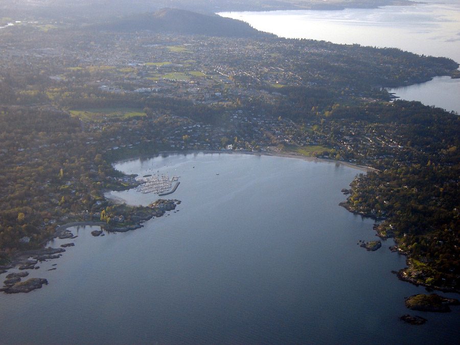
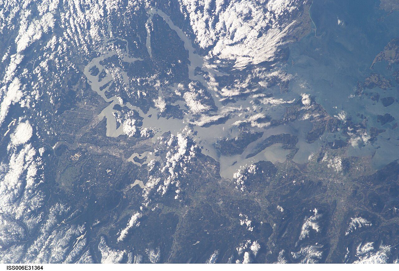
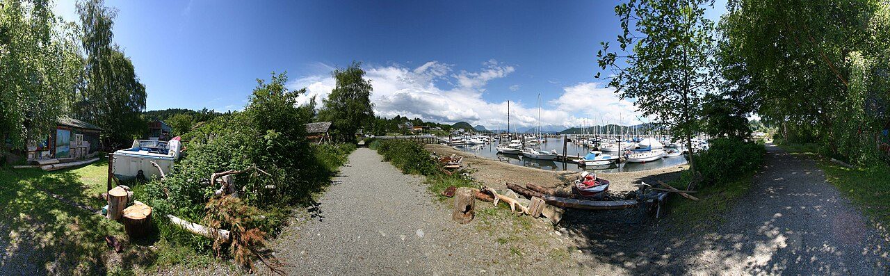
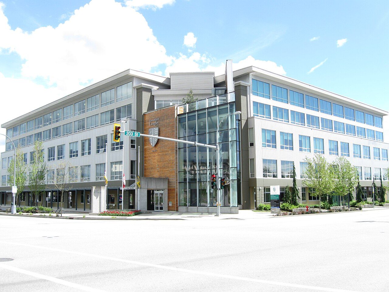
Photos: Oak Bay, rpaterso (CC BY-SA 2.0 ) · North Vancouver, Xicotencatl (CC BY-SA 4.0 ) · Bowen Island, Hameltion (CC BY-SA 4.0 ) · Central Saanich, Ken Walker (CC BY 2.5 ) · Comox, U.S. Coast Guard (Public domain ) · Saltspring Island, Michal Klajban (CC BY-SA 4.0 ) · Saanich, Keefer4~commonswiki (CC BY-SA 2.5 ) · North Saanich, Shawn from Airdrie, Canada (CC BY-SA 2.0 ) · Southern Gulf Islands, Earth Science and Remote Sensing Unit , Lyndon B. Johnson S… (Public domain ) · Rossland, Michael Rogers. Original uploader was Mjrogers50 at en.wiki… (CC BY-SA 3.0 ) · Fernie, Holger Steinhaus (CC BY-SA 3.0 ) · Squamish, The original uploader was Damieng at English Wikipedia . (CC BY-SA 3.0 ) · Anmore, Ben Waardenburg benwubbleyou (CC0 ) · Coldstream, LN? from Canada (CC BY 2.0 ) · Golden, Murray Foubister (CC BY-SA 2.0 ) · Port Moody, waferboard (CC BY 2.0 ) · Electoral Area F, Central Kootenay, Earth Science and Remote Sensing Unit , Lyndon B. Johnson S… (Public domain ) · Kimberley, Royalbroil (CC BY-SA 3.0 ) · Esquimalt, The original uploader was IDuke at English Wikipedia . (CC BY-SA 2.5 ) · Whistler, Ruth Hartnup from Vancouver, Canada (CC BY 2.0 ) · West Vancouver, Buidhe (CC BY-SA 4.0 ) · Elkford, Earth Science and Remote Sensing Unit , Lyndon B. Johnson S… (Public domain ) · Electoral Area E, Central Kootenay, Earth Science and Remote Sensing Unit , Lyndon B. Johnson S… (Public domain ) · Sparwood, Rod Lafond (CC BY 3.0 ) · North Vancouver, Miranda.Kopetzky (CC BY-SA 4.0 ) · Sidney, Sidney Museum (CC BY-SA 3.0 ) · View Royal, John Newcomb (CC BY 3.0 ) · Pitt Meadows, Jarcardo (CC BY-SA 3.0 ) · Electoral Area C, North Okanagan, Earth Science and Remote Sensing Unit , Lyndon B. Johnson S… (Public domain ) · Port Coquitlam, Ursus sapien (CC BY-SA 4.0 ) · Nelson, Quinn Desilets (CC BY-SA 4.0 ) · Roberts Creek, TwoWild (CC BY-SA 2.0 ) · Electoral Area D (Rural Grand Forks), Kootenay Boundary, Earth Science and Remote Sensing Unit , Lyndon B. Johnson S… (Public domain ) · Fort Nelson, CanadianEman (CC BY-SA 3.0 ) · Grand Forks, Vxceprex (CC BY-SA 3.0 ) · Colwood, Kyle Wilson (CC BY-SA 4.0 ) · Revelstoke, Darren Kirby (CC BY-SA 3.0 ) · Pemberton, SoftwareSimian (CC BY-SA 3.0 ) · Invermere, The original uploader was GreenB1983 at English Wikipedia . (CC BY-SA 3.0 ) · Summerland, (WT-shared) Bulliver at wts wikivoyage (CC BY-SA 1.0 ) · Electoral Area B (Lazo North), Comox Valley, Earth Science and Remote Sensing Unit , Lyndon B. Johnson S… (Public domain ) · Delta, UBC Micrometeorology (CC BY 2.0 ) · Metchosin, P199 (CC BY-SA 4.0 ) · Cobble Hill, Alasdair McLellan (CC BY-SA 3.0 ) · Electoral Area B, Central Kootenay, Earth Science and Remote Sensing Unit , Lyndon B. Johnson S… (Public domain ) · Qualicum Beach, Ken Walker (CC BY-SA 2.5 ) · Electoral Area G, Nanaimo, starkerry (CC BY-SA 3.0 ) · Shawnigan, David Stanley from Nanaimo, Canada (CC BY 2.0 ) · White Rock, Quintin Soloviev (CC BY 4.0 ) · Lantzville, This image is Image Number 937549 at Mushroom Observer , a … (CC BY-SA 3.0 ) · Electoral Area A, Cowichan Valley, Ymblanter (CC BY-SA 4.0 ) · Electoral Area H, Central Kootenay, Earth Science and Remote Sensing Unit , Lyndon B. Johnson S… (Public domain ) · Coquitlam, John Shorten (CC BY 4.0 ) · Electoral Area A, Bulkley-Nechako, George Dean (CC BY-SA 3.0 ) · Cumberland, Ruth Hartnup from Vancouver, Canada (CC BY 2.0 ) · Sechelt, waferboard (CC BY 2.0 ) · Langford, P199 (CC BY-SA 4.0 ) · Electoral Area F, East Kootenay, Photo by Alan Silvester ( mascdman ) (CC BY-SA 2.0 ca ) · Gibsons, Visit-World. com Author: www.visit-world.com (CC BY-SA 3.0 ) · Electoral Area A, Columbia-Shuswap, Earth Science and Remote Sensing Unit , Lyndon B. Johnson S… (Public domain ) · Electoral Area B, North Okanagan, Earth Science and Remote Sensing Unit , Lyndon B. Johnson S… (Public domain ) · Electoral Area A, Comox Valley, Earth Science and Remote Sensing Unit , Lyndon B. Johnson S… (Public domain ) · Smithers, Shawn from Airdrie, Canada (CC BY-SA 2.0 ) · Victoria, Michal Klajban (CC BY-SA 4.0 ) · Langley, Leoboudv (CC BY-SA 4.0 ) · New Westminster, Dennis Sylvester Hurd (CC0 ) · Electoral Area C, East Kootenay, Earth Science and Remote Sensing Unit , Lyndon B. Johnson S… (Public domain ) · Spallumcheen, Earth Science and Remote Sensing Unit , Lyndon B. Johnson S… (Public domain ) · Courtenay, Ken Walker (CC BY-SA 3.0 ) · Electoral Area I, Central Kootenay, Earth Science and Remote Sensing Unit , Lyndon B. Johnson S… (Public domain ) · Welcome Beach, Earth Science and Remote Sensing Unit , Lyndon B. Johnson S… (Public domain ) · Electoral Area F, Nanaimo, Earth Science and Remote Sensing Unit , Lyndon B. Johnson S… (Public domain ) · Armstrong, Historyted at English Wikipedia (Public domain ) · Electoral Area J, Central Kootenay, Earth Science and Remote Sensing Unit , Lyndon B. Johnson S… (Public domain ) · Vanderhoof, Bell and Jeff from Wellington, New Zealand (CC BY 2.0 ) · Fort St. John, jasonwoodhead23 (CC BY 2.0 ) · Electoral Area F, Sunshine Coast, Earth Science and Remote Sensing Unit , Lyndon B. Johnson S… (Public domain ) · Electoral Area D, North Okanagan, Earth Science and Remote Sensing Unit , Lyndon B. Johnson S… (Public domain ) · Oliver, Adam Jones from Kelowna, BC, Canada (CC BY-SA 2.0 ) · Electoral Area E, Peace River, Mengqiu Chen (CC BY 3.0 ) · Juan de Fuca (Part 1), Earth Science and Remote Sensing Unit , Lyndon B. Johnson S… (Public domain ) · Lake Country, outofthought (CC BY-SA 3.0 ) · Fairwinds, KenWalker (CC BY-SA 4.0 ) · Electoral Area C (Part 1), Kitimat-Stikine, Shawn from Airdrie, Canada (CC BY-SA 2.0 ) · Parksville, Doug Wortley (CC BY-SA 4.0 ) · Okanagan Falls, AndrewEnns (CC BY-SA 3.0 ) · Electoral Area E, Kitimat-Stikine, TerradiseBC (CC BY-SA 4.0 ) · Kent, Joe Mabel (CC BY-SA 3.0 ) · Electoral Area H, Nanaimo, Earth Science and Remote Sensing Unit , Lyndon B. Johnson S… (Public domain ) · Maple Ridge, Glen Jackson glen_jackson (CC0 ) · Peachland, Extemporalist (CC0 ) · Cranbrook, waferboard (CC BY 2.0 ) · Richmond, Canuckle (CC0 ) · Electoral Area C (Puntledge - Black Creek), Comox Valley, Earth Science and Remote Sensing Unit , Lyndon B. Johnson S… (Public domain ) · Electoral Area C, Peace River, awmcphee (CC BY-SA 4.0 ) · Penticton, Original uploader was Fawcett5 at en.wikipedia Later versio… (Public domain ) · Houston, William Matheson (CC BY-SA 2.0 ) · Cultus Lake, The High Fin Sperm Whale (CC BY-SA 3.0 ) · Dawson Creek, maclean (Public domain ) · Powell River, James Blake aka Webgeer at en.wikipedia (CC BY 2.0 ) · Vernon, Valentin8107 (CC BY-SA 4.0 ) · Creston, K29328 (CC BY-SA 4.0 ) · Prince Rupert, Sam Beebe (CC BY 2.0 ) · Electoral Area B, Peace River, tuchodi from Fort St. John, BC, Canada (CC BY-SA 2.0 ) · Mackenzie, RTBoughner at English Wikipedia (Public domain ) · Electoral Area D, Peace River, calind (CC BY-SA 3.0 ) · Kamloops, Kiyoteru Awaji (CC BY 4.0 ) · Highlands, Kiwibirdman (CC BY 3.0 ) · Trail, The original uploader was RandyMac at English Wikipedia . (CC BY-SA 3.0 ) · Enderby, Shawn from Airdrie, Canada (CC BY-SA 2.0 ) · Terrace, Sam Beebe (CC BY 2.0 ) · Salmon Arm, The Interior (CC BY-SA 4.0 ) · West Kelowna, 36reasons (Public domain ) · Tumbler Ridge, Urban Walnut (Public domain ) · Port Hardy, Dan Huntington from Anacortes, WA (CC BY-SA 2.0 ) · Langley, Reg Natarajan from Vancouver, Canada (CC BY 2.0 ) · Castlegar, Ken Eckert (CC BY-SA 4.0 ) · Kitimat, Sam Beebe (CC BY 2.0 ) · Abbotsford, Dllu (CC BY-SA 4.0 ) · Electoral Area E, Cariboo, Earth Science and Remote Sensing Unit , Lyndon B. Johnson S… (Public domain ) · Kelowna, Jd.101 (CC BY-SA 3.0 ) · Electoral Area A, Sunshine Coast, Earth Science and Remote Sensing Unit , Lyndon B. Johnson S… (Public domain ) · Chilliwack, University of the Fraser Valley (CC BY 2.0 ) · Osoyoos, GoToVan from Vancouver, Canada (CC BY 2.0 ) · Electoral Area C, Nanaimo, Gerry Thomasen from Nanaimo, Canada (CC BY 2.0 ) · Electoral Area C, Okanagan-Similkameen, Earth Science and Remote Sensing Unit , Lyndon B. Johnson S… (Public domain ) · Central Okanagan, Adam Jones from Kelowna, BC, Canada (CC BY-SA 2.0 ) · Sooke, Kyle Wilson (CC BY-SA 4.0 ) · Tofino, Buiobuione (CC BY-SA 4.0 ) · Campbell River, Darren Kirby from Penticton, Canada (CC BY-SA 2.0 ) · Electoral Area D (Oyster Bay - Buttle Lake), Strathcona, Earth Science and Remote Sensing Unit , Lyndon B. Johnson S… (Public domain ) · Ladysmith, A.Davey (CC BY 2.0 ) · Cowichan Bay, James Abbott from New Westminster, B.C., Canada (CC BY-SA 2.0 ) · Nanaimo, Gerry Thomasen from Nanaimo, Canada (CC BY 2.0 ) · North Cowichan, Blake Handley from Victoria, Canada (CC BY 2.0 ) · Electoral Area C, Strathcona, Earth Science and Remote Sensing Unit , Lyndon B. Johnson S… (Public domain ) · Princeton, GerthMichael (CC BY-SA 3.0 ) · Clearwater, Kiyoteru Awaji (CC BY 4.0 ) · Electoral Area E, Cowichan Valley, Earth Science and Remote Sensing Unit , Lyndon B. Johnson S… (Public domain ) · Prince George, CPG1100 (CC BY-SA 4.0 ) · Electoral Area H, Cowichan Valley, Earth Science and Remote Sensing Unit , Lyndon B. Johnson S… (Public domain ) · Electoral Area F, North Okanagan, Earth Science and Remote Sensing Unit , Lyndon B. Johnson S… (Public domain ) · Blind Bay, The Interior (CC BY-SA 4.0 ) · Electoral Area G, Cowichan Valley, D&J Huber from Canada (CC BY 2.0 ) · Central Okanagan West, Earth Science and Remote Sensing Unit , Lyndon B. Johnson S… (Public domain ) · Mission, Bernard Samuel Fenn (Public domain ) · Electoral Area D, Columbia-Shuswap, Earth Science and Remote Sensing Unit , Lyndon B. Johnson S… (Public domain ) · Electoral Area E (West Boundary), Kootenay Boundary, Earth Science and Remote Sensing Unit , Lyndon B. Johnson S… (Public domain ) · Williams Lake, Globalphotobank (CC BY-SA 4.0 ) · Electoral Area L (Grasslands), Thompson-Nicola, Earth Science and Remote Sensing Unit , Lyndon B. Johnson S… (Public domain ) · Electoral Area A, Nanaimo, Earth Science and Remote Sensing Unit , Lyndon B. Johnson S… (Public domain ) · Port Alberni, Kevstan (CC BY-SA 3.0 ) · Electoral Area F, Bulkley-Nechako, Jack Borno (CC BY-SA 3.0 ) · Lake Cowichan, James O'Brien (CC BY-SA 4.0 ) · Sicamous, Mangoandmay (CC BY-SA 4.0 ) · Electoral Area P (Rivers and the Peaks), Thompson-Nicola, Earth Science and Remote Sensing Unit , Lyndon B. Johnson S… (Public domain ) · Duncan, Doug Hay derivative work: MrPanyGoff (CC BY 2.0 ) · Merritt, Eric Friedebach (CC BY 3.0 ) · Quesnel, Asahel Curtis (Public domain ) · Hope, Joe Mabel (CC BY-SA 3.0 ) · Chase, The Interior (CC BY-SA 3.0 ) · Electoral Area F, Columbia-Shuswap, Earth Science and Remote Sensing Unit , Lyndon B. Johnson S… (Public domain ), via Wikimedia Commons.
Sources: TownRatings grades: our own summary of the data, ranking Canadian towns against each other only, run #73 of 10 November 2026 · Statistics Canada, 2021 Census of Population and population estimates. Under the Statistics Canada Open Licence.
Adapted from Statistics Canada (Census of Population 2021, population estimates 2025, 2021 census boundaries) under the Statistics Canada Open Licence; this does not constitute an endorsement by Statistics Canada. Neighbourhood names in some cities © OpenStreetMap contributors (ODbL).