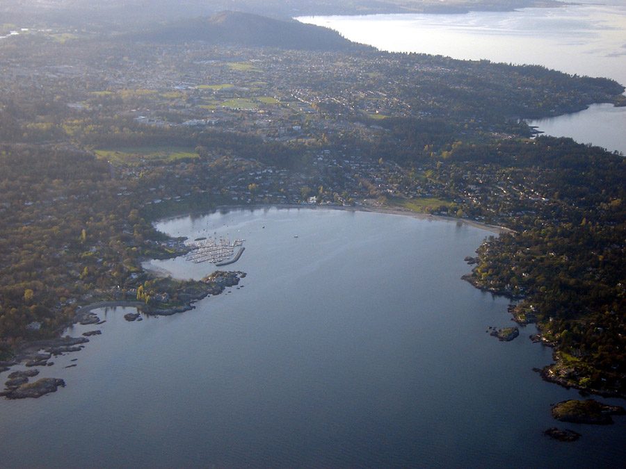
 Oak Bay, #1 on this list · Photo: rpaterso (CC BY-SA 2.0)
British Columbia’s rankings: 26 lists
Oak Bay leads the overall list with a grade of A+. Nobody leads more lists than Bowen Island, first on 3. Oak Bay finishes in the top three 4 times. Graded in British Columbia only, schools has no Canada-wide list. On 5 of these lists, the leader in British Columbia is also first in all of Canada. In all, 254 places in British Columbia appear on 26 lists.
Each list ranks the places in British Columbia against one another; the letters compare every place with Canada’s towns. How grades work
Every list for British Columbia
Grouped by what they measure, each card with its top three.
Overall, and by size




Subject by subject
- Fort NelsonA+
- Tumbler RidgeA
- ElkfordA−


- Bowen IslandA+
- Oak BayA+
- Central SaanichA

- Bowen IslandA+
- WhistlerA+
- Cobble HillA+


- North VancouverA+
- Powell RiverA+
- North VancouverA+

- North SaanichA+
- SmithersA+
- Central SaanichA+


- FairviewA+
- KitsilanoA+
- GreektownA+


- SicamousA
- SmithersA
- Electoral Area A, Bulkley-NechakoA


- VictoriaA
- NelsonA
- SmithersA


Described: figures, no letters
- Anmore$165,200
- Colebrook$148,300
- Shaughnessy$138,700


- Pemberton+32.4%
- Langford+31.8%
- Electoral Area F, East Kootenay+29.2%


- Electoral Area A, Columbia-Shuswap27
- Esquimalt22
- Colwood12


- Pemberton18.6%
- Kitsilano16.6%
- Greektown16.4%
- Electoral Area B, Peace River30.6 years
- Fort St. John32.4 years
- Burnaby Mountain34 years


- Qualicum Beach67.5 years
- Osoyoos63.2 years
- Electoral Area B, Nanaimo63.2 years


- Tofino6°C (43°F)
- Oak Bay6°C (42°F)
- Saanich6°C (42°F)

- Fort Nelson-20°C (-5°F)
- Dawson Creek-14°C (8°F)
- Electoral Area D, Peace River-14°C (8°F)


- Oliver32°C (89°F)
- Osoyoos32°C (89°F)
- Electoral Area C, Okanagan-Similkameen32°C (89°F)


- Prince Rupert15°C (58°F)
- Tofino17°C (63°F)
- Port Hardy18°C (64°F)


- Oak Bay10 frost days
- Esquimalt10 frost days
- View Royal10 frost days

- Tofino14 cm
- Prince Rupert30 cm
- Southern Gulf Islands35 cm
- Clearwater416 cm
- Electoral Area C (Part 1), Kitimat-Stikine328 cm
- Electoral Area E, Kitimat-Stikine328 cm


- Kamloops273 mm
- Electoral Area L (Grasslands), Thompson-Nicola273 mm
- Electoral Area P (Rivers and the Peaks), Thompson-Nicola273 mm


- Tofino3,111 mm
- Squamish2,344 mm
- Whistler2,344 mm

Neighbourhood lists in British Columbia’s cities
Rankings in other provinces and territories
Photos: Oak Bay, rpaterso (CC BY-SA 2.0) · North Vancouver, Xicotencatl (CC BY-SA 4.0) · Bowen Island, Hameltion (CC BY-SA 4.0) · Saanich, Keefer4~commonswiki (CC BY-SA 2.5) · North Vancouver, Miranda.Kopetzky (CC BY-SA 4.0) · Southern Gulf Islands, Earth Science and Remote Sensing Unit , Lyndon B. Johnson S… (Public domain) · Rossland, Michael Rogers. Original uploader was Mjrogers50 at en.wiki… (CC BY-SA 3.0) · Fort Nelson, CanadianEman (CC BY-SA 3.0) · Tumbler Ridge, Urban Walnut (Public domain) · Elkford, Earth Science and Remote Sensing Unit , Lyndon B. Johnson S… (Public domain) · Central Saanich, Ken Walker (CC BY 2.5) · Whistler, Ruth Hartnup from Vancouver, Canada (CC BY 2.0) · Cobble Hill, Alasdair McLellan (CC BY-SA 3.0) · Powell River, James Blake aka Webgeer at en.wikipedia (CC BY 2.0) · North Saanich, Shawn from Airdrie, Canada (CC BY-SA 2.0) · Smithers, Shawn from Airdrie, Canada (CC BY-SA 2.0) · Fairview, Canmenwalker (CC BY 4.0) · Kitsilano, Xicotencatl (CC BY-SA 4.0) · Greektown, Tavis Ford from Canada (CC BY 2.0) · Sicamous, Mangoandmay (CC BY-SA 4.0) · Electoral Area A, Bulkley-Nechako, George Dean (CC BY-SA 3.0) · Victoria, Michal Klajban (CC BY-SA 4.0) · Nelson, Quinn Desilets (CC BY-SA 4.0) · Anmore, Ben Waardenburg benwubbleyou (CC0) · Colebrook, Larry LaRose (CC BY-SA 3.0) · Shaughnessy, Wpcpey (CC BY-SA 4.0) · Pemberton, SoftwareSimian (CC BY-SA 3.0) · Langford, P199 (CC BY-SA 4.0) · Electoral Area F, East Kootenay, Photo by Alan Silvester ( mascdman ) (CC BY-SA 2.0 ca) · Electoral Area A, Columbia-Shuswap, Earth Science and Remote Sensing Unit , Lyndon B. Johnson S… (Public domain) · Esquimalt, The original uploader was IDuke at English Wikipedia . (CC BY-SA 2.5) · Colwood, Kyle Wilson (CC BY-SA 4.0) · Electoral Area B, Peace River, tuchodi from Fort St. John, BC, Canada (CC BY-SA 2.0) · Fort St. John, jasonwoodhead23 (CC BY 2.0) · Burnaby Mountain, The Cosmonaut (CC BY-SA 2.5 ca) · Qualicum Beach, Ken Walker (CC BY-SA 2.5) · Osoyoos, GoToVan from Vancouver, Canada (CC BY 2.0) · Tofino, Buiobuione (CC BY-SA 4.0) · Dawson Creek, maclean (Public domain) · Electoral Area D, Peace River, calind (CC BY-SA 3.0) · Oliver, Adam Jones from Kelowna, BC, Canada (CC BY-SA 2.0) · Electoral Area C, Okanagan-Similkameen, Earth Science and Remote Sensing Unit , Lyndon B. Johnson S… (Public domain) · Prince Rupert, Sam Beebe (CC BY 2.0) · Port Hardy, Dan Huntington from Anacortes, WA (CC BY-SA 2.0) · View Royal, John Newcomb (CC BY 3.0) · Clearwater, Kiyoteru Awaji (CC BY 4.0) · Electoral Area C (Part 1), Kitimat-Stikine, Shawn from Airdrie, Canada (CC BY-SA 2.0) · Electoral Area E, Kitimat-Stikine, TerradiseBC (CC BY-SA 4.0) · Kamloops, Kiyoteru Awaji (CC BY 4.0) · Electoral Area L (Grasslands), Thompson-Nicola, Earth Science and Remote Sensing Unit , Lyndon B. Johnson S… (Public domain) · Electoral Area P (Rivers and the Peaks), Thompson-Nicola, Earth Science and Remote Sensing Unit , Lyndon B. Johnson S… (Public domain) · Squamish, The original uploader was Damieng at English Wikipedia . (CC BY-SA 3.0), via Wikimedia Commons.
Sources: TownRatings grades: our own summary of the data, ranking Canadian towns against each other only, run #73 of 10 November 2026. Under the Statistics Canada Open Licence.
Adapted from Statistics Canada (Census of Population 2021, population estimates 2025, 2021 census boundaries) under the Statistics Canada Open Licence; this does not constitute an endorsement by Statistics Canada. Neighbourhood names in some cities © OpenStreetMap contributors (ODbL).