Guest, Sign inJoin
The Wisconsin Battleship in Norfolk, VANorfolk, #1 on this list · Photo: Bruce Emmerling · CC BY-SA 4.0
Virginia rankings · Climate

Towns with the mildest winters in Virginia

Norfolk has the mildest winters of Virginia’s 225 towns of 2,500+: January nights average a low of 33° (NOAA 1991–2020 normals). The typical town here averages 26°; 5 of the 225 stay above freezing.

The average January low. NOAA U.S. Climate Normals, 1991–2020, from NOAA’s 5 km grid at each town’s center; one town for each grid cell. A described list: no letters. How grades work

#1

Norfolk

Norfolk city · 231,013 people
33°

January low·July high 88°·41 freezing nights a year

#2

Portsmouth

Portsmouth city · 96,777 people
33°

January low·July high 88°·41 freezing nights a year
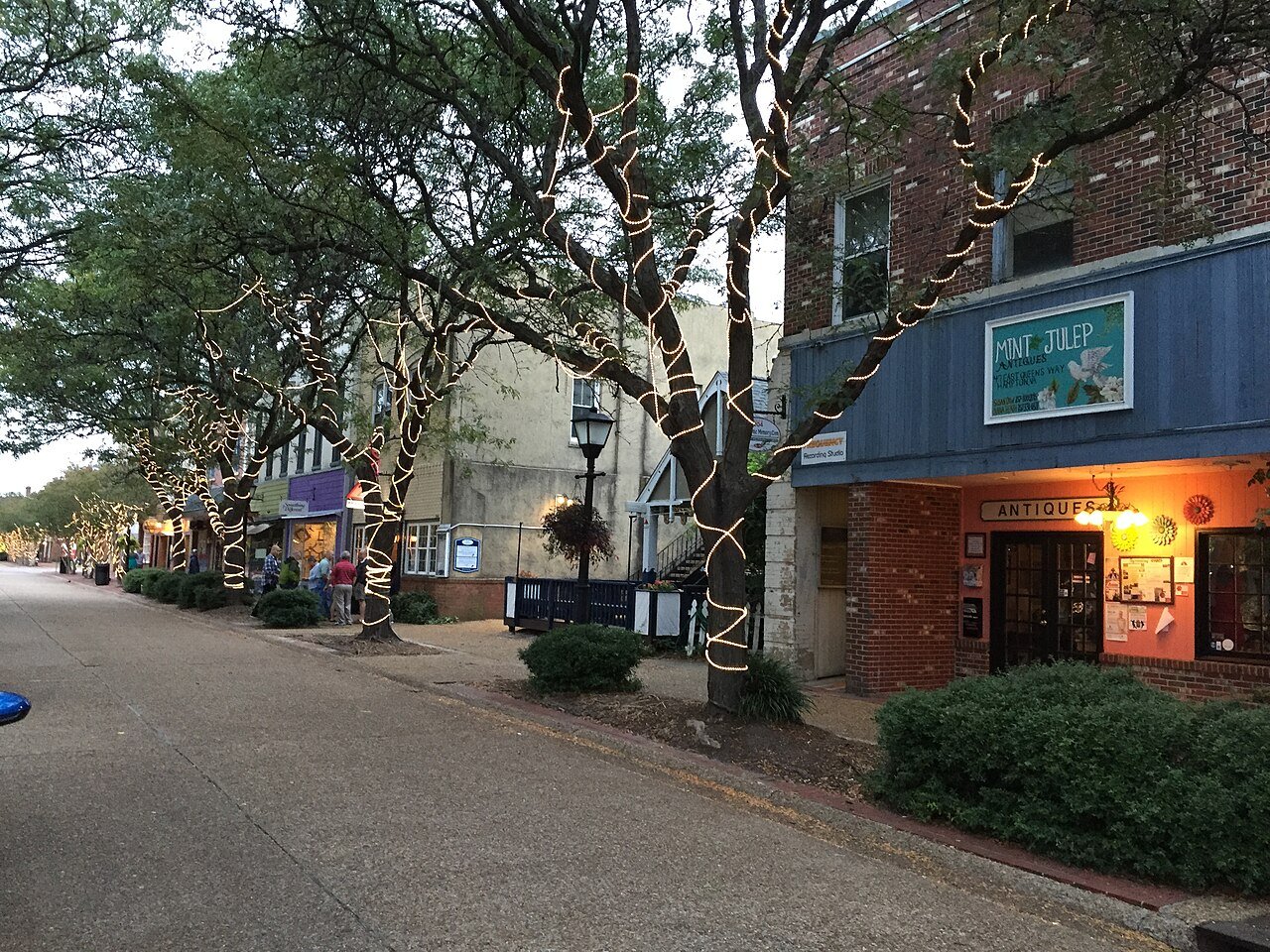
#3

Hampton

Hampton city · 137,315 people
32°

January low·July high 88°·52 freezing nights a year

All 225 towns

January low, highest first. Towns with the same figure share a rank (T = tied; 197 towns here).

225 towns ranked. Not here? See why a town may be missing.

#TownJanuary lowNights ≤32°July high
1NorfolkNorfolk city · 231,013 people33°4188°average high
2PortsmouthPortsmouth city · 96,777 people33°4188°average high
3HamptonHampton city · 137,315 people32°5288°average high
4Virginia BeachVirginia Beach city · 453,737 people32°5087°average high
5Carrolltonunincorporated, Isle of Wight County · 8,436 people32°3289°average high
6PoquosonPoquoson city · 13,292 people32°5288°average high
T7Newport NewsNewport News city · 183,230 people32°6489°average high
T7SmithfieldIsle of Wight County · 9,112 people32°6489°average high
9Bethel Manorunincorporated, York County · 4,393 people32°5289°average high
10ChesapeakeChesapeake city · 255,332 people31°5289°average high
11Gloucester Pointunincorporated, Gloucester County · 11,109 people31°6889°average high
12ChincoteagueAccomack County · 3,309 people31°6986°average high
13Gloucester Courthouseunincorporated, Gloucester County · 3,336 people30°7788°average high
14WilliamsburgWilliamsburg city · 15,861 people30°6889°average high
15SuffolkSuffolk city · 104,699 people30°5689°average high
16WindsorIsle of Wight County · 2,947 people30°8489°average high
17Enonunincorporated, Chesterfield County · 4,137 people29°5890°average high
18HopewellHopewell city · 23,261 people29°5890°average high
19FranklinFranklin city · 8,478 people29°8490°average high
20EmporiaEmporia city · 5,447 people29°8390°average high
21Colonial HeightsColonial Heights city · 18,738 people29°8590°average high
T22Ettrickunincorporated, Chesterfield County · 5,910 people29°8590°average high
T22PetersburgPetersburg city · 33,734 people29°8590°average high
T22West PointKing William County · 3,595 people29°8389°average high
25Bellwoodunincorporated, Chesterfield County · 7,907 people28°7490°average high
T26Bensleyunincorporated, Chesterfield County · 5,949 people28°7490°average high
T26Chesterunincorporated, Chesterfield County · 24,474 people28°5890°average high
T26Matoacaunincorporated, Chesterfield County · 2,724 people28°8590°average high
T26Montroseunincorporated, Henrico County · 8,285 people28°7490°average high
T26Sandstonunincorporated, Henrico County · 7,399 people28°7490°average high
T31DanvilleDanville city · 41,647 people28°8789°average high
T31South HillMecklenburg County · 4,889 people28°8089°average high
33Meadowbrookunincorporated, Chesterfield County · 20,749 people28°7489°average high
T34Dahlgrenunincorporated, King George County · 3,350 people28°7689°average high
T34Highland Springsunincorporated, Henrico County · 14,296 people28°7490°average high
36East Highland Parkunincorporated, Henrico County · 15,265 people28°7490°average high
T37Manchesterunincorporated, Chesterfield County · 12,445 people28°7489°average high
T37RichmondRichmond city · 237,257 people28°7489°average high
39Colonial BeachWestmoreland County · 4,151 people28°9389°average high
T40Bon Airunincorporated, Chesterfield County · 16,904 people28°7489°average high
T40Brandermillunincorporated, Chesterfield County · 13,730 people28°7489°average high
T40Mechanicsvilleunincorporated, Hanover County · 38,683 people28°7489°average high
T40Mount Hermonunincorporated, Pittsylvania County · 4,155 people28°12588°average high
T44BlackstoneNottoway County · 3,389 people27°10288°average high
T44CreweNottoway County · 2,279 people27°9288°average high
T44Dumbartonunincorporated, Henrico County · 7,997 people27°8989°average high
T44Lakesideunincorporated, Henrico County · 12,654 people27°8989°average high
T48Midlothianunincorporated, Chesterfield County · 19,120 people27°7489°average high
T48RoanokeRoanoke city · 99,111 people27°7788°average high
T48South BostonHalifax County · 7,795 people27°10888°average high
T48VintonRoanoke County · 7,967 people27°7788°average high
T48Woodlakeunincorporated, Chesterfield County · 7,358 people27°9289°average high
T53Chamberlayneunincorporated, Henrico County · 4,692 people27°8889°average high
T53FarmvillePrince Edward County · 7,593 people27°10588°average high
T53Glen Allenunincorporated, Henrico County · 17,551 people27°8989°average high
T56Fort Belvoirunincorporated, Fairfax County · 8,449 people27°6088°average high
T56Hybla Valleyunincorporated, Fairfax County · 17,257 people27°6089°average high
T56Laurelunincorporated, Henrico County · 18,721 people27°8989°average high
T56Woodlawnunincorporated, Fairfax County · 21,194 people27°6089°average high
T60AlexandriaAlexandria city · 160,662 people27°6089°average high
T60Huntingtonunincorporated, Fairfax County · 13,502 people27°6089°average high
T60Innsbrookunincorporated, Henrico County · 8,578 people27°8989°average high
T60MartinsvilleMartinsville city · 13,849 people27°11988°average high
T60Rose Hillunincorporated, Fairfax County · 21,066 people27°6088°average high
T60Tuckahoeunincorporated, Henrico County · 49,183 people27°8989°average high
T66Cherry Hillunincorporated, Prince William County · 26,044 people27°7688°average high
T66Kingstowneunincorporated, Fairfax County · 18,360 people27°6088°average high
T66Leesylvaniaunincorporated, Prince William County · 21,632 people27°7689°average high
T66Newingtonunincorporated, Fairfax County · 13,478 people27°6088°average high
T66Short Pumpunincorporated, Henrico County · 29,026 people27°8989°average high
T71AshlandHanover County · 7,982 people27°8989°average high
T71Cave Springunincorporated, Roanoke County · 25,742 people27°7787°average high
T71Cloverdaleunincorporated, Botetourt County · 3,208 people27°7787°average high
T71Collinsvilleunincorporated, Henry County · 7,139 people27°11988°average high
T71Hollinsunincorporated, Botetourt County · 17,097 people27°7787°average high
T71King Georgeunincorporated, King George County · 4,851 people27°9388°average high
T71Lincolniaunincorporated, Fairfax County · 20,320 people27°6088°average high
T71Lortonunincorporated, Fairfax County · 20,991 people27°6088°average high
T71North Shoreunincorporated, Franklin County · 3,638 people27°10487°average high
T71Rocky MountFranklin County · 4,973 people27°10487°average high
T81BedfordBedford County · 7,911 people27°8487°average high
T81Newington Forestunincorporated, Fairfax County · 12,316 people27°6088°average high
T81Quantico Baseunincorporated, Prince William County · 5,840 people27°7688°average high
T81Springfieldunincorporated, Fairfax County · 31,154 people27°6088°average high
T81Triangleunincorporated, Prince William County · 10,450 people27°7688°average high
T81Woodbridgeunincorporated, Prince William County · 43,945 people27°7688°average high
T81Wyndhamunincorporated, Henrico County · 12,099 people27°8989°average high
T88Annandaleunincorporated, Fairfax County · 41,705 people27°9688°average high
T88Bailey's Crossroadsunincorporated, Fairfax County · 24,271 people27°6088°average high
T88Pantopsunincorporated, Albemarle County · 4,665 people27°7788°average high
T88SalemSalem city · 25,816 people27°7788°average high
T88South Rununincorporated, Fairfax County · 6,600 people27°9988°average high
T93CharlottesvilleCharlottesville city · 44,388 people26°7788°average high
T93Potomac Millsunincorporated, Prince William County · 5,741 people26°7688°average high
T93University of Virginia College campusunincorporated, Albemarle County · 9,065 people26°7788°average high
T93Wakefieldunincorporated, Fairfax County · 11,930 people26°9987°average high
T93West Springfieldunincorporated, Fairfax County · 22,532 people26°6088°average high
T98AltavistaCampbell County · 3,353 people26°9487°average high
T98ArlingtonArlington County (county government) · 236,254 people26°6088°average high
T98Dalevilleunincorporated, Botetourt County · 3,797 people26°9786°average high
T98Lake Ridgeunincorporated, Prince William County · 46,049 people26°7688°average high
T98Madison Heightsunincorporated, Amherst County · 10,266 people26°9486°average high
T98Montclairunincorporated, Prince William County · 22,387 people26°7688°average high
T98West Falls Churchunincorporated, Fairfax County · 31,279 people26°9687°average high
T105Blue Ridgeunincorporated, Botetourt County · 2,800 people26°7785°average high
T105Burkeunincorporated, Fairfax County · 44,029 people26°9987°average high
T105County Centerunincorporated, Prince William County · 3,789 people26°9488°average high
T105Dale Cityunincorporated, Prince William County · 71,016 people26°7688°average high
T105Forestunincorporated, Bedford County · 13,430 people26°9487°average high
T105Long Branchunincorporated, Fairfax County · 7,034 people26°9987°average high
T105LynchburgLynchburg city · 81,347 people26°9487°average high
T105Merrifieldunincorporated, Fairfax County · 20,698 people26°9987°average high
T113Burke Centreunincorporated, Fairfax County · 17,037 people26°9987°average high
T113Hollymeadunincorporated, Albemarle County · 8,482 people26°8888°average high
T113Idylwoodunincorporated, Fairfax County · 17,559 people26°9687°average high
T113Timberlakeunincorporated, Campbell County · 12,725 people26°9486°average high
T117Aquia Harbourunincorporated, Stafford County · 7,481 people26°7688°average high
T117Dunn Loringunincorporated, Fairfax County · 8,957 people26°9987°average high
T117Kings Park Westunincorporated, Fairfax County · 13,442 people26°9987°average high
T117Mantuaunincorporated, Fairfax County · 8,298 people26°9987°average high
T117McLeanunincorporated, Fairfax County · 49,627 people26°9687°average high
T117Tysonsunincorporated, Fairfax County · 28,936 people26°9687°average high
T123BristolBristol city · 16,418 people26°10885°average high
T123Crozetunincorporated, Albemarle County · 9,289 people26°11788°average high
T123Independent Hillunincorporated, Prince William County · 10,853 people26°9487°average high
T123Lake Monticellounincorporated, Fluvanna County · 10,662 people26°11288°average high
T127Buckhallunincorporated, Prince William County · 21,602 people26°9488°average high
T127FairfaxFairfax city · 26,772 people26°9987°average high
T127Fairfax Stationunincorporated, Fairfax County · 12,566 people26°9987°average high
T127Manassas ParkManassas Park city · 16,560 people26°9488°average high
T127Oaktonunincorporated, Fairfax County · 36,528 people26°9987°average high
T127ViennaFairfax County · 16,691 people26°9987°average high
T127Wolf Trapunincorporated, Fairfax County · 15,858 people26°9987°average high
T134Fair Lakesunincorporated, Fairfax County · 8,894 people26°10287°average high
T134Fair Oaksunincorporated, Fairfax County · 35,545 people26°9987°average high
T134ManassasManassas city · 44,332 people26°9488°average high
T134Union Millunincorporated, Fairfax County · 4,484 people26°9487°average high
T138Difficult Rununincorporated, Fairfax County · 9,938 people26°9987°average high
T138Loch Lomondunincorporated, Prince William County · 4,606 people26°9488°average high
T138Restonunincorporated, Fairfax County · 64,414 people26°10287°average high
T141Big Stone GapWise County · 5,102 people26°10884°average high
T141Centrevilleunincorporated, Fairfax County · 71,706 people26°10288°average high
T141Chantillyunincorporated, Fairfax County · 24,036 people26°10287°average high
T141Dranesvilleunincorporated, Fairfax County · 11,828 people26°10287°average high
T141Franklin Farmunincorporated, Fairfax County · 18,736 people26°10287°average high
T141Great Fallsunincorporated, Fairfax County · 15,228 people26°10287°average high
T141HerndonFairfax County · 25,506 people26°10287°average high
T141Lake Carolineunincorporated, Caroline County · 2,862 people26°8989°average high
T141Linton Hallunincorporated, Prince William County · 41,876 people26°9488°average high
T141McNairunincorporated, Fairfax County · 22,655 people26°10287°average high
T141Sudleyunincorporated, Prince William County · 19,162 people26°9488°average high
T141Sugarland Rununincorporated, Loudoun County · 12,629 people26°11987°average high
T153Buena VistaBuena Vista city · 6,672 people26°11987°average high
T153Bull Rununincorporated, Fairfax County · 7,823 people26°10288°average high
T153LexingtonLexington city · 7,769 people26°11987°average high
T156Cascadesunincorporated, Loudoun County · 12,357 people25°11988°average high
T156Lowes Islandunincorporated, Loudoun County · 11,018 people25°11987°average high
T156OrangeOrange County · 5,365 people25°9287°average high
T156Sterlingunincorporated, Loudoun County · 32,411 people25°11987°average high
T156University Centerunincorporated, Loudoun County · 3,923 people25°11988°average high
T161FredericksburgFredericksburg city · 30,393 people25°10189°average high
T161Lake Land'Orunincorporated, Caroline County · 4,390 people25°9388°average high
T161Lansdowneunincorporated, Loudoun County · 12,328 people25°11988°average high
T161South Ridingunincorporated, Loudoun County · 34,352 people25°10287°average high
T165AbingdonWashington County · 8,284 people25°10884°average high
T165Arcolaunincorporated, Loudoun County · 3,509 people25°11987°average high
T165Ashburnunincorporated, Loudoun County · 46,026 people25°11988°average high
T165Belmontunincorporated, Loudoun County · 9,729 people25°11987°average high
T165Brambletonunincorporated, Loudoun County · 24,537 people25°11988°average high
T165Clifton ForgeAlleghany County · 3,372 people25°11987°average high
T165Gainesvilleunincorporated, Prince William County · 18,196 people25°9487°average high
T165Moorefieldunincorporated, Loudoun County · 6,123 people25°11988°average high
T173Bealetonunincorporated, Fauquier County · 5,034 people25°9888°average high
T173CulpeperCulpeper County · 22,074 people25°12188°average high
T173New Baltimoreunincorporated, Fauquier County · 11,919 people25°9887°average high
T173Stone Ridgeunincorporated, Loudoun County · 16,603 people25°10287°average high
T173WaynesboroWaynesboro city · 23,951 people25°12085°average high
T178Broadlandsunincorporated, Loudoun County · 14,353 people25°11988°average high
T178CovingtonCovington city · 5,680 people25°11986°average high
T178Spotsylvania Courthouseunincorporated, Spotsylvania County · 7,180 people25°9388°average high
T181LeesburgLoudoun County · 49,917 people25°11587°average high
T181WarrentonFauquier County · 10,213 people25°9886°average high
T183Fishersvilleunincorporated, Augusta County · 9,484 people25°12085°average high
T183GrottoesRockingham County · 3,099 people25°12386°average high
T183Stuarts Draftunincorporated, Augusta County · 11,780 people25°12085°average high
T186Blacksburg College campusMontgomery County · 45,104 people25°12584°average high
T186GalaxGalax city · 6,670 people25°12382°average high
T186Lake Wildernessunincorporated, Spotsylvania County · 3,139 people25°10188°average high
T186LebanonRussell County · 3,075 people25°12183°average high
T186Merrimacunincorporated, Montgomery County · 2,733 people25°12584°average high
T186PearisburgGiles County · 2,873 people25°12284°average high
T192ChristiansburgMontgomery County · 22,442 people25°10483°average high
T192Lake of the Woodsunincorporated, Orange County · 7,984 people25°10188°average high
T192NortonNorton city · 3,477 people25°9681°average high
T192Veronaunincorporated, Augusta County · 4,165 people25°12086°average high
T196ElktonRockingham County · 3,136 people24°12386°average high
T196HillsvilleCarroll County · 2,836 people24°12382°average high
T196RadfordRadford city · 17,243 people24°11984°average high
T196StauntonStaunton city · 26,801 people24°12085°average high
T196Weyers Caveunincorporated, Augusta County · 2,744 people24°12386°average high
T201DublinPulaski County · 2,652 people24°11984°average high
T201Marshallunincorporated, Fauquier County · 3,219 people24°9886°average high
T203Massanetta Springsunincorporated, Rockingham County · 6,358 people24°12385°average high
T203PulaskiPulaski County · 8,807 people24°11984°average high
205LovettsvilleLoudoun County · 2,708 people24°11587°average high
T206PurcellvilleLoudoun County · 8,890 people24°11587°average high
T206ShenandoahPage County · 2,480 people24°12386°average high
208HarrisonburgHarrisonburg city · 50,839 people24°12385°average high
209BridgewaterRockingham County · 6,924 people24°12386°average high
T210LurayPage County · 4,823 people24°13286°average high
T210RichlandsTazewell County · 5,051 people24°12683°average high
T210Shenandoah Farmsunincorporated, Clarke County · 4,179 people24°10186°average high
T210WiseWise County · 2,853 people24°9680°average high
T214Front RoyalWarren County · 15,722 people24°10187°average high
T214WythevilleWythe County · 8,128 people24°13183°average high
T216BroadwayRockingham County · 4,463 people23°12386°average high
T216MarionSmyth County · 5,555 people23°12183°average high
T216TimbervilleRockingham County · 3,166 people23°12386°average high
T219BerryvilleClarke County · 4,828 people23°12686°average high
T219TazewellTazewell County · 4,291 people23°9282°average high
T219WinchesterWinchester city · 28,272 people23°12686°average high
222BluefieldTazewell County · 4,839 people23°9281°average high
T223StrasburgShenandoah County · 7,380 people23°12387°average high
T223WoodstockShenandoah County · 6,002 people23°12387°average high
225Shawneelandunincorporated, Frederick County · 2,754 people22°12684°average high
Quick answers

Questions people ask

Which Virginia town has the mildest winters?

Norfolk (Norfolk city): January nights average a low of 33°. Portsmouth (33°) and Hampton (32°) follow.

How are these towns ranked?

By the average January low (the coldest month’s nights), highest first, on NOAA’s 1991–2020 normals, read from its 5 km grid at each town’s center. Towns with the same figure share a rank (T); the figure and the state rank are the ones on each town’s Climate page. How grades work.

Why isn’t my town on this list?

The list covers towns of 2,500+ residents, one for each of NOAA’s 5 km grid cells (225 in Virginia): where towns share a cell, one of them stands for it, since the grid gives them the same figures. Every town’s own figures are on its Climate page. Every town is on the Virginia page.

Go deeper

More Virginia lists

Every list ranks the same 2,500+ towns, so a town’s rank means the same thing on each.

All Virginia rankings →
Other states

Mildest winters in other states