 Photo: Municipal Affairs and Housing · CC BY 2.0
Pictures of old Oakville, 1900–1920: 12 in all
Only 8.1% of its homes were built before 1961, against 18% in the typical Canadian town. 9 places on the heritage registers lie within 25 km of Oakville, the nearest Lislehurst, 11 km away. For the highest designations, the closest town is Burlington, 13 km off. John Urquhart heads a list of 11 people born in Oakville before 1914.
Oakville through the years, 1900–1920
By date: 12 old photographs of the town. Every picture opens full screen, credit and all.
 c. 1900
 1906
 c. 1908
 1910s
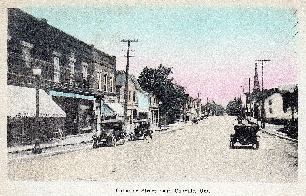 c. 1910
 c. 1910
 c. 1910
 c. 1910
 c. 1910
 1914
 c. 1916
 1920
Public domain or CC0, made before 1950, from Wikimedia Commons; old views of places can be drawings, prints or maps of their time. Each credit opens the image’s page.
From 1856 on: the dated places within 25 km of Oakville
The nearest historic places to Oakville, out to 25 km, by the first construction date on each record.
Oldest of all: Hamilton Waterworks, Parkview West, 1856. Within 25 km, 8 records give a date. 2 are older than 1867.
The heritage closest to Oakville: Lislehurst, at 11 km
Among them are 5 National Historic Sites and 4 provincial or municipal listings. 9 places lie within 25 km. Of 5 top designations nearby, Royal Botanical Gardens is the closest, at 23 km.
The 9 nearest, within 25 km
| LislehurstDesignated heritage property (part IV) · 1885 · 11 km away, in Erin Mills |
| Adamson EstateDesignated heritage property (part IV) · 17 km away, in Lakeview |
| Boston Presbyterian ChurchDesignated heritage property (part IV) · 1868 · 19 km away, in Georgetown |
| Royal Botanical GardensNational Historic Site · 1929–1990 · 23 km away, in Burlington |
| Hamilton WaterworksNational Historic Site · 1856–1860 · 23 km away, in Parkview West |
| HMCS HaidaNational Historic Site · 1942–1943 · 23 km away, in North End East |
| Former Hamilton Railway Station (Canadian National)National Historic Site · 1929–1932 · 25 km away, in Beasley |
| Former Hamilton Customs HouseNational Historic Site · 1858–1861 · 25 km away, in Central |
| Christ's Church CathedralOntario Heritage Trust easement · 1873 · 25 km away, in Beasley |
Oakville is still building: 11% of homes date from 2016 to 2021, against 4.1%
Homes built from 2001 to 2015 make up 27% of Oakville’s, against 15% in the typical town. Oakville’s largest group of homes, 35%, went up from 1981 to 2000. Only 19% of Oakville’s homes were built from 1961 to 1980, less than the typical town’s 27%.
2021 Census, private dwellings by period of construction (Statistics Canada); the typical town is the middle Canadian town of 2,500 or more.
Natives of Oakville from 1844 to 1901
The widest known is Brock Chisholm: 23 Wikipedia editions. Wikidata and Wikipedia agree on 11 births here before 1914. Most of them, 6 of 11, came into the world in the decades after Confederation. Martha Matilda Harper lived longest, to 93, dying in 1950.


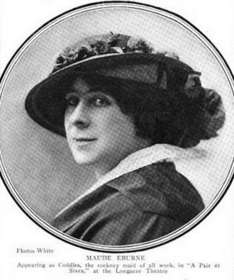


Everyone born in Oakville → Born before 1914 (the page’s periods: Confederation to the First World War). Birthplaces from Wikidata, each checked against the person’s Wikipedia article.
How Oakville compares with 16 towns its size
Towns of 160,800 to 239,600 residents, by places on the registers.
13 have more. Their median is 2. 3 of them have none.
Oakville and its neighbours
| Town | People | Places | Highest | Oldest |
|---|---|---|---|---|
| Oakville | 243,107 | 0 | 0 | — |
| Erin Mills | 39,194 | 1 | 0 | 1885 |
| Sheridan | 15,775 | 0 | 0 | — |
| South Common | 4,867 | 0 | 0 | — |
| Clarkson - Lorne Park | 39,523 | 0 | 0 | — |
| Churchill Meadows | 48,872 | 0 | 0 | — |
| Central Erin Mills | 36,393 | 0 | 0 | — |
Oakville in brief
Its people of the past include Brock Chisholm (1896), Martha Matilda Harper (1857) and Maude Eburne (1875). Its oldest homes, those from before 1961, are 8.1% of the total, against 18% in the typical town. Towns its size usually have more historic places; the middle one has 2.
What this data can and can’t tell you
- The federal register. Parks Canada’s Directory of Federal Heritage Designations lists every National Historic Site, federal heritage building, heritage railway station and lighthouse; the Canadian Register of Historic Places adds their statements in English and French.
- Provincial and municipal lists. The local and provincial lists outside Québec aren’t published openly, so this page counts what Wikidata records and pages only the places an encyclopedia describes.
- Protection. National historic designation honours a place but binds only federal owners; a private building’s protection depends on its province or municipality.
- The grade. History isn’t one of Canada’s graded pillars, so this page describes and compares without a letter.
- The tiers. National Historic Sites and the most protected buildings form the top tier; recognized federal buildings, stations and lighthouses the second; provincial and municipal listings the third.
- People and events. The open directory puts its national historic persons nowhere, so a town shows one only on firm ground: a birth there, matched by name and life years, or a historic place there named for the person whose record says so. Events are left out.
Questions about Oakville’s history
How many historic places does Oakville have on the registers?
None inside Oakville yet. The nearest is Lislehurst, 11 km away in Erin Mills.
When did Oakville become a municipality?
By Wikidata, Oakville dates from 1827; the record doesn’t say whether that is a founding, an incorporation or a merger.
How old are the homes in Oakville?
The 2021 Census dates 8.1% of its homes before 1961 (18% in the typical town).
Why might a heritage building in Oakville be missing here?
Provincial and municipal registers outside Québec aren’t open data. Wikidata knows 13 more listings in Oakville, but without an open description or an encyclopedia article they get no page.
Contains information licensed under the Open Government Licence – Canada (Parks Canada).
Sources: Parks Canada, Directory of Federal Heritage Designations · Canadian Register of Historic Places (federal extract) · Wikidata (CC0) for map points, other names and articles · Statistics Canada, 2021 Census (homes by period of construction). Under the Statistics Canada Open Licence.
Adapted from Statistics Canada (Census of Population 2021, population estimates 2025, 2021 census boundaries) under the Statistics Canada Open Licence; this does not constitute an endorsement by Statistics Canada. Neighbourhood names in some cities © OpenStreetMap contributors (ODbL).