Guest, Sign inJoin
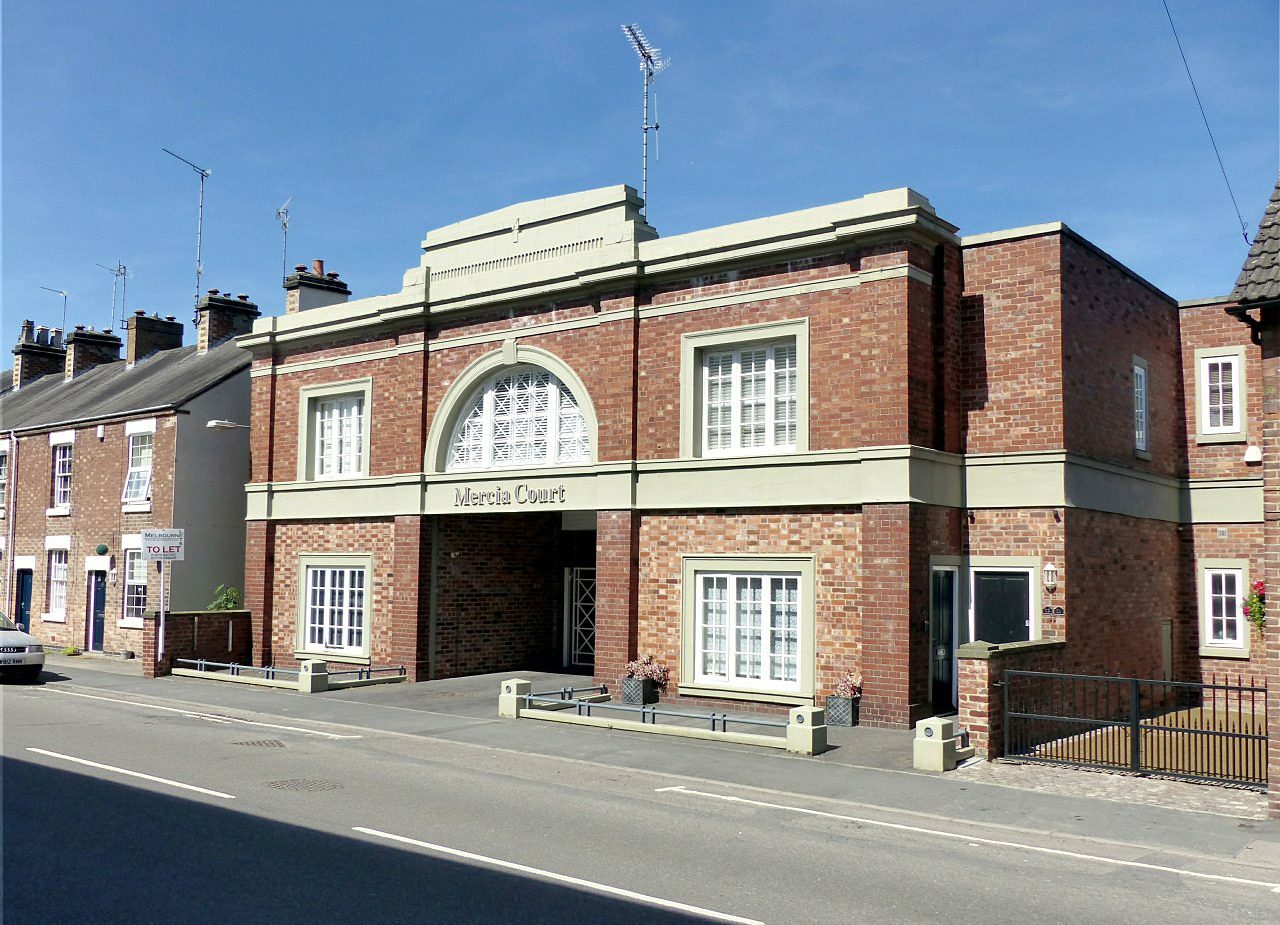
Mercia Court, High Street, ReptonRepton, #1 on this list · Photo: Alan Murray-Rust · CC BY-SA 2.0
Derbyshire · 2026

Best places to live in Derbyshire

Repton ranks first of 59 Derbyshire towns of 2,500+ residents, and #7 of 2,138 UK towns. 12 of the 59 grade A− or better; scores run from 79.7 down to 25.7.

The overall score, sorted within Derbyshire; the letter compares each town with every UK town, and its rank among UK towns sits beside it. How grades work

#1

Repton

Derbyshire · 2,766 people
A+

Score 79.7·#7 of 2,138 UK towns

Strongest: jobs & income A, health A·lowest: hazard risk C+

#2

Melbourne

Derbyshire · 4,860 people
A+

Score 78.4·#13 of 2,138 UK towns

Strongest: cost of living A, jobs & income A−·lowest: walkability B

#3

Hilton

Derbyshire · 8,269 people
A+

Score 74.3·#47 of 2,138 UK towns

Strongest: cost of living A+, jobs & income A+·lowest: walkability D

All 59 towns, ranked

By overall score against UK towns; ranks are within Derbyshire, and each UK rank links to the national list. The score (0–100) blends the seven livability grades and sets the order; the letter places that score among UK towns of 2,500+, and A+ is the top 5%, so neighbours on the list often share a letter.

Every town in Derbyshire →

59 towns.

#TownScoreGrade · UK rankWhat drives it
1Repton2,766 people79.7top 0.4%A+#7 of 2,138 nationallyStrongest: jobs & income A, health A·lowest: hazard risk C+
2Melbourne4,860 people78.4top 0.6%A+#13 of 2,138 nationallyStrongest: cost of living A, jobs & income A−·lowest: walkability B
3Hilton8,269 people74.3top 2.4%A+#47 of 2,138 nationallyStrongest: cost of living A+, jobs & income A+·lowest: walkability D
4Willington2,717 people73.2top 3.1%A+#63 of 2,138 nationallyStrongest: cost of living A, jobs & income A·lowest: hazard risk C−
5Makeney4,691 people71.3top 4.8%A+#99 of 2,138 nationallyStrongest: health A+, jobs & income A+·lowest: hazard risk D−
6Etwall3,080 people69.6top 7.0%A#146 of 2,138 nationallyStrongest: schools A, jobs & income A·lowest: walkability C−
7Wingerworth6,404 people65.7top 12.1%A#251 of 2,138 nationallyStrongest: hazard risk A, jobs & income A−·lowest: walkability D
8Dronfield21,161 people64.7top 13.6%A#282 of 2,138 nationallyStrongest: jobs & income A, schools A−·lowest: walkability C+
9Hatton2,560 people62.0top 17.7%A−#371 of 2,138 nationallyStrongest: cost of living A+, jobs & income B+·lowest: hazard risk D−
10Whaley Bridge4,618 people61.6top 18.8%A−#392 of 2,138 nationallyStrongest: health A−, jobs & income A−·lowest: hazard risk D
11Darley Dale3,985 people61.1top 20.6%A−#431 of 2,138 nationallyStrongest: schools A−, cost of living A−·lowest: hazard risk C
12Bakewell3,275 people59.0top 24.5%A−#514 of 2,138 nationallyStrongest: walkability A, schools A·lowest: hazard risk D−
13Borrowash7,171 people58.4top 25.5%B+#536 of 2,138 nationallyStrongest: schools B+, jobs & income B+·lowest: health C+
14West Hallam5,912 people57.8top 27.0%B+#569 of 2,138 nationallyStrongest: hazard risk A, safety A−·lowest: schools C−
15Matlock11,990 people57.1top 28.1%B+#592 of 2,138 nationallyStrongest: cost of living A, walkability A−·lowest: hazard risk C
16Belper19,076 people57.0top 28.3%B+#595 of 2,138 nationallyStrongest: cost of living B+, jobs & income B·lowest: hazard risk C+
17Ashbourne8,854 people54.7top 33.7%B+#710 of 2,138 nationallyStrongest: cost of living A, walkability A−·lowest: safety C+
18Heage2,584 people54.4top 34.3%B+#723 of 2,138 nationallyStrongest: cost of living A−, safety A−·lowest: walkability D
19Breaston and Draycott7,393 people53.6top 35.7%B#753 of 2,138 nationallyStrongest: jobs & income B, cost of living B·lowest: health C+
20Kilburn and Horsley Woodhouse4,447 people53.1top 36.5%B#769 of 2,138 nationallyStrongest: cost of living A, hazard risk B·lowest: walkability C−
21Wirksworth4,904 people52.8top 37.1%B#782 of 2,138 nationallyStrongest: cost of living A, walkability B+·lowest: schools C
22Sandiacre9,373 people50.7top 41.4%B#875 of 2,138 nationallyStrongest: cost of living B+, schools B+·lowest: health C
23New Mills9,195 people50.4top 41.9%B#888 of 2,138 nationallyStrongest: walkability A, hazard risk B·lowest: schools C
24Chapel-en-le-Frith7,235 people49.8top 43.4%B#918 of 2,138 nationallyStrongest: walkability B+, hazard risk B·lowest: schools C+
25Glossop17,820 people47.1top 49.7%B−#1,053 of 2,138 nationallyStrongest: walkability A−, jobs & income B·lowest: hazard risk D
26Overseal and Castle Gresley5,055 people46.4bottom 48.5%B−#1,092 of 2,138 nationallyStrongest: cost of living A+, hazard risk B+·lowest: walkability D−
27Hadfield16,271 people46.4bottom 48.4%B−#1,094 of 2,138 nationallyStrongest: cost of living B+, safety B+·lowest: health C−
28Brimington11,068 people45.1bottom 45.9%B−#1,149 of 2,138 nationallyStrongest: schools A−, cost of living B·lowest: health C−
29Pilsley and Lower Pilsley3,470 people45.1bottom 45.8%B−#1,152 of 2,138 nationallyStrongest: cost of living A−, schools B·lowest: walkability D
30Barlborough2,859 people44.6bottom 44.1%C+#1,187 of 2,138 nationallyStrongest: hazard risk A, jobs & income B+·lowest: walkability C−
31Long Eaton37,815 people43.7bottom 42.2%C+#1,228 of 2,138 nationallyStrongest: walkability A−, cost of living A−·lowest: safety C−
32Shirland and Stonebroom3,988 people42.0bottom 38.1%C+#1,318 of 2,138 nationallyStrongest: hazard risk A, cost of living A−·lowest: jobs & income C−
33Newton and Blackwell3,053 people41.0bottom 35.8%C+#1,366 of 2,138 nationallyStrongest: hazard risk A, cost of living B+·lowest: health C−
34South Normanton and Pinxton16,028 people40.3bottom 34.5%C#1,395 of 2,138 nationallyStrongest: cost of living B+, schools B·lowest: health D
35Whitwell3,722 people40.2bottom 34.1%C#1,403 of 2,138 nationallyStrongest: schools B+, cost of living B+·lowest: health D
36Somercotes and Swanwick15,105 people39.5bottom 32.6%C#1,435 of 2,138 nationallyStrongest: cost of living A, hazard risk A·lowest: schools C−
37Old Tupton4,190 people39.1bottom 31.7%C#1,453 of 2,138 nationallyStrongest: hazard risk B+, cost of living B+·lowest: walkability C−
38Tibshelf4,352 people39.0bottom 31.4%C#1,460 of 2,138 nationallyStrongest: hazard risk A, cost of living B+·lowest: walkability D
39Swadlincote34,569 people38.8bottom 31.1%C#1,466 of 2,138 nationallyStrongest: cost of living A+, hazard risk A·lowest: schools D
40Killamarsh9,082 people38.3bottom 29.7%C#1,496 of 2,138 nationallyStrongest: cost of living B+, safety B−·lowest: schools D
41Chesterfield76,394 people37.9bottom 28.9%C#1,515 of 2,138 nationallyStrongest: walkability B+, cost of living B·lowest: safety D
42Woodville7,255 people37.9bottom 28.7%C#1,518 of 2,138 nationallyStrongest: cost of living A+, hazard risk A·lowest: walkability D
43Ripley20,191 people37.9bottom 28.7%C#1,519 of 2,138 nationallyStrongest: cost of living A−, hazard risk B·lowest: safety D
44Clowne7,759 people37.3bottom 27.3%C#1,548 of 2,138 nationallyStrongest: hazard risk A, cost of living B+·lowest: safety C−
45Gamesley3,124 people36.9bottom 26.2%C#1,573 of 2,138 nationallyStrongest: walkability A, cost of living A·lowest: jobs & income D
46Ilkeston38,723 people36.9bottom 25.9%C#1,578 of 2,138 nationallyStrongest: cost of living A, walkability B+·lowest: safety D
47Buxton20,048 people36.8bottom 25.8%C#1,580 of 2,138 nationallyStrongest: walkability A, cost of living B+·lowest: safety D
48Alfreton8,790 people36.2bottom 24.2%C−#1,615 of 2,138 nationallyStrongest: cost of living A, hazard risk A·lowest: safety D
49Heanor24,264 people36.2bottom 23.9%C−#1,621 of 2,138 nationallyStrongest: cost of living A, walkability B+·lowest: safety D
50Eckington7,435 people36.2bottom 23.8%C−#1,624 of 2,138 nationallyStrongest: cost of living A−, hazard risk B−·lowest: schools D
51Grassmoor3,528 people35.6bottom 22.3%C−#1,656 of 2,138 nationallyStrongest: hazard risk A, cost of living A−·lowest: health D
52Derby275,561 people35.3bottom 21.4%C−#1,675 of 2,138 nationallyStrongest: walkability A−, cost of living A−·lowest: safety D
53Creswell5,792 people33.2bottom 16.4%C−#1,783 of 2,138 nationallyStrongest: cost of living B+, schools B+·lowest: health D−
54North Wingfield and Holmewood9,545 people32.0bottom 13.7%D#1,843 of 2,138 nationallyStrongest: cost of living B+, hazard risk B+·lowest: health D
55Staveley15,151 people31.2bottom 12.5%D#1,867 of 2,138 nationallyStrongest: hazard risk B+, cost of living B·lowest: health D−
56Shirebrook11,571 people31.1bottom 12.4%D#1,870 of 2,138 nationallyStrongest: hazard risk A, walkability A−·lowest: health D−
57Clay Cross8,915 people27.4bottom 6.6%D#1,996 of 2,138 nationallyStrongest: cost of living B+, walkability B+·lowest: health D−
58Bolsover11,228 people27.3bottom 6.4%D#2,000 of 2,138 nationallyStrongest: hazard risk B+, cost of living B·lowest: jobs & income D
59Langwith3,009 people25.7bottom 4.6%D−#2,038 of 2,138 nationallyStrongest: cost of living B+, walkability C+·lowest: health D−
Quick answers

Questions people ask

What is the best place to live in Derbyshire?

Repton ranks first of 59 graded towns of 2,500+: jobs & income (A) and health (A) are its strongest grades; hazard risk (C+) is its lowest. Melbourne and Hilton follow.

How are these towns ranked?

By the overall grade, which blends seven livability grades (cost of living, safety, schools, health, jobs & income, walkability, hazard risk) from public data, each comparing a town with every UK town. The rank is within Derbyshire. How grades work.

Why isn’t my town on this list?

The list covers places of 2,500+ residents with an overall grade. Smaller places, and towns missing figures the overall grade needs, show their subject grades on their own pages; every town in Derbyshire is listed on the county page.

County by county

Best places to live, county by county

Sources: TownRatings grades: our own summary of the data, ranked against UK towns only. All under the Open Government Licence v3.0.

Contains public sector information licensed under the Open Government Licence v3.0. Contains HM Land Registry data © Crown copyright and database right 2026. Contains OS data © Crown copyright and database right 2026 (ONS boundaries). Northern Ireland: Source: NISRA; contains Land & Property Services data and Ordnance Survey of Northern Ireland information, © Crown copyright, licensed under the Open Government Licence v3.0. Scotland: contains National Records of Scotland data, Registers of Scotland data and SEPA data, © Crown copyright / © SEPA 2025, licensed under the Open Government Licence v3.0.