8 places in town are on the National Register, among them two historic districts with 89 buildings between them. Below: 1 old photo or paper, maps from 1895 on, and the census since 1820.
Founding year: the first Jay post office (Blevins & Helbock, CC0).The full story ↓
History grade
What drives Jay’s History grade
On its age, its old homes and the National Register, Jay is more historic than 85% of U.S. towns. All 3 inputs are above most U.S. towns; its National Register listings ranks highest and its share of homes from before 1940 lowest.
A
HistoryA character grade: shown, never part of Jay’s overall grade.
New York towns list more on the Register than most of the country (a typical New York town has 12.3 per 10,000 residents, the U.S. 2.4), so Jay’s 425 sits above most of its state (90% of New York towns have fewer) while its 100 historic buildings outnumber those of 89% of U.S. towns.
How sure. Graded on any two of the three inputs instead, the letter would range from B+ to A. The pre-1940 share is a Census survey estimate (±4.5 points). The founding year is the first post office, not a stated founding date.
Founding year: the first post office (other dates in Quick answers). Homes: Census ACS 2020–24. National Register: National Park Service, May 2026 list; each listing counted once (boundary changes and added documentation belong to their listing), and a historic district counts its contributing buildings. How TownRatings grades history →
What stands out about Jay’s past
Read from the archive, the National Register and the record. The page puts what stands out first.
The area was originally known as "Mallory's Bush", after the principal settlement, based on early settler Nathaniel Mallory, who arrived around 1797..
The town of Jay, named in honor of New York Governor John Jay, was formed in January 1798 from part of the town of Willsboro. Afterwards, part of Jay was used to form, in whole or part, the towns of Keene (1808), Elizabethtown and Wilmington (1821). In 1822, the town was increased by territory from the town of Chateaugay (now in Franklin County), and the town of Peru (now in Clinton County).
Lumber production and iron ore extraction were important to the early economy of the town.
Land of Makebelieve, an amusement park (1954–1979), was located in Upper Jay.
Jay had started out in the railroad field with a bang, and from that day to the end of his life considered himself a railroad man. We do not have many details of Gould’s first coups. He was still working entirely alone, and not on large roads. He saw great possibilities in this field of buying up small trunk roads and selling them to large consolidations. Another opportunity came to him in the same year. A friend told Gould that he
Text read by machine from the scan; it may contain errors.
The American Secretaries of State and Their Diplomacy. Volume I1927 · page 310Read the page →
Read the text
Floridas, 19, 20, 23, 25, 29, 30, 62, 138, 219, 236, 269, 299; draft boundary convention (1803), 85; settlement of Jay Treaty controversies, 85; Maryland bankstock settlement, 86. See also Impressment; Napoleonic wars; Neutral trade; War of 1812.
Text read by machine from the scan; it may contain errors.
Rutland & Washington Railroad was in its last stages of decay. The stock of the road was worth nothing, and the first mortgage bonds were selling at io cents on the dollar. Miller sent Jay up to look things over, more to give his son-in-law something to do, rather than in hope of retrieving anything from the investment. Jay was familiar with the territory; he had been reared in the vicinity, and as a surveyor had covered a large
Text read by machine from the scan; it may contain errors.
The American Secretaries of State and Their Diplomacy. Volume I1927 · page 203Read the page →
Read the text
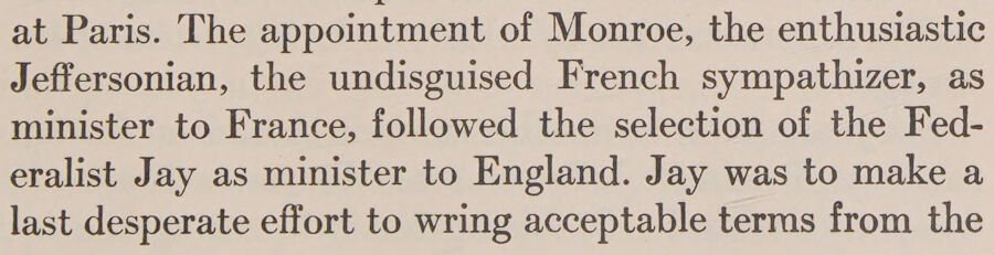
at Paris. The appointment of Monroe, the enthusiastic Jeffersonian, the undisguised French sympathizer, as minister to France, followed the selection of the Federalist Jay as minister to England. Jay was to make a last desperate effort to wring acceptable terms from the
Text read by machine from the scan; it may contain errors.
Scans and text from the Internet Archive. Books published in 1930 or earlier, which are in the public domain.
Timeline
Jay, 1803 to 1942
Woven from the archive, old maps, post office records, the National Register and the people born here.
Nothing in the archives for these yearsWeddings on Main Street, storms, parades, school pictures, the old store. If it’s in your family album, it belongs here.
The Jay post office opened in 1803, the earliest record of the town by name (U.S. post office records).
How does Jay rank for history?
Jay is more historic than 85% of U.S. towns. The History grade combines the town’s founding era, the share of homes built before 1940 and its National Register listings. It’s a character grade, so it isn’t part of the overall grade. How it works.
What is on the National Register in Jay?
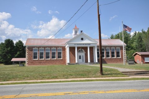
8 listings: 6 buildings, among them the Hopkins Cottage (listed 1992, the first), and 2 historic districts, the Asgaard Farm and the Au Sable Forks Historic District, with 89 contributing buildings. 100 historic buildings in all.
How old are the homes in Jay?
12% of Jay’s homes were built before 1940 (Census estimate, ±4.5 points), against a typical 27% for a New York town; the median home was built in 1977.
Founding dates: Wikidata, Wikipedia, the U.S. post office records of Blevins & Helbock (CC0) and the Census. Homes by year built: Census ACS 2020–24. National Register of Historic Places: National Park Service (list of May 22, 2026). Old photos, postcards and papers: Wikimedia Commons, the Library of Congress and other public archives, credited on each item’s page. Maps: U.S. Geological Survey historical topographic maps (via Esri) and Sanborn fire-insurance maps (Library of Congress). History text and census tables: Wikipedia (CC BY-SA 4.0). Places that used to be: USGS Geographic Names Information System (2021).
From Wikimedia Commons (8), Wikidata (1), the National Register of Historic Places (8), Wikipedia, Wikidata and Wikipedia for famous people, U.S. Geological Survey historical maps, U.S. Census counts (via Wikipedia), the US Post Offices dataset (Blevins & Helbock), the USGS Geographic Names Information System and old county and town histories (Internet Archive). Archive images are copied here with their credits and licenses, shown on each photo’s page. Refreshed monthly.




 2026
 2018
 2018
 2018
 2018
 2018
 2018