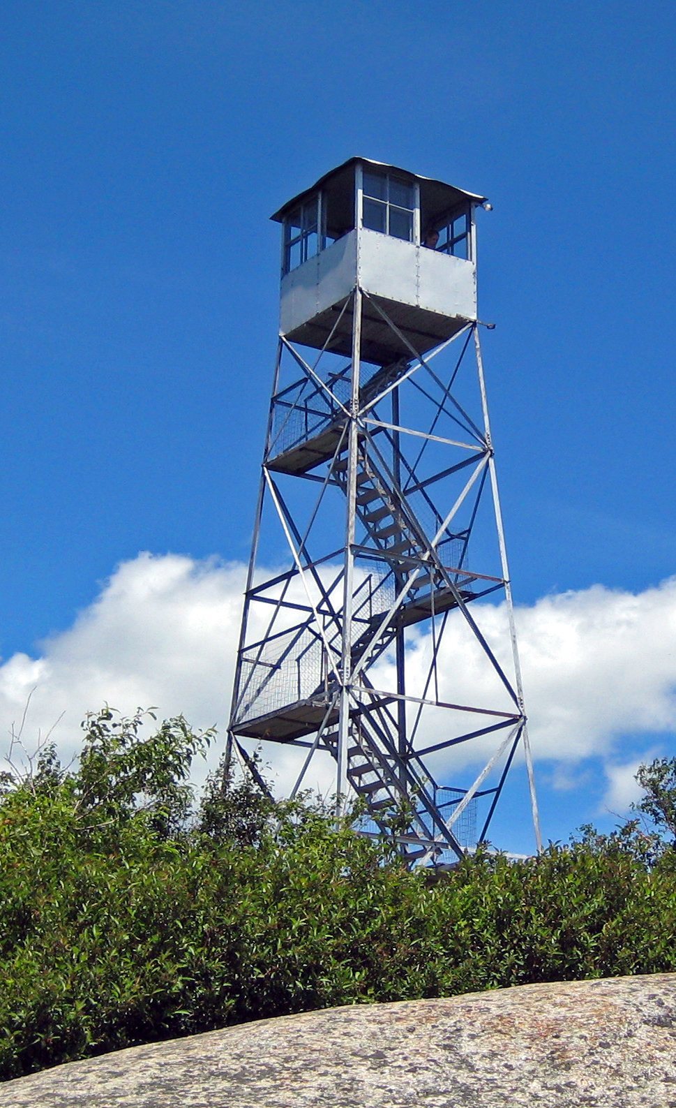
Its Register listings are the Poke-O-Moonshine Mountain Fire Observation Station and the First Congregational Church and Cemetery. Below: maps from 1895 on and the census since 1820.
Founding year: Wikipedia. First post office: 1818.The full story ↓
History grade
What drives Lewis’ History grade
On its age, its old homes and the National Register, Lewis is more historic than 77% of U.S. towns. All 3 inputs are above most U.S. towns; its age ranks highest and its National Register listings lowest.
A−
HistoryA character grade: shown, never part of Lewis’ overall grade.
New York towns list more on the Register than most of the country (a typical New York town has 12.3 per 10,000 residents, the U.S. 2.4), so Lewis’ 17.3 sits near the middle of its state (54% of New York towns have fewer) while its 2 listings outnumber those of 60% of U.S. towns.
How sure. Graded on any two of the three inputs instead, the letter would range from B+ to A−. The pre-1940 share is a Census survey estimate (±6.9 points). Two sources give 1805.
Founding year: Wikipedia (other dates in Quick answers). Homes: Census ACS 2020–24. National Register: National Park Service, May 2026 list; each listing counted once (boundary changes and added documentation belong to their listing), and a historic district counts its contributing buildings. How TownRatings grades history →
What stands out about Lewis’ past
Read from the archive, the National Register and the record. The page puts what stands out first.
The town of Lewis was established in 1805 from a section of the town of Willsboro. Part of Lewis was taken in 1844 and 1854 to increase the size of the town of Elizabethtown.
Iron mining was an important early industry. Both Stowersville and Deerhead were communities based on the iron industry.
The First Congregational Church and Cemetery was listed on the National Register of Historic Places in 2005.
Passages that mention Lewis, cut from the printed page as they were published.
A history of Lewis County, West Virginia1920 · page 294Read the page →
Read the text
The neighboring counties were almost as much divided as Lewis. Harrison, though strongly Union for the most part, had a strong Southern group on Duck creek, just north of the Lewis County line. Upshur was almost solidly for the North, with the exception of a settlement in the extreme southern part of the county, corresponding to the Collins Settlement in Lewis ; though the French creek settlement exercised a great influence
Text read by machine from the scan; it may contain errors.
A history of Lewis County, West Virginia1920 · page 200Read the page →
Read the text
Whorter's Mills with Fields McWhorter as postmaster, in 1829. The number of residents in the vicinity and the natural importance of the site as a center for the Hacker's creek community led Lewis Maxwell, one of the founders of Weston, to purchase the Jacob Bonnett farm and divide it into town lots, in 1835. The town thus laid out was named Jane Lew in honor of Jane Lewis, mother of Lewis Maxwell. There were several
Text read by machine from the scan; it may contain errors.
Scans and text from the Internet Archive. Books published in 1930 or earlier, which are in the public domain.
Timeline
Lewis, 1805 to 1922
Woven from the archive, old maps, post office records, the National Register and the people born here.
In 1805, according to Wikipedia’s history of the town. Lewis’ post office opened in 1818, and the census of 1820 counted 779 people here.
How does Lewis rank for history?
Lewis is more historic than 77% of U.S. towns. The History grade combines the town’s founding era, the share of homes built before 1940 and its National Register listings. It’s a character grade, so it isn’t part of the overall grade. How it works.
What is on the National Register in Lewis?
Two places: the Poke-O-Moonshine Mountain Fire Observation Station (listed 2001) and the First Congregational Church and Cemetery (2005).
How old are the homes in Lewis?
18% of Lewis’ homes were built before 1940 (Census estimate, ±6.9 points), against a typical 27% for a New York town; the median home was built in 1980.
Founding dates: Wikidata, Wikipedia, the U.S. post office records of Blevins & Helbock (CC0) and the Census. Homes by year built: Census ACS 2020–24. National Register of Historic Places: National Park Service (list of May 22, 2026). Old photos, postcards and papers: Wikimedia Commons, the Library of Congress and other public archives, credited on each item’s page. Maps: U.S. Geological Survey historical topographic maps (via Esri) and Sanborn fire-insurance maps (Library of Congress). History text and census tables: Wikipedia (CC BY-SA 4.0). Places that used to be: USGS Geographic Names Information System (2021).
From the National Register of Historic Places (2), Wikipedia, Wikidata and Wikipedia for famous people, U.S. Geological Survey historical maps, U.S. Census counts (via Wikipedia), the US Post Offices dataset (Blevins & Helbock), the USGS Geographic Names Information System and old county and town histories (Internet Archive). Archive images are copied here with their credits and licenses, shown on each photo’s page. Refreshed monthly.