Middlebury dates to 1761, and 26% of its homes were built before 1940
More historic than 98% of U.S. towns · #10 of 71 in Vermont. What drives it
9 places in town are on the National Register, among them the Emma Willard House, a National Historic Landmark, and three historic districts with 469 buildings between them. Below: 22 old photos and papers, maps from 1885 on, and the census since 1790.
Founding year: Wikidata. First post office: 1793.The full story ↓
History grade
What drives Middlebury’s History grade
On its age, its old homes and the National Register, Middlebury is more historic than 98% of U.S. towns, #10 of 71 in Vermont. All 3 inputs are above most U.S. towns; its age ranks highest and its share of homes from before 1940 lowest.
A+
HistoryA character grade: shown, never part of Middlebury’s overall grade.
Vermont towns list more on the Register than most of the country (a typical Vermont town has 147 per 10,000 residents, the U.S. 2.4), so Middlebury’s 519 sits above most of its state (87% of Vermont towns have fewer) while its 476 historic buildings outnumber those of 97% of U.S. towns.
NoteThe founding year comes from Wikidata alone; no second source gives 1761.
How sure. Graded on any two of the three inputs instead, the letter would range from A to A+. The pre-1940 share is a Census survey estimate (±4.2 points).
Founding year: Wikidata (other dates in Quick answers). Homes: Census ACS 2020–24. National Register: National Park Service, May 2026 list; each listing counted once (boundary changes and added documentation belong to their listing), and a historic district counts its contributing buildings. How TownRatings grades history →
What stands out about Middlebury’s past
Read from the archive, the National Register and the record. The page puts what stands out first.
The country’s official list of buildings and places worth saving. One is a National Historic Landmark, the highest tier. Boundary changes and added documentation are counted with their listing.
Nothing in the archives for these yearsWeddings on Main Street, storms, parades, school pictures, the old store. If it’s in your family album, it belongs here.
One of the New Hampshire Grants, Middlebury was chartered by Colonial Governor Benning Wentworth on November 2, 1761. The name "Middlebury" came from its location between the towns of Salisbury and New Haven. It was awarded to John Evarts and 62 others. The French and Indian Wars ended in 1763; the first settlers arrived in 1766. John Chipman was the first to clear his land, Lot Seven. During the Revolutionary War, much of the town was burned in Carleton's Raid on November 6, 1778. After the war concluded in 1783, settlers returned to rebuild homes, clear forests and establish farms. The principal crops were grains and hay.
Passages that mention Middlebury, cut from the printed page as they were published.
History of Addison county Vermont, with illustrations and biographical sketches of some of its prominent men and pioneers1886 · page 239Read the page →
Read the text
" 4. Voted that, if any man or men, by the first day of May next shall appear and give sufficient bond to the proprietor's Committee to build a good saw-mill, within fifteen months from this day in the township of Middlebury, he shall have any mill-place he or they shall choose in said township, viz : in the undivided part thereof, and also fifty acres of land adjoining said millplace, he or they to be at the cost of laying out said fifty acres, and build said mill so as to leave room for fifty acres, to be laid out to accommodate a grist mill, and proper place to set a grist mill, if the proprietors see fit to improve it.
Text read by machine from the scan; it may contain errors.
History of the town of Middlebury, in the country of Addison, Vermont1859Read the page →
Read the text
'' March, 1700, "Voted to receive that partof the town of Cornwall.and petition the legislature to have the same annexed to the town of Middlebury, which said town of Cornwall have voted should bo annexed to said Middlebui-y." »• Voted not to set oft" the westerly part of Middlebury to Cornwall. " ' ' Voted that the house of Samuel Mattooks be the place of holding town and freemen's meetings in future."
Text read by machine from the scan; it may contain errors.
History of Addison county Vermont, with illustrations and biographical sketches of some of its prominent men and pioneers1886 · page 432Read the page →
Read the text
three rods each way from the line surveyed. In 1795 the town decided to make the width of the roads discretionary with the selectmen, in the exercise •of which discretion they have considerably narrowed the roads. Before the setting off of a portion of Cornwall to Middlebury, this town was responsible with Middlebury for all the bridges which it was necessary to build over the creek between the towns. Since its release from the expense of sharing in the maintenance of these bridges, the town has had occasion to make appropriations worth speaking of for only two bridges, viz., that across the Fair and the
Text read by machine from the scan; it may contain errors.
History of the town of Middlebury, in the country of Addison, Vermont1859 · page 16Read the page →
Read the text
Middlcbury River rises in the mountain east of Middlebury, in two branches ; the principal of which rises within the limits of Hancock. These unite in Ripton, and the stream descending the west slope of the mountain, empties into the creek near the south line of Middlebury. At the village of East Middlebury, at tho foot of the mountain, is a series of falls, which furnish several valuable sites for mills. On these are now a forge, two saw mills, a grist mill, tannery, two shops with machinery for boring, sawing
Text read by machine from the scan; it may contain errors.
Scans and text from the Internet Archive. Books published in 1930 or earlier, which are in the public domain.
Timeline
Middlebury, 1761 to 1972
Woven from the archive, old maps, post office records, the National Register and the people born here.
Every edition of the U.S. Geological Survey’s map of Middlebury. Tap a year, or press play to watch the town change.
1903Middlebury sheet · 1:62,500
U.S. Geological Survey historical topographic maps (public domain), via Esri’s collection of the scans. The red ring marks the center of Middlebury.
Every building
Middlebury, building by building, 1885–1927
Fire insurance maps drew every building, what it was made of and what it was used for, so insurers could price the risk of fire. Pick a year, then a sheet.
In 1761, according to Wikidata. Middlebury’s post office opened in 1793, and the first U.S. census counted 395 people here in 1790.
How does Middlebury rank for history?
Middlebury is more historic than 98% of U.S. towns, #10 of 71 in Vermont. The History grade combines the town’s founding era, the share of homes built before 1940 and its National Register listings. It’s a character grade, so it isn’t part of the overall grade. How it works.
What is on the National Register in Middlebury?
9 listings: 4 buildings, among them the Emma Willard House (a National Historic Landmark since 1965), 3 historic districts, the Heights, The, the Fenn Farm and the Middlebury Village Historic District, with 469 contributing buildings, and 2 structures. 476 historic buildings in all.
How old are the homes in Middlebury?
26% of Middlebury’s homes were built before 1940 (Census estimate, ±4.2 points), against a typical 22% for a Vermont town; the median home was built in 1976.
Founding dates: Wikidata, Wikipedia, the U.S. post office records of Blevins & Helbock (CC0) and the Census. Homes by year built: Census ACS 2020–24. National Register of Historic Places: National Park Service (list of May 22, 2026). Old photos, postcards and papers: Wikimedia Commons, the Library of Congress and other public archives, credited on each item’s page. Maps: U.S. Geological Survey historical topographic maps (via Esri) and Sanborn fire-insurance maps (Library of Congress). History text and census tables: Wikipedia (CC BY-SA 4.0). Places that used to be: USGS Geographic Names Information System (2021).
From Wikimedia Commons (22), Wikidata (1), the National Register of Historic Places (9), Wikipedia, Wikidata and Wikipedia for famous people, U.S. Geological Survey historical maps, U.S. Census counts (via Wikipedia), the US Post Offices dataset (Blevins & Helbock), the USGS Geographic Names Information System, Sanborn fire insurance maps (Library of Congress) and old county and town histories (Internet Archive). Archive images are copied here with their credits and licenses, shown on each photo’s page. Refreshed monthly.


 ★ Landmark


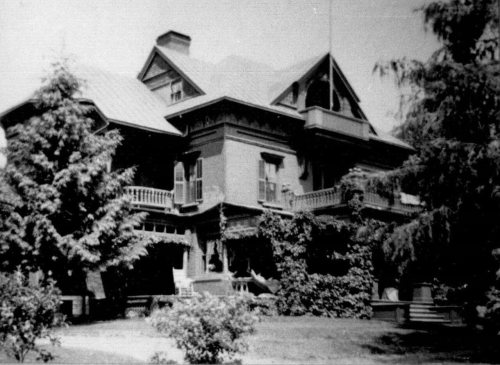

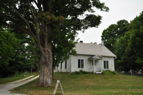

 1850
 1868
 1908
 1910
 c. 1930
 c. 1930
 c. 1930
 c. 1930
 c. 1930
 c. 1930
 c. 1930
 c. 1930
 c. 1930
 c. 1930
 c. 1930
 1933
 1933
 1933
 1933
 1933
 1933
 1933


