Weybridge dates to 1761, and 19% of its homes were built before 1940
4 places in town are on the National Register, among them a historic district with 3 buildings. Below: 1 old photo or paper, maps from 1903 on, and the census since 1790.
Lost half of its people between 1830 and 1940, then more than doubled.
24 censuses, 1790–2020.
U.S. Census Bureau decennial counts, from the census table on Weybridge’s Wikipedia page.
On the map
Weybridge on the map, 1903 to 1963
Every edition of the U.S. Geological Survey’s map of Weybridge. Tap a year, or press play to watch the town change.
1903Middlebury sheet · 1:62,500
U.S. Geological Survey historical topographic maps (public domain), via Esri’s collection of the scans. The red ring marks the center of Weybridge.
The story so far
Weybridge, in brief
Wikipedia doesn’t have a history of Weybridge yet. The photos, dates and memories neighbors add here are how it gets written.
Weybridge is a town in Addison County, Vermont, United States. The population was 814 at the 2020 census.
Weybridge was established in 1761. Between the 2010 and 2020 censuses its population fell from 833 to 814 (-2%).
Intro from Wikipedia. Population: U.S. Census Bureau.
From the old history books
What they wrote about Weybridge in 1886
Passages that mention Weybridge, cut from the printed page as they were published.
History of Addison county Vermont, with illustrations and biographical sketches of some of its prominent men and pioneers1886Read the page →
Read the text
year, in Weybridge one year, and in Starksboro five years, where he conducted a rake factory and wheelwright shop, after which he went to New Haven for three years, working at the carpenter and joiner's trade. In the spring of 1875 he came to Weybridge and worked at his trade until May, 1880, when he took charge of the Weybridge grist-mill, which he has since conducted. He was married March 20, 1805, to Miss Marcia L. Evans, of Randolph, Vt. They have had three sons born to them — Albert E., who died December 2, 1885, aged nineteen; Merle B., now a student at Beeman Academy, New Haven, and Claude M. Mr. Sneden haa always taken a deep interest in the issues of the day, and for many years has been an earnest
Text read by machine from the scan; it may contain errors.
History of Addison county Vermont, with illustrations and biographical sketches of some of its prominent men and pioneers1886 · page 271Read the page →
Read the text
After Daniel Foot discovered the defect in his title under the Weybridge charter, he purchased the right of pitching under the Cornwall charter and laid out one hundred acres, which included the whole of the falls on the Cornwall side and extended some forty rods south of them to " the old Weybridge corner." In the same year (1784) he erected a large building for a saw and a gristmill; the first was put in operation in July, and the other in November, 1785.
Text read by machine from the scan; it may contain errors.
Scans and text from the Internet Archive. Books published in 1930 or earlier, which are in the public domain.
Timeline
Weybridge, 1761 to 1913
Woven from the archive, old maps, post office records, the National Register and the people born here.
In 1761, according to Wikidata. Weybridge’s post office opened in 1832, and the first U.S. census counted 175 people here in 1790.
What is on the National Register in Weybridge?
4 listings: 2 buildings, 1 historic district, the University of Vermont Morgan Horse Farm, with 3 contributing buildings, and 1 structure. 5 historic buildings in all.
Founding dates: Wikidata, Wikipedia, the U.S. post office records of Blevins & Helbock (CC0) and the Census. Homes by year built: Census ACS 2020–24. National Register of Historic Places: National Park Service (list of May 22, 2026). Old photos, postcards and papers: Wikimedia Commons, the Library of Congress and other public archives, credited on each item’s page. Maps: U.S. Geological Survey historical topographic maps (via Esri) and Sanborn fire-insurance maps (Library of Congress). History text and census tables: Wikipedia (CC BY-SA 4.0). Places that used to be: USGS Geographic Names Information System (2021). How TownRatings grades history →
From Wikimedia Commons (17), Wikidata (1), the National Register of Historic Places (4), Wikidata and Wikipedia for famous people, U.S. Geological Survey historical maps, U.S. Census counts (via Wikipedia), the US Post Offices dataset (Blevins & Helbock), the USGS Geographic Names Information System and old county and town histories (Internet Archive). Archive images are copied here with their credits and licenses, shown on each photo’s page. Refreshed monthly.


 2015
 2014
 2013
 2013
 2013
 2013
 2013
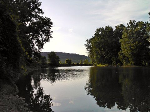 2012
 2012
 2012
 2012
 2011
 2011
 2011
 2009
 2004


