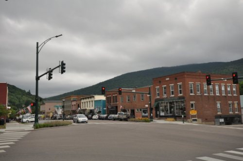
Bristol dates to 1762, and 30% of its homes were built before 1940
More historic than 94% of U.S. towns · #26 of 71 in Vermont. What drives it
1 place in town is on the National Register, among them a historic district with 19 buildings. Below: 28 old photos and papers, maps from 1885 on, and the census since 1790.
Founding year: Wikidata; Wikipedia’s history section gives the same year. First post office: 1804.
History grade
What drives Bristol’s History grade
On its age, its old homes and the National Register, Bristol is more historic than 94% of U.S. towns, #26 of 71 in Vermont. All 3 inputs are above most U.S. towns; its age ranks highest and its National Register listings lowest.
A
HistoryA character grade: shown, never part of Bristol’s overall grade.
Vermont towns list more on the Register than most of the country (a typical Vermont town has 147 per 10,000 residents, the U.S. 2.4), so Bristol’s 50.3 sits near the middle of its state (49% of Vermont towns have fewer) while its 19 historic buildings outnumber those of 79% of U.S. towns.
How sure. Graded on any two of the three inputs instead, the letter would range from A− to A+. The pre-1940 share is a Census survey estimate (±7.4 points). Two sources give 1762.
Founding year: Wikidata (other dates in Quick answers). Homes: Census ACS 2020–24. National Register: National Park Service, May 2026 list; each listing counted once (boundary changes and added documentation belong to their listing), and a historic district counts its contributing buildings. How TownRatings grades history →
What stands out about Bristol’s past
Read from the archive, the National Register and the record. The page puts what stands out first.
Nothing in the archives for these yearsWeddings on Main Street, storms, parades, school pictures, the old store. If it’s in your family album, it belongs here.
Nothing in the archives for these yearsWeddings on Main Street, storms, parades, school pictures, the old store. If it’s in your family album, it belongs here.
Fire insurance maps drew every building, what it was made of and what it was used for, so insurers could price the risk of fire. Pick a year, then a sheet.
1885Sheet 1 of 1
Edition
Sheets
BrickWoodStone
Sanborn Map Company, via the Library of Congress. Editions published in 1930 or earlier, which are in the public domain.
On the map
Bristol on the map, 1903 to 1997
Every edition of the U.S. Geological Survey’s map of Bristol. Tap a year, or press play to watch the town change.
1903Middlebury sheet · 1:62,500
U.S. Geological Survey historical topographic maps (public domain), via Esri’s collection of the scans. The red ring marks the center of Bristol.
The story so far
Bristol, in brief
Wikipedia doesn’t have a history of Bristol yet. The photos, dates and memories neighbors add here are how it gets written.
Bristol is a town in Addison County, Vermont, United States. The town was chartered on June 26, 1762, by the colonial governor of New Hampshire, Benning Wentworth. The charter was granted to Samuel Averill and sixty-three associates in the name of Pocock—in honor of a distinguished English admiral of that name. The population was 3,782 at the 2020 census. Main Street is home to most of the businesses of the town. The town is also home to the Lord's Prayer Rock.
Bristol was established in 1762. Between the 2010 and 2020 censuses its population fell from 3,894 to 3,782 (-3%).
Intro from Wikipedia. Population: U.S. Census Bureau.
From the old history books
What they wrote about Bristol in 1886
Passages that mention Bristol, cut from the printed page as they were published.
History of Addison county Vermont, with illustrations and biographical sketches of some of its prominent men and pioneers1886 · page 398Read the page →
Read the text
23,606 acres; but this area was curtailed by the Legislature November 18, 1824, when a portion of land described as follows was set off to the town of Lincoln, viz. : " Beginning at the southeast corner of the town of Bristol and thence running west one mile to the west line of the second tier of lots ; thence north on the west line of said lots six miles and eighty rods, to the north line of lots numbered twenty-two and twenty-three ; thence east to Starksboro line ; thence south to the northwest corner of Lincoln; and thence south on Lincoln
Text read by machine from the scan; it may contain errors.
History of Addison county Vermont, with illustrations and biographical sketches of some of its prominent men and pioneers1886 · page 411Read the page →
Read the text
Post-office. — A post-office was first established in Bristol in 1803, with Thaddeus McLaughlin postmaster. The office was located in the first brick building erected in the town, by the father of Thaddeus, Henry McLaughlin, in 1800, and located about a mile west of the present village. Previous to this the mail matter for Bristol, consisting of a few letters and the Middlebury Mercury, was brought from Middlebury each week by the settlers themselves, who
Text read by machine from the scan; it may contain errors.
Scans and text from the Internet Archive. Books published in 1930 or earlier, which are in the public domain.
Timeline
Bristol, 1762 to 1940
Woven from the archive, old maps, post office records, the National Register and the people born here.
In 1762, according to Wikidata and Wikipedia’s history of the town. Bristol’s post office opened in 1804, and the first U.S. census counted 211 people here in 1790.
How does Bristol rank for history?
Bristol is more historic than 94% of U.S. towns, #26 of 71 in Vermont. The History grade combines the town’s founding era, the share of homes built before 1940 and its National Register listings. It’s a character grade, so it isn’t part of the overall grade. How it works.
What is on the National Register in Bristol?
One place: the Bristol Downtown Historic District (listed 1983).
How old are the homes in Bristol?
30% of Bristol’s homes were built before 1940 (Census estimate, ±7.4 points), against a typical 22% for a Vermont town; the median home was built in 1976.
Founding dates: Wikidata, Wikipedia, the U.S. post office records of Blevins & Helbock (CC0) and the Census. Homes by year built: Census ACS 2020–24. National Register of Historic Places: National Park Service (list of May 22, 2026). Old photos, postcards and papers: Wikimedia Commons, the Library of Congress and other public archives, credited on each item’s page. Maps: U.S. Geological Survey historical topographic maps (via Esri) and Sanborn fire-insurance maps (Library of Congress). History text and census tables: Wikipedia (CC BY-SA 4.0). Places that used to be: USGS Geographic Names Information System (2021).
From Wikimedia Commons (7), the Library of Congress (21), the National Register of Historic Places (1), U.S. Geological Survey historical maps, U.S. Census counts (via Wikipedia), the US Post Offices dataset (Blevins & Helbock), the USGS Geographic Names Information System, Sanborn fire insurance maps (Library of Congress) and old county and town histories (Internet Archive). Archive images are copied here with their credits and licenses, shown on each photo’s page. Refreshed monthly.


 c. 1865
 c. 1865
 1890
 1890
 1933
 1940
 1940
 1940
 1940
 1940
 1940
 1940
 1940
 1940
 1940
 1940
 1940
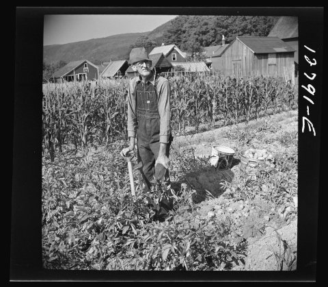 1940
 1940
 1940
 1940
 1940
 1940
 1940
 1940
 1940
 1940
 1940