Ripton dates to 1781, and 27% of its homes were built before 1940
2 places in town are on the National Register, among them the Robert Frost Farm, a National Historic Landmark. Below: maps from 1902 on and the census since 1810.
Lost two-thirds of its people between 1880 and 1960, then grew 5-fold.
22 censuses, 1810–2020.
U.S. Census Bureau decennial counts, from the census table on Ripton’s Wikipedia page.
On the map
Ripton on the map, 1902 to 1997
Every edition of the U.S. Geological Survey’s map of Ripton. Tap a year, or press play to watch the town change.
1902Brandon sheet · 1:62,500
U.S. Geological Survey historical topographic maps (public domain), via Esri’s collection of the scans. The red ring marks the center of Ripton.
The story so far
Ripton, in brief
Wikipedia doesn’t have a history of Ripton yet. The photos, dates and memories neighbors add here are how it gets written.
Ripton is a town in Addison County, Vermont, United States. The population was 739 at the 2020 census.
Ripton was established in 1781. Between the 2010 and 2020 censuses its population grew from 588 to 739 (+26%).
Intro from Wikipedia. Population: U.S. Census Bureau.
From the old history books
What they wrote about Ripton in 1886
Passages that mention Ripton, cut from the printed page as they were published.
History of Addison county Vermont, with illustrations and biographical sketches of some of its prominent men and pioneers1886 · page 235Read the page →
Read the text
The town of Middlebury is bounded at the present time as follows : On the north by New Haven and Bristol ; on the east by Ripton ; on the south by Salisbury, and on the west by Weybridge and Cornwall. The surface of the town is, since the setting off to the town of Ripton of a large part of the eastern mountainous tract,1 either level, rolling or moderately hilly, except the portion which lies along the western slopes and ridges of the mountains ; much of this latter is steep and almost unfit for tillage ; some of it is good for pasturage and small portions of it for cultivation. The lands lying along Otter Creek
Text read by machine from the scan; it may contain errors.
History of Addison county Vermont, with illustrations and biographical sketches of some of its prominent men and pioneers1886Read the page →
Read the text
Ripton, history of the town of, 590. churches of, 594. early settlements of, 591.
Text read by machine from the scan; it may contain errors.
Scans and text from the Internet Archive. Books published in 1930 or earlier, which are in the public domain.
Timeline
Ripton, 1781 to 2020
Woven from the archive, old maps, post office records, the National Register and the people born here.
Founding dates: Wikidata, Wikipedia, the U.S. post office records of Blevins & Helbock (CC0) and the Census. Homes by year built: Census ACS 2020–24. National Register of Historic Places: National Park Service (list of May 22, 2026). Old photos, postcards and papers: Wikimedia Commons, the Library of Congress and other public archives, credited on each item’s page. Maps: U.S. Geological Survey historical topographic maps (via Esri) and Sanborn fire-insurance maps (Library of Congress). History text and census tables: Wikipedia (CC BY-SA 4.0). Places that used to be: USGS Geographic Names Information System (2021). How TownRatings grades history →
From Wikimedia Commons (9), the Library of Congress (2), the National Register of Historic Places (2), U.S. Geological Survey historical maps, U.S. Census counts (via Wikipedia), the US Post Offices dataset (Blevins & Helbock), the USGS Geographic Names Information System and old county and town histories (Internet Archive). Archive images are copied here with their credits and licenses, shown on each photo’s page. Refreshed monthly.


 2017
 2017
 2014
 2014
 2014
 2011
 2011
 2011
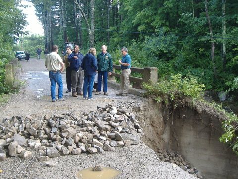 2008
 2004
 2004
 ★ Landmark
