Xenia dates to 1803, and 16% of its homes were built before 1940
More historic than 89% of U.S. towns · #172 of 993 in Ohio. What drives it
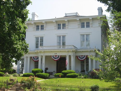
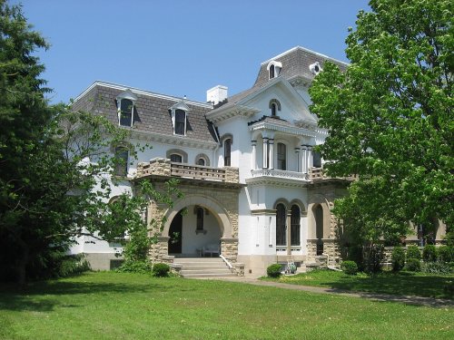
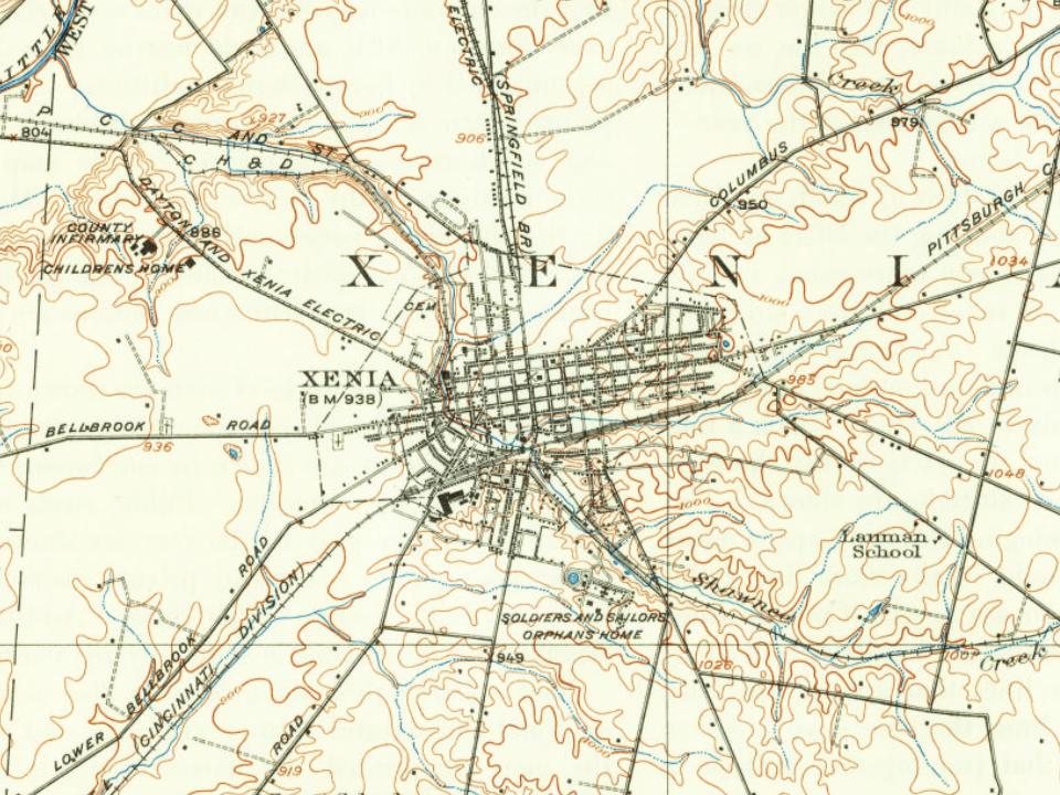
9 places in town are on the National Register, among them three historic districts with 137 buildings between them. Below: 4 old photos and papers, maps from 1885 on, and the census since 1810.
Founding year: Wikidata; Wikipedia’s history section gives the same year. First post office: 1805.The full story ↓
History grade
What drives Xenia’s History grade
On its age, its old homes and the National Register, Xenia is more historic than 89% of U.S. towns, #172 of 993 in Ohio. All 3 inputs are above most U.S. towns; its National Register listings ranks highest and its share of homes from before 1940 lowest.
A
HistoryA character grade: shown, never part of Xenia’s overall grade.
Ohio towns list about as much on the Register as the country (a typical Ohio town has 2.9 per 10,000 residents, the U.S. 2.4), so Xenia’s 56.4 sits above most of its state (89% of Ohio towns have fewer) while its 145 historic buildings outnumber those of 91% of U.S. towns.
How sure. Graded on any two of the three inputs instead, the letter would range from A− to A. The pre-1940 share (±2.9 points) is firm at this size. Two sources give 1803.
Founding year: Wikidata (other dates in Quick answers). Homes: Census ACS 2020–24. National Register: National Park Service, May 2026 list; each listing counted once (boundary changes and added documentation belong to their listing), and a historic district counts its contributing buildings. How TownRatings grades history →
What stands out about Xenia’s past
Read from the archive, the National Register and the record. The page puts what stands out first.
National Park Service, National Register of Historic Places. Photos from Wikimedia Commons, credited on each place’s page.
Every building
Xenia, building by building, 1885–1919
Fire insurance maps drew every building, what it was made of and what it was used for, so insurers could price the risk of fire. Pick a year, then a sheet.
Xenia was founded in 1803, the same year Ohio was admitted to the Union. In that year, Hollander-American pioneer John Paul bought 2,000 acres (8.1 km2) of land from Thomas and Elizabeth Richardson of Hanover County, Virginia, for "1050 pounds current moneys of Virginia." Paul influenced county commissioners to locate the county seat on this land at the forks of the Shawnee creeks, stimulating development of the settlement here.
Passages that mention Xenia, cut from the printed page as they were published.
History of Greene County, Ohio1902 · page 117Read the page →
Read the text
for the County of Greene: The representation and petition of the subscribing inhabitants and householders of Xenia town respectfully showeth that the town of Xenia contains eighty-eight householders, and that the town of Xenia is the county seat of Greene county, and is situated on the north side of Shawnee run,
Text read by machine from the scan; it may contain errors.
In making up a list of those residents of Xenia aforetime who contributed actively to the general business and industrial development of the city of Xenia, mention should be made of the life and services of the late John Lutz, a veteran of the Civil War. who for many years was engaged in the blacksmithing and wagon-making business at Xenia and who departed this life at his home in that city on December 17, 191 2, and is buried in Woodland cemetery. John Lutz was a native of the state of Maryland, but had been a resident of Xenia since the days of his young manhood. He was
Text read by machine from the scan; it may contain errors.
Reared on the home farm on the outskirts of the city of Xenia, Joseph E. Eavey received his schooling at Xenia, completing the same in Professor Smith's Seminary, which then was quite an institution of higher education, situated on East Church street, and after leaving school became engaged in the grocery business at Xenia in association with his brother Henry. This form of occupation did not suit him, however, and after nine months of experience with the grocery business he left the store and returned to the home farm. Three years later, in 1872, he began farming on
Text read by machine from the scan; it may contain errors.
History of Greene County, Ohio1902 · page 113Read the page →
Read the text
Mr. .\dams came to Xenia in 1S08. In 1810 lie purchased of William A. Beatty, then director of the town of Xenia. lot Xo.
Text read by machine from the scan; it may contain errors.
Scans and text from the Internet Archive. Books published in 1930 or earlier, which are in the public domain.
Timeline
Xenia, 1803 to 1917
Woven from the archive, old maps, post office records, the National Register and the people born here.
Nothing in the archives for these yearsWeddings on Main Street, storms, parades, school pictures, the old store. If it’s in your family album, it belongs here.
In 1803, according to Wikidata and Wikipedia’s history of the town. Xenia’s post office opened in 1805, and the census of 1810 counted 429 people here.
How does Xenia rank for history?
Xenia is more historic than 89% of U.S. towns, #172 of 993 in Ohio. The History grade combines the town’s founding era, the share of homes built before 1940 and its National Register listings. It’s a character grade, so it isn’t part of the overall grade. How it works.
What is on the National Register in Xenia?
9 listings: 6 buildings and 3 historic districts, the East Second Street District, the Waterstreet Historic District and the Downtown Xenia Historic District, with 137 contributing buildings. 145 historic buildings in all.
How old are the homes in Xenia?
16% of Xenia’s homes were built before 1940 (Census estimate, ±2.9 points), against a typical 15% for an Ohio town; the median home was built in 1971.
Founding dates: Wikidata, Wikipedia, the U.S. post office records of Blevins & Helbock (CC0) and the Census. Homes by year built: Census ACS 2020–24. National Register of Historic Places: National Park Service (list of May 22, 2026). Old photos, postcards and papers: Wikimedia Commons, the Library of Congress and other public archives, credited on each item’s page. Maps: U.S. Geological Survey historical topographic maps (via Esri) and Sanborn fire-insurance maps (Library of Congress). History text and census tables: Wikipedia (CC BY-SA 4.0). Places that used to be: USGS Geographic Names Information System (2021).
From Wikimedia Commons (3), the Library of Congress (1), Wikidata (2), the National Register of Historic Places (9), Wikipedia, Wikidata and Wikipedia for famous people, U.S. Geological Survey historical maps, U.S. Census counts (via Wikipedia), the US Post Offices dataset (Blevins & Helbock), the USGS Geographic Names Information System, Sanborn fire insurance maps (Library of Congress) and old county and town histories (Internet Archive). Archive images are copied here with their credits and licenses, shown on each photo’s page. Refreshed monthly.