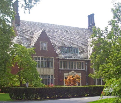
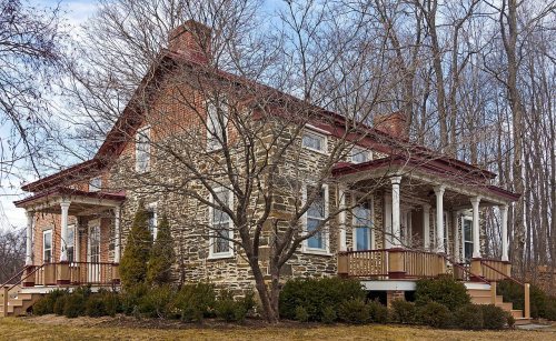
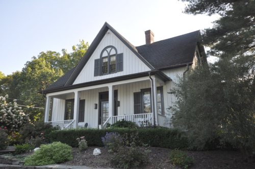
Rhinebeck’s historic district, a National Historic Landmark, takes in 1,402 buildings
More historic than 98% of U.S. towns · #51 of 758 in New York. What drives it
42 places in town are on the National Register, among them the Hudson River Heritage Historic District, a National Historic Landmark, and five historic districts with 1,694 buildings between them. Below: 1 old photo or paper, maps from 1886 on, and the census since 1820.
On its age, its old homes and the National Register, Rhinebeck is more historic than 98% of U.S. towns, #51 of 758 in New York. All 2 inputs are above most U.S. towns; its National Register listings ranks highest and its share of homes from before 1940 lowest.
A+
HistoryA character grade: shown, never part of Rhinebeck’s overall grade.
New York towns list more on the Register than most of the country (a typical New York town has 12.3 per 10,000 residents, the U.S. 2.4), so Rhinebeck’s 2,356 sits above most of its state (99% of New York towns have fewer) while its 1,793 historic buildings outnumber those of 99% of U.S. towns.
How sure. Graded on two of the three inputs, so a change in either one moves the letter more than it would with three. The pre-1940 share is a Census survey estimate (±5.3 points).
Founding year: our sources. Homes: Census ACS 2020–24. National Register: National Park Service, May 2026 list; each listing counted once (boundary changes and added documentation belong to their listing), and a historic district counts its contributing buildings. How TownRatings grades history →
What stands out about Rhinebeck’s past
Read from the archive, the National Register and the record. The page puts what stands out first.
The country’s official list of buildings and places worth saving. One is a National Historic Landmark, the highest tier. Boundary changes and added documentation are counted with their listing.
The Sepasco band of Native Americans lived in the area of today's Rhinebeck at the time white colonists arrived. Sepasco/Sepascot is derived from the word sepuus, which means little river or stream, and refers to the Landman's Kill stream whose cot or coot, meaning mouth, opens onto the southwestern shoreline of present-day Rhinebeck. This was the watershed of the Sepascos.
Passages that mention Rhinebeck, cut from the printed page as they were published.
The history of Dutchess County, New York1909 · page 444Read the page →
Read the text
The first church in Rhinebeck, and one of the earHest in the county, was the Old German Church, which stood until the year 1800, on the post road, three miles north of the present village of Rhinebeck. It was erected by the Palatines in 1716, on the land of Judge Beekman.
Text read by machine from the scan; it may contain errors.
The history of Dutchess County, New York1909 · page 39Read the page →
Read the text
The patent granted Gerrit Artsen, Arie Rosa and Jan Elton, June 2, 1688, covered twelve hundred acres in the southwest part of the present town of Rhinebeck. The Indian title was extinguished by deed dated June 8, 1686. This patent was granted with the understanding that adjoining lands deeded to Hendrick Kip by the Indians, July 28, 1688, were to be covered by the same Royal Patent.
Text read by machine from the scan; it may contain errors.
Scans and text from the Internet Archive. Books published in 1930 or earlier, which are in the public domain.
Timeline
Rhinebeck, 1739 to 1991
Woven from the archive, old maps, post office records, the National Register and the people born here.
Nothing in the archives for these yearsWeddings on Main Street, storms, parades, school pictures, the old store. If it’s in your family album, it belongs here.
Every edition of the U.S. Geological Survey’s map of Rhinebeck. Tap a year, or press play to watch the town change.
1898Rhinebeck sheet · 1:62,500
U.S. Geological Survey historical topographic maps (public domain), via Esri’s collection of the scans. The red ring marks the center of Rhinebeck.
Every building
Rhinebeck, building by building, 1886–1912
Fire insurance maps drew every building, what it was made of and what it was used for, so insurers could price the risk of fire. Pick a year, then a sheet.
Lost post offices, old corners, places now gone and burying grounds
Rhinebeck’s post office has been open since 1786. Three other post offices opened and closed inside today’s town.
Rhinebeck
1786–today
Rhinebeck Station
1858–1861
Rhinecliff
1861–today
Wurtemburg
1884–1901
Eighmyville
1888–1901
17801900today
Hamlets and corners on the map
EighmyvilleEllerslieRhinebeck Manor Mobile Home ParkRhinecliffWeys CornersWurtemburg
Gone or out of use
Cardinal Farley Military AcademyschoolEllerslie SchoolschoolFlatrock SchoolschoolHillside SchoolschoolHook SchoolschoolMiller SchoolschoolRhinebeck Central School Primary BuildingschoolSchool Number 7schoolWhite Schoolschool
7cemeteries and burying grounds inside Rhinebeck
Old RhinebeckRhinebeckRhinebeck Dutch ReformedRock CitySaint JosephSaint Paul's LutheranSaint Peter's Lutheran
US Post Offices dataset (Blevins & Helbock, CC0). Places and cemeteries from the USGS Geographic Names Information System (2021).
Stories next door
History across the town line
Each neighbor’s History grade, on the same three inputs.
Rhinebeck is more historic than 98% of U.S. towns, #51 of 758 in New York. The History grade combines the town’s founding era, the share of homes built before 1940 and its National Register listings. It’s a character grade, so it isn’t part of the overall grade. How it works.
What is on the National Register in Rhinebeck?
42 listings: 35 buildings, among them the Henry Delamater House (listed 1973, the first), 5 historic districts with 1,694 contributing buildings, and 2 structures. 1,793 historic buildings in all.
How old are the homes in Rhinebeck?
25% of Rhinebeck’s homes were built before 1940 (Census estimate, ±5.3 points), against a typical 27% for a New York town; the median home was built in 1969.
Founding dates: Wikidata, Wikipedia, the U.S. post office records of Blevins & Helbock (CC0) and the Census. Homes by year built: Census ACS 2020–24. National Register of Historic Places: National Park Service (list of May 22, 2026). Old photos, postcards and papers: Wikimedia Commons, the Library of Congress and other public archives, credited on each item’s page. Maps: U.S. Geological Survey historical topographic maps (via Esri) and Sanborn fire-insurance maps (Library of Congress). History text and census tables: Wikipedia (CC BY-SA 4.0). Places that used to be: USGS Geographic Names Information System (2021).
From the Library of Congress (1), Wikidata (5), the National Register of Historic Places (42), Wikipedia, Wikidata and Wikipedia for famous people, U.S. Geological Survey historical maps, U.S. Census counts (via Wikipedia), the US Post Offices dataset (Blevins & Helbock), the USGS Geographic Names Information System, Sanborn fire insurance maps (Library of Congress) and old county and town histories (Internet Archive). Archive images are copied here with their credits and licenses, shown on each photo’s page. Refreshed monthly.


 ★ Landmark