Among the most historic 1% of U.S. towns · #7 of 758 in New York. What drives it
48 places in town are on the National Register, among them the First Reformed Protestant Dutch Church of Kingston, a National Historic Landmark, and seven historic districts with 502 buildings between them. Below: 8 old photos and papers, maps from 1887 on, and the census since 1870.
On its age, its old homes and the National Register, Kingston is among the most historic 1% of U.S. towns, #7 of 758 in New York. All 2 inputs put Kingston near the top nationally; its share of homes from before 1940 ranks highest.
A+
HistoryA character grade: shown, never part of Kingston’s overall grade.
New York towns list more on the Register than most of the country (a typical New York town has 12.3 per 10,000 residents, the U.S. 2.4), so Kingston’s 232 sits above most of its state (84% of New York towns have fewer) while its 555 historic buildings outnumber those of 97% of U.S. towns.
How sure. Graded on two of the three inputs, so a change in either one moves the letter more than it would with three. The pre-1940 share is a Census survey estimate (±3.9 points).
Founding year: our sources. Homes: Census ACS 2020–24. National Register: National Park Service, May 2026 list; each listing counted once (boundary changes and added documentation belong to their listing), and a historic district counts its contributing buildings. How TownRatings grades history →
What stands out about Kingston’s past
Read from the archive, the National Register and the record. The page puts what stands out first.
National Park Service, National Register of Historic Places. Photos from Wikimedia Commons, credited on each place’s page.
Places that used to be
Lost post offices, old corners, places now gone and burying grounds
Kingston’s post office has been open since 1792. Two other post offices opened and closed inside today’s town.
Kingston
1792–today
Rondout
1832–1895
Wilbur
1858–1895
17901910today
Hamlets and corners on the map
Ponck HockieRondoutWilburWiltwyck Gardens
Gone or out of use
District School Number 1schoolSaint Mary's ConventchurchSchool Number 6schoolSchool Number 7schoolSchool Number 8schoolUlster County InfirmaryhospitalUlster County Tuberculosis HospitalhospitalWiltwyck Hose Company Number 1building
4cemeteries and burying grounds inside Kingston
MontreposeSaint MarysSaint PetersWiltwyck
US Post Offices dataset (Blevins & Helbock, CC0). Places and cemeteries from the USGS Geographic Names Information System (2021).
Kingston is the traditional home of the Esopus people. As early as 1614, the Dutch had set up a factorij (trading post) at Ponckhockie, at the junction of the Rondout Creek and the Hudson River. They traded European goods with the Lenape and Mohican for the furs their trappers collected. In 1652, the Indians of Ulster County ceded some land to the Dutch in what is now known as Kingston. The first recorded permanent settler in what would become the city of Kingston was Thomas Chambers. He came from the area of Rensselaerswyck in 1653. The new settlement was called Esopus after the local Lenape people.
Passages that mention Kingston, cut from the printed page as they were published.
The history of Kingston, New York1888 · page 380Read the page →
Read the text
It appearing that in the distribution of lots in the commons the inhabitants of the village of Kingston had not fared as well in the quality and character of the lots set apart for them as the residents of other parts of the to war, the trustees on the lOtli day of January, 1804, " Resolved that the lands reserved by the resolution of the 1st of april then last, between the Kuyck Uyt and the Rondout Kill and bounds of Hurley, be laid out in ten acre lots as a compensation to the inhabitants of the village of Kingston, whose lots
Text read by machine from the scan; it may contain errors.
The history of Kingston, New York1888 · page 382Read the page →
Read the text
Kingston vilhige was incorporated by an act of the Legislature passed on the 6th day of April, 1805, and it included so much of the territory of the town of Kingston as was comprised in the following limits : Beginning at the southern extremity of the bridge across the Esopus Creek, and running thence to the east corner of the division line between Jacobus S. Bruyn and Gerrifc Van Keuren, deceased ; then in a straight line to the intersection of the Twaalfskill and Greenkill roads ; thence in a straight line to a swing gate
Text read by machine from the scan; it may contain errors.
Scans and text from the Internet Archive. Books published in 1930 or earlier, which are in the public domain.
Timeline
Kingston, 1792 to 1970
Woven from the archive, old maps, post office records, the National Register and the people born here.
Every edition of the U.S. Geological Survey’s map of Kingston. Tap a year, or press play to watch the town change.
1898Rhinebeck sheet · 1:62,500
U.S. Geological Survey historical topographic maps (public domain), via Esri’s collection of the scans. The red ring marks the center of Kingston.
Every building
Kingston, building by building, 1887–1899
Fire insurance maps drew every building, what it was made of and what it was used for, so insurers could price the risk of fire. Pick a year, then a sheet.
Kingston is among the most historic 1% of U.S. towns, #7 of 758 in New York. The History grade combines the town’s founding era, the share of homes built before 1940 and its National Register listings. It’s a character grade, so it isn’t part of the overall grade. How it works.
What is on the National Register in Kingston?
48 listings: 37 buildings, among them the First Reformed Protestant Dutch Church of Kingston (a National Historic Landmark since 2008), 7 historic districts with 502 contributing buildings, 1 site, and 3 structures. 555 historic buildings in all.
How old are the homes in Kingston?
57% of Kingston’s homes were built before 1940 (Census estimate, ±3.9 points), against a typical 27% for a New York town; the median home was built in 1938.
Founding dates: Wikidata, Wikipedia, the U.S. post office records of Blevins & Helbock (CC0) and the Census. Homes by year built: Census ACS 2020–24. National Register of Historic Places: National Park Service (list of May 22, 2026). Old photos, postcards and papers: Wikimedia Commons, the Library of Congress and other public archives, credited on each item’s page. Maps: U.S. Geological Survey historical topographic maps (via Esri) and Sanborn fire-insurance maps (Library of Congress). History text and census tables: Wikipedia (CC BY-SA 4.0). Places that used to be: USGS Geographic Names Information System (2021).
From Wikimedia Commons (8), Wikidata (4), the National Register of Historic Places (48), Wikipedia, Wikidata and Wikipedia for famous people, U.S. Geological Survey historical maps, U.S. Census counts (via Wikipedia), the US Post Offices dataset (Blevins & Helbock), the USGS Geographic Names Information System, Sanborn fire insurance maps (Library of Congress) and old county and town histories (Internet Archive). Archive images are copied here with their credits and licenses, shown on each photo’s page. Refreshed monthly.


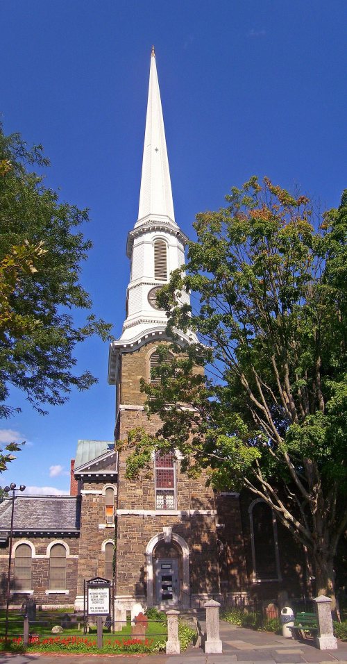 ★ Landmark
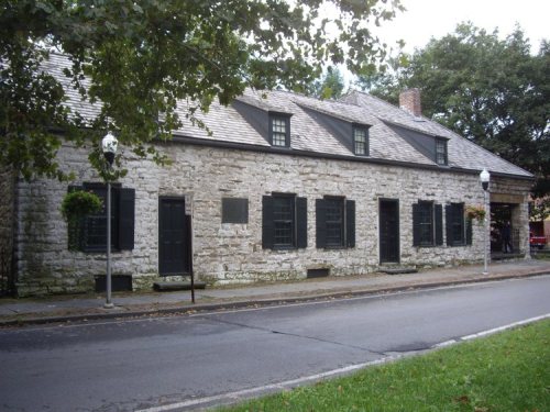


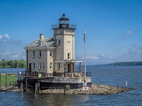
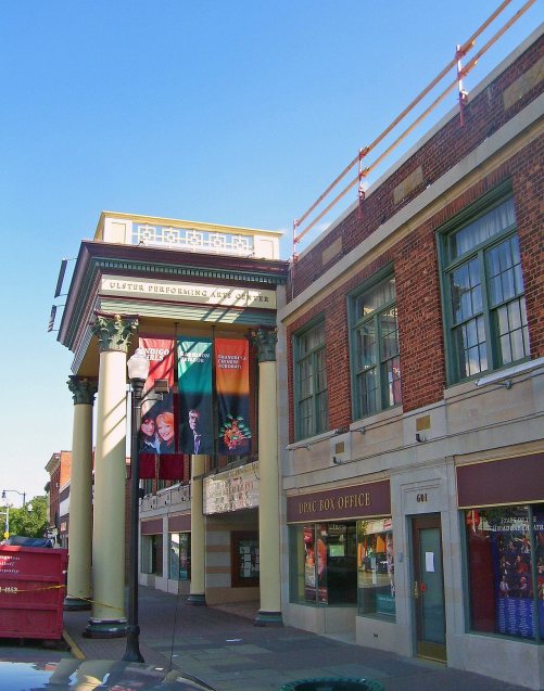


 1875
 1875
 1875
 1875


