More historic than 84% of U.S. towns · #368 of 758 in New York. What drives it
9 places in town are on the National Register, among them a historic district with 7 buildings. Below: 6 old photos and papers, maps from 1892 on, and the census since 1820.
On its age, its old homes and the National Register, Red Hook is more historic than 84% of U.S. towns, #368 of 758 in New York. All 2 inputs are above most U.S. towns; its share of homes from before 1940 ranks highest and its National Register listings lowest.
A−
HistoryA character grade: shown, never part of Red Hook’s overall grade.
New York towns list more on the Register than most of the country (a typical New York town has 12.3 per 10,000 residents, the U.S. 2.4), so Red Hook’s 18.0 sits near the middle of its state (55% of New York towns have fewer) while its 20 historic buildings outnumber those of 79% of U.S. towns.
How sure. Graded on two of the three inputs, so a change in either one moves the letter more than it would with three. The pre-1940 share is a Census survey estimate (±3.7 points).
Founding year: our sources. Homes: Census ACS 2020–24. National Register: National Park Service, May 2026 list; each listing counted once (boundary changes and added documentation belong to their listing), and a historic district counts its contributing buildings. How TownRatings grades history →
What stands out about Red Hook’s past
Read from the archive, the National Register and the record. The page puts what stands out first.
Lost post offices, old corners, places now gone and burying grounds
Red Hook’s post office has been open since 1792. Six other post offices opened and closed inside today’s town.
Red Hook
1792–today
Upper Red Hook
1819–1934
Upper Red Hook Landing
1820–1821
Barrytown
1830–1976
Tivoli
1831–today
Madalin
1861–1949
Anandale
1864–1916
Cokertown
1882–1903
Annandale-On-Hudson
1916–today
17901910today
Hamlets and corners on the map
Annandale-on-HudsonBarrytownCokertownCollege ParkCruger VillageFraleighsKerleys CornersLamplight CourtLinden AcresMountain View Mobile EstatesNorthern Dutchess Mobile Home ParkRed Hook MillsRed Hook Mobile Home ParkTivoliUpper Red Hook
Bard CollegeOld Red - Madalin ChurchRed Hook MethodistSacred HeartSaint John the Evangelist ChurchSaint John's ChurchSaint Paul's ChurchSaint Paul's Lutheran
US Post Offices dataset (Blevins & Helbock, CC0). Places and cemeteries from the USGS Geographic Names Information System (2021).
Every building
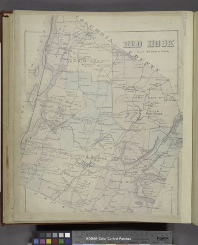
Red Hook, building by building, 1892–1923
Fire insurance maps drew every building, what it was made of and what it was used for, so insurers could price the risk of fire. Pick a year, then a sheet.
1892Sheet 1 of 1
Edition
Sheets
BrickWoodStone
Sanborn Map Company, via the Library of Congress. Editions published in 1930 or earlier, which are in the public domain.
On the National Register
9 historic places in Red Hook
The country’s official list of buildings and places worth saving.
The original inhabitants of this land were the Mohican, Munsee and Lenape people. During European settlement, Native American tribes played a fundamental role in the area's economy as they traded beaver skin with European settlers. European settlers imported several foreign goods, such as cattle, horses, and sheep. Enslaved African American individuals were also brought.
Through importing non-native species, the landscape and ecology of this region has been dramatically changed.
Red Hook is more historic than 84% of U.S. towns, #368 of 758 in New York. The History grade combines the town’s founding era, the share of homes built before 1940 and its National Register listings. It’s a character grade, so it isn’t part of the overall grade. How it works.
What is on the National Register in Red Hook?
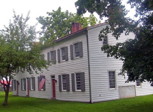
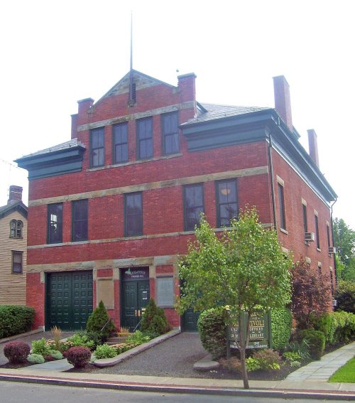
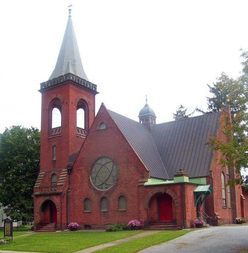
9 listings: 8 buildings and 1 historic district, the Rokeby, with 7 contributing buildings. 20 historic buildings in all.
How old are the homes in Red Hook?
24% of Red Hook’s homes were built before 1940 (Census estimate, ±3.7 points), against a typical 27% for a New York town; the median home was built in 1970.
Founding dates: Wikidata, Wikipedia, the U.S. post office records of Blevins & Helbock (CC0) and the Census. Homes by year built: Census ACS 2020–24. National Register of Historic Places: National Park Service (list of May 22, 2026). Old photos, postcards and papers: Wikimedia Commons, the Library of Congress and other public archives, credited on each item’s page. Maps: U.S. Geological Survey historical topographic maps (via Esri) and Sanborn fire-insurance maps (Library of Congress). History text and census tables: Wikipedia (CC BY-SA 4.0). Places that used to be: USGS Geographic Names Information System (2021).
From Wikimedia Commons (3), the Library of Congress (3), the National Register of Historic Places (9), Wikipedia, Wikidata and Wikipedia for famous people, U.S. Geological Survey historical maps, U.S. Census counts (via Wikipedia), the US Post Offices dataset (Blevins & Helbock), the USGS Geographic Names Information System and Sanborn fire insurance maps (Library of Congress). Archive images are copied here with their credits and licenses, shown on each photo’s page. Refreshed monthly.








 1817


