Middletown Township dates to 1693, and 10% of its homes were built before 1940
More historic than 90% of U.S. towns · #66 of 468 in New Jersey. What drives it
16 places in town are on the National Register, among them 3 National Historic Landmarks and six historic districts with 257 buildings between them. Below: 6 old photos and papers, maps from 1888 on, and the census since 1790.
Founding year: Wikidata. First post office: 1812.The full story ↓
History grade
What drives Middletown Township’s History grade
On its age, its old homes and the National Register, Middletown Township is more historic than 90% of U.S. towns, #66 of 468 in New Jersey. Its age holds the grade up; its share of homes from before 1940 pulls it down.
A
HistoryA character grade: shown, never part of Middletown Township’s overall grade.
New Jersey towns list more on the Register than most of the country (a typical New Jersey town has 3.7 per 10,000 residents, the U.S. 2.4), so Middletown Township’s 40.5 sits above most of its state (79% of New Jersey towns have fewer) while its 271 historic buildings outnumber those of 95% of U.S. towns.
NoteThe founding year comes from Wikidata alone; no second source gives 1693.
How sure. Graded on any two of the three inputs instead, the letter would range from A− to A+. The pre-1940 share (±1.6 points) is firm at this size.
Founding year: Wikidata (other dates in Quick answers). Homes: Census ACS 2020–24. National Register: National Park Service, May 2026 list; each listing counted once (boundary changes and added documentation belong to their listing), and a historic district counts its contributing buildings. How TownRatings grades history →
What stands out about Middletown Township’s past
Read from the archive, the National Register and the record. The page puts what stands out first.
Small communities of the Lenape Navesink tribe were common throughout the area when the first known European landing in what would become Middletown Township occurred in 1609. Sea captain and explorer Henry Hudson, in search of the mythical Northwest Passage in the service of the Dutch West India Company, anchored along the shores of Sandy Hook Bay in 1609, describing the area "a very good land to fall in with and a pleasant land to see." While a patroonship was granted by the company in 1651 the land wasn't officially settled. Today's Shoal Harbor Museum and Old Spy House includes portions of a house constructed by Thomas Whitlock, one of the area's first European settlers (and a Reformed Baptist at Middletown) who arrived here as early as 1664, around the time of the English takeover of New Netherland as a prelude of the Second Anglo-Dutch War. Long-standing tradition had Penelope Sto…
What they wrote about Middletown Township, 1885–1923
Passages that mention Middletown Township, cut from the printed page as they were published.
History of Monmouth county, New Jersey ..1885 · page 206Read the page →
Read the text
part of Township boundary line, 1693, 103 origin of name, and early bridge, 371 head streams in Freehold Township, 503 a boundary of Middletown Township, 1693. 519 Swimming River Bridge, mentioned in 1708 road records, 374 mentioned in Atlantic Township boundaries, 1847, 665 Sword, Thomas, merchant at Holmdel, 81 5
Text read by machine from the scan; it may contain errors.
organization “‘the territorial jurisdiction of the Middletown Township Branch shall be all of the Middletown Township excepting the village of Middletown.” The first annual meeting was held on October 1st, 1917. On account of the burden of work, Miss Waldron felt she could no longer serve as chairman, and J. H.
Text read by machine from the scan; it may contain errors.
Scans and text from the Internet Archive. Books published in 1930 or earlier, which are in the public domain.
Timeline
Middletown Township, 1693 to 1989
Woven from the archive, old maps, post office records, the National Register and the people born here.
Every edition of the U.S. Geological Survey’s map of Middletown Township. Tap a year, or press play to watch the town change.
1888Sandy Hook sheet · 1:62,500
U.S. Geological Survey historical topographic maps (public domain), via Esri’s collection of the scans. The red ring marks the center of Middletown Township.
Then & now
Stand where they stood
No then-and-now pairs yet. Take a photo from the same spot as an old one and they appear here side by side.
Retake this viewMiddletown Folk Festival, 1973
Find the spot, match the angle, and add your photo. It becomes the first then-and-now pair on Middletown Township’s page.
In 1693, according to Wikidata. Middletown Township’s post office opened in 1812, and the first U.S. census counted 3,225 people here in 1790.
How does Middletown Township rank for history?
Middletown Township is more historic than 90% of U.S. towns, #66 of 468 in New Jersey. The History grade combines the town’s founding era, the share of homes built before 1940 and its National Register listings. It’s a character grade, so it isn’t part of the overall grade. How it works.
What is on the National Register in Middletown Township?
16 listings, 3 of them National Historic Landmarks: 10 buildings, among them the All Saints' Memorial Church Complex (a National Historic Landmark since 1987) and the Sandy Hook Light (listed 1966, the first), and 6 historic districts with 257 contributing buildings. 271 historic buildings in all.
How old are the homes in Middletown Township?
10% of Middletown Township’s homes were built before 1940 (Census estimate, ±1.6 points), against a typical 15% for a New Jersey town; the median home was built in 1970.
Founding dates: Wikidata, Wikipedia, the U.S. post office records of Blevins & Helbock (CC0) and the Census. Homes by year built: Census ACS 2020–24. National Register of Historic Places: National Park Service (list of May 22, 2026). Old photos, postcards and papers: Wikimedia Commons, the Library of Congress and other public archives, credited on each item’s page. Maps: U.S. Geological Survey historical topographic maps (via Esri) and Sanborn fire-insurance maps (Library of Congress). History text and census tables: Wikipedia (CC BY-SA 4.0). Places that used to be: USGS Geographic Names Information System (2021).
From Wikimedia Commons (14), Wikidata (3), the National Register of Historic Places (16), Wikipedia, Wikidata and Wikipedia for famous people, U.S. Geological Survey historical maps, U.S. Census counts (via Wikipedia), the US Post Offices dataset (Blevins & Helbock), the USGS Geographic Names Information System and old county and town histories (Internet Archive). Archive images are copied here with their credits and licenses, shown on each photo’s page. Refreshed monthly.


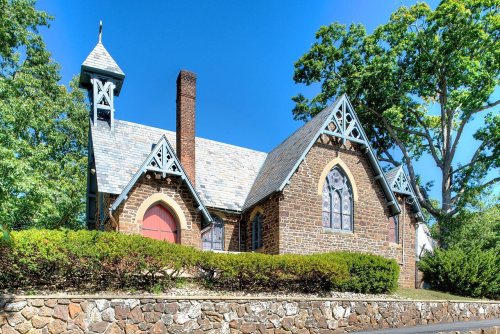 ★ Landmark
 ★ Landmark
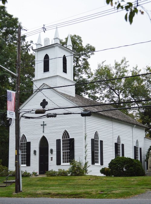
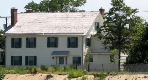


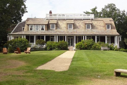
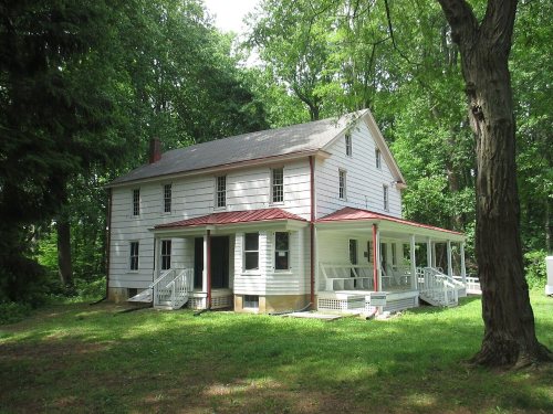


 1973
 1973
 1995
 1995
 1995
 2009
 2009
 2008
 2008
 2008
 2008
 2007
 2005


