Every edition of the U.S. Geological Survey’s map of Navesink. Tap a year, or press play to watch the town change.
1888Sandy Hook sheet · 1:62,500
U.S. Geological Survey historical topographic maps (public domain), via Esri’s collection of the scans. The red ring marks the center of Navesink.
The story so far
Navesink, in brief
Wikipedia doesn’t have a history of Navesink yet. The photos, dates and memories neighbors add here are how it gets written.
Navesink (, NAY-və-sink) is an unincorporated community and census-designated place (CDP) located on the northernmost stretch of the Jersey Shore in Middletown Township in Monmouth County, in the U.S. state of New Jersey. As of the 2020 United States census, the CDP's population was 2,004, reflecting a decrease of 16 (-0.8%) from the 2,020 residents enumerated at the 2010 U.S. census.
Its population held steady between the last two censuses: 2,020 in 2010, 2,004 in 2020.
Intro from Wikipedia. Population: U.S. Census Bureau.
From the old history books
What they wrote about Navesink, 1885–1923
Passages that mention Navesink, cut from the printed page as they were published.
only after a very heavy expenditure. It was at first thought feasible to build the road through the valley back of Atlantic Highlands, but if that plan had been carried out it would have deprived Highland Beach, Navesink Beach, Normandy and Rumson Beach, all facing the ocean and on the old Sandy Hook route, of railroad facilities; so it was determined to secure the right of way for a distance of four miles along the base of the Highlands, across the Shrewsbury River on a drawbridge, and continue on as before, taking in all the established stations.
Text read by machine from the scan; it may contain errors.
On the south of the borough of Atlantic Highlands nestles the pretty village of Navesink, which delights sumraer visitors with its quaint attractiveness. Its long, straggling streets terminate at the post office and grocery stores.
Text read by machine from the scan; it may contain errors.
History of Monmouth county, New Jersey ..1885 · page 153Read the page →
Read the text
1685, (see also Neversmks, Nethesinks and Newasink) Navesink Baptist Church, formerly known as Second Middletown Baptist Church, had chapel at Leonardville, 1883, Navesink Bridge Company, opened bridge at Highlands, 1878, organization of, 1878,
Text read by machine from the scan; it may contain errors.
Scans and text from the Internet Archive. Books published in 1930 or earlier, which are in the public domain.
Timeline
Navesink, 1788 to 1917
Woven from the archive, old maps, post office records, the National Register and the people born here.
Founding dates: Wikidata, Wikipedia, the U.S. post office records of Blevins & Helbock (CC0) and the Census. Homes by year built: Census ACS 2020–24. National Register of Historic Places: National Park Service (list of May 22, 2026). Old photos, postcards and papers: Wikimedia Commons, the Library of Congress and other public archives, credited on each item’s page. Maps: U.S. Geological Survey historical topographic maps (via Esri) and Sanborn fire-insurance maps (Library of Congress). History text and census tables: Wikipedia (CC BY-SA 4.0). Places that used to be: USGS Geographic Names Information System (2021). How TownRatings grades history →
From Wikimedia Commons (1), Wikidata and Wikipedia for famous people, U.S. Geological Survey historical maps, U.S. Census counts (via Wikipedia) and old county and town histories (Internet Archive). Archive images are copied here with their credits and licenses, shown on each photo’s page. Refreshed monthly.


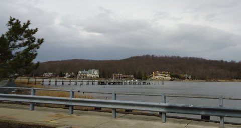 2013