
Locust Level · National Register of Historic Places
Montvale’s story
136 years in pictures
The archive holds 2 maps from 1950 on.
1 place on the National Register of Historic Places.
- 1890Montvale is settled
Each edition grades its towns against each other only.
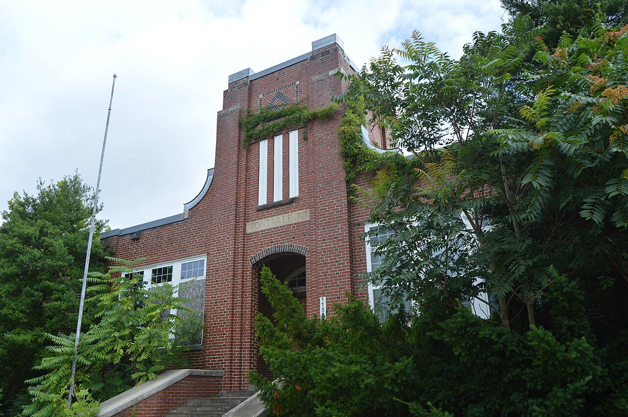
With 351 residents, this town was settled in 1890.
Montvale’s typical journey to work is 49 minutes, against 27 minutes in Virginia’s towns and 25 minutes across U.S. towns. Locust Level and Twin Oaks Farm is on the National Register of Historic Places. Montvale has fewer than 1,000 residents, too few for fair grades; the figures below are still real.
The archive holds 2 maps from 1950 on.
1 place on the National Register of Historic Places.
In a town this size, neighbors are the best guide. Ask them anything.
Ordered by what stands out in Montvale.
Home values are up 3.2% over the year to September 2026. 63% of households own their home in Montvale.
Census ACS, 2020–24 · Zillow Home Value Index · Redfin Data Center
For half of commuters, work is under 16 miles away. Between 2013 and 2023, jobs in Montvale dropped by 53, to 146. Most people who work leave Montvale to do it: just 2% work in town. Also worth knowing: in Montvale, 15% of residents live below the poverty line.
| Montvale | Virginia towns | U.S. towns | |
|---|---|---|---|
| Below the poverty line | 15% | 7.7% | 9.6% |
| Working residents who work in town | 1.6% | 4.9% | 8% |
Census LEHD 2023 · ACS
July afternoons reach 87°, January nights drop to 27° and about 11 inches of snow falls in a winter.
NOAA U.S. Climate Normals, 1991–2020
FEMA puts 78% of Montvale’s expected hazard losses down to inland flooding. Expected damage from storms and floods is lower here than in 66% of U.S. communities. Federal disaster aid has reached households in Montvale once, in 2024.
FEMA disaster declarations and aid · FEMA National Risk Index · OpenFEMA
For adults in Montvale, the share who binge drink is 15%. Among adults locally, 14% have diabetes and 39% have high blood pressure.
| Montvale | Virginia towns | U.S. towns | |
|---|---|---|---|
| Frequent physical distress (CDC PLACES) | 16% | 12% | 14% |
| Diabetes (CDC PLACES) | 14% | 11% | 12% |
| High blood pressure (CDC PLACES) | 39% | 33% | 35% |
| Get no exercise (CDC PLACES) | 29% | 23% | 25% |
| What stands out | Montvale | VA |
|---|---|---|
| More adults with COPD | 8.5% | 6.2% |
| More adults who have had cancer | 10% | 7.7% |
| More adults with heart disease | 7.9% | 6.1% |
CDC PLACES 2025 · modeled estimates for adults · CMS · HRSA
There are 1.5 miles of trail across 1 park or preserve. Parks and preserves in Montvale: one, of 17 acres. The town’s density of trails stands at 0.6 miles per square mile.
| Montvale | Virginia towns | U.S. towns | |
|---|---|---|---|
| Conserved land | 1.6% | 4.7% | 4.3% |
| Miles of trail per square mile | 0.6 miles per square mile | 0.7 | 0.4 |
| Biggest places to walk | Trails | Acres |
|---|---|---|
| 1. Montvale Park | 0.4 mi | 17 |
Trails & parks © OpenStreetMap contributors · Conserved land: USGS PAD-US
Museums, parks, gardens and other places to visit around Montvale. Close and well known come first.
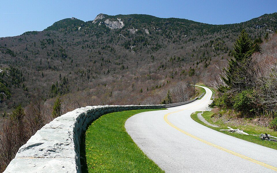 3 mi ParkwayBlue Ridge Parkway16.5M visitors a year
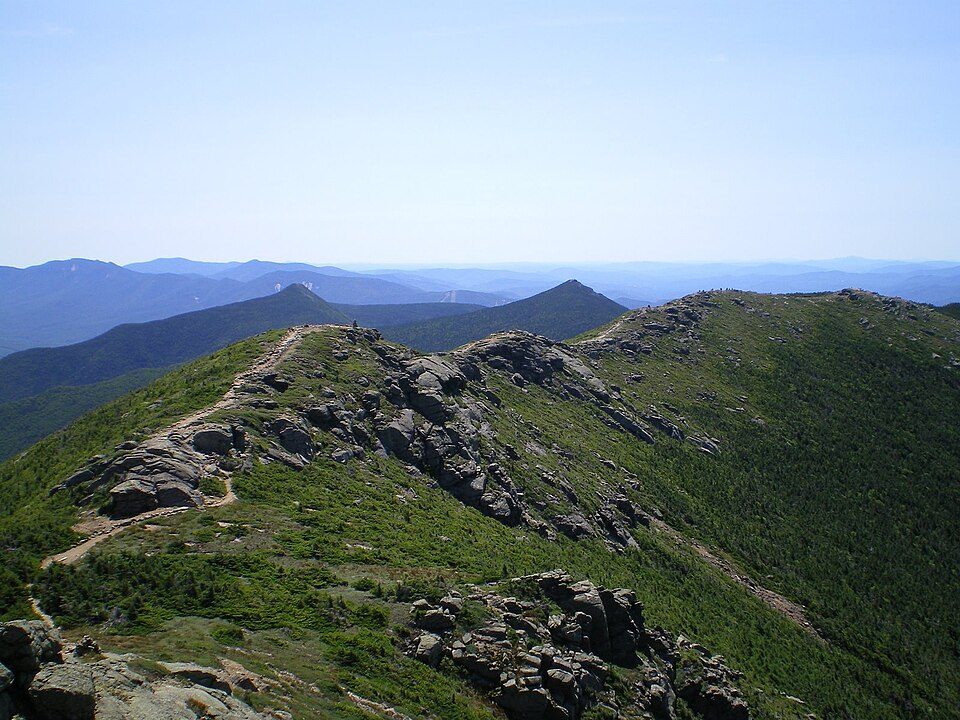 Big draw36 mi Park & preserveAppalachian Trail3.0M visitors a year
 40 mi Stadium & arenaLane Stadium
 26 mi LakeSmith Mountain Lake
 11 mi LandmarkNational D-Day Memorial
 14 mi MuseumVirginia Museum of Transportation
Blue Ridge Parkway: Ken Thomas, Public domain · Appalachian Trail: Paulba. Original uploader was Paulbalegend at en.wikipedia, CC BY-SA 3.0 · Lane Stadium: User:B, CC BY-SA 4.0 · Smith Mountain Lake: Jay White, Public domain · National D-Day Memorial: RebelAt at English Wikipedia, Public domain · Virginia Museum of Transportation: Warfieldian, CC BY-SA 3.0
Montvale is unincorporated, so Bedford County and regional agencies provide most services.
EPA SDWIS (Oct 9, 2026) · HIFLD + EIA-861 2025 · Census 2020 ZCTAs · NCES 2024–25 · registration: vote.gov, updated Sep 30, 2026.
Where Montvale’s working residents go each day. Line width shows the share.
Census LEHD 2023
1 within 15 miles of the center of Montvale
About 2 of every 100 Montvale residents are enrolled in college, against 7 across Virginia.
Census-designated place in Virginia, United States
Montvale is a census-designated place (CDP) in western Bedford County, Virginia, United States. The population as of the 2020 census was 635. The community is located between Roanoke and Bedford. It is part of the Lynchburg Metropolitan Statistical Area.
From Wikipedia, licensed CC BY-SA 4.0 · facts via Wikidata (CC0)
Short answers, built from the data on this page.
Montvale has fewer than 1,000 residents, too few for fair grades; the figures below are still real.
Ask a question, answer one, post a photo or an event. Free, and the parts only a neighbor would know are the parts worth reading.


