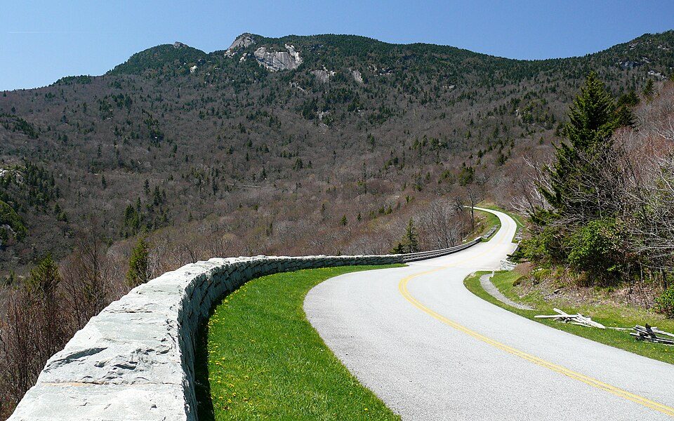
Blue Ridge Parkway
The Blue Ridge Parkway is a National Parkway and All-American Road in the United States, noted for its scenic beauty. This one stands 4 mi east of Asheville. Management falls to the National Park Service.

A parkway, 4 mi east of Asheville
July is the busiest month
July averages about 1,933,895 visitors, 4.6 times January. When to go ↓
You can sleep inside the park
17 places to stay are inside the park: Peaks of Otter Lodge and Puckett Cabin. The nearest town with more is Asheville. Where to stay ↓
One of the most looked-up attractions in the U.S.
About 93K people a year read its Wikipedia article, more than for 96% of the 7,770 attractions we track.
Best month: Apr
April is mild and quieter than average, with a high of 69°. When to go ↓
A day trip from Charlotte
Charlotte is about 96 miles east (straight-line). Where to stay ↓
Written from National Park Service visitor counts, NOAA 1991–2020 normals, Overture places to stay, Census town figures, Wikidata and Wikipedia. Updated when the Park Service posts a new month.
When it’s busy, and the weather
Pick a quieter month for Blue Ridge Parkway from the chart below.
Blue Ridge Parkway
The Blue Ridge Parkway is a National Parkway and All-American Road in the United States, noted for its scenic beauty. The parkway, which is the longest linear park in the U.S., runs for 469 miles (755 km) through 29 counties in Virginia and North Carolina, linking Shenandoah National Park to Great Smoky Mountains National Park. It runs mostly along the spine of the Blue Ridge, a major mountain chain that is part of the Appalachian Mountains. Its southern terminus is at U.S. Route 441 (US 441) on the boundary between Great Smoky Mountains National Park and the Qualla Boundary of the Eastern Band of Cherokee Indians in North Carolina, from which it travels north to Shenandoah National Park in Virginia. The roadway continues through Shenandoah as Skyline Drive, a similar scenic road which is managed by a different National Park Service unit.
- Type
- Parkway
- Run by
- National Park Service
- Wikipedia readers
- 93K a year
- Official site
- nps.gov/blri
Hours, entry and address
Hotels and campgrounds near Blue Ridge Parkway
You can sleep inside the park (17 places). Lodging nearby is in Asheville (139) and Black Mountain (20).
- 1Appalachian Trail
- 2Lane Stadium
- 3Mount Rogers
- 4Grandfather Mountain
- 5Pilot Mountain
- 6Allegacy Federal Credit Union Stadium
- 7Mountain Lake
- 8Tweetsie Railroad
Stay in the park
- Peaks of Otter Lodge lodge or cabins
- Puckett Cabin lodge or cabins
- Moose Lodge lodge or cabins
- Brinegar Cabin lodge or cabins
- Skyline Village Inn hotel
- Chetola Mountain Resort hotel
Asheville
The closest town with somewhere to stay.
93,523 people
4 mi west of Blue Ridge Parkway Visitor Center (Milepost 384) · 3 mi to the park
Black Mountain
8,491 people
10 mi east of Blue Ridge Parkway Visitor Center (Milepost 384) · 6 mi to the park
Fletcher
8,373 people
9 mi south of Blue Ridge Parkway Visitor Center (Milepost 384) · 5 mi to the park
Compare 8 towns
| Town | From the visitor center | Drive | Places to stay | People | Typical home | Safety |
|---|---|---|---|---|---|---|
| Asheville | 4 mi west | 5 min | 139 89 hotels · 7 motels · 28 inns & B&Bs · 7 lodges & cabins · 3 hostels · 2 campgrounds · 3 RV parks | 93,523 | $440K | D− |
| Black Mountain | 10 mi east | 15 min | 20 5 hotels · 2 motels · 5 inns & B&Bs · 4 lodges & cabins · 4 campgrounds | 8,491 | $359K | B |
| Fletcher | 9 mi south | 15 min | 18 10 hotels · 1 motel · 3 inns & B&Bs · 3 campgrounds · 1 RV park | 8,373 | $331K | B |
| Woodfin | 8 mi northwest | 10 min | 12 5 hotels · 1 inn or B&B · 2 lodges & cabins · 1 hostel · 2 campgrounds · 1 RV park | 8,229 | $367K | B− |
| Fairview | 6 mi southeast | 10 min | 8 2 hotels · 5 lodges & cabins · 1 campground | 2,298 | $440K | — |
| Weaverville | 10 mi northwest | 15 min | 10 4 hotels · 1 motel · 4 inns & B&Bs · 1 lodge or cabins | 4,790 | $464K | C |
| Montreat 92% vacation homes | 12 mi northeast | 20 min | 12 3 inns & B&Bs · 5 lodges & cabins · 4 campgrounds | 1,024 | $606K | — |
| Swannanoa | 6 mi northeast | 10 min | 6 1 hotel · 3 lodges & cabins · 2 campgrounds | 6,901 | $288K | — |
Getting there
Nearest airports with airline service, from the visitor center
Also within reach
Also within 67 miles are these.
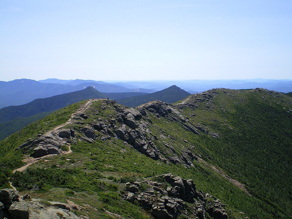 Big draw166 mi Park & preserveAppalachian Trail3.0M visitors a year
 258 mi Stadium & arenaLane Stadium
 330 mi MountainMount Rogers
 453 mi MountainGrandfather Mountain
 534 mi MountainPilot Mountain
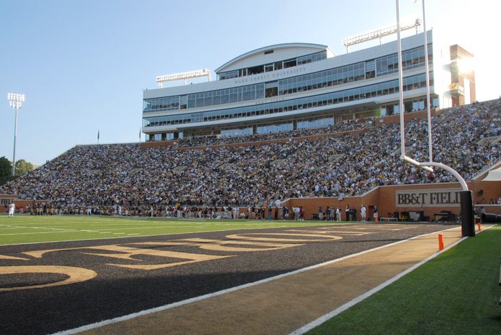 651 mi Stadium & arenaAllegacy Federal Credit Union Stadium
 763 mi LakeMountain Lake843 mi Theme parkTweetsie Railroad
Photo credits
Appalachian Trail: Paulba. Original uploader was Paulbalegend at en.wikipedia, CC BY-SA 3.0 · Lane Stadium: User:B, CC BY-SA 4.0 · Mount Rogers: USDA-FS, Public domain · Grandfather Mountain: Original uploader was KyleAndMelissa22 at en.wikipedia, Public domain · Pilot Mountain: Berean Hunter, CC BY-SA 2.5 · Allegacy Federal Credit Union Stadium: BobHWS, CC BY-SA 3.0 · Mountain Lake: Rolfmueller, CC BY-SA 3.0


The 2025 count: 16,533,753
From 2016 to 2025, these are the yearly visits.
Asked about Blue Ridge Parkway
What town is Blue Ridge Parkway near?
Asheville, NC, about 4 miles west.
When is the best time to visit Blue Ridge Parkway?
April, with a high of 69°. July is the busiest month (about 1,933,895 visitors).
How many people visit Blue Ridge Parkway each year?
16,533,753 in 2025, according to the National Park Service. The record is 16,757,635, set in 2023.
How far is Blue Ridge Parkway from Charlotte?
About 96 miles east of Charlotte, as the crow flies.
What is the closest airport to Blue Ridge Parkway?
Asheville Regional (AVL), about 10 miles away. The nearest big hub is McGhee Tyson (TYS), about 86 miles.
Where should I stay near Blue Ridge Parkway?
Inside the park: Peaks of Otter Lodge, Puckett Cabin and Moose Lodge. Nearby: Asheville (4 mi, 139 places to stay), Black Mountain (10 mi, 20 places to stay) and Fletcher (9 mi, 18 places to stay).
Advice from Asheville
Share what you know in Asheville’s Town Square.
Sources: National Park Service · ski areas © OpenSkiMap / OpenStreetMap contributors · Wikidata · Wikipedia readership · National Park Service visitor use statistics · NOAA climate normals · U.S. Census.