East Greenwich dates to 1677, and 16% of its homes were built before 1940
More historic than 94% of U.S. towns · #11 of 38 in Rhode Island. What drives it
12 places in town are on the National Register, among them four historic districts with 340 buildings between them. Below: 16 old photos and papers, maps from 1884 on, and the census since 1790.
Founding year: Wikidata; Wikipedia’s history section gives the same year. First post office: 1782.The full story ↓
History grade
What drives East Greenwich’s History grade
On its age, its old homes and the National Register, East Greenwich is more historic than 94% of U.S. towns, #11 of 38 in Rhode Island. All 3 inputs are above most U.S. towns; its age ranks highest and its share of homes from before 1940 lowest.
A
HistoryA character grade: shown, never part of East Greenwich’s overall grade.
Rhode Island towns list more on the Register than most of the country (a typical Rhode Island town has 94.7 per 10,000 residents, the U.S. 2.4), so East Greenwich’s 241 sits above most of its state (84% of Rhode Island towns have fewer) while its 351 historic buildings outnumber those of 96% of U.S. towns.
How sure. Graded on any two of the three inputs instead, the letter would range from A− to A+. The pre-1940 share is a Census survey estimate (±3.8 points). Two sources give 1677.
Founding year: Wikidata (other dates in Quick answers). Homes: Census ACS 2020–24. National Register: National Park Service, May 2026 list; each listing counted once (boundary changes and added documentation belong to their listing), and a historic district counts its contributing buildings. How TownRatings grades history →
What stands out about East Greenwich’s past
Read from the archive, the National Register and the record. The page puts what stands out first.
Andrews Lot Cemetery · Anthony Hall Plot · Bailey - Brayton Plot · Bailey - Hall Lot · Benjamin Johnson Lot Cemetery · Briggs - Jacoy - Corey Plot · Caleb Cooke Lot Cemetery · Capron - Bailey Lot Cemetery · Captain Allen Johnson Plot · Captain John Wells Lot Cemetery · Captain Samuel Fry Lot Cemetery · Carr - Rathbun Lot Cemetery · Charles Nichols Lot Cemetery · Clement Weaver Lot Cemetery · Cornelius Clark Lot Cemetery · Cornell - Briggs Plot · Daniel C Bailey Lot Cemetery · Daniel Howland Lot Cemetery · East Greenwich Cemetery · East Greenwich Swedish Cemetery · Edmund Andrews Lot · Elder John Gorton Meeting Burial Ground · Foster Lot Cemetery · Fry - Howland Lot Cemetery · Gardiner Lot · Glenwood Cemetery · Greene Lot Cemetery · Henry Spencer Lot · Isaac Spencer Lot · James Sweet Lot · Jeffrey Davis Lot · Joanna Vaughn Plot · Job Carr Lot Cemetery · Job Tillinghast Plot · John Spencer Plot · Jonathan Nichols Lot Cemetery · Jonathan Sherman Lot Cemetery · Joseph Card Plot · Joseph Carpenter Plot · Joseph Fry Lot Cemetery · Joshua Godfrey Lot Cemetery · Lutheran Church Cemetery · Moses Spencer Lot Cemetery · Oliver Wickes Plot · Paine - Spencer Lot Cemetery · Pardon Mawney Lot · Pardon Tillinghast Lot Cemetery · Peirce - Spencer Lot Cemetery · Peleg Wood Lot Cemetery · Quaker Plot · Richard Briggs Lot Cemetery · Robert Vaughn Plot · Rodman Vaughn Plot · Saint Lukes Church Cemetery · Saint Patrick Cemetery · Samuel Gardner Lot Cemetery · Samuel Shippee Plot · Shippee - Arnold Cemetery · Spencer - Briggs Lot Cemetery · Spencer - Shippee Plot · Spencer Lot Cemetery · Spencer Plot · Spencer Shippee Plot · Stephen Greene Lot · Thomas Brayton Plot · Vaughn Lot Cemetery · Vaughn Lot Cemetery · Walter Spencer Lot Cemetery · Whitman - Wightman Lot Cemetery · Winsor Fry Lot Cemetery
US Post Offices dataset (Blevins & Helbock, CC0). Places and cemeteries from the USGS Geographic Names Information System (2021).
East Greenwich, the 8th oldest town in Rhode Island, was founded in October 1677 by the General Assembly in an attempt to solidify land claims against those of Connecticut and the Narragansett Proprietors. The Assembly designated 5,000 acres to the new town and provided lots to settlers who would agree to live there—land was deeded to 48 men who had fought in King Phillip's War against the Wampanoag. Locals quickly took the assembly up on this offer, and the quick establishment of the town helped hold back plans of Connecticut in pushing their border eastward. East Greenwich was therefore the only Rhode Island town established by an act of government, not commercial interests. In 1687, the Narragansett Proprietors attempted to settle land north of Wickford which overlapped with the land of East Greenwich; however, the Massachusetts governor Sir Edmund Andros, who had authority to settle…
Nothing in the archives for these yearsWeddings on Main Street, storms, parades, school pictures, the old store. If it’s in your family album, it belongs here.
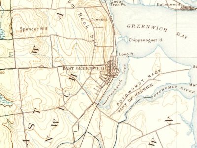
Every edition of the U.S. Geological Survey’s map of East Greenwich. Tap a year, or press play to watch the town change.
1890Narragansett Bay sheet · 1:62,500
U.S. Geological Survey historical topographic maps (public domain), via Esri’s collection of the scans. The red ring marks the center of East Greenwich.
Every building
East Greenwich, building by building, 1884–1923
Fire insurance maps drew every building, what it was made of and what it was used for, so insurers could price the risk of fire. Pick a year, then a sheet.
In 1677, according to Wikidata and Wikipedia’s history of the town. East Greenwich’s post office opened in 1782, and the first U.S. census counted 1,824 people here in 1790.
How does East Greenwich rank for history?
East Greenwich is more historic than 94% of U.S. towns, #11 of 38 in Rhode Island. The History grade combines the town’s founding era, the share of homes built before 1940 and its National Register listings. It’s a character grade, so it isn’t part of the overall grade. How it works.
What is on the National Register in East Greenwich?
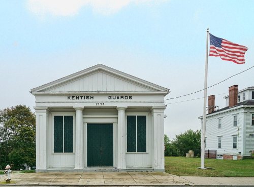
12 listings: 8 buildings, among them the Armory of the Kentish Guards (listed 1970, the first), and 4 historic districts with 340 contributing buildings. 351 historic buildings in all.
How old are the homes in East Greenwich?
16% of East Greenwich’s homes were built before 1940 (Census estimate, ±3.8 points), against a typical 20% for a Rhode Island town; the median home was built in 1976.
Founding dates: Wikidata, Wikipedia, the U.S. post office records of Blevins & Helbock (CC0) and the Census. Homes by year built: Census ACS 2020–24. National Register of Historic Places: National Park Service (list of May 22, 2026). Old photos, postcards and papers: Wikimedia Commons, the Library of Congress and other public archives, credited on each item’s page. Maps: U.S. Geological Survey historical topographic maps (via Esri) and Sanborn fire-insurance maps (Library of Congress). History text and census tables: Wikipedia (CC BY-SA 4.0). Places that used to be: USGS Geographic Names Information System (2021).
From Wikimedia Commons (16), Wikidata (2), the National Register of Historic Places (12), Wikipedia, Wikidata and Wikipedia for famous people, U.S. Geological Survey historical maps, U.S. Census counts (via Wikipedia), the US Post Offices dataset (Blevins & Helbock), the USGS Geographic Names Information System and Sanborn fire insurance maps (Library of Congress). Archive images are copied here with their credits and licenses, shown on each photo’s page. Refreshed monthly.








 1787
 c. 1930
 c. 1930
 1933
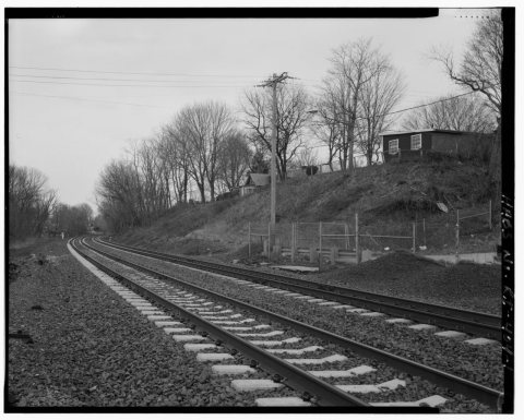 1933
 1933
 1933
 1933
 1933
 1933
 1933
 1933


