Warwick dates to 1642, and 22% of its homes were built before 1940
More historic than 92% of U.S. towns · #14 of 38 in Rhode Island. What drives it
32 places in town are on the National Register, among them five historic districts with 511 buildings between them. Below: 14 old photos and papers, maps from 1890 on, and the census since 1830.
Founding year: Wikidata; Wikipedia’s history section gives the same year. First post office: 1811.
History grade
What drives Warwick’s History grade
On its age, its old homes and the National Register, Warwick is more historic than 92% of U.S. towns, #14 of 38 in Rhode Island. All 3 inputs are above most U.S. towns; its age ranks highest and its National Register listings lowest.
A
HistoryA character grade: shown, never part of Warwick’s overall grade.
Rhode Island towns list more on the Register than most of the country (a typical Rhode Island town has 94.7 per 10,000 residents, the U.S. 2.4), so Warwick’s 73.5 sits near the middle of its state (39% of Rhode Island towns have fewer) while its 611 historic buildings outnumber those of 98% of U.S. towns.
How sure. Graded on any two of the three inputs instead, the letter would range from A− to A. The pre-1940 share (±2.1 points) is firm at this size. Two sources give 1642.
Founding year: Wikidata (other dates in Quick answers). Homes: Census ACS 2020–24. National Register: National Park Service, May 2026 list; each listing counted once (boundary changes and added documentation belong to their listing), and a historic district counts its contributing buildings. How TownRatings grades history →
What stands out about Warwick’s past
Read from the archive, the National Register and the record. The page puts what stands out first.
Wikipedia doesn’t have a history of Warwick yet. The photos, dates and memories neighbors add here are how it gets written.
Warwick ( WORR-ik or WOR-wik) is a city in Kent County, Rhode Island, United States, and is the third-largest city in the state, with a population of 82,823 at the 2020 census. Warwick is located approximately 12 miles (19 km) south of downtown Providence, Rhode Island, 63 miles (101 km) southwest of Boston, Massachusetts, and 171 miles (275 km) northeast of New York City. Warwick was founded by Samuel Gorton in 1642 and has witnessed major events in American history. It was decimated during King Philip's War (1675–1676) and was the site of the Gaspee Affair, the first act of armed resistance against the British, preceding even the Boston Tea Party, and a significant prelude to the American…
Warwick was established in 1642. Its population held steady between the last two censuses: 82,672 in 2010, 82,823 in 2020.
Intro from Wikipedia. Population: U.S. Census Bureau.
From the old history books
What they wrote about Warwick in 1875
Passages that mention Warwick, cut from the printed page as they were published.
The history of Warwick, Rhode Island, from its settlement in 1642 to the present time1875 · page 207Read the page →
Read the text
Under date of Ma^s 1737, the General Assemblyauthorized the construction of a highway " from near the house of Capt. Rice, in Warwick, to the grist mill commonly called Edmonds mill, and from thence to extend westerly to the south-east corner of the town of Scituate." This old highway is the one that passes through the present ' village of Natick, over the lower bridge, thence up over Natick hill to the present village
Text read by machine from the scan; it may contain errors.
The history of Warwick, Rhode Island, from its settlement in 1642 to the present time1875 · page 208Read the page →
Read the text
his estate was divided between his three sons, Charles, Nehemiah and Caleb. A quit claim deed of partition of the estate, signed by the three sons and recorded in Book 2d, Warwick records, in connection with a plat of the estate, reads as follows : "The above deciphered farm was laid out the 20th day of February, 1783 ; the bigger part of said farm lies in Warwick and the rest in Coventry, and the above said farm was laid out for the three
Text read by machine from the scan; it may contain errors.
Scans and text from the Internet Archive. Books published in 1930 or earlier, which are in the public domain.
By decade
Warwick, decade by decade
6 decades in the archive, from the 1870s to the 1990s. Scroll each row; tap a photo for its story.
Nothing in the archives for these yearsWeddings on Main Street, storms, parades, school pictures, the old store. If it’s in your family album, it belongs here.
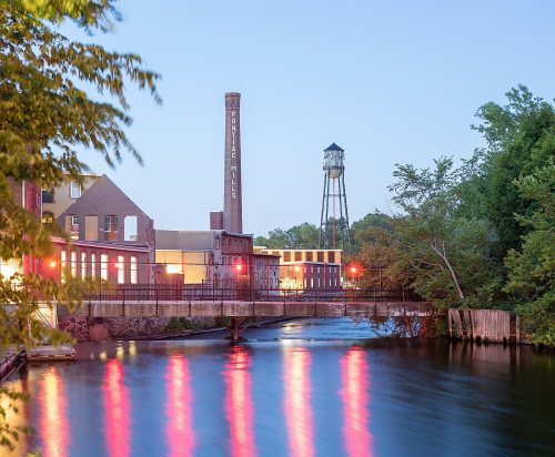
District Four SchoolschoolHillsgrove Army Air FieldmilitaryLakeside PreventoriumhospitalPontiac Millslocale
107family graveyards and cemeteries inside Warwick
All SaintsAmbrose Taylor PlotAmos Lockwood LotArnold PawtuxetAustin - Card LotBenajah Lockwood LotBennett - Spencer LotBraytonBriggs LotBrown - Vickory LotCaptain Joseph Arnold LotCaptain Joseph Spencer LotCaptain Randall Holden Junior LotCaptain Samuel Greene LotCarpenter - Wightman LotCharles Low LotChristopher Greene LotChristopher Spencer LotColonel Christopher Smith LotColonel John Waterman LotColonel Stephen Arnold LotDavid Bennett PlotDorothy Mayor ParkDr James Greene LotDrake - LadEphraim Arnold LotEphraim Covill PlotEssex - Congdon - Shippee LotFoster Kenyon LotGeneral Thomas Wescott LotGeneral Thomas Westcott PlotGeorge H Arnold LotGorton - Arnold LotGorton - Arnold LotGorton - Wing LotGorton LotGovernor Greene LotGovernor Samuel Gorton PlotGreene LotHolden - Bicknell - TaylorHoward - Remington LotJames Arnold LotJames Budlong LotJerauld - Gerald LotJohn Briggs LotJohn Browning LotJohn Budlong LotJohn Clemmons FamilyJohn H Holden LotJohn KinnecomJoseph Bennett LotJoseph Briggs LotLakewoodLincoln Family LotLincoln ParkLippit - Spywood LotLippitt PlotLockwood - Phillips LotMajor General George Sears GreeneMajor General Thomas Holden LotMowry - Knight - Mott LotNathan Rice LotNathaniel Arnold PlotNathaniel Millard LotNew PawtuxetNicholas Arnold LotNichols - Waite LotOld Baptist ChurchOld ForgePawtuxet Burial YardPawtuxet HighlandPerry LotPeter Freeman LotPhilip Arnold LotPhillips - Moone - Jenkins LotProphet - Babcock - Holden LotRemington - Arnold LotReverend Samuel Littlefield LotRice Burial YardRobert EdmondsRogers LotRowland Barton LotSaint Paul's Lutheran ChurchSamuel Budlong LotSenator John Chafee LotSinai Memorial ParkSpring GreeneSquire Millerd LotStone Castle LotSurgeon John Greene LotThomas C Mattson LotThomas Holden LotThomas Rice LotThomas Stafford LotThomas Taylor LotThomas Warner LotUtter - Arnold - Rhodes PlotVincent Gardiner LotWanton Arnold - Major William Snow LotWarwick Poor FarmWestcott - Brown LotWhipple LotWilliam Davis Cole LotWilliam J Cole PlotWilliam Jenison LotWilliam Marble LotWilliam Stone Lot
See all 107
All Saints Cemetery · Ambrose Taylor Plot · Amos Lockwood Lot · Arnold Pawtuxet Burial Ground · Austin - Card Lot Cemetery · Benajah Lockwood Lot Cemetery · Bennett - Spencer Lot Cemetery · Brayton Cemetery · Briggs Lot · Brown - Vickory Lot Cemetery · Captain Joseph Arnold Lot Cemetery · Captain Joseph Spencer Lot Cemetery · Captain Randall Holden Junior Lot Cemetery · Captain Samuel Greene Lot · Carpenter - Wightman Lot · Charles Low Lot · Christopher Greene Lot Cemetery · Christopher Spencer Lot · Colonel Christopher Smith Lot · Colonel John Waterman Lot Cemetery · Colonel Stephen Arnold Lot · David Bennett Plot · Dorothy Mayor Park Cemetery · Dr James Greene Lot · Drake - Lad Burial Ground · Ephraim Arnold Lot · Ephraim Covill Plot · Essex - Congdon - Shippee Lot · Foster Kenyon Lot Cemetery · General Thomas Wescott Lot · General Thomas Westcott Plot · George H Arnold Lot · Gorton - Arnold Lot · Gorton - Arnold Lot · Gorton - Wing Lot Cemetery · Gorton Lot Cemetery · Governor Greene Lot Cemetery · Governor Samuel Gorton Plot · Greene Lot Cemetery · Holden - Bicknell - Taylor Cemetery · Howard - Remington Lot Cemetery · James Arnold Lot · James Budlong Lot · Jerauld - Gerald Lot · John Briggs Lot · John Browning Lot · John Budlong Lot Cemetery · John Clemmons Family Cemetery · John H Holden Lot · John Kinnecom Cemetery · Joseph Bennett Lot · Joseph Briggs Lot Cemetery · Lakewood Burial Ground · Lincoln Family Lot · Lincoln Park Cemetery · Lippit - Spywood Lot · Lippitt Plot · Lockwood - Phillips Lot · Major General George Sears Greene Cemetery · Major General Thomas Holden Lot · Mowry - Knight - Mott Lot Cemetery · Nathan Rice Lot · Nathaniel Arnold Plot · Nathaniel Millard Lot Cemetery · New Pawtuxet Cemetery · Nicholas Arnold Lot · Nichols - Waite Lot Cemetery · Old Baptist Church Burial Ground · Old Forge Burial Ground · Pawtuxet Burial Yard · Pawtuxet Highland Cemetery · Perry Lot · Peter Freeman Lot · Philip Arnold Lot · Phillips - Moone - Jenkins Lot · Prophet - Babcock - Holden Lot Cemetery · Remington - Arnold Lot · Reverend Samuel Littlefield Lot Cemetery · Rice Burial Yard Cemetery · Robert Edmonds Burial Ground · Rogers Lot Cemetery · Rowland Barton Lot · Saint Paul's Lutheran Church Cemetery · Samuel Budlong Lot · Senator John Chafee Lot Cemetery · Sinai Memorial Park · Spring Greene Burial Ground · Squire Millerd Lot Cemetery · Stone Castle Lot Cemetery · Surgeon John Greene Lot Cemetery · Thomas C Mattson Lot · Thomas Holden Lot Cemetery · Thomas Rice Lot Cemetery · Thomas Stafford Lot · Thomas Taylor Lot · Thomas Warner Lot · Utter - Arnold - Rhodes Plot · Vincent Gardiner Lot · Wanton Arnold - Major William Snow Lot · Warwick Poor Farm Cemetery · Westcott - Brown Lot · Whipple Lot · William Davis Cole Lot · William J Cole Plot · William Jenison Lot Cemetery · William Marble Lot · William Stone Lot
US Post Offices dataset (Blevins & Helbock, CC0). Places and cemeteries from the USGS Geographic Names Information System (2021).
Help out
Finish Warwick’s story
Most archives stop around 1920. The photos from after that are in family albums, not libraries.
Decades since 1900 with photos
00s10s20s30s40s50s60s70s80s90s
4 of 10 decades. The empty ones are waiting for someone’s album.
In 1642, according to Wikidata and Wikipedia’s history of the town. Warwick’s post office opened in 1811, and the census of 1830 counted 5,529 people here.
How does Warwick rank for history?
Warwick is more historic than 92% of U.S. towns, #14 of 38 in Rhode Island. The History grade combines the town’s founding era, the share of homes built before 1940 and its National Register listings. It’s a character grade, so it isn’t part of the overall grade. How it works.
What is on the National Register in Warwick?
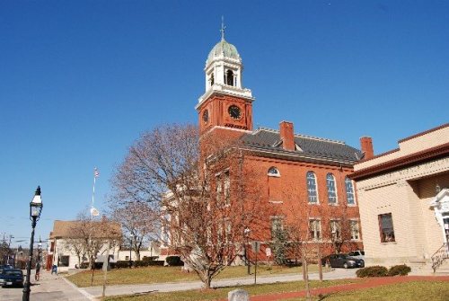
32 listings: 22 buildings, among them the Christopher Rhodes House (listed 1971, the first), 5 historic districts with 511 contributing buildings, 2 sites, and 3 structures. 611 historic buildings in all.
How old are the homes in Warwick?
22% of Warwick’s homes were built before 1940 (Census estimate, ±2.1 points), against a typical 20% for a Rhode Island town; the median home was built in 1961.
Founding dates: Wikidata, Wikipedia, the U.S. post office records of Blevins & Helbock (CC0) and the Census. Homes by year built: Census ACS 2020–24. National Register of Historic Places: National Park Service (list of May 22, 2026). Old photos, postcards and papers: Wikimedia Commons, the Library of Congress and other public archives, credited on each item’s page. Maps: U.S. Geological Survey historical topographic maps (via Esri) and Sanborn fire-insurance maps (Library of Congress). History text and census tables: Wikipedia (CC BY-SA 4.0). Places that used to be: USGS Geographic Names Information System (2021).
From Wikimedia Commons (13), the Library of Congress (1), Wikidata (4), the National Register of Historic Places (32), Wikidata and Wikipedia for famous people, U.S. Geological Survey historical maps, U.S. Census counts (via Wikipedia), the US Post Offices dataset (Blevins & Helbock), the USGS Geographic Names Information System and old county and town histories (Internet Archive). Archive images are copied here with their credits and licenses, shown on each photo’s page. Refreshed monthly.






 1971
 1971
 1980
 1980
 1980
 1993
 1996
 1996
 1996
 1996


