Cumberland dates to 1635, and 14% of its homes were built before 1940
More historic than 85% of U.S. towns · #21 of 38 in Rhode Island. What drives it
16 places in town are on the National Register, among them five historic districts with 222 buildings between them. Below: 9 old photos and papers, maps from 1894 on, and the census since 1790.
Founding year: Wikidata. First post office: 1822.The full story ↓
History grade
What drives Cumberland’s History grade
On its age, its old homes and the National Register, Cumberland is more historic than 85% of U.S. towns, #21 of 38 in Rhode Island. All 3 inputs are above most U.S. towns; its age ranks highest and its share of homes from before 1940 lowest.
A−
HistoryA character grade: shown, never part of Cumberland’s overall grade.
Rhode Island towns list more on the Register than most of the country (a typical Rhode Island town has 94.7 per 10,000 residents, the U.S. 2.4), so Cumberland’s 67.9 sits below most of its state (34% of Rhode Island towns have fewer) while its 250 historic buildings outnumber those of 94% of U.S. towns.
NoteThe founding year comes from Wikidata alone; no second source gives 1635.
How sure. Graded on any two of the three inputs instead, the letter would range from B+ to A. The pre-1940 share (±2.5 points) is firm at this size.
Founding year: Wikidata (other dates in Quick answers). Homes: Census ACS 2020–24. National Register: National Park Service, May 2026 list; each listing counted once (boundary changes and added documentation belong to their listing), and a historic district counts its contributing buildings. How TownRatings grades history →
What stands out about Cumberland’s past
Read from the archive, the National Register and the record. The page puts what stands out first.
Camp SwamplocaleCentral Grammar SchoolschoolCistercian MonasterychurchEcho Hill FarmlocaleElder Ballou MeetinghousechurchFranklin FarmlocaleFriends MeetinghousechurchLonsdale StationlocaleValley Falls Mill Office and Bath HousebuildingValley Falls MillslocaleWgng AirportairportWilliam F Blackstone Schoolschool
23cemeteries and burying grounds inside Cumberland
Arnold MillsBallouCarpenter PlotCumberlandElder Ballou Meeting HouseEvergreenJames Whipple LotMetcalfMount CalvaryNew and Old Diamond HillPeckPickering - Staples LotQuakerResurrectionSaint Basil the GreatSaint John Ukrainian OrthodoxSaint John's EpiscopalSaint JosephSaint Patrick'sStaples Family LotWeedenWhipple - SmithWilkinson Cemetery and Tomb
See all 23
Arnold Mills Cemetery · Ballou Cemetery · Carpenter Plot · Cumberland Cemetery · Elder Ballou Meeting House Cemetery · Evergreen Cemetery · James Whipple Lot · Metcalf Cemetery · Mount Calvary Cemetery · New and Old Diamond Hill Cemetery · Peck Cemetery · Pickering - Staples Lot · Quaker Cemetery · Resurrection Cemetery · Saint Basil the Great Cemetery · Saint John Ukrainian Orthodox Cemetery · Saint John's Episcopal Cemetery · Saint Joseph Cemetery · Saint Patrick's Cemetery · Staples Family Lot · Weeden Cemetery · Whipple - Smith Cemetery · Wilkinson Cemetery and Tomb
US Post Offices dataset (Blevins & Helbock, CC0). Places and cemeteries from the USGS Geographic Names Information System (2021).
Cumberland was originally settled as part of Wrentham, Massachusetts, which was purchased from the local Indigenous Americans by the Plymouth Colony. It was later transferred to Rhode Island as part of a long-running boundary dispute. The town was named in honor of Prince William, Duke of Cumberland.
Passages that mention Cumberland, cut from the printed page as they were published.
History of Providence County, Rhode Island1891 · page 425Read the page →
Read the text
ceed. In the autumn of 1874 the question of dividing the town was revived in a new shape, and appeared in the form of petitions to set off a portion of the villages of Valley Falls, Lonsdale, Ashton and Albion to the town of Cumberland, of which notice was given to the town council on October 31st, 1874, that it would be presented at the ensuing January session of the legislature; and also two petitions to set off a portion of the town of Lincoln to the town of North Providence, of which the town council was notified on November 28th,
Text read by machine from the scan; it may contain errors.
History of Providence County, Rhode Island1891 · page 265Read the page →
Read the text
Mr. Wood is a farmer and resides upon and owns the old Razee homestead. Near the house stands a gigantic elm tree, the trunk measuring nearly 20 feet in circumference. The town of Cumberland was incorporated in 1747, and Joseph Razee was the first male child born within its limits after said incorporation. That would make Joseph Razee born nearly 143 years ago. The elm tree was a sapling when Joseph's father built his house, which is the ell still standing, therefore it is safe to conclude that the venerable tree is upwards of
Text read by machine from the scan; it may contain errors.
Scans and text from the Internet Archive. Books published in 1930 or earlier, which are in the public domain.
By decade
Cumberland, decade by decade
6 decades in the archive, from the 1900s to the 1990s. Scroll each row; tap a photo for its story.
In 1635, according to Wikidata. Cumberland’s post office opened in 1822, and the first U.S. census counted 1,964 people here in 1790.
How does Cumberland rank for history?
Cumberland is more historic than 85% of U.S. towns, #21 of 38 in Rhode Island. The History grade combines the town’s founding era, the share of homes built before 1940 and its National Register listings. It’s a character grade, so it isn’t part of the overall grade. How it works.
What is on the National Register in Cumberland?
16 listings: 11 buildings and 5 historic districts with 222 contributing buildings. 250 historic buildings in all.
How old are the homes in Cumberland?
14% of Cumberland’s homes were built before 1940 (Census estimate, ±2.5 points), against a typical 20% for a Rhode Island town; the median home was built in 1972.
Founding dates: Wikidata, Wikipedia, the U.S. post office records of Blevins & Helbock (CC0) and the Census. Homes by year built: Census ACS 2020–24. National Register of Historic Places: National Park Service (list of May 22, 2026). Old photos, postcards and papers: Wikimedia Commons, the Library of Congress and other public archives, credited on each item’s page. Maps: U.S. Geological Survey historical topographic maps (via Esri) and Sanborn fire-insurance maps (Library of Congress). History text and census tables: Wikipedia (CC BY-SA 4.0). Places that used to be: USGS Geographic Names Information System (2021).
From Wikimedia Commons (11), Wikidata (1), the National Register of Historic Places (16), Wikipedia, Wikidata and Wikipedia for famous people, U.S. Geological Survey historical maps, U.S. Census counts (via Wikipedia), the US Post Offices dataset (Blevins & Helbock), the USGS Geographic Names Information System and old county and town histories (Internet Archive). Archive images are copied here with their credits and licenses, shown on each photo’s page. Refreshed monthly.


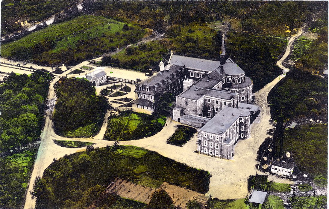


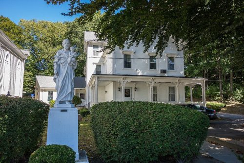




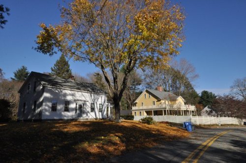

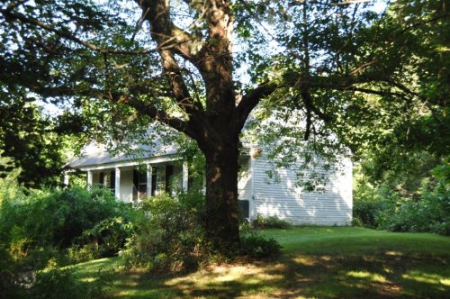


 c. 1975
 1976
 1976
 1993
 1995
 2010
 2007


