Warwick dates to 1788, and 21% of its homes were built before 1940
More historic than 90% of U.S. towns · #272 of 758 in New York. What drives it
8 places in town are on the National Register, among them a historic district with 207 buildings. Below: 6 old photos and papers, maps from 1885 on, and the census since 1820.
Founding year: Wikidata. First post office: 1792.The full story ↓
History grade
What drives Warwick’s History grade
On its age, its old homes and the National Register, Warwick is more historic than 90% of U.S. towns, #272 of 758 in New York. All 3 inputs are above most U.S. towns; its National Register listings ranks highest and its share of homes from before 1940 lowest.
A
HistoryA character grade: shown, never part of Warwick’s overall grade.
New York towns list more on the Register than most of the country (a typical New York town has 12.3 per 10,000 residents, the U.S. 2.4), so Warwick’s 69.7 sits above most of its state (72% of New York towns have fewer) while its 222 historic buildings outnumber those of 94% of U.S. towns.
NoteThe founding year comes from Wikidata alone; no second source gives 1788.
How sure. Graded on any two of the three inputs instead, the letter would range from A− to A. The pre-1940 share (±2.8 points) is firm at this size.
Founding year: Wikidata (other dates in Quick answers). Homes: Census ACS 2020–24. National Register: National Park Service, May 2026 list; each listing counted once (boundary changes and added documentation belong to their listing), and a historic district counts its contributing buildings. How TownRatings grades history →
What stands out about Warwick’s past
Read from the archive, the National Register and the record. The page puts what stands out first.
Mid Orange State Correctional FacilitybuildingOakland TheatrebuildingSaint Stephen's Roman Catholic ChurchchurchState Training School for BoysschoolSterling Furnacelocale
US Post Offices dataset (Blevins & Helbock, CC0). Places and cemeteries from the USGS Geographic Names Information System (2021).
Every building
Warwick, building by building, 1885–1923
Fire insurance maps drew every building, what it was made of and what it was used for, so insurers could price the risk of fire. Pick a year, then a sheet.
In the early 1700s, one of the original patent holders, Benjamin Aske, named his land "Warwick", presumably after an area of England near his original ancestral home. He began to sell it off to settlers in 1719. His first parcel of land, 100 acres, was sold to Lawrence Decker. Other familiar family names of the Valley appeared in subsequent years. The European population of the valley grew rapidly from 1730 to 1765, and the previously existing populations of indigenous native people declined as forests and land were cleared for pasture and were re-organized. By the start of the American Revolution, almost all of the native population had disappeared in various ways. The region has been referred to as Warwick since the early eighteenth century, but a governmental form for a town named Warwick was officially created in 1788.
Passages that mention Warwick, cut from the printed page as they were published.
The history of the town and castle of Tamworth, in the counties of Stafford & Warwick1845 · page 169Read the page →
Read the text
Queen-dowager and her attendants, there were added the earl of Warwick, lord lieutenant of the county of Warwick; discount Ingestre; the hon. and rev. Henry Edward John Howard, dean of Lichfield; and Charles Newdegate Newdegate, esq., M. P. for North Warwickshire.
Text read by machine from the scan; it may contain errors.
An historical and descriptive account of the town and castle of Warwick and of the neighbouring spa of Leamington1815Read the page →
Read the text
<< It was the custom of Warwick, that* when the King went on an expedition by land, 10 Burgesses of Warwick went in lieu of all. He who did not go when summoned, paid the King one hundred shillings. And if tbe King went by sea against his enemies, 4 mariners (bacsweins—- boatswains) or 4 pounds in pence were sent to him.'*
Text read by machine from the scan; it may contain errors.
The history of the town and castle of Tamworth, in the counties of Stafford & Warwick1845 · page 503Read the page →
Read the text
Pages 49, 60. We have been favoured by William Staunton, esq., of Longbridge-house, near Warwick, with a note of five silver pennies issued from the royal mint of Tamworth, which are in his collection, differing from any we have mentioned.
Text read by machine from the scan; it may contain errors.
Scans and text from the Internet Archive. Books published in 1930 or earlier, which are in the public domain.
Timeline
Warwick, 1788 to 1997
Woven from the archive, old maps, post office records, the National Register and the people born here.
In 1788, according to Wikidata. Warwick’s post office opened in 1792, and the census of 1820 counted 4,506 people here.
How does Warwick rank for history?
Warwick is more historic than 90% of U.S. towns, #272 of 758 in New York. The History grade combines the town’s founding era, the share of homes built before 1940 and its National Register listings. It’s a character grade, so it isn’t part of the overall grade. How it works.
What is on the National Register in Warwick?
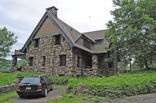
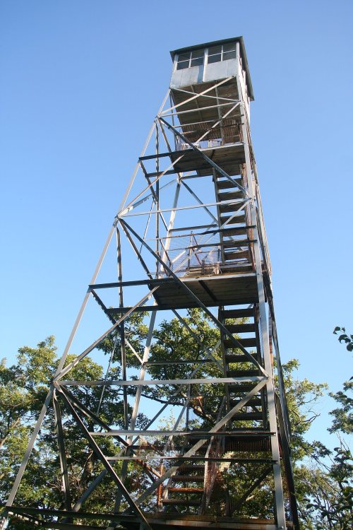
8 listings: 4 buildings, 1 historic district, the Warwick Village Historic District, with 207 contributing buildings, 2 structures, and 1 object. 222 historic buildings in all.
How old are the homes in Warwick?
21% of Warwick’s homes were built before 1940 (Census estimate, ±2.8 points), against a typical 27% for a New York town; the median home was built in 1973.
Founding dates: Wikidata, Wikipedia, the U.S. post office records of Blevins & Helbock (CC0) and the Census. Homes by year built: Census ACS 2020–24. National Register of Historic Places: National Park Service (list of May 22, 2026). Old photos, postcards and papers: Wikimedia Commons, the Library of Congress and other public archives, credited on each item’s page. Maps: U.S. Geological Survey historical topographic maps (via Esri) and Sanborn fire-insurance maps (Library of Congress). History text and census tables: Wikipedia (CC BY-SA 4.0). Places that used to be: USGS Geographic Names Information System (2021).
From Wikimedia Commons (6), the National Register of Historic Places (8), Wikipedia, Wikidata and Wikipedia for famous people, U.S. Geological Survey historical maps, U.S. Census counts (via Wikipedia), the US Post Offices dataset (Blevins & Helbock), the USGS Geographic Names Information System, Sanborn fire insurance maps (Library of Congress) and old county and town histories (Internet Archive). Archive images are copied here with their credits and licenses, shown on each photo’s page. Refreshed monthly.




 1872
 1875
 1875
 1875


