Wawayanda dates to 1849, and 14% of its homes were built before 1940
More historic than 72% of U.S. towns · #513 of 758 in New York. What drives it
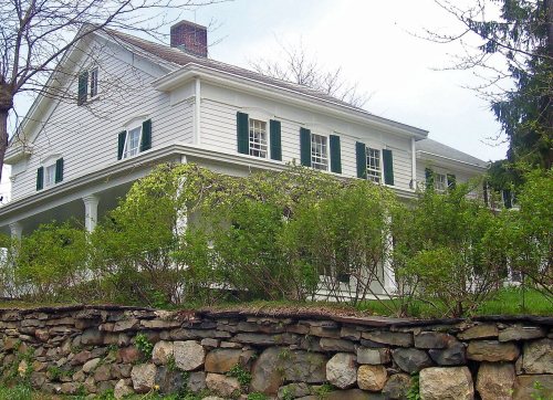
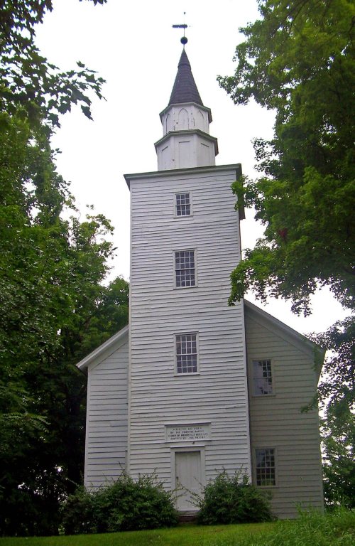
Its Register listings are the Primitive Baptist Church of Brookfield, the Dunning House and the Woodlawn Farm. Below: 1 old photo or paper, maps from 1906 on, and the census since 1860.
Founding year: Wikipedia. First post office: 1817.The full story ↓
History grade
What drives Wawayanda’s History grade
On its age, its old homes and the National Register, Wawayanda is more historic than 72% of U.S. towns, #513 of 758 in New York. All 3 inputs are above most U.S. towns; its age ranks highest and its National Register listings lowest.
B+
HistoryA character grade: shown, never part of Wawayanda’s overall grade.
New York towns list more on the Register than most of the country (a typical New York town has 12.3 per 10,000 residents, the U.S. 2.4), so Wawayanda’s 6.6 sits near the middle of its state (39% of New York towns have fewer) while its 5 historic buildings outnumber those of 70% of U.S. towns.
NoteThe founding year comes from Wikipedia alone; no second source gives 1849.
How sure. Graded on any two of the three inputs instead, the letter would range from B to B+. The pre-1940 share is a Census survey estimate (±4.4 points).
Founding year: Wikipedia (other dates in Quick answers). Homes: Census ACS 2020–24. National Register: National Park Service, May 2026 list; each listing counted once (boundary changes and added documentation belong to their listing), and a historic district counts its contributing buildings. How TownRatings grades history →
What stands out about Wawayanda’s past
Read from the archive, the National Register and the record. The page puts what stands out first.
The town of Wawayanda was established in 1849 from the town of Minisink. It had been first settled after the American Revolution. The name Wawayanda had historically been more broadly used to describe the region, even earlier than a 1769 map, which also shows the line of partition used to resolve the 50-years long New York – New Jersey Line War.
Passages that mention Wawayanda, cut from the printed page as they were published.
History of Orange County, New York1881 · page 676Read the page →
Read the text
In further showing the names of the families residing in what is now the town of Wawayanda just before the Eevolutionary war, we are fortunately able to give the assessment-roll of this section, made out for district No. 10 in the old precinct of Goshen, — the last one, probably, made under provincial authority, — September, 1775. District No. 10, with James Little assessor, undoubtedly comprised most of the town of
Text read by machine from the scan; it may contain errors.
general northerly direction to the town line of Crawford and thence to the village of Pine Bush. Another road starts from the southern corporate limits of the city of Middletown and runs in a southerly direction to the town line of Wawayanda, and thence to the village of Goshen. This road branches off in a southwesterly direction in the town of Wawayanda and extends to Unionville, and by another branch is being extended to Port Jervis. Another State road, known as the Middletown-Cuddebackville road, starts from the northwesterly line of the city of Middletown and
Text read by machine from the scan; it may contain errors.
town of Crawford near BuUville and runs .thence to fine liush. The Susquehanna «S: Western Railroad passes into the town from the southerly border of the city of Middletowai and runs in a southwesterly direction in tlie town of Wawayanda. In addition to the above, the Erie & Jersey Railroad Company is now building a low-grade road which enters the town near Hov.-ells and runs in a general easterly direction through the town, passing about one mile north of the city of Middletown, thence leaving the town and passing into the town of Hamptonburgh in the
Text read by machine from the scan; it may contain errors.
History of Orange County, New York1881 · page 521Read the page →
Read the text
Goshen bearing date as early as 1714. The deed of trust from John Everett, John Carpenter, and others to John Yelverton is dated July 10, 1721, and in that document it is recited that the owners of Wawayanda had lately made a conveyance to John Everett and Samuel Clowes of one-sixth part of all said lands, to the intent that a township should be taken up and laid out, and ten acres for highways, and for settling
Text read by machine from the scan; it may contain errors.
Scans and text from the Internet Archive. Books published in 1930 or earlier, which are in the public domain.
Timeline
Wawayanda, 1792 to 1966
Woven from the archive, old maps, post office records, the National Register and the people born here.
In 1849, according to Wikipedia’s history of the town. Wawayanda’s post office opened in 1817, and the census of 1860 counted 2,085 people here.
How does Wawayanda rank for history?
Wawayanda is more historic than 72% of U.S. towns, #513 of 758 in New York. The History grade combines the town’s founding era, the share of homes built before 1940 and its National Register listings. It’s a character grade, so it isn’t part of the overall grade. How it works.
What is on the National Register in Wawayanda?
Three places: the Primitive Baptist Church of Brookfield (listed 1976), the Dunning House (2001) and the Woodlawn Farm (2008).
How old are the homes in Wawayanda?
14% of Wawayanda’s homes were built before 1940 (Census estimate, ±4.4 points), against a typical 27% for a New York town; the median home was built in 1983.
Founding dates: Wikidata, Wikipedia, the U.S. post office records of Blevins & Helbock (CC0) and the Census. Homes by year built: Census ACS 2020–24. National Register of Historic Places: National Park Service (list of May 22, 2026). Old photos, postcards and papers: Wikimedia Commons, the Library of Congress and other public archives, credited on each item’s page. Maps: U.S. Geological Survey historical topographic maps (via Esri) and Sanborn fire-insurance maps (Library of Congress). History text and census tables: Wikipedia (CC BY-SA 4.0). Places that used to be: USGS Geographic Names Information System (2021).
From Wikimedia Commons (11), Wikidata (1), the National Register of Historic Places (3), Wikipedia, U.S. Geological Survey historical maps, U.S. Census counts (via Wikipedia), the US Post Offices dataset (Blevins & Helbock), the USGS Geographic Names Information System and old county and town histories (Internet Archive). Archive images are copied here with their credits and licenses, shown on each photo’s page. Refreshed monthly.




 2011
 2008
 2007
 2007
 2007
 2007
 2007
 2007
 2007
 2005