On its age, its old homes and the National Register, Maryland is more historic than 80% of U.S. towns. Its share of homes from before 1940 holds the grade up; its National Register listings pull it down.
A−
HistoryA character grade: shown, never part of Maryland’s overall grade.
New York towns list more on the Register than most of the country (a typical New York town has 12.3 per 10,000 residents, the U.S. 2.4), so Maryland’s 6.7 sits near the middle of its state (39% of New York towns have fewer) while its 1 listings outnumber those of 51% of U.S. towns.
How sure. Graded on any two of the three inputs instead, the letter would range from B to A. The pre-1940 share is a Census survey estimate (±7.2 points). Two sources give 1808.
Founding year: Wikidata (other dates in Quick answers). Homes: Census ACS 2020–24. National Register: National Park Service, May 2026 list; each listing counted once (boundary changes and added documentation belong to their listing), and a historic district counts its contributing buildings. How TownRatings grades history →
What stands out about Maryland’s past
Read from the archive, the National Register and the record. The page puts what stands out first.
The town was first settled around 1790 in the southwest part of the town.
From about 1909 until 1912, an extensive lumber operation by Emmons L. Peck of Carbondale, Pennsylvania, utilizing a steam tramway which straddled the county line on South Hill east of Mud Lake, shipping finished lumber from Burnsides Switch on the D&HRR. Peck's personal cabin was later dismantled and rebuilt in the hamlet of Maryland next to the present post office. During World War I, Porter Brothers contracted to build the third rail for the D&HRR "bridge line" through Maryland and Worcester to allow larger eastbound freight trains without extra locomotives to clear Richmondville Hill by an alternate route, much of which was later obliterated by I-88 construction.
Passages that mention Maryland, cut from the printed page as they were published.
A character of the province of Maryland1869 · page 115Read the page →
Read the text
Tlie first Quakers in Maryland were Elizabeth Harris, Josiah Cole, and Thomas Thurston, who visited it in 1657, but as early as July 23, 1659, the governor and council issued an order to seize any Quakers and whip them from constable to constable out of the province. Yet in spite of this they had settled meetings as early as 1061, and Peter Sharpe, the Quaker physician, appears as a landholder in 1665, the very year of Alsop's publication.— Norris, Early Friends or Quakem in Maryland (Maryland Hist.
Text read by machine from the scan; it may contain errors.
Portrait and biographical record of Harford and Cecil counties, Maryland. Containing portraits and biographical sketches of prominent1897Read the page →
Read the text
1S97, to map out the campaign of 1897 for the state of Maryland. He was one of the subcommittee of the state of Maryland for the centennial of 1S76, also one of the World’s Fair managers of the state of Maryland at the World’s Fair in 1S93.
Text read by machine from the scan; it may contain errors.
Portrait and biographical record of Harford and Cecil counties, Maryland. Containing portraits and biographical sketches of prominent1897Read the page →
Read the text
his charter was ready for passage under the great seal, he died, and the grant was inherited by his son, Cecilius Calvert, to whom the charter of Maryland was granted, June 20, 1632. The granting of Maryland to Lord Baltimore aroused the indignation of Virginian colonists,
Text read by machine from the scan; it may contain errors.
Scans and text from the Internet Archive. Books published in 1930 or earlier, which are in the public domain.
Timeline
Maryland, 1802 to 1931
Woven from the archive, old maps, post office records, the National Register and the people born here.
Nothing in the archives for these yearsWeddings on Main Street, storms, parades, school pictures, the old store. If it’s in your family album, it belongs here.
In 1808, according to Wikidata. Maryland’s post office opened in 1816, and the census of 1820 counted 1,439 people here.
How does Maryland rank for history?
Maryland is more historic than 80% of U.S. towns. The History grade combines the town’s founding era, the share of homes built before 1940 and its National Register listings. It’s a character grade, so it isn’t part of the overall grade. How it works.
What is on the National Register in Maryland?
One place: the Twentieth Century Steam Riding Gallery No. 409 (listed 1998).
How old are the homes in Maryland?
30% of Maryland’s homes were built before 1940 (Census estimate, ±7.2 points), against a typical 27% for a New York town; the median home was built in 1964.
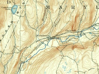
Founding dates: Wikidata, Wikipedia, the U.S. post office records of Blevins & Helbock (CC0) and the Census. Homes by year built: Census ACS 2020–24. National Register of Historic Places: National Park Service (list of May 22, 2026). Old photos, postcards and papers: Wikimedia Commons, the Library of Congress and other public archives, credited on each item’s page. Maps: U.S. Geological Survey historical topographic maps (via Esri) and Sanborn fire-insurance maps (Library of Congress). History text and census tables: Wikipedia (CC BY-SA 4.0). Places that used to be: USGS Geographic Names Information System (2021).
From the Library of Congress (1), the National Register of Historic Places (1), Wikipedia, Wikidata and Wikipedia for famous people, U.S. Geological Survey historical maps, U.S. Census counts (via Wikipedia), the US Post Offices dataset (Blevins & Helbock), the USGS Geographic Names Information System and old county and town histories (Internet Archive). Archive images are copied here with their credits and licenses, shown on each photo’s page. Refreshed monthly.