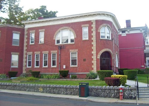
Haverstraw dates to 1616, and 12% of its homes were built before 1940
More historic than 82% of U.S. towns · #398 of 758 in New York. What drives it
9 places in town are on the National Register, among them a historic district with 24 buildings. Below: 6 old photos and papers, maps from 1887 on, and the census since 1790.
Founding year: Wikidata. First post office: 1815.The full story ↓
History grade
What drives Haverstraw’s History grade
On its age, its old homes and the National Register, Haverstraw is more historic than 82% of U.S. towns, #398 of 758 in New York. All 3 inputs are above most U.S. towns; its age ranks highest and its share of homes from before 1940 lowest.
A−
HistoryA character grade: shown, never part of Haverstraw’s overall grade.
New York towns list more on the Register than most of the country (a typical New York town has 12.3 per 10,000 residents, the U.S. 2.4), so Haverstraw’s 8.2 sits near the middle of its state (43% of New York towns have fewer) while its 32 historic buildings outnumber those of 82% of U.S. towns.
NoteThe founding year comes from Wikidata alone; no second source gives 1616.
How sure. Graded on any two of the three inputs instead, the letter would range from B to A. The pre-1940 share (±2.1 points) is firm at this size.
Founding year: Wikidata (other dates in Quick answers). Homes: Census ACS 2020–24. National Register: National Park Service, May 2026 list; each listing counted once (boundary changes and added documentation belong to their listing), and a historic district counts its contributing buildings. How TownRatings grades history →
What stands out about Haverstraw’s past
Read from the archive, the National Register and the record. The page puts what stands out first.
Lost half of its people between 1790 and 1830, then grew more than tenfold.
22 censuses, 1790–2020.
U.S. Census Bureau decennial counts, from the census table on Haverstraw’s Wikipedia page.
Places that used to be
Lost post offices, old corners, places now gone and burying grounds
Haverstraw’s post office has been open since 1815. Another post office, Mount Ivy, opened and closed inside today’s town.
Haverstraw
1815–today
Garnerville
1875–today
Thiells
1879–today
Mount Ivy
1882–1928
West Haverstraw
1893–today
18101920today
Hamlets and corners on the map
Felters CornersFountain Head Mobile Home ParkGarnervilleMazzaleone ParkMount IvyParkway Mobile Home ParkQuaker ParkSamsondaleThiellsWest HaverstrawWillow Grove
Gone or out of use
Letchworth Village Developmental Centerhospital
4cemeteries and burying grounds inside Haverstraw
Letchworth VillageMount ReposeSaint Johns in the WildernessSaint Peters
US Post Offices dataset (Blevins & Helbock, CC0). Places and cemeteries from the USGS Geographic Names Information System (2021).
In 1609, the region was explored by Henry Hudson. A land purchase was made in this town in 1666 from local natives and confirmed as a patent in 1671. The region was known as Haverstroo, meaning "oat straw" in Dutch.
During the American Revolution, it served (under the command of Col. Ann Hawkes Hay) as an important lookout for British activities on the Hudson. A blue-marked trail, the Long Path, may be taken 2 miles (3 km) eastward from Central Highway along the crest of South Mountain to High Tor. Halfway is Little Tor, the second highest peak on South Mountain.
deed as follows: “This Indenture made the 17th day of August 1789, between Thomas Smith, Esq., and the trustees of the English Protestant Society of Haverstraw. Whereas the said Thomas Smith, in order to promote and advance the cause of Religion and virtue among the inhabitants of Haverstraw did heretofore promise to give to the Society a piece or parcel of ground for the purpose of erecting a
Text read by machine from the scan; it may contain errors.
S. 25° 40' E. to the Pascack River, and crossing the New Jersey line a little to the east of the ninth mile stone, was made to separate the two. (See history of Kakiat Patent in history of town of Haverstraw.) (3) That the line between New York and New Jersey was next settled, October 7th 1769, when Charles Stewart, “ Surveyor General of the customs for the district of Quebec;” Andrew Elliott, “Receiver General of the
Text read by machine from the scan; it may contain errors.
Scans and text from the Internet Archive. Books published in 1930 or earlier, which are in the public domain.
By decade
Haverstraw, decade by decade
5 decades in the archive, from the 1810s to the 1940s. Scroll each row; tap a photo for its story.
Nothing in the archives for these yearsWeddings on Main Street, storms, parades, school pictures, the old store. If it’s in your family album, it belongs here.
Every edition of the U.S. Geological Survey’s map of Haverstraw. Tap a year, or press play to watch the town change.
1892Tarrytown sheet · 1:62,500
U.S. Geological Survey historical topographic maps (public domain), via Esri’s collection of the scans. The red ring marks the center of Haverstraw.
Every building
Haverstraw, building by building, 1887–1921
Fire insurance maps drew every building, what it was made of and what it was used for, so insurers could price the risk of fire. Pick a year, then a sheet.
In 1616, according to Wikidata. Haverstraw’s post office opened in 1815, and the first U.S. census counted 4,826 people here in 1790.
How does Haverstraw rank for history?
Haverstraw is more historic than 82% of U.S. towns, #398 of 758 in New York. The History grade combines the town’s founding era, the share of homes built before 1940 and its National Register listings. It’s a character grade, so it isn’t part of the overall grade. How it works.
What is on the National Register in Haverstraw?
9 listings: 8 buildings, among them the Smith Bly House (listed 1974, the first), and 1 historic district, the Rockland Print Works, with 24 contributing buildings. 32 historic buildings in all.
How old are the homes in Haverstraw?
12% of Haverstraw’s homes were built before 1940 (Census estimate, ±2.1 points), against a typical 27% for a New York town; the median home was built in 1972.
Founding dates: Wikidata, Wikipedia, the U.S. post office records of Blevins & Helbock (CC0) and the Census. Homes by year built: Census ACS 2020–24. National Register of Historic Places: National Park Service (list of May 22, 2026). Old photos, postcards and papers: Wikimedia Commons, the Library of Congress and other public archives, credited on each item’s page. Maps: U.S. Geological Survey historical topographic maps (via Esri) and Sanborn fire-insurance maps (Library of Congress). History text and census tables: Wikipedia (CC BY-SA 4.0). Places that used to be: USGS Geographic Names Information System (2021).
From Wikimedia Commons (1), the Library of Congress (5), the National Register of Historic Places (9), Wikipedia, Wikidata and Wikipedia for famous people, U.S. Geological Survey historical maps, U.S. Census counts (via Wikipedia), the US Post Offices dataset (Blevins & Helbock), the USGS Geographic Names Information System, Sanborn fire insurance maps (Library of Congress) and old county and town histories (Internet Archive). Archive images are copied here with their credits and licenses, shown on each photo’s page. Refreshed monthly.


 1943