Guest, Sign inJoin

Post to Stony Point

We’ll email a one-tap link to publish your post. No password, and nothing is public until you click it.
Already a member? Sign in
B−History
History · Stony Point

Stony Point dates to 1865, and 11% of its homes were built before 1940

More historic than 46% of U.S. towns · #692 of 758 in New York. What drives it

8 places in town are on the National Register, among them the Stony Point Battlefield, a National Historic Landmark. Below: 11 old photos and papers, maps from 1938 on, and the census since 1870.

1865founded
8on the National Register
11%homes built before 1940
11old photos & papers
4famous people
From Stony Point’s archive · credits on each photo
Quick answers

How Stony Point began

When was Stony Point founded?

1865

Stony Point dates its founding to 1865 (Wikidata and Wikipedia’s history agree). The census first counted it in 1870.

First census: 3,205 in 18702020 census: 14,813161 years

How historic is Stony Point?

B−

More historic than 46% of U.S. towns, on its age, its old homes and the National Register.

What drives the grade ↓
Founding year: Wikidata; Wikipedia’s history section gives the same year. First post office: 1834.The full story ↓
History grade

What drives Stony Point’s History grade

On its age, its old homes and the National Register, Stony Point is more historic than 46% of U.S. towns, #692 of 758 in New York. Its National Register listings hold the grade up; its age pulls it down.

B−
HistoryA character grade: shown, never part of Stony Point’s overall grade.
All U.S. towns we grade (21,289)Ahead of 46%
NewerOlder
New York towns of 2,500+ (758)Ahead of 9%

New York towns list more on the Register than most of the country (a typical New York town has 12.3 per 10,000 residents, the U.S. 2.4), so Stony Point’s 5.4 sits near the middle of its state (36% of New York towns have fewer) while its 8 listings outnumber those of 74% of U.S. towns.

How sure. Graded on any two of the three inputs instead, the letter would range from C+ to B−. The pre-1940 share (±2.4 points) is firm at this size. Two sources give 1865.

Founding year: Wikidata (other dates in Quick answers). Homes: Census ACS 2020–24. National Register: National Park Service, May 2026 list; each listing counted once (boundary changes and added documentation belong to their listing), and a historic district counts its contributing buildings. How TownRatings grades history →

What stands out about Stony Point’s past

Read from the archive, the National Register and the record. The page puts what stands out first.

★ What stands out · Places that used to be

Lost post offices, old corners, places now gone and burying grounds

Stony Point’s post office has been open since 1870. Four other post offices opened and closed inside today’s town.

Grassy Point
1834–1937
North Haverstraw
1834–1865
Tompkins Cove
1860–today
Flora Falls
1865–1870
Stony Point
1870–today
Jones Point
1885–1940
Bear Mountain
1937–today
18301930today
Hamlets and corners on the map
BuckbergBulsontownCedar FlatsDoodletownFort ClintonJones PointMountain View Mobile Home ParkRed Ridge Mobile Home ParkTomkins Cove
Gone or out of use
Fort VaughanmilitaryKing's FerrycrossingMontville Community ChurchchurchMontville SchoolschoolNaval Ammunition Depot Iona IslandmilitaryTomkins Cove Quarrymine
4cemeteries and burying grounds inside Stony Point
HerbertHillsideJonesJune

US Post Offices dataset (Blevins & Helbock, CC0). Places and cemeteries from the USGS Geographic Names Information System (2021).

People over time

Stony Point, census by census

02,0004,0006,0008,00010,00012,00014,00016,000188019001920194019601980200020204,614 in 1890Low: 3,211

Lost a third of its people between 1890 and 1920, then grew 4-fold.

16 censuses, 1870–2020.

U.S. Census Bureau decennial counts, from the census table on Stony Point’s Wikipedia page.

On the National Register

8 historic places in Stony Point

The country’s official list of buildings and places worth saving. One is a National Historic Landmark, the highest tier.

places listed
8
National Historic Landmark
1
Stony Point Battlefield
historic buildings protected
8
each building in a district counts
first listed
1966
Stony Point Battlefield
All 8 listings

National Park Service, National Register of Historic Places. Photos from Wikimedia Commons, credited on each place’s page.

The story

How Stony Point came to be

From Wikipedia’s history of Stony Point.

Read it all →

During the American Revolution, the King's Ferry in Stony Point linked New York and the southern colonies with New England; it was used many times by General George Washington's Continental Army, and in 1781 Washington's French allies also used it on their way to the Battle of Yorktown.

The economy of the town improved upon the rediscovery of limestone deposits in the 19th century. The town of Stony Point was founded in 1865 from the northern part of the town of Haverstraw.

Text from Wikipedia, licensed CC BY-SA 4.0.

From the old history books

What they wrote about Stony Point in 1884

Passages that mention Stony Point, cut from the printed page as they were published.

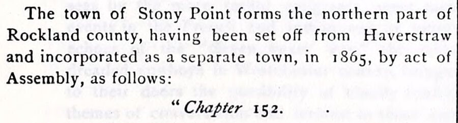
The town of Stony Point forms the northern part of Rockland county, having been set off from Haverstraw and incorporated as a separate town, in 1865, by act of Assembly, as follows: “ Chapter 152.
History of Rockland County, New York1884Read the page →
Read the text

The town of Stony Point forms the northern part of Rockland county, having been set off from Haverstraw and incorporated as a separate town, in 1865, by act of Assembly, as follows: “ Chapter 152.

Text read by machine from the scan; it may contain errors.
That portion of the town of Stony Point which lies north of the “ Northwest Line,” is composed of comparatively small tracts, into which the great Evans Patent (see page 155) was divided, and a brief notice of each will be given. A full account of the Bradley and Jamison Patent, or Stony Point Trac…
History of Rockland County, New York1884Read the page →
Read the text

That portion of the town of Stony Point which lies north of the “ Northwest Line,” is composed of comparatively small tracts, into which the great Evans Patent (see page 155) was divided, and a brief notice of each will be given. A full account of the Bradley and Jamison Patent, or Stony Point Tract, will be found in another place, and its subdivisions are fully described.

Text read by machine from the scan; it may contain errors.

Scans and text from the Internet Archive. Books published in 1930 or earlier, which are in the public domain.

Timeline

Stony Point, 1779 to 1951

Woven from the archive, old maps, post office records, the National Register and the people born here.

  1. 18th century
  2. 1779In the archiveSketch of Stoney & Verplank's Points upon the North River, as taken possession of, and fo…
  3. 19th century
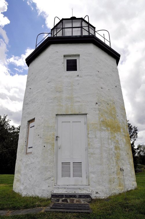
  4. 1826BuiltStony Point Lighthouse is built
  5. 1831Born hereEdward Brooks is born here
  6. 1834Post officeThe Grassy Point post office opens
  7. 1834Post officeThe North Haverstraw post office opens
  8. 1837In the archiveUntitled photo
  9. 1851In the archiveJasper Francis Cropsey - Tourn Mountain, Head Quarters of Washington, Rockland Co., New Y…
  10. 1860Post officeThe Tompkins Cove post office opens
  11. 1865
    FoundingStony Point is established
  12. 1865Post officeThe North Haverstraw post office closes
  13. 20th century
  14. 1915BuiltStony Point District School No. 4 is built
  15. 1917In the archiveNew York - Sidney through
  16. 1923In the archiveStony Point NY Presby PHS832
  17. 1924Born hereDaniel J. Miller is born here
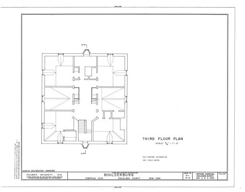
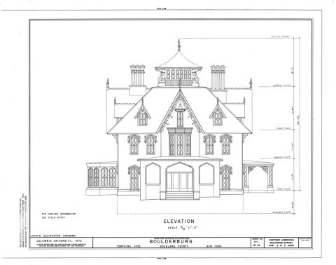
  18. 1933In the archiveHABS NY,44-TOMC,1- (sheet 1 of 5) - Boulderburg, Tomkins Cove, Rockland County, NY
  19. 1937Post officeThe Grassy Point post office closes
  20. 1938On the mapFirst mapped by the U.S. Geological Survey
  21. 1951Born hereMike Deane is born here
By decade

Stony Point, decade by decade

6 decades in the archive, from the 1770s to the 1930s. Scroll each row; tap a photo for its story.

On the map

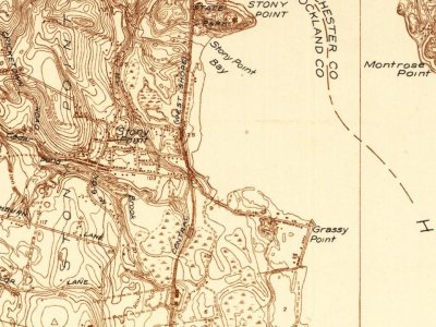
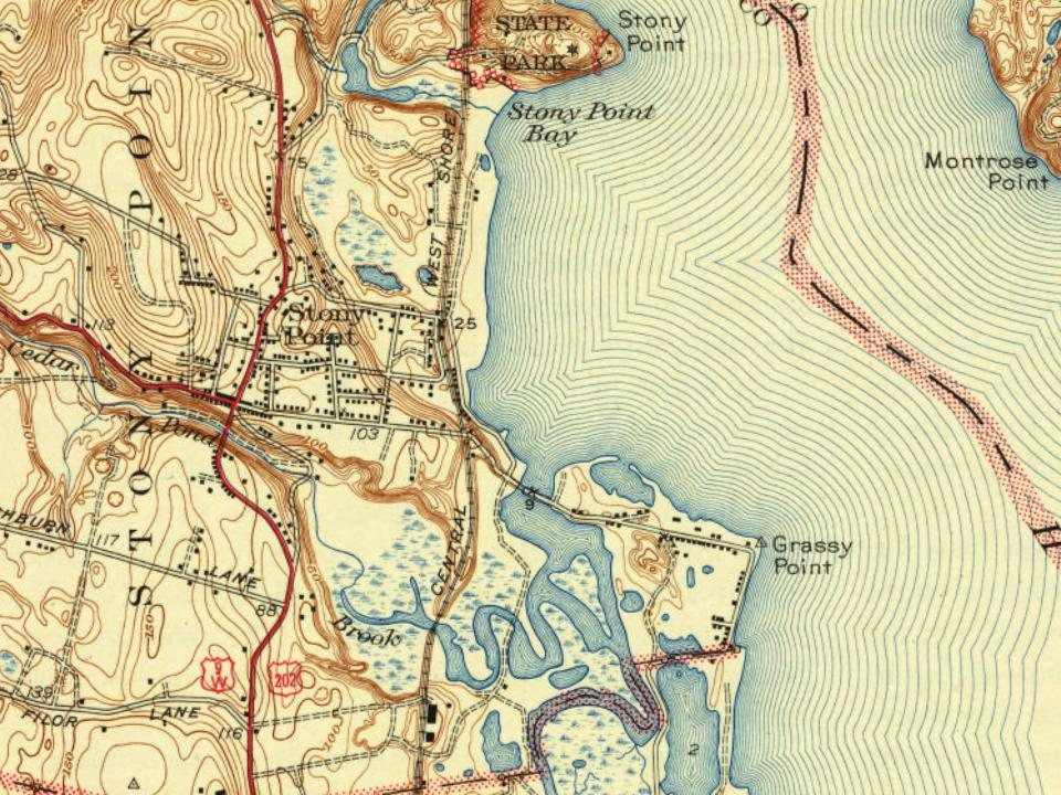
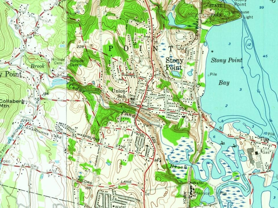
Stony Point on the map, 1938 to 1979

Every edition of the U.S. Geological Survey’s map of Stony Point. Tap a year, or press play to watch the town change.

Stony Point on the 1938 USGS mapStony Point on the 1943 USGS mapStony Point on the 1955 USGS mapStony Point on the 1967 USGS mapStony Point on the 1979 USGS map1938Haverstraw sheet · 1:24,000

U.S. Geological Survey historical topographic maps (public domain), via Esri’s collection of the scans. The red ring marks the center of Stony Point.

Then & now

Stand where they stood

No then-and-now pairs yet. Take a photo from the same spot as an old one and they appear here side by side.

Jasper Francis Cropsey - Tourn Mountain, Head Quarters of Washington, Rockland Co., New York - 2015.19.109 - Corcoran G…
Retake this viewJasper Francis Cropsey - Tourn Mountain, Head Quarters of Washington, Rockland Co., New York - 2015.19.109 - Corcoran G…, 1851

Find the spot, match the angle, and add your photo. It becomes the first then-and-now pair on Stony Point’s page.

Retake this view · +15
Famous people

4 famous people were born in Stony Point

Writers, athletes, leaders and more, ranked by how widely they’re known.

See all →
Help out

Finish Stony Point’s story

Most archives stop around 1920. The photos from after that are in family albums, not libraries.

Decades since 1900 with photos
00s10s20s30s40s50s60s70s80s90s
3 of 10 decades. The empty ones are waiting for someone’s album.
Stories next door

History across the town line

Each neighbor’s History grade, on the same three inputs.

Questions about Stony Point’s history

What year was Stony Point founded?

In 1865, according to Wikidata and Wikipedia’s history of the town. Stony Point’s post office opened in 1834, and the census of 1870 counted 3,205 people here.

How does Stony Point rank for history?

Stony Point is more historic than 46% of U.S. towns, #692 of 758 in New York. The History grade combines the town’s founding era, the share of homes built before 1940 and its National Register listings. It’s a character grade, so it isn’t part of the overall grade. How it works.

What is on the National Register in Stony Point?

8 listings: 4 buildings, 1 site, and 3 structures.

How old are the homes in Stony Point?

11% of Stony Point’s homes were built before 1940 (Census estimate, ±2.4 points), against a typical 27% for a New York town; the median home was built in 1970.

Memory lane

What the archives can’t tell you, neighbors can.

Town Square →
Start a conversation
Sources

Where this page comes from

Founding dates: Wikidata, Wikipedia, the U.S. post office records of Blevins & Helbock (CC0) and the Census. Homes by year built: Census ACS 2020–24. National Register of Historic Places: National Park Service (list of May 22, 2026). Old photos, postcards and papers: Wikimedia Commons, the Library of Congress and other public archives, credited on each item’s page. Maps: U.S. Geological Survey historical topographic maps (via Esri) and Sanborn fire-insurance maps (Library of Congress). History text and census tables: Wikipedia (CC BY-SA 4.0). Places that used to be: USGS Geographic Names Information System (2021).

From Wikimedia Commons (11), Wikidata (1), the National Register of Historic Places (8), Wikipedia, Wikidata and Wikipedia for famous people, U.S. Geological Survey historical maps, U.S. Census counts (via Wikipedia), the US Post Offices dataset (Blevins & Helbock), the USGS Geographic Names Information System and old county and town histories (Internet Archive). Archive images are copied here with their credits and licenses, shown on each photo’s page. Refreshed monthly.