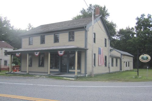
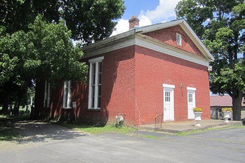
Clifton Park’s post office opened in 1832, and 11 of its places are on the National Register
More historic than 60% of U.S. towns · #603 of 758 in New York. What drives it
Most of Clifton Park was built recently: 3% of its homes predate 1940 and the median home dates from 1982. 11 places in town are on the National Register, among them a historic district with 46 buildings. Below: 1 old photo or paper, maps from 1893 on, and the census since 1830.
From Clifton Park’s archive · credits on each photo
Quick answers
How Clifton Park began
When was Clifton Park founded?
1832
The Clifton Park post office opened in 1832, the earliest record of the town by name. Five smaller post offices, Jonesville (1819), Rexford Flats (1825) and Vischer Ferry (1833), opened inside today’s town and later closed.
First census: 2,494 in 18302020 census: 38,029194 years
How historic is Clifton Park?
B
More historic than 60% of U.S. towns, on its age, its old homes and the National Register.
Founding year: the first Clifton Park post office (Blevins & Helbock, CC0).The full story ↓
History grade
What drives Clifton Park’s History grade
On its age, its old homes and the National Register, Clifton Park is more historic than 60% of U.S. towns, #603 of 758 in New York. Its age holds the grade up; its share of homes from before 1940 pulls it down.
B
HistoryA character grade: shown, never part of Clifton Park’s overall grade.
New York towns list more on the Register than most of the country (a typical New York town has 12.3 per 10,000 residents, the U.S. 2.4), so Clifton Park’s 16.3 sits near the middle of its state (53% of New York towns have fewer) while its 62 historic buildings outnumber those of 86% of U.S. towns.
How sure. Graded on any two of the three inputs instead, the letter would range from C+ to A−. The pre-1940 share (±0.9 points) is firm at this size. The founding year is the first post office, not a stated founding date.
Founding year: the first post office (other dates in Quick answers). Homes: Census ACS 2020–24. National Register: National Park Service, May 2026 list; each listing counted once (boundary changes and added documentation belong to their listing), and a historic district counts its contributing buildings. How TownRatings grades history →
What stands out about Clifton Park’s past
Read from the archive, the National Register and the record. The page puts what stands out first.
The Indigenous Mohawks and Mohicans referred to the area as Canastigione, meaning corn flats. The first settlements in what is now Clifton Park were established in the 17th century. The town or area was named in 1707 by Nanning Harmansen. At that time, Nanning Harmansen sent letters to Lord Cornbury requesting letters of Patent for Land he bought from the Indigenous Americans. He also stated in this correspondence that he wanted the patent to be known by "Your name of Cliftons Park", and the patent was named the Clifton Park Patent. The Iroqouis name for the Clifton Park Patent was Shenendehowa (meaning "Great Plains") which is where the school district gets its name.
Passages that mention Clifton Park, cut from the printed page as they were published.
History of Saratoga County, New York1893 · page 450Read the page →
Read the text
the Erie canal. The following year he became weighm aster on the canal, and in 1856 purchased and moved upon a farm in the town of Clifton Park, Saratoga county, where he rerided until 1861, when he removed to the village of Clifton Park. Here he has resided ever since, engaged in auctioneering and settling up estates. In 1861 he was elected jus-
Text read by machine from the scan; it may contain errors.
History of Saratoga County, New York1893 · page 482Read the page →
Read the text
son, the subject of this sketch. He served with honor and distinction in the war of 1812, was a whig in politics, and was the third clerk of the town of Clifton Park. In religion he was a Baptist, and for many years served as clerk of the Clifton Park Baptist church.
Text read by machine from the scan; it may contain errors.
History of Saratoga County, New York, with illustrations biographical sketches of some of its prominent men and pioneers1878 · page 348Read the page →
Read the text
of Anthony's Kill. Smithtown, from the number of Smith families that live in that vicinity. Crescent retains the early designation, — the synonym for half-moon. Clifton Park, partly in the town of Clifton Park, takes its name from the latter. 3Iiddletown, lying between Waterford and Crescent, seems to have had this name without any particular reason. It is now assuming the name of Half-Moon, which, indeed, has been the post-oiEce name for years.
Text read by machine from the scan; it may contain errors.
History of Saratoga County, New York, with illustrations biographical sketches of some of its prominent men and pioneers1878 · page 352Read the page →
Read the text
dletown and this are successors of the old Newtown church that was dissolved some years ago. That old church had its house of worship at the four corners by the cemetery, near the present residence of John Baker. Clifton Park village was an out-station, at which preaching was established for some time before the formation of a society by the pastors of the First Baptist church of Clifton Park, and under the labors of Elder F. S. Parke, assisted by Elder Parmalee,
Text read by machine from the scan; it may contain errors.
Scans and text from the Internet Archive. Books published in 1930 or earlier, which are in the public domain.
Timeline
Clifton Park, 1789 to 2020
Woven from the archive, old maps, post office records, the National Register and the people born here.
The Clifton Park post office opened in 1832, the earliest record of the town by name (U.S. post office records).
How does Clifton Park rank for history?
Clifton Park is more historic than 60% of U.S. towns, #603 of 758 in New York. The History grade combines the town’s founding era, the share of homes built before 1940 and its National Register listings. It’s a character grade, so it isn’t part of the overall grade. How it works.
What is on the National Register in Clifton Park?
11 listings: 10 buildings and 1 historic district, the Vischer Ferry Historic District, with 46 contributing buildings. 62 historic buildings in all.
How old are the homes in Clifton Park?
3% of Clifton Park’s homes were built before 1940 (Census estimate), against a typical 27% for a New York town; the median home was built in 1982.
Founding dates: Wikidata, Wikipedia, the U.S. post office records of Blevins & Helbock (CC0) and the Census. Homes by year built: Census ACS 2020–24. National Register of Historic Places: National Park Service (list of May 22, 2026). Old photos, postcards and papers: Wikimedia Commons, the Library of Congress and other public archives, credited on each item’s page. Maps: U.S. Geological Survey historical topographic maps (via Esri) and Sanborn fire-insurance maps (Library of Congress). History text and census tables: Wikipedia (CC BY-SA 4.0). Places that used to be: USGS Geographic Names Information System (2021).
From Wikimedia Commons (25), Wikidata (5), the National Register of Historic Places (11), Wikipedia, Wikidata and Wikipedia for famous people, U.S. Geological Survey historical maps, U.S. Census counts (via Wikipedia), the US Post Offices dataset (Blevins & Helbock), the USGS Geographic Names Information System and old county and town histories (Internet Archive). Archive images are copied here with their credits and licenses, shown on each photo’s page. Refreshed monthly.


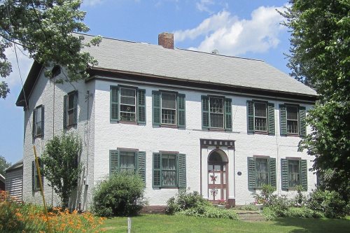


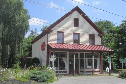


 2007
 2007
 2007
 2007
 2007
 2007
 2007
 2007
 2007
 2007
 2007
 2007
 2007
 2007
 2007
 2007
 2007
 2007
 2007
 2007
 2007
 2007
 2007
 2003