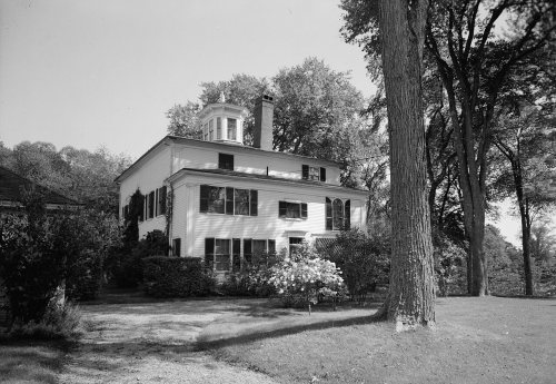
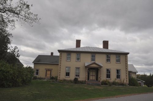
More historic than 80% of U.S. towns · #78 of 143 in Maine. What drives it
7 places in town are on the National Register, among them a historic district with 56 buildings. Below: 3 old photos and papers, maps from 1894 on, and the census since 1790.
On its age, its old homes and the National Register, Topsham is more historic than 80% of U.S. towns, #78 of 143 in Maine. All 2 inputs are above most U.S. towns; its National Register listings ranks highest and its share of homes from before 1940 lowest.
A−
HistoryA character grade: shown, never part of Topsham’s overall grade.
Maine towns list more on the Register than most of the country (a typical Maine town has 15.9 per 10,000 residents, the U.S. 2.4), so Topsham’s 67.0 sits above most of its state (80% of Maine towns have fewer) while its 65 historic buildings outnumber those of 87% of U.S. towns.
How sure. Graded on two of the three inputs, so a change in either one moves the letter more than it would with three. The pre-1940 share is a Census survey estimate (±3.8 points).
Founding year: our sources. Homes: Census ACS 2020–24. National Register: National Park Service, May 2026 list; each listing counted once (boundary changes and added documentation belong to their listing), and a historic district counts its contributing buildings. How TownRatings grades history →
What stands out about Topsham’s past
Read from the archive, the National Register and the record. The page puts what stands out first.
Called Sawacook, the area was territory of the Pejepscot Abenaki, a subtribe of the Anasagunticooks (now Androscoggins), who controlled the Androscoggin River. They lived and fished at Pejepscot Falls. But a plague, probably smallpox brought by Europeans, decimated the tribe's population in 1615–1616. On June 16, 1632, the area was granted by the Plymouth Council to Thomas Purchase and George Way, later acquired by Richard Wharton and then, in 1714, by the Pejepscot Company.
Passages that mention Topsham, cut from the printed page as they were published.
History of Brunswick, Topsham, and Harpswell, Maine, including the ancient territory known as Pejepscot1878 · page 418Read the page →
Read the text
on account of the information it contains in regard to parishes in general, is herewith given in full : — "The committee appointed at a meeting of the First Parish in Topsham, held on the twelfth instant, to ascertain who are the legal members thereof, respectfully report that they have examined the statutes and reported cases in i)oint, and have unanimously come to the conclusion that all inhabitants of twenty-one years of age and upwards, within the bounds of said parish, and Avho have not Avith-
Text read by machine from the scan; it may contain errors.
History of Brunswick, Topsham, and Harpswell, Maine, including the ancient territory known as Pejepscot1878 · page 395Read the page →
Read the text
A part of the congregation was composed of Topsham people, and after a time the meetings alternated between Brunswick and Topsham to accommodate them. Finally it was agreed between the Universalists and Unitarians that the former shonld maintain preacliing in Brunswick and the latter in Topsham. (See sketch of Unitarian society of Topsham.) In 1835 the UNI VERBALISTS Made a third engagement with Reverend Seth Stetson to supply
Text read by machine from the scan; it may contain errors.
Scans and text from the Internet Archive. Books published in 1930 or earlier, which are in the public domain.
Timeline
Topsham, 1764 to 2020
Woven from the archive, old maps, post office records, the National Register and the people born here.
Topsham is more historic than 80% of U.S. towns, #78 of 143 in Maine. The History grade combines the town’s founding era, the share of homes built before 1940 and its National Register listings. It’s a character grade, so it isn’t part of the overall grade. How it works.
What is on the National Register in Topsham?
7 listings: 3 buildings, among them the Pejepscot Paper Company (listed 1974, the first), 1 historic district, the Topsham Historic District, with 56 contributing buildings, and 3 structures. 65 historic buildings in all.
How old are the homes in Topsham?
12% of Topsham’s homes were built before 1940 (Census estimate, ±3.8 points), against a typical 19% for a Maine town; the median home was built in 1980.
Founding dates: Wikidata, Wikipedia, the U.S. post office records of Blevins & Helbock (CC0) and the Census. Homes by year built: Census ACS 2020–24. National Register of Historic Places: National Park Service (list of May 22, 2026). Old photos, postcards and papers: Wikimedia Commons, the Library of Congress and other public archives, credited on each item’s page. Maps: U.S. Geological Survey historical topographic maps (via Esri) and Sanborn fire-insurance maps (Library of Congress). History text and census tables: Wikipedia (CC BY-SA 4.0). Places that used to be: USGS Geographic Names Information System (2021).
From Wikimedia Commons (3), Wikidata (3), the National Register of Historic Places (7), Wikipedia, Wikidata and Wikipedia for famous people, U.S. Geological Survey historical maps, U.S. Census counts (via Wikipedia), the US Post Offices dataset (Blevins & Helbock), the USGS Geographic Names Information System and old county and town histories (Internet Archive). Archive images are copied here with their credits and licenses, shown on each photo’s page. Refreshed monthly.