Brunswick dates to 1628, and 20% of its homes were built before 1940
More historic than 96% of U.S. towns · #20 of 143 in Maine. What drives it
15 places in town are on the National Register, among them 2 National Historic Landmarks and six historic districts with 206 buildings between them. Below: 16 old photos and papers, maps from 1884 on, and the census since 1790.
Founding year: Wikidata. First post office: 1792.The full story ↓
History grade
What drives Brunswick’s History grade
On its age, its old homes and the National Register, Brunswick is more historic than 96% of U.S. towns, #20 of 143 in Maine. All 3 inputs are above most U.S. towns; its age ranks highest and its share of homes from before 1940 lowest.
A+
HistoryA character grade: shown, never part of Brunswick’s overall grade.
Maine towns list more on the Register than most of the country (a typical Maine town has 15.9 per 10,000 residents, the U.S. 2.4), so Brunswick’s 96.3 sits above most of its state (86% of Maine towns have fewer) while its 215 historic buildings outnumber those of 94% of U.S. towns.
NoteThe founding year comes from Wikidata alone; no second source gives 1628.
How sure. Graded on any two of the three inputs instead, the letter would range from A to A+. The pre-1940 share is a Census survey estimate (±3.0 points).
Founding year: Wikidata (other dates in Quick answers). Homes: Census ACS 2020–24. National Register: National Park Service, May 2026 list; each listing counted once (boundary changes and added documentation belong to their listing), and a historic district counts its contributing buildings. How TownRatings grades history →
What stands out about Brunswick’s past
Read from the archive, the National Register and the record. The page puts what stands out first.
Settled in 1628 by Thomas Purchase and other fishermen, the area was called by its Indigenous Peoples' name, Pejepscot, meaning "the long, rocky rapids part [of the river]". In 1639, Purchase placed his settlement under protection of the Massachusetts Bay Colony. During King Philip's War in 1676, Pejepscot was burned and abandoned, although a garrison called Fort Andros was built on the ruins during King William's War. During the war, in Major Benjamin Church's second expedition a year later, he arrived on September 11, 1690, with 300 men at Casco Bay. He went up the Androscoggin River to Fort Pejepscot (present day Brunswick, Maine). From there he went 40 miles (64 km) upriver and attacked a native village. Three or four native men were shot in retreat. When Church discovered five captive settlers in the wigwams, six or seven prisoners were butchered as an example, and nine prisoners w…
Passages that mention Brunswick, cut from the printed page as they were published.
History of Brunswick, Topsham and Harpswell, Maine [microform]1878 · page 521Read the page →
Read the text
Brunswick Town Commons. — The Town Commons of Brunswick originated in x vote of the proprietors, May 8, 1719, ** That one Thousand Acres of Land with in the ‘Township of Brunswick be Laid out; ‘To LY in General & perpetual comonage to y® s* Town of Brunswick Forever.”!
Text read by machine from the scan; it may contain errors.
History of Brunswick, Topsham, and Harpswell, Maine, including the ancient territory known as Pejepscot1878 · page 521Read the page →
Read the text
Brunswick Forever. "^ Nothing further was done until Februarj' 3, 1742, when the proprietors passed a vote that " the one thousand Acres as laid down in the Plan of the Township of Brunswick which was granted by the Proprietors of Brunswick the eighth day of Ma}' 1719 be reserved for a General and perpetual Commonage to the Town of Brunswick forever." 2 No further action was taken until June 10, 1771, when, at a meet-
Text read by machine from the scan; it may contain errors.
History of Brunswick, Topsham, and Harpswell, Maine, including the ancient territory known as Pejepscot1878 · page 104Read the page →
Read the text
The town of Brunswick first received its name legally, in the year 1717, when it was incorporated as a township. This name was probably given to the town in honor of the house of Brunswick, to which family the then king of Great Britain belonged. The reason for this presumption is. that this town, being earlier settled and incorporated than any of the other nine or ten towns of the same name in the United States, could not have been named after either of them, and as there were, so far as known, no Germans among the earlier settlers
Text read by machine from the scan; it may contain errors.
History of Brunswick, Topsham and Harpswell, Maine [microform]1878 · page 548Read the page →
Read the text
In 1795 an attempt was made to have a bridge built across the Androscoggin River by the towns of Brunswick and ‘Topsham, and the town of Brunswick ‘* voted very generally to build the one half of a bridge across Androscoggin River, to begin near Doctor Nye’s Mill.’ A committee was chosen to ** see the matter carried on,” and the town also voted to raise £300 for building the bridge, but not to assess the money until leave to buiid it had been granted by the General Court. Nothing came of this attempt to construct a free bridge, but
Text read by machine from the scan; it may contain errors.
Scans and text from the Internet Archive. Books published in 1930 or earlier, which are in the public domain.
By decade
Brunswick, decade by decade
9 decades in the archive, from the 1720s to the 1900s. Scroll each row; tap a photo for its story.
Nothing in the archives for these yearsWeddings on Main Street, storms, parades, school pictures, the old store. If it’s in your family album, it belongs here.
Every edition of the U.S. Geological Survey’s map of Brunswick. Tap a year, or press play to watch the town change.
1894Bath sheet · 1:62,500
U.S. Geological Survey historical topographic maps (public domain), via Esri’s collection of the scans. The red ring marks the center of Brunswick.
Every building
Brunswick, building by building, 1884–1912
Fire insurance maps drew every building, what it was made of and what it was used for, so insurers could price the risk of fire. Pick a year, then a sheet.
In 1628, according to Wikidata. Brunswick’s post office opened in 1792, and the first U.S. census counted 1,357 people here in 1790.
How does Brunswick rank for history?
Brunswick is more historic than 96% of U.S. towns, #20 of 143 in Maine. The History grade combines the town’s founding era, the share of homes built before 1940 and its National Register listings. It’s a character grade, so it isn’t part of the overall grade. How it works.
What is on the National Register in Brunswick?
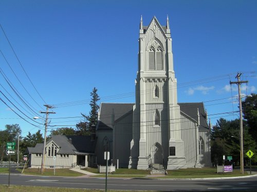
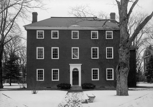
15 listings, 2 of them National Historic Landmarks: 9 buildings, among them the Harriet Beecher Stowe House (a National Historic Landmark since 1962), and 6 historic districts with 206 contributing buildings. 215 historic buildings in all.
How old are the homes in Brunswick?
20% of Brunswick’s homes were built before 1940 (Census estimate, ±3.0 points), against a typical 19% for a Maine town; the median home was built in 1982.
Founding dates: Wikidata, Wikipedia, the U.S. post office records of Blevins & Helbock (CC0) and the Census. Homes by year built: Census ACS 2020–24. National Register of Historic Places: National Park Service (list of May 22, 2026). Old photos, postcards and papers: Wikimedia Commons, the Library of Congress and other public archives, credited on each item’s page. Maps: U.S. Geological Survey historical topographic maps (via Esri) and Sanborn fire-insurance maps (Library of Congress). History text and census tables: Wikipedia (CC BY-SA 4.0). Places that used to be: USGS Geographic Names Information System (2021).
From Wikimedia Commons (14), the Library of Congress (2), Wikidata (2), the National Register of Historic Places (15), Wikipedia, Wikidata and Wikipedia for famous people, U.S. Geological Survey historical maps, U.S. Census counts (via Wikipedia), the US Post Offices dataset (Blevins & Helbock), the USGS Geographic Names Information System, Sanborn fire insurance maps (Library of Congress) and old county and town histories (Internet Archive). Archive images are copied here with their credits and licenses, shown on each photo’s page. Refreshed monthly.


 ★ Landmark
 ★ Landmark


 c. 1869
 c. 1869
 c. 1869
 c. 1869
 1878
 1878
 1893
 1893
 1898
 1901