Guest, Sign inJoin

Post to Durham

We’ll email a one-tap link to publish your post. No password, and nothing is public until you click it.
Already a member? Sign in
BHistory
History · Durham

12% of Durham’s homes were built before 1940

More historic than 59% of U.S. towns · #118 of 143 in Maine. What drives it

5 places in town are on the National Register. Below: 3 old photos and papers, maps from 1892 on, and the census since 1790.

5on the National Register
12%homes built before 1940
3old photos & papers
4famous people
Quick answers

About Durham’s history

How historic is Durham?

B

More historic than 59% of U.S. towns, on its age, its old homes and the National Register.

What drives the grade ↓
History grade

What drives Durham’s History grade

On its age, its old homes and the National Register, Durham is more historic than 59% of U.S. towns, #118 of 143 in Maine. All 2 inputs are above most U.S. towns; its National Register listings ranks highest and its share of homes from before 1940 lowest.

B
HistoryA character grade: shown, never part of Durham’s overall grade.
All U.S. towns we grade (21,289)Ahead of 59%
NewerOlder
Maine towns of 2,500+ (143)Ahead of 18%

Maine towns list more on the Register than most of the country (a typical Maine town has 15.9 per 10,000 residents, the U.S. 2.4), so Durham’s 11.7 sits near the middle of its state (46% of Maine towns have fewer) while its 5 listings outnumber those of 70% of U.S. towns.

How sure. Graded on two of the three inputs, so a change in either one moves the letter more than it would with three. The pre-1940 share is a Census survey estimate (±5.7 points).

Founding year: our sources. Homes: Census ACS 2020–24. National Register: National Park Service, May 2026 list; each listing counted once (boundary changes and added documentation belong to their listing), and a historic district counts its contributing buildings. How TownRatings grades history →

What stands out about Durham’s past

Read from the archive, the National Register and the record. The page puts what stands out first.

★ What stands out · Help out

Start Durham’s collection

The first neighbors to add old photos shape how Durham’s history is told.

Decades since 1900 with photos
00s10s20s30s40s50s60s70s80s90s
0 of 10 decades. The empty ones are waiting for someone’s album.
People over time

Durham, census by census

05001,0001,5002,0002,5003,0003,5004,0004,500180018501900195020001,886 in 1850Low: 784

Lost half of its people between 1850 and 1940, then grew 5-fold.

24 censuses, 1790–2020.

U.S. Census Bureau decennial counts, from the census table on Durham’s Wikipedia page.

On the map

Durham on the map, 1892 to 1979

Every edition of the U.S. Geological Survey’s map of Durham. Tap a year, or press play to watch the town change.

Durham on the 1892 USGS mapDurham on the 1941 USGS mapDurham on the 1957 USGS mapDurham on the 1979 USGS map1892Freeport sheet · 1:62,500

U.S. Geological Survey historical topographic maps (public domain), via Esri’s collection of the scans. The red ring marks the center of Durham.

The story

How Durham came to be

From Wikipedia’s history of Durham.

Read it all →

Durham was named after County Durham, England, the ancestral home of the town's first settler. It was previously known as Royallsborough, named after Isaac Royall Jr.

Text from Wikipedia, licensed CC BY-SA 4.0.

From the old history books

What they wrote about Durham, 1891–1899

Passages that mention Durham, cut from the printed page as they were published.

population in 1790, and 722 in 1800). The settlement in Greene, begun before the Revolution, numbered nearly five hundred people at its incorporation in 1788, and in 1796 a post-office was established. Royalsborough had been settled rapidly from 1760, and when incorporated as Durham in 1789 was a p…
History of Androscoggin County, Maine ..1891 · page 65Read the page →
Read the text

population in 1790, and 722 in 1800). The settlement in Greene, begun before the Revolution, numbered nearly five hundred people at its incorporation in 1788, and in 1796 a post-office was established. Royalsborough had been settled rapidly from 1760, and when incorporated as Durham in 1789 was a prosperous community. Poland had 1,400 inhabitants at its incorporation in 1794. Lewiston in 1790 had 532 residents, while at the settlement of Port Royal, later Livermore, about 400 people were living (increased to 863 in 1800). Thompsonborough (Lisbon) became a town in 1799. Littleborough

Text read by machine from the scan; it may contain errors.
Elder Benjamin Randall held meetings in Lisbon in 1780, in which some from Durham were converted, and a church was gathered, made up of inhabitants from both sides of the river. In 1790 a Free Baptist church was organized on the Durham side by Elders E. Stinchfield and Christopher Tracy. A record o…
History of Durham, Maine1899Read the page →
Read the text

Elder Benjamin Randall held meetings in Lisbon in 1780, in which some from Durham were converted, and a church was gathered, made up of inhabitants from both sides of the river. In 1790 a Free Baptist church was organized on the Durham side by Elders E. Stinchfield and Christopher Tracy. A record of baptisms kept by Elder Stinchfield contains the following names

Text read by machine from the scan; it may contain errors.
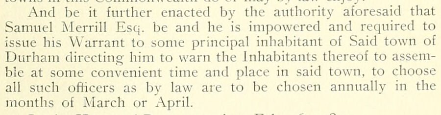
And be it further enacted by the authority aforesaid that Samuel Merrill Esq. be and he is impowered and required to issue his Warrant to some principal inhabitant of Said town of Durham directing him to warn the Inhabitants thereof to assemble at some convenient time and place in said town, to cho…
History of Durham, Maine1899Read the page →
Read the text

And be it further enacted by the authority aforesaid that Samuel Merrill Esq. be and he is impowered and required to issue his Warrant to some principal inhabitant of Said town of Durham directing him to warn the Inhabitants thereof to assemble at some convenient time and place in said town, to choose all such officers as by law are to be chosen annually in the months of March or April.

Text read by machine from the scan; it may contain errors.

Scans and text from the Internet Archive. Books published in 1930 or earlier, which are in the public domain.

Timeline

Durham, 1832 to 2020

Woven from the archive, old maps, post office records, the National Register and the people born here.

  1. 19th century
  2. 1832Born hereNelson Dingley is born here
  3. 1847Born hereHosea M. Knowlton is born here
  4. 1866Born hereWilliam R. Miller is born here
  5. 1881Born hereJohn A. Randall is born here
  6. 1892On the mapFirst mapped by the U.S. Geological Survey
  7. 1898Post officeThe Shiloh post office opens
  8. 20th century
  9. 1920Post officeThe Shiloh post office closes
  10. 21st century
  11. 2020CensusPopulation peaks at 4,173
By decade

Durham, decade by decade

On the National Register

5 historic places in Durham

The country’s official list of buildings and places worth saving.

places listed
5
National Historic Landmarks
0
none yet
historic buildings protected
5
each building in a district counts
first listed
1975
Shiloh Temple
Buildings

Architectural styles listings

Greek Revival2
Late 19th Century Vernacular1
Federal1
Gothic Revival1
Late Victorian1
Italianate1

National Park Service, National Register of Historic Places. Photos from Wikimedia Commons, credited on each place’s page.

Famous people

4 famous people were born in Durham

Writers, athletes, leaders and more, ranked by how widely they’re known.

See all →
Places that used to be

Lost post offices, old corners and burying grounds

Another post office, Shiloh, opened and closed inside today’s town.

Hamlets and corners on the map
Crossman CornerPlummer MillShilohSouth DurhamSouth West BendWest Durham
22cemeteries and burying grounds inside Durham
BradburyCedar GroveFairfieldFriendsGerrishGerrish FamilyHarmony GroveHighlandHilltopKnight - SnowLittlefieldOld North Meeting HouseParker - MerrillParkerPleasant ViewRobertsSawyerShilohStroutSylvesterViningWaterhouse
See all 22

Bradbury Cemetery · Cedar Grove Cemetery · Fairfield Cemetery · Friends Cemetery · Gerrish Cemetery · Gerrish Family Cemetery · Harmony Grove Cemetery · Highland Cemetery · Hilltop Cemetery · Knight - Snow Cemetery · Littlefield Cemetery · Old North Meeting House Cemetery · Parker - Merrill Cemetery · Parker Cemetery · Pleasant View Cemetery · Roberts Cemetery · Sawyer Cemetery · Shiloh Cemetery · Strout Cemetery · Sylvester Cemetery · Vining Cemetery · Waterhouse Cemetery

US Post Offices dataset (Blevins & Helbock, CC0). Places and cemeteries from the USGS Geographic Names Information System (2021).

Stories next door

History across the town line

Each neighbor’s History grade, on the same three inputs.

Questions about Durham’s history

How does Durham rank for history?

Durham is more historic than 59% of U.S. towns, #118 of 143 in Maine. The History grade combines the town’s founding era, the share of homes built before 1940 and its National Register listings. It’s a character grade, so it isn’t part of the overall grade. How it works.

What is on the National Register in Durham?

5 listings: 5 buildings, among them the Shiloh Temple (listed 1975, the first).

How old are the homes in Durham?

12% of Durham’s homes were built before 1940 (Census estimate, ±5.7 points), against a typical 19% for a Maine town; the median home was built in 1986.

Memory lane

What the archives can’t tell you, neighbors can.

Town Square →
Start a conversation
Sources

Where this page comes from

Founding dates: Wikidata, Wikipedia, the U.S. post office records of Blevins & Helbock (CC0) and the Census. Homes by year built: Census ACS 2020–24. National Register of Historic Places: National Park Service (list of May 22, 2026). Old photos, postcards and papers: Wikimedia Commons, the Library of Congress and other public archives, credited on each item’s page. Maps: U.S. Geological Survey historical topographic maps (via Esri) and Sanborn fire-insurance maps (Library of Congress). History text and census tables: Wikipedia (CC BY-SA 4.0). Places that used to be: USGS Geographic Names Information System (2021).

From Wikimedia Commons (16), the National Register of Historic Places (5), Wikipedia, Wikidata and Wikipedia for famous people, U.S. Geological Survey historical maps, U.S. Census counts (via Wikipedia), the US Post Offices dataset (Blevins & Helbock), the USGS Geographic Names Information System and old county and town histories (Internet Archive). Archive images are copied here with their credits and licenses, shown on each photo’s page. Refreshed monthly.