San Francisco has 201 places on the National Register, 18 of them National Historic Landmarks
More historic than 98% of U.S. towns · #2 of 847 in California. What drives it
Dated to 1848 (Wikipedia’s history), with 45% of its homes built before 1940 and 31 historic districts holding 2,284 contributing buildings. Below: 8 old photos and papers, maps from 1886 on, the census since 1860, and every listing on the Register.
From San Francisco’s archive · credits on each photo
Quick answers
How San Francisco began, and where its name came from
When was San Francisco founded?
1848
San Francisco dates its founding to 1848 (Wikipedia’s history). The census first counted it in 1860.
First census: 56,802 in 18602020 census: 873,965178 years
How did San Francisco get its name?
San Francisco, Spanish for 'Saint Francis', takes its name from Mission San Francisco de Asís, which had been named in honor of Saint Francis of Assisi.
More on the name
The mission received its name in 1776, when it was founded by the Spanish under the leadership of Padre Francisco Palóu. The city has officially been known as San Francisco since 1847, when Washington Allon Bartlett, then serving as the city's alcalde, renamed it from Yerba Buena ('good herb' in Spanish), which had been the name of the first civilian pueblo in San Francisco.
How historic is San Francisco?
A+
More historic than 98% of U.S. towns, on its age, its old homes and the National Register.
On its age, its old homes and the National Register, San Francisco is more historic than 98% of U.S. towns, #2 of 847 in California. All 3 inputs are above most U.S. towns; its National Register listings ranks highest and its age lowest.
A+
HistoryA character grade: shown, never part of San Francisco’s overall grade.
Among the 400 U.S. cities of 100,000 or more, San Francisco ranks #23 on History.
Few California towns list much on the Register (a typical California town has 0.0 per 10,000 residents, the U.S. 2.4), so San Francisco’s 27.5 sits above most of its state (95% of California towns have fewer) while its 2,284 historic buildings outnumber those of 99% of U.S. towns.
How sure. Graded on any two of the three inputs instead, the letter would still be A+. The pre-1940 share (±0.6 points) is firm at this size. Two sources give 1848.
Founding year: Wikipedia (other dates in Quick answers). Homes: Census ACS 2020–24. National Register: National Park Service, May 2026 list; each listing counted once (boundary changes and added documentation belong to their listing), and a historic district counts its contributing buildings. How TownRatings grades history →
What stands out about San Francisco’s past
Read from the archive, the National Register and the record. The page puts what stands out first.
The country’s official list of buildings and places worth saving. 18 are National Historic Landmarks, the highest tier. Boundary changes and added documentation are counted with their listing.
The earliest archaeological evidence of human habitation in the area dates to 3000 BCE. The Ohlone name for San Francisco was Ahwaste, meaning "place at the bay". The Yelamu group of the Ramaytush people lived in a few small villages when an overland Spanish exploration party arrived on November 2, 1769, the first documented European visit to San Francisco Bay. The arrival of Spanish colonists, and the establishment of the Mission system, marked the beginning of the assimilation of the Ramaytush people and the decline of their language and culture.
certain parties to construct a railroad from the westerly end of the bridge between Oakland and Clinton through the streets of Oakland to a point on the Bay of San Francisco, where the shore approaches nearest to Yerba Bnena Island, " or at such a point as a railroad may be built from the shore to said island," under or by virtue of an act granting to certain
Text read by machine from the scan; it may contain errors.
Bv the first section of the charter it was declared, that " the limits of the City of San Francisco shall be the same which bounded the pueblo lands and town of San Francisco ; and its municipal jurisdiction shall extend to said limits, and over the waters of the Bay of San Francisco, for the space of one league from the shore, including the Islands of Yerba Buena, Los Angeles, and Alcantraz."
Text read by machine from the scan; it may contain errors.
' I, Brigadier-General S. "W. Kearny, Governor of California, by virtue of authority in me vested by the President of the United States of America, do hereby grant, convey, and release unto the town of San Francisco, the people, or corporate authorities thereof, all the right, title, and interest of the Government of the United States, and of the Territory of California, in and to the beach and water lots on the east front of said town of San Francisco, included between the points known as the Rincon and Fort Montgomery, except such lots as may be selected for the use of the United States Government by the
Text read by machine from the scan; it may contain errors.
19" Whereas, the local name of Yerba Buena, as applied to the settlement or town of San Francisco, is unknown beyond the immediate district, and has been applied from the local name of the cove on which the town is built; therefore, to prevent confusion and mistakes m public documeuts, and that the town may have tbe advantage of the name given on the published maps, it is hereby ordered that the name of San
Text read by machine from the scan; it may contain errors.
Scans and text from the Internet Archive. Books published in 1930 or earlier, which are in the public domain.
Timeline
San Francisco, 1776 to 1930
Woven from the archive, old maps, post office records, the National Register and the people born here.
Nothing in the archives for these yearsWeddings on Main Street, storms, parades, school pictures, the old store. If it’s in your family album, it belongs here.
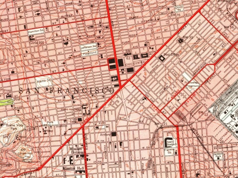
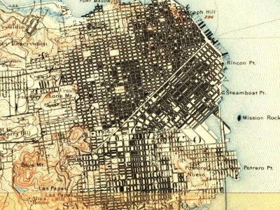
Every edition of the U.S. Geological Survey’s map of San Francisco. Tap a year, or press play to watch the town change.
1895San Francisco sheet · 1:62,500
U.S. Geological Survey historical topographic maps (public domain), via Esri’s collection of the scans. The red ring marks the center of San Francisco.
Every building
San Francisco, building by building, 1886–1899
Fire insurance maps drew every building, what it was made of and what it was used for, so insurers could price the risk of fire. Pick a year, then a sheet.
In 1848, according to Wikipedia’s history of the town. San Francisco’s post office opened in 1849, and the census of 1860 counted 56,802 people here.
How does San Francisco rank for history?
San Francisco is more historic than 98% of U.S. towns, #2 of 847 in California. The History grade combines the town’s founding era, the share of homes built before 1940 and its National Register listings. It’s a character grade, so it isn’t part of the overall grade. How it works.
What is on the National Register in San Francisco?
201 listings, 18 of them National Historic Landmarks: 152 buildings, among them the Old U.S. Mint (a National Historic Landmark since 1961), 31 historic districts with 1,578 contributing buildings, 4 sites, 12 structures, and 2 objects. 2,284 historic buildings in all.
How old are the homes in San Francisco?
45% of San Francisco’s homes were built before 1940 (Census estimate), against a typical 3.4% for a California town; the median home was built in 1946.
Founding dates: Wikidata, Wikipedia, the U.S. post office records of Blevins & Helbock (CC0) and the Census. Homes by year built: Census ACS 2020–24. National Register of Historic Places: National Park Service (list of May 22, 2026). Old photos, postcards and papers: Wikimedia Commons, the Library of Congress and other public archives, credited on each item’s page. Maps: U.S. Geological Survey historical topographic maps (via Esri) and Sanborn fire-insurance maps (Library of Congress). History text and census tables: Wikipedia (CC BY-SA 4.0). Places that used to be: USGS Geographic Names Information System (2021).
From the Library of Congress (8), Wikidata (8), the National Register of Historic Places (201), Wikipedia, Wikidata and Wikipedia for famous people, U.S. Geological Survey historical maps, U.S. Census counts (via Wikipedia), the US Post Offices dataset (Blevins & Helbock), the USGS Geographic Names Information System, Sanborn fire insurance maps (Library of Congress) and old county and town histories (Internet Archive). Archive images are copied here with their credits and licenses, shown on each photo’s page. Refreshed monthly.


 ★ Landmark
 ★ Landmark
 ★ Landmark
 ★ Landmark
 ★ Landmark
 ★ Landmark
 ★ Landmark
 ★ Landmark




 1851
 1939
 1939
 1942