Guest, Sign inJoin

Post to Berkeley

We’ll email a one-tap link to publish your post. No password, and nothing is public until you click it.
Already a member? Sign in
AHistory
History · Berkeley

Berkeley dates to 1866, and 46% of its homes were built before 1940

More historic than 87% of U.S. towns · #13 of 847 in California. What drives it

63 places in town are on the National Register, among them 2 National Historic Landmarks and four historic districts with 34 buildings between them. Below: 12 old photos and papers, maps from 1894 on, and the census since 1890.

1866founded
63on the National Register
46%homes built before 1940
12old photos & papers
26famous people
From Berkeley’s archive · credits on each photo
Quick answers

How Berkeley began

When was Berkeley founded?

1866

Berkeley dates its founding to 1866 (Wikidata). The census first counted it in 1890.

First census: 5,101 in 18902020 census: 124,321160 years

How historic is Berkeley?

A

More historic than 87% of U.S. towns, on its age, its old homes and the National Register.

What drives the grade ↓
Founding year: Wikidata. First post office: 1851.The full story ↓
History grade

What drives Berkeley’s History grade

On its age, its old homes and the National Register, Berkeley is more historic than 87% of U.S. towns, #13 of 847 in California. Its share of homes from before 1940 holds the grade up; its age pulls it down.

A
HistoryA character grade: shown, never part of Berkeley’s overall grade.
All U.S. towns we grade (21,289)Ahead of 87%
NewerOlder
California towns of 2,500+ (847)#13 of 847

Among the 400 U.S. cities of 100,000 or more, Berkeley ranks #85 on History.

Few California towns list much on the Register (a typical California town has 0.0 per 10,000 residents, the U.S. 2.4), so Berkeley’s 8.1 sits above most of its state (90% of California towns have fewer) while its 97 historic buildings outnumber those of 89% of U.S. towns.

How sure. Graded on any two of the three inputs instead, the letter would range from B+ to A+. The pre-1940 share (±1.7 points) is firm at this size. Two sources give 1866.

Founding year: Wikidata (other dates in Quick answers). Homes: Census ACS 2020–24. National Register: National Park Service, May 2026 list; each listing counted once (boundary changes and added documentation belong to their listing), and a historic district counts its contributing buildings. How TownRatings grades history →

What stands out about Berkeley’s past

Read from the archive, the National Register and the record. The page puts what stands out first.

★ What stands out · On the National Register

63 historic places in Berkeley

The country’s official list of buildings and places worth saving. 2 are National Historic Landmarks, the highest tier.

places listed
63
National Historic Landmarks
2
Room 307, Gilman Hall, University of California
historic buildings protected
97
each building in a district counts
first listed
1966
Room 307, Gilman Hall, University of California
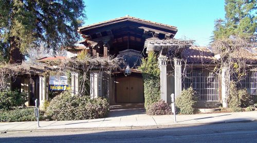
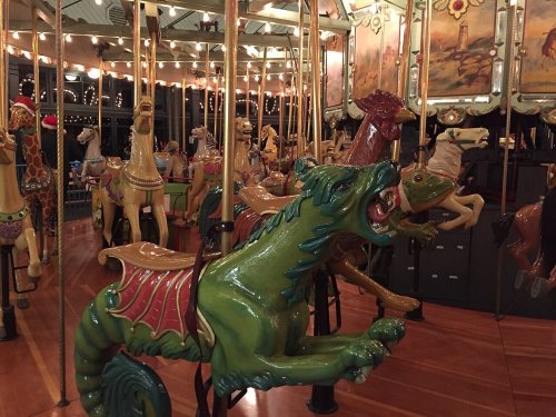
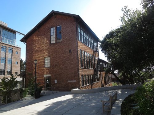
St. John's Presbyterian ChurchSenior HallHershell-Spillman Merry-Go-Round, built 1911Drawing Building, built 1914Berkeley Day Nursery, built 1927Berkeley Women's City ClubGolden Sheaf Bakery, built 1905Studio BuildingWilliam R. Thorsen HouseAnna Head School for Girls, built 1887U.S. Post Office, built 1914City HallFirst Unitarian Church, built 1898Corder BuildingCollege Women's ClubTupper and Reed BuildingHaviland HallFox Court, built 1927California HallDoe Memorial LibraryDurant Hall, built 1911Faculty Club, built 1902Founders' RockGiannini Hall, built 1930Hearst Greek Theatre, built 1903Hearst Gymnasium for Women, built 1927Hilgard Hall, built 1917Sather Gate and Bridge, built 1910Sather Tower, built 1917South Hall, built 1873Wellman Hall, built 1912Garfield Intermediate School, built 1915Berkeley Public LibraryMasonic TempleHillside School, built 1925Boone's University SchoolPhi Delta Theta Chapter HouseChamber of Commerce Building, built 1925Church of the Good Shepherd-EpiscopalLoring House, built 1914Girton HallCloyne Court HotelEdwards, George C., StadiumBerkeley Historic Civic Center DistrictBerkeley Hillside ClubLeConte HallCalifornia Memorial StadiumSouth Berkeley Community ChurchBerkeley High School Campus Historic DistrictWeston Havens House, built 1940Donald and Helen Olsen HousePeople’s ParkToverii TuppaHearst Memorial Mining Building, built 1907North Gate HallUniversity HouseWheeler HallState Asylum for the Deaf,Dumb and Blind, built 1860Bowles HallCowell Memorial Hospital, built 1930University Art MuseumRoom 307, Gilman Hall, University of California★First Church of Christ, Scientist★
BuildingsDistrictsSitesStructures★ landmark

Architectural styles listings

Classical Revival9
Beaux Arts Classicism4
Shingle Style3
Beaux Arts3
Moderne3
Neo-Tudor2
All 63 listings
Golden Sheaf BakeryBuilding · listed 1978Studio BuildingBuilding · listed 1978William R. Thorsen HouseBuilding · listed 1978Anna Head School for GirlsBuilding · listed 1980U.S. Post OfficeBuilding · listed 1981City HallBuilding · listed 1981First Unitarian ChurchBuilding · listed 1981Corder BuildingBuilding · listed 1982College Women's ClubBuilding · listed 1982Tupper and Reed BuildingBuilding · listed 1982Haviland HallBuilding · listed 1982Fox CourtBuilding · listed 1982California HallBuilding · listed 1982Doe Memorial LibraryBuilding · listed 1982Durant HallBuilding · listed 1982Faculty ClubBuilding · listed 1982Founders' RockSite · listed 1982Giannini HallBuilding · listed 1982Hearst Greek TheatreSite · listed 1982Hearst Gymnasium for WomenBuilding · listed 1982Hilgard HallBuilding · listed 1982Sather Gate and BridgeStructure · listed 1982Sather TowerBuilding · listed 1982South HallBuilding · listed 1982Wellman HallBuilding · listed 1982Garfield Intermediate SchoolBuilding · listed 1982Berkeley Public LibraryBuilding · listed 1982Masonic TempleBuilding · listed 1982Hillside SchoolBuilding · listed 1982Boone's University SchoolBuilding · listed 1982Phi Delta Theta Chapter HouseBuilding · listed 1983Chamber of Commerce BuildingBuilding · listed 1985Church of the Good Shepherd-EpiscopalBuilding · listed 1986Loring HouseBuilding · listed 1989Girton HallBuilding · listed 1991Cloyne Court HotelBuilding · listed 1992Edwards, George C., StadiumDistrict · listed 1993Berkeley Historic Civic Center DistrictDistrict · listed 1998Berkeley Hillside ClubBuilding · listed 2004LeConte HallBuilding · listed 2004California Memorial StadiumStructure · listed 2006South Berkeley Community ChurchBuilding · listed 2007Berkeley High School Campus Historic DistrictDistrict · listed 2008Weston Havens HouseBuilding · listed 2008Donald and Helen Olsen HouseBuilding · listed 2010People’s ParkSite · listed 2022Toverii TuppaBuilding · listed 1978Hearst Memorial Mining BuildingBuilding · listed 1982North Gate HallBuilding · listed 1982University HouseBuilding · listed 1982Wheeler HallBuilding · listed 1982State Asylum for the Deaf,Dumb and BlindDistrict · listed 1982Bowles HallBuilding · listed 1989Cowell Memorial HospitalBuilding · listed 1993University Art MuseumBuilding · listed 2014

National Park Service, National Register of Historic Places. Photos from Wikimedia Commons, credited on each place’s page.

Places that used to be

Lost post offices, old corners and places now gone

Berkeley’s post office has been open since 1872. Three other post offices opened and closed inside today’s town.

Contra Costa
1851–1855
Berkeley
1872–today
West Berkeley
1875–1900
Lorin
1882–1900
18501940today
Hamlets and corners on the map
ClaremontCragmontLa Loma ParkNormandy VillageRochedale VillageSouth BerkeleyThousand OaksWest BerkeleyWestbrae
Gone or out of use
Adeline Street StationlocaleAlcatraz Avenue StationlocaleAnna Head SchoolschoolAshby StationlocaleBerryman StationlocaleCarleton StationlocaleChurch of the CrosschurchCorbin StationlocaleDelaware Street StationlocaleDwight Way StationlocaleGrowing Light Montessori SchoolschoolHillside SchoolschoolNorth HallbuildingPosen StationlocalePotter StationlocaleRandolph SchoolschoolTilden Primary SchoolschoolTillman Stationlocale

US Post Offices dataset (Blevins & Helbock, CC0). Places and cemeteries from the USGS Geographic Names Information System (2021).

Then & now

The same spot, years apart

Drag across each photo to compare.

Faculty ClubFaculty Club, University of California. Berkeley1890Today
Faculty Club, University of California. BerkeleyMatched from the two captions
The story

How Berkeley came to be

From Wikipedia’s history of Berkeley.

Read it all →

The site of today's City of Berkeley was the territory of the Chochenyo/Huchiun Ohlone people when the first Europeans arrived. Evidence of their existence in the area include pits in rock formations, which they used to grind acorns, wildflower seeds, grass seeds, and many different foods, including squirrel fat, and a shellmound, now mostly leveled and covered up, along the shoreline of San Francisco Bay at the mouth of Strawberry Creek. Human remains and skeletons from Native American burials have been unearthed in West Berkeley and on campus alongside Strawberry Creek. Other artifacts were discovered in the 1950s in the downtown area during remodeling of a commercial building, near the upper course of the creek.

Text from Wikipedia, licensed CC BY-SA 4.0.

From the old history books

What they wrote about Berkeley in 1881

Passages that mention Berkeley, cut from the printed page as they were published.

The public schools of Berkeley occupy handsome buildings, and are supplied with competent instructors. The Kellogg School at East Berkeley stands near Strawberry Creek, and almost in the shadow of the old oaks of the University. The Principal is A. L. Fuller. His lady assistants are Sarah T.
A description of the town of Berkeley1881 · page 22Read the page →
Read the text

The public schools of Berkeley occupy handsome buildings, and are supplied with competent instructors. The Kellogg School at East Berkeley stands near Strawberry Creek, and almost in the shadow of the old oaks of the University. The Principal is A. L. Fuller. His lady assistants are Sarah T.

Text read by machine from the scan; it may contain errors.

Scans and text from the Internet Archive. Books published in 1930 or earlier, which are in the public domain.

Timeline

Berkeley, 1851 to 1972

Woven from the archive, old maps, post office records, the National Register and the people born here.

  1. 19th century
  2. 1851Post officeThe Contra Costa post office opens
  3. 1855Post officeThe Contra Costa post office closes
  4. 1866
    FoundingBerkeley is established
  5. 1872Post officeThe Berkeley post office opens
  6. 1875In the archiveHorses Grazing
  7. 1875Post officeThe West Berkeley post office opens
  8. 1890In the archiveFaculty Club, University of California. Berkeley
  9. 1895On the mapFirst mapped by the U.S. Geological Survey
  10. 20th century
  11. 1900Post officeThe West Berkeley post office closes
  12. 1901In the archiveUniversity of California
  13. 1905BuiltGolden Sheaf Bakery is built
  14. 1911BuiltHershell-Spillman Merry-Go-Round is built
  15. 1914BuiltDrawing Building is built
  16. 1927BuiltBerkeley Day Nursery is built
  17. 1929Born hereUrsula K. Le Guin is born here
  18. 1952Born hereGary Ruvkun is born here
  19. 1965LandmarkRoom 307, Gilman Hall, University of California named a National Historic Landmark
  20. 1972Born hereBen Affleck is born here
By decade

Berkeley, decade by decade

3 decades in the archive, from the 1870s to the 1900s. Scroll each row; tap a photo for its story.

On the map

Berkeley on the map, 1895 to 1915

Every edition of the U.S. Geological Survey’s map of Berkeley. Tap a year, or press play to watch the town change.

Berkeley on the 1895 USGS mapBerkeley on the 1915 USGS map1895San Francisco sheet · 1:62,500

U.S. Geological Survey historical topographic maps (public domain), via Esri’s collection of the scans. The red ring marks the center of Berkeley.

Every building

Berkeley, building by building, 1894–1911

Fire insurance maps drew every building, what it was made of and what it was used for, so insurers could price the risk of fire. Pick a year, then a sheet.

Berkeley fire insurance map, 1894, sheet 11894Sheet 1 of 14
Edition
BrickWoodStone

Sanborn Map Company, via the Library of Congress. Editions published in 1930 or earlier, which are in the public domain.

People over time

Berkeley, census by census

020,00040,00060,00080,000100,000120,0001900192019401960198020002020124,321

Grew from 5,101 people in 1890 to 124,321 in 2020, more than tenfold.

14 censuses, 1890–2020.

U.S. Census Bureau decennial counts, from the census table on Berkeley’s Wikipedia page.

Famous people

26 famous people were born in Berkeley

Writers, athletes, leaders and more, ranked by how widely they’re known.

See all →
Help out

Finish Berkeley’s story

Most archives stop around 1920. The photos from after that are in family albums, not libraries.

Decades since 1900 with photos
00s10s20s30s40s50s60s70s80s90s
1 of 10 decades. The empty ones are waiting for someone’s album.
Stories next door

History across the town line

Each neighbor’s History grade, on the same three inputs.

Questions about Berkeley’s history

What year was Berkeley founded?

In 1866, according to Wikidata. Berkeley’s post office opened in 1851, and the census of 1890 counted 5,101 people here.

How does Berkeley rank for history?

Berkeley is more historic than 87% of U.S. towns, #13 of 847 in California. The History grade combines the town’s founding era, the share of homes built before 1940 and its National Register listings. It’s a character grade, so it isn’t part of the overall grade. How it works.

What is on the National Register in Berkeley?

63 listings, 2 of them National Historic Landmarks: 53 buildings, among them the Room 307, Gilman Hall, University of California (a National Historic Landmark since 1965), 4 historic districts with 34 contributing buildings, 3 sites, and 3 structures. 97 historic buildings in all.

How old are the homes in Berkeley?

46% of Berkeley’s homes were built before 1940 (Census estimate, ±1.7 points), against a typical 3.4% for a California town; the median home was built in 1944.

Memory lane

What the archives can’t tell you, neighbors can.

Town Square →
Start a conversation
Sources

Where this page comes from

Founding dates: Wikidata, Wikipedia, the U.S. post office records of Blevins & Helbock (CC0) and the Census. Homes by year built: Census ACS 2020–24. National Register of Historic Places: National Park Service (list of May 22, 2026). Old photos, postcards and papers: Wikimedia Commons, the Library of Congress and other public archives, credited on each item’s page. Maps: U.S. Geological Survey historical topographic maps (via Esri) and Sanborn fire-insurance maps (Library of Congress). History text and census tables: Wikipedia (CC BY-SA 4.0). Places that used to be: USGS Geographic Names Information System (2021).

From Wikimedia Commons (2), the Library of Congress (10), Wikidata (7), the National Register of Historic Places (63), Wikipedia, Wikidata and Wikipedia for famous people, U.S. Geological Survey historical maps, U.S. Census counts (via Wikipedia), the US Post Offices dataset (Blevins & Helbock), the USGS Geographic Names Information System, Sanborn fire insurance maps (Library of Congress) and old county and town histories (Internet Archive). Archive images are copied here with their credits and licenses, shown on each photo’s page. Refreshed monthly.