Guest, Sign inJoin

Post to Albany

We’ll email a one-tap link to publish your post. No password, and nothing is public until you click it.
Already a member? Sign in
BHistory
History · Albany

Albany was first counted by the census in 1910, and 39% of its homes were built before 1940

More historic than 58% of U.S. towns · #113 of 847 in California. What drives it

Its Register listing is the Peterson House. Below: 36 old photos and papers, maps from 1895 on, and the census since 1910.

1910first census
1on the National Register
39%homes built before 1940
36old photos & papers
9famous people
From Albany’s archive · credits on each photo
Quick answers

How Albany began

When was Albany founded?

1910

Albany first appears in the census in 1910.

First census: 808 in 19102020 census: 20,271116 years

How historic is Albany?

B

More historic than 58% of U.S. towns, on its age, its old homes and the National Register.

What drives the grade ↓
Founding year: the first census.The full story ↓
History grade

What drives Albany’s History grade

On its age, its old homes and the National Register, Albany is more historic than 58% of U.S. towns, #113 of 847 in California. Its share of homes from before 1940 holds the grade up; its age pulls it down.

B
HistoryA character grade: shown, never part of Albany’s overall grade.
All U.S. towns we grade (21,289)Ahead of 58%
NewerOlder
California towns of 2,500+ (847)Ahead of 87%

Few California towns list much on the Register (a typical California town has 0.0 per 10,000 residents, the U.S. 2.4), so Albany’s 0.5 sits above most of its state (71% of California towns have fewer) while its 1 listings outnumber those of 51% of U.S. towns.

How sure. Graded on any two of the three inputs instead, the letter would range from C to A. The pre-1940 share (±2.8 points) is firm at this size.

Founding year: the first census (other dates in Quick answers). Homes: Census ACS 2020–24. National Register: National Park Service, May 2026 list; each listing counted once (boundary changes and added documentation belong to their listing), and a historic district counts its contributing buildings. How TownRatings grades history →

What stands out about Albany’s past

Read from the archive, the National Register and the record. The page puts what stands out first.

★ What stands out · By decade

Albany, decade by decade

2 decades in the archive, from the 1880s to the 1940s. Scroll each row; tap a photo for its story.

1890s–1930snothing yet
Nothing in the archives for these yearsWeddings on Main Street, storms, parades, school pictures, the old store. If it’s in your family album, it belongs here.
Add from your album
1940s34 items
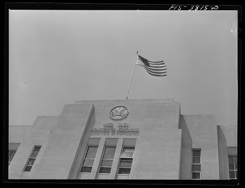
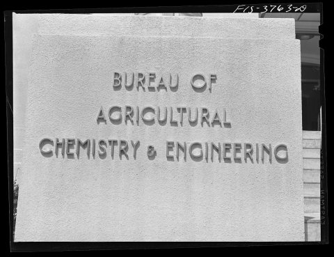
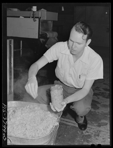
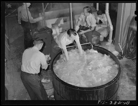
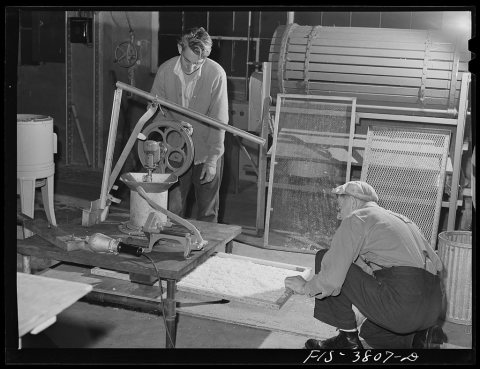
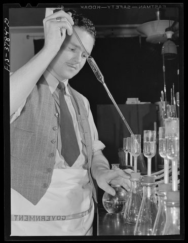
Construction of Key System bridge, 19421942Construction of Key System bridge, 1942Facade of regional agricultural research laboratory. Albany, California1942Facade of regional agricultural research laboratory. …Legend on regional agricultural research laboratory. Albany, California1942Legend on regional agricultural research laboratory. …Legend on regional agricultural research laboratory. Albany, California1942Legend on regional agricultural research laboratory. …Albany, California. Testing various dehydrated products for their palatability1942Albany, California. Testing various dehydrated produc…Preparing cabbage for dehydration. Regional agricultural research laboratory1942Preparing cabbage for dehydration. Regional agricultu…Weighing cabbage for dehydration. Regional agricultural research laboratory1942Weighing cabbage for dehydration. Regional agricultur…Weighing cabbage for dehydration. Regional agricultural research laboratory1942Weighing cabbage for dehydration. Regional agricultur…Tunnel dehydrater at the regional agricultural research laboratory. Albany, California1942Tunnel dehydrater at the regional agricultural resear…Taking sample of precooked cabbage. Regional agricultural research laboratory1942Taking sample of precooked cabbage. Regional agricult…Cabbage coming from blanching chamber. Regional agricultural research laboratory1942Cabbage coming from blanching chamber. Regional agric…Emptying dehydrated cabbage into hopper. Western regional agricultural research laboratory. Albany, California1942Emptying dehydrated cabbage into hopper. Western regi…Emptying dehydrated cabbage into hopper. Western regional agricultural research laboratory. Albany, California1942Emptying dehydrated cabbage into hopper. Western regi…Emptying dehydrated cabbage into hopper. Western regional agricultural research laboratory. Albany, California1942Emptying dehydrated cabbage into hopper. Western regi…Emptying dehydrated cabbage into hopper. Western regional agricultural research laboratory1942Emptying dehydrated cabbage into hopper. Western regi…Washing cabbage which will be dehydrated. Regional agricultural research laboratory1942Washing cabbage which will be dehydrated. Regional ag…Washing cabbage which will by dehydrated. Regional agricultural research laboratory1942Washing cabbage which will by dehydrated. Regional ag…Charging the tunnel dehydrater at the regional agricultural research laboratory. Albany, California1942Charging the tunnel dehydrater at the regional agricu…Charging the tunnel dehydrater at the regional agricultural research laboratory. Albany, California1942Charging the tunnel dehydrater at the regional agricu…Preparing samples for vitamin C determination. Regional agricultural research laboratory1942Preparing samples for vitamin C determination. Region…Emptying dehydrated cabbage into hopper, Western Regional Agricultural Research Laboratory1942Emptying dehydrated cabbage into hopper, Western Regi…Seal on floor at entrance to the regional agricultural research laboratory. Albany, California1942Seal on floor at entrance to the regional agricultura…Weighing dehydrated potatoes to determine rate of dehydration degree. Regional agricultural laboratory1942Weighing dehydrated potatoes to determine rate of deh…Dicing potatoes which will be dehydrated at the regional agricultural research laboratory. Albany, California1942Dicing potatoes which will be dehydrated at the regio…Blindfold test for flavor of cooked dehydrated spinach. Regional agricultural research laboratory1942Blindfold test for flavor of cooked dehydrated spinac…Blindfold test for aroma of cooked dehydrated spinach. Regional agricultural research laboratory1942Blindfold test for aroma of cooked dehydrated spinach…Blindfold test for flavor in cooked dehydrated spinach. Regional agricultural research laboratory1942Blindfold test for flavor in cooked dehydrated spinac…Blindfold test for aroma of cooked dehydrated spinach. Regional agricultural research laboratory1942Blindfold test for aroma of cooked dehydrated spinach…Blindfold test for aroma of cooked dehydrated spinach. Regional agricultural research laboratory1942Blindfold test for aroma of cooked dehydrated spinach…Filtering solution in vitamin determination tests at the regional agricultural research laboratory. Albany, California1942Filtering solution in vitamin determination tests at …Pushing trays of cabbage into cabinet dryer for dehydration. Regional agricultural research laboratory1942Pushing trays of cabbage into cabinet dryer for dehyd…Trays of dehydrated cabbage freshly removed from cabinet dryer. Regional agricultural research laboratory1942Trays of dehydrated cabbage freshly removed from cabi…Trays of dehydrated cabbage freshly removed from cabinet dryer. Regional agricultural research laboratory1942Trays of dehydrated cabbage freshly removed from cabi…Pipetting solution in vitamin determination test on dehydrated vegetable. Regional agricultural research laboratory1942Pipetting solution in vitamin determination test on d…
1950s–1990snothing yet
Nothing in the archives for these yearsWeddings on Main Street, storms, parades, school pictures, the old store. If it’s in your family album, it belongs here.
Add from your album
On the map

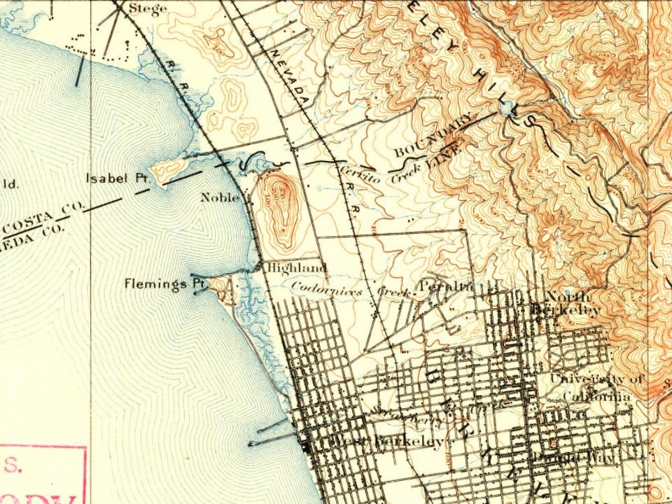
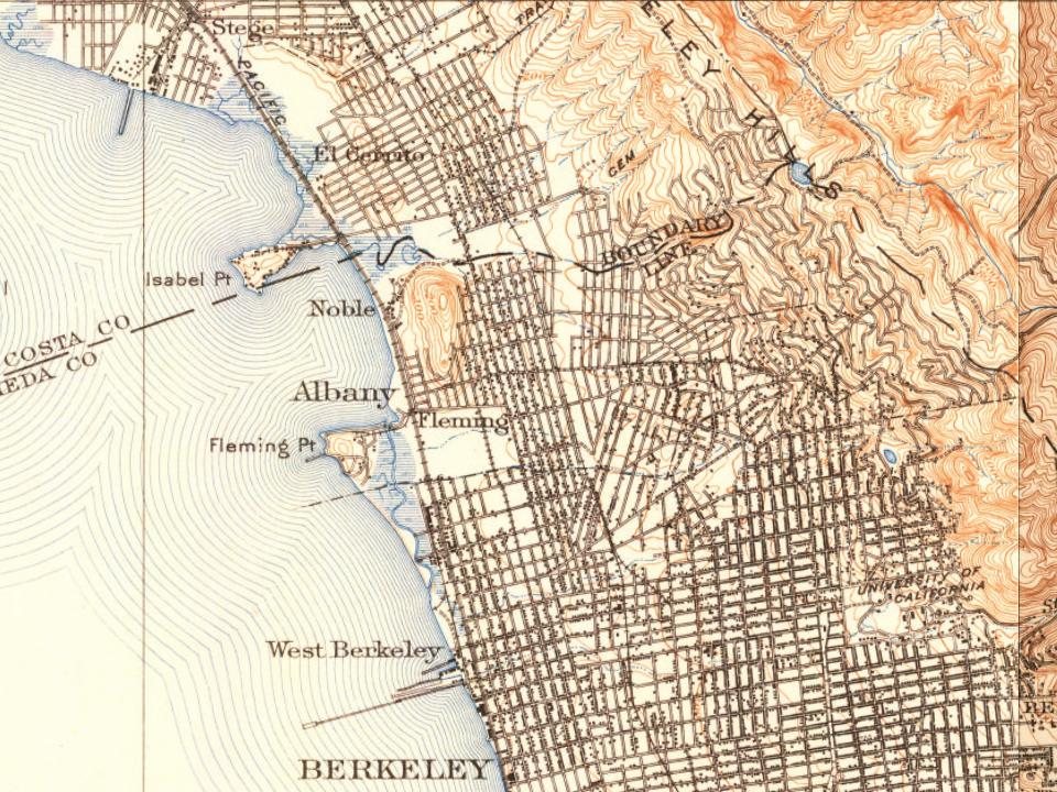
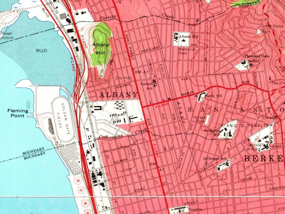
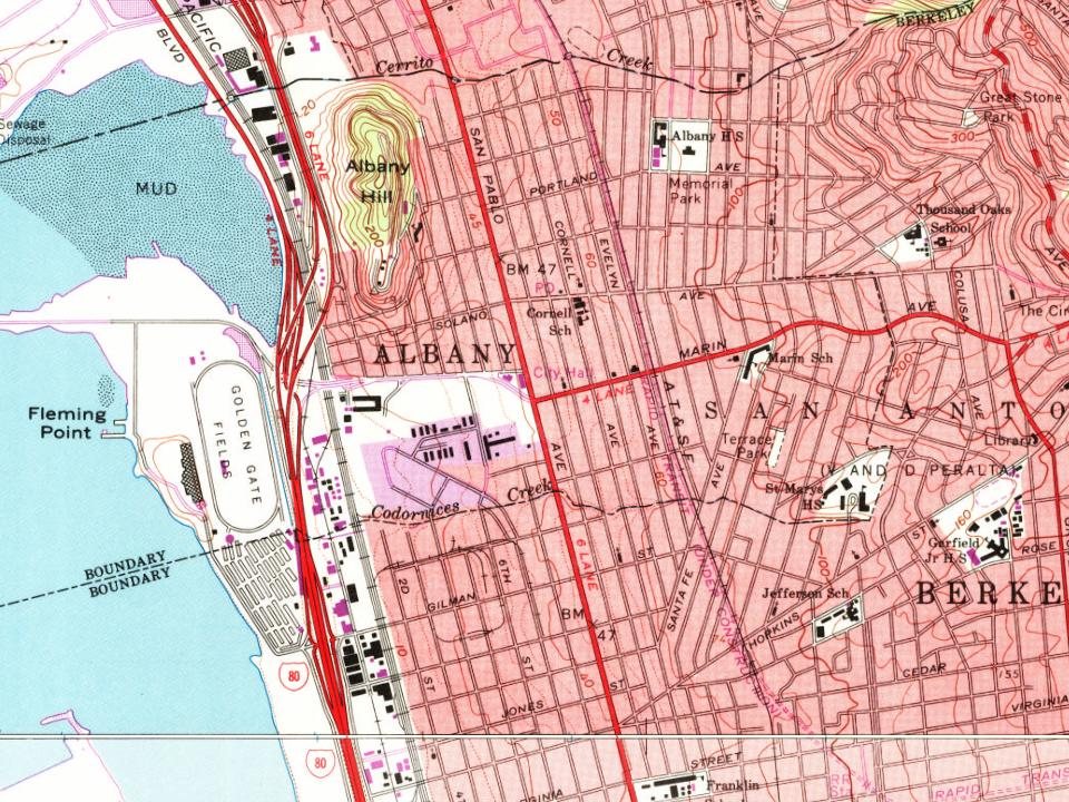
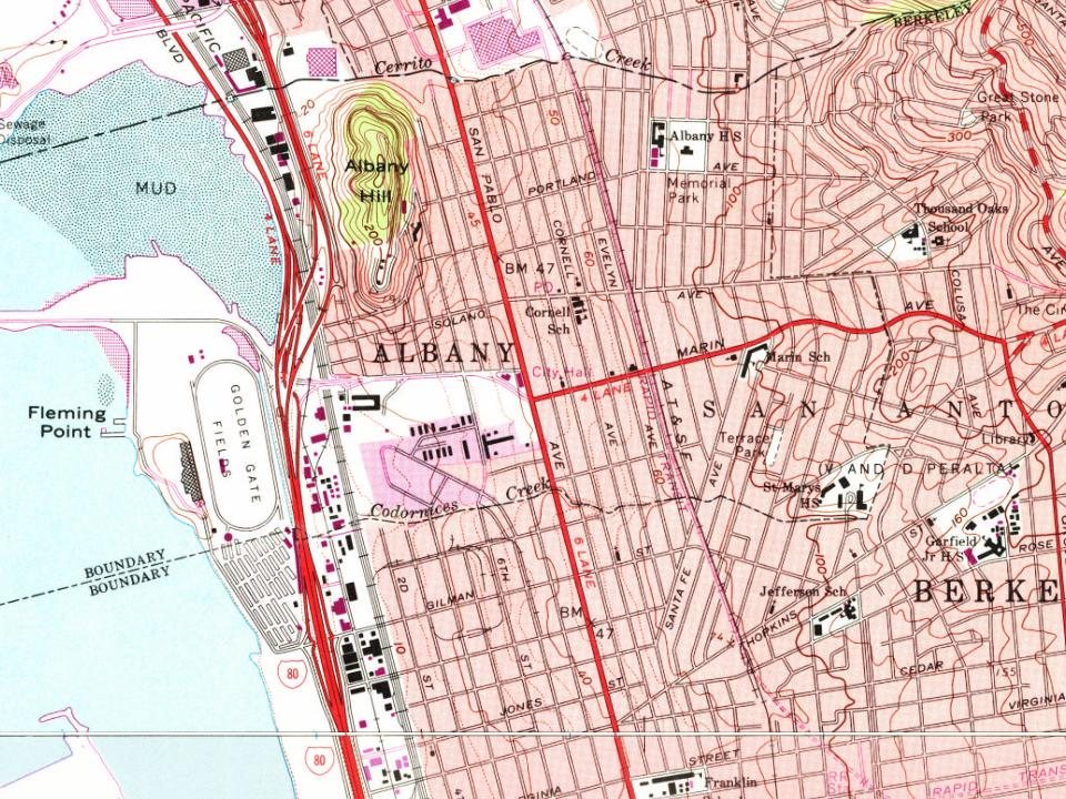
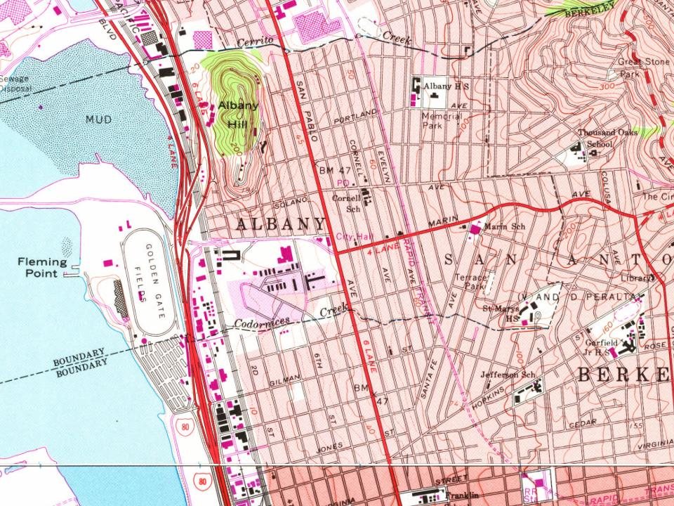
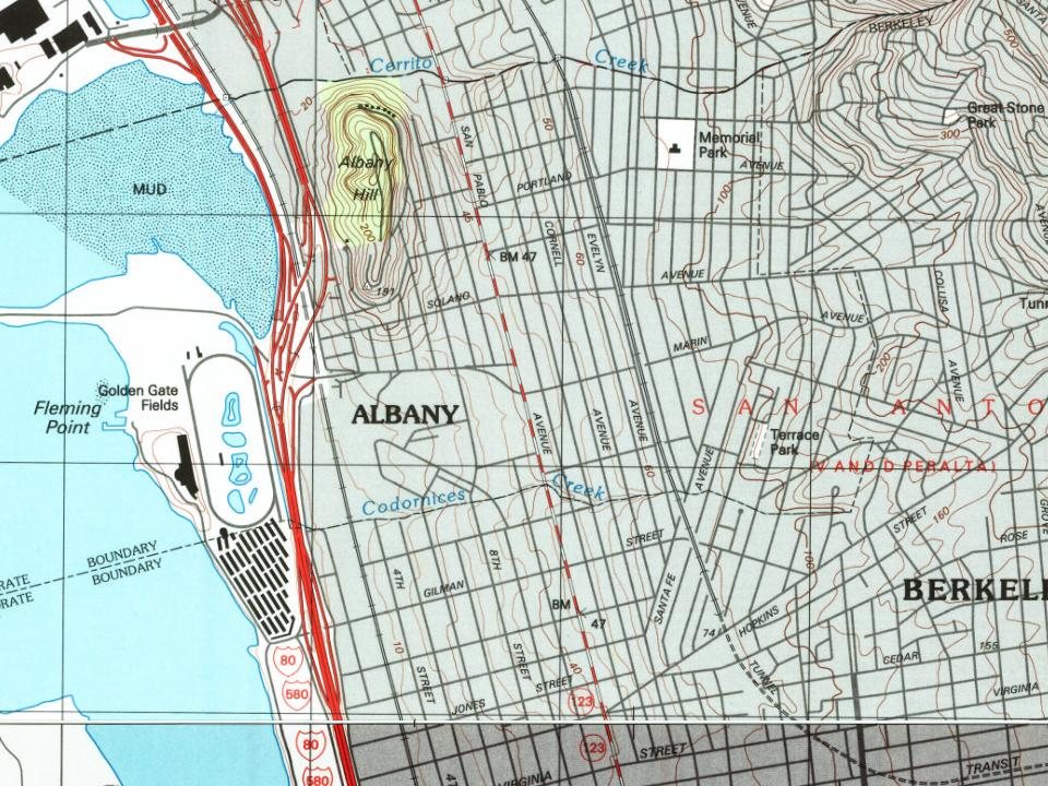
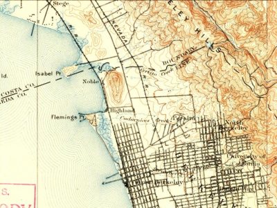
Albany on the map, 1895 to 1993

Every edition of the U.S. Geological Survey’s map of Albany. Tap a year, or press play to watch the town change.

Albany on the 1895 USGS mapAlbany on the 1915 USGS mapAlbany on the 1947 USGS mapAlbany on the 1959 USGS mapAlbany on the 1968 USGS mapAlbany on the 1973 USGS mapAlbany on the 1980 USGS mapAlbany on the 1993 USGS map1895San Francisco sheet · 1:62,500

U.S. Geological Survey historical topographic maps (public domain), via Esri’s collection of the scans. The red ring marks the center of Albany.

The story

How Albany came to be

From Wikipedia’s history of Albany.

Read it all →

The first known residents were the Ohlone before Spanish settlement in the early 19th century.

In 1908, a group of local women protested the dumping of Berkeley garbage in their community. Armed with two shotguns and a twenty-two-caliber rifle, they confronted the drivers of the wagons near what is now the corner of San Pablo Avenue and Buchanan Street. The women told the drivers of the horse-drawn garbage wagons to go home, which they did quickly and without complaint. Shortly thereafter, the residents of the town voted to incorporate as the City of Ocean View.

Text from Wikipedia, licensed CC BY-SA 4.0.

From the old history books

What they wrote about Albany in 1888

Passages that mention Albany, cut from the printed page as they were published.

said, to be and remain to the use and behoof of them and their successors forever. To havp: and to hold, all and singular the premises, to the said Mayor, Aldermen and Commonalty of the said city of Albany, and their successors forever, RENDERING and paying therefor unto his most sacred Majesty, hi…
Albany bi-centennial. Historical memoirs1888 · page 435Read the page →
Read the text

said, to be and remain to the use and behoof of them and their successors forever. To havp: and to hold, all and singular the premises, to the said Mayor, Aldermen and Commonalty of the said city of Albany, and their successors forever, RENDERING and paying therefor unto his most sacred Majesty, his heirs, successors and assigns or to such officer or receiver, as shall be appointed to receive the same, yearly, forever hereafter, the annual quit-rent or

Text read by machine from the scan; it may contain errors.

Scans and text from the Internet Archive. Books published in 1930 or earlier, which are in the public domain.

Timeline

Albany, 1880 to 1990

Woven from the archive, old maps, post office records, the National Register and the people born here.

  1. 19th century
  2. 1880In the archive1940 Census Enumeration District Maps - California - Alameda County - Albany - ED 1-71 - …
  3. 1895On the mapFirst mapped by the U.S. Geological Survey
  4. 20th century
  5. 1935Born hereWalter De Maria is born here
  6. 1939Born hereT. J. Cloutier is born here
  7. 1942In the archiveConstruction of Key System bridge, 1942
  8. 1942Born hereAngel Tompkins is born here
  9. 1990Born hereLil Debbie is born here
Then & now

Stand where they stood

No then-and-now pairs yet. Take a photo from the same spot as an old one and they appear here side by side.

1940 Census Enumeration District Maps - California - Alameda County - Albany - ED 1-71 - ED 1-80
Retake this view1940 Census Enumeration District Maps - California - Alameda County - Albany - ED 1-71 - ED 1-80, 1880

Find the spot, match the angle, and add your photo. It becomes the first then-and-now pair on Albany’s page.

Retake this view · +15
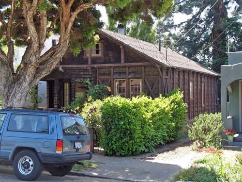
On the National Register

1 historic place in Albany

The country’s official list of buildings and places worth saving.

place listed
1
National Historic Landmarks
0
none yet
historic buildings protected
1
each building in a district counts
first listed
1982
Peterson House

National Park Service, National Register of Historic Places. Photos from Wikimedia Commons, credited on each place’s page.

People over time

Albany, census by census

05,00010,00015,00020,00019201940196019802000202020,271

Grew from 808 people in 1910 to 20,271 in 2020, more than tenfold.

12 censuses, 1910–2020.

U.S. Census Bureau decennial counts, from the census table on Albany’s Wikipedia page.

Famous people

9 famous people were born in Albany

Writers, athletes, leaders and more, ranked by how widely they’re known.

See all →
Places that used to be

Old corners and places now gone

Old hamlets and crossroads still carry their names on the map.

Hamlets and corners on the map
University Village
Gone or out of use
Albany Community Methodist ChurchchurchAlbany HospitalhospitalHighland StationlocaleNobel StationlocaleVista MacGregor Primary Schoolschool

Places and cemeteries from the USGS Geographic Names Information System (2021).

Help out

Finish Albany’s story

Most archives stop around 1920. The photos from after that are in family albums, not libraries.

Decades since 1900 with photos
00s10s20s30s40s50s60s70s80s90s
1 of 10 decades. The empty ones are waiting for someone’s album.
Stories next door

History across the town line

Each neighbor’s History grade, on the same three inputs.

Questions about Albany’s history

What year was Albany founded?

The Albany post office opened in 1910, the earliest record of the town by name (U.S. post office records).

How does Albany rank for history?

Albany is more historic than 58% of U.S. towns, #113 of 847 in California. The History grade combines the town’s founding era, the share of homes built before 1940 and its National Register listings. It’s a character grade, so it isn’t part of the overall grade. How it works.

What is on the National Register in Albany?

One place: the Peterson House (listed 1982).

How old are the homes in Albany?

39% of Albany’s homes were built before 1940 (Census estimate, ±2.8 points), against a typical 3.4% for a California town; the median home was built in 1951.

Memory lane

What the archives can’t tell you, neighbors can.

Town Square →
Start a conversation
Sources

Where this page comes from

Founding dates: Wikidata, Wikipedia, the U.S. post office records of Blevins & Helbock (CC0) and the Census. Homes by year built: Census ACS 2020–24. National Register of Historic Places: National Park Service (list of May 22, 2026). Old photos, postcards and papers: Wikimedia Commons, the Library of Congress and other public archives, credited on each item’s page. Maps: U.S. Geological Survey historical topographic maps (via Esri) and Sanborn fire-insurance maps (Library of Congress). History text and census tables: Wikipedia (CC BY-SA 4.0). Places that used to be: USGS Geographic Names Information System (2021).

From Wikimedia Commons (3), the Library of Congress (33), the National Register of Historic Places (1), Wikipedia, Wikidata and Wikipedia for famous people, U.S. Geological Survey historical maps, U.S. Census counts (via Wikipedia), the USGS Geographic Names Information System and old county and town histories (Internet Archive). Archive images are copied here with their credits and licenses, shown on each photo’s page. Refreshed monthly.