Alameda dates to 1853, and 32% of its homes were built before 1940
More historic than 85% of U.S. towns · #18 of 847 in California. What drives it
14 places in town are on the National Register, among them two historic districts with 64 buildings between them. Below: 6 old photos and papers, maps from 1897 on, and the census since 1860.
Founding year: Wikidata; Wikipedia’s history section gives the same year. First post office: 1854.The full story ↓
History grade
What drives Alameda’s History grade
On its age, its old homes and the National Register, Alameda is more historic than 85% of U.S. towns, #18 of 847 in California. Its National Register listings hold the grade up; its age pulls it down.
A
HistoryA character grade: shown, never part of Alameda’s overall grade.
Few California towns list much on the Register (a typical California town has 0.0 per 10,000 residents, the U.S. 2.4), so Alameda’s 23.7 sits above most of its state (95% of California towns have fewer) while its 183 historic buildings outnumber those of 93% of U.S. towns.
How sure. Graded on any two of the three inputs instead, the letter would range from B to A+. The pre-1940 share (±1.8 points) is firm at this size. Two sources give 1853.
Founding year: Wikidata (other dates in Quick answers). Homes: Census ACS 2020–24. National Register: National Park Service, May 2026 list; each listing counted once (boundary changes and added documentation belong to their listing), and a historic district counts its contributing buildings. How TownRatings grades history →
What stands out about Alameda’s past
Read from the archive, the National Register and the record. The page puts what stands out first.
Alameda originally occupied a peninsula connected to Oakland. The area was low-lying and marshy, while higher ground was part of one of the largest coastal oak forests in the world. A local band of the Ohlone tribe inhabited the region for more than 3,000 years. They were present at the time of the arrival of the Spanish in the late 18th century. The Ohlone created numerous oyster shell mounds across the peninsula, some as large as 14 feet tall.
Passages that mention Alameda, cut from the printed page as they were published.
The Centennial Year Book of Alameda Country, California1876 · page 99Read the page →
Read the text
It was ordered that the order creating the Township of Alameda, heretofore made, be amended so as to prescribe the following boundaries: Commencing in the centre of the estuary or Bay of San Leandro, northeastwardly from the place known as the Bay Farm ; thence running northwestwardly up the centre of the Brick Yard Greek, and thence to the northwest corner or point of the Encinal San Antonio; thence around said Encinal, on the westwardly side thereof, to the northwestern corner of the incorporated
Text read by machine from the scan; it may contain errors.
The Centennial Year Book of Alameda Country, California1876 · page 471Read the page →
Read the text
The promoters of the Town of Alameda procured an Act of the Legislature, incorporating the town the year after, as Oakland was incorporated, but it does: not appear that any town government was organized, ‘The first settlement was near High street, and subsequently two other towns were laid out—one at the Point, named Woodstock, and another about the center of the Peninsula, named Encinal. Although Alameda did not grow rapidly, it soon became the abode of many prominent citizens, several of whom, as will be
Text read by machine from the scan; it may contain errors.
The centennial year book of Alameda County, California1876 · page 471Read the page →
Read the text
The promoters of the Town of Alameda procured an Act of the Legislature, incorporating the town the year after, as Oakland was incorporated, but it does not appear that any town government was organized. The first settlement was near High street, and subsequentlytwo other towns were laid out — one at the Point, named Woodstock, and another about the center of the Peninsula, named Encinal. Although Alameda did not grow rapidly, it soon became the abode of many prominent citizens, several of whom, as will be
Text read by machine from the scan; it may contain errors.
Scans and text from the Internet Archive. Books published in 1930 or earlier, which are in the public domain.
Timeline
Alameda, 1853 to 1994
Woven from the archive, old maps, post office records, the National Register and the people born here.
Nothing in the archives for these yearsWeddings on Main Street, storms, parades, school pictures, the old store. If it’s in your family album, it belongs here.
Grew from 460 people in 1860 to 78,280 in 2020, more than tenfold.
17 censuses, 1860–2020.
U.S. Census Bureau decennial counts, from the census table on Alameda’s Wikipedia page.
Places that used to be
Lost post offices, old corners and places now gone
Alameda’s post office has been open since 1854. Two other post offices opened and closed inside today’s town.
Alameda
1854–today
Encinal
1876–1877
West End
1877–1891
18501940today
Hamlets and corners on the map
FernsideSouth ShoreWest EndWoodstock
Gone or out of use
Alameda Naval Air StationmilitaryAlameda Naval Supply CentermilitaryAlameda PierlocaleAlameda Post Officepost officeAlameda StationlocaleBay Street StationlocaleBenton FieldairportChestnut Street StationlocaleEncinal StationlocaleFernside StationlocaleFifth Street StationlocaleGeorge P Miller Elementary SchoolschoolHigh Street StationlocaleLongfellow Elementary SchoolschoolMastic StationlocaleMorton Street StationlocalePark Street StationlocaleSeventh Street Stationlocale
US Post Offices dataset (Blevins & Helbock, CC0). Places and cemeteries from the USGS Geographic Names Information System (2021).
Help out
Start Alameda’s collection
The first neighbors to add old photos shape how Alameda’s history is told.
Decades since 1900 with photos
00s10s20s30s40s50s60s70s80s90s
3 of 10 decades. The empty ones are waiting for someone’s album.
In 1853, according to Wikidata and Wikipedia’s history of the town. Alameda’s post office opened in 1854, and the census of 1860 counted 460 people here.
How does Alameda rank for history?
Alameda is more historic than 85% of U.S. towns, #18 of 847 in California. The History grade combines the town’s founding era, the share of homes built before 1940 and its National Register listings. It’s a character grade, so it isn’t part of the overall grade. How it works.
What is on the National Register in Alameda?
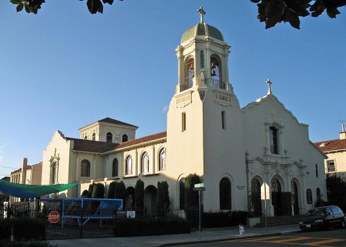
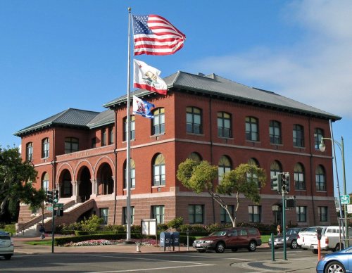
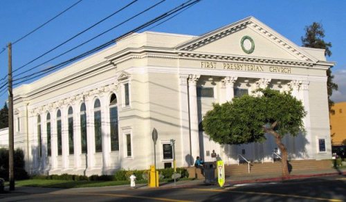
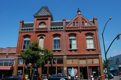
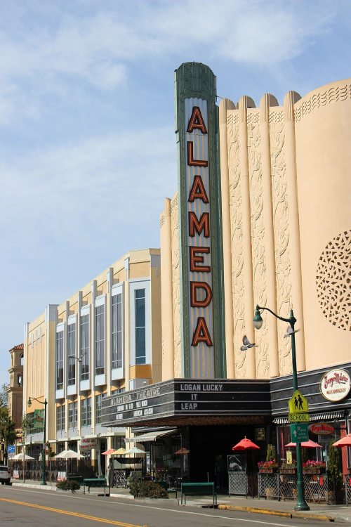
14 listings: 11 buildings, among them the Alameda High School (listed 1977, the first), and 2 historic districts, the Park Street Historic Commercial District and the Naval Air Station Alameda Historic District, with 64 contributing buildings. 183 historic buildings in all.
How old are the homes in Alameda?
32% of Alameda’s homes were built before 1940 (Census estimate, ±1.8 points), against a typical 3.4% for a California town; the median home was built in 1965.
Founding dates: Wikidata, Wikipedia, the U.S. post office records of Blevins & Helbock (CC0) and the Census. Homes by year built: Census ACS 2020–24. National Register of Historic Places: National Park Service (list of May 22, 2026). Old photos, postcards and papers: Wikimedia Commons, the Library of Congress and other public archives, credited on each item’s page. Maps: U.S. Geological Survey historical topographic maps (via Esri) and Sanborn fire-insurance maps (Library of Congress). History text and census tables: Wikipedia (CC BY-SA 4.0). Places that used to be: USGS Geographic Names Information System (2021).
From Wikimedia Commons (8), the Library of Congress (4), Wikidata (10), the National Register of Historic Places (13), Wikipedia, Wikidata and Wikipedia for famous people, U.S. Geological Survey historical maps, U.S. Census counts (via Wikipedia), the US Post Offices dataset (Blevins & Helbock), the USGS Geographic Names Information System, Sanborn fire insurance maps (Library of Congress) and old county and town histories (Internet Archive). Archive images are copied here with their credits and licenses, shown on each photo’s page. Refreshed monthly.








 Date?
 Date?
 Date?
 2017
 2016
 2016
 2016
 2013
 2009
