Founding year: Wikidata. First post office: 1815.The full story ↓
History grade
What drives Westford’s History grade
On its age, its old homes and the National Register, Westford is more historic than 65% of U.S. towns. Its age holds the grade up; its National Register listings pull it down.
B+
HistoryA character grade: shown, never part of Westford’s overall grade.
Vermont towns list more on the Register than most of the country (a typical Vermont town has 147 per 10,000 residents, the U.S. 2.4), so Westford’s 0.0 sits below most of its state (5% of Vermont towns have fewer) while its 0 listings outnumber those of 23% of U.S. towns.
NoteThe founding year comes from Wikidata alone; no second source gives 1763.
How sure. Graded on any two of the three inputs instead, the letter would range from C to A. The pre-1940 share is a Census survey estimate (±7.9 points).
Founding year: Wikidata (other dates in Quick answers). Homes: Census ACS 2020–24. National Register: National Park Service, May 2026 list; each listing counted once (boundary changes and added documentation belong to their listing), and a historic district counts its contributing buildings. How TownRatings grades history →
What stands out about Westford’s past
Read from the archive, the National Register and the record. The page puts what stands out first.
The area that is today described as Westford, Vermont originally fell within the traditional territories of the Sokoki, Missisquoi, and Cowasuck bands of the Western Abenaki tribes. Newly introduced infectious diseases and attacks by English settlers greatly impacted native populations and prompted their emigration to Quebec by the 1670s, opening the land for settlement by European immigrants. The original charter for the Town of Westford was granted at a cost of £20 (equivalent to £3,707 or US$4,738 in 2024) by New Hampshire's provisional governor Benning Wentworth on June 8, 1763, as part of a series of what came to be known as New Hampshire Grants. According to Wentworth's grant, six lots were set aside (3 for religious use, 1 for the town's school, and 2 for Wentworth himself) and the remainder of the land was subdivided among the founding residents. Although officially granted simu…
Passages that mention Westford, cut from the printed page as they were published.
History of Chittenden County, Vermont, with illustrations and biographical sketches of some of its prominent men and pioneers1886Read the page →
Read the text
Westford Center, situated as its name indicates, in the central part of the town, is the only village in town. The river here affords the best of mill privileges, which induced a class of manufacturers to come to Westford at an early day. The first settlement was made on the site of the village by Elisha, Baker in 1795. who erected and operated a sawmill on the river. Soon after Joshua Stanton built a forge and grist-mill in the near vicinity, which naturally lent an impetus to settlement and enterprise. Previous to this event the settlers traveled long distances over almost impassable roads, and in some in-
Text read by machine from the scan; it may contain errors.
History of Chittenden County, Vermont, with illustrations and biographical sketches of some of its prominent men and pioneers1886 · page 758Read the page →
Read the text
wife was born in 1799, and died May 26, 1883. They reared a family of four girls and two boys, of whom Seymour J. was the eldest. John Parker died June 13, 1876. He was deservedly a prominent man ; served one term in the State Senate, and held all the highest offices in the town of Westford. Seymour J. Parker was educated in the district schools of Milton and accompanied his father to Westford in 1837. After his marriage in 1839 he purchased a part of his father's farm, to the west of the paternal residence, and for a number of years carried it on separately. About 1855 he purchased the rest of his father's property, and returned
Text read by machine from the scan; it may contain errors.
Scans and text from the Internet Archive. Books published in 1930 or earlier, which are in the public domain.
Timeline
Westford, 1763 to 2000
Woven from the archive, old maps, post office records, the National Register and the people born here.
Nothing in the archives for these yearsWeddings on Main Street, storms, parades, school pictures, the old store. If it’s in your family album, it belongs here.
In 1763, according to Wikidata. Westford’s post office opened in 1815, and the first U.S. census counted 63 people here in 1790.
How does Westford rank for history?
Westford is more historic than 65% of U.S. towns. The History grade combines the town’s founding era, the share of homes built before 1940 and its National Register listings. It’s a character grade, so it isn’t part of the overall grade. How it works.
How old are the homes in Westford?
18% of Westford’s homes were built before 1940 (Census estimate, ±7.9 points), against a typical 22% for a Vermont town; the median home was built in 1982.
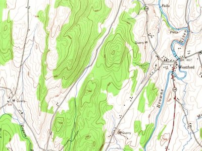
Founding dates: Wikidata, Wikipedia, the U.S. post office records of Blevins & Helbock (CC0) and the Census. Homes by year built: Census ACS 2020–24. National Register of Historic Places: National Park Service (list of May 22, 2026). Old photos, postcards and papers: Wikimedia Commons, the Library of Congress and other public archives, credited on each item’s page. Maps: U.S. Geological Survey historical topographic maps (via Esri) and Sanborn fire-insurance maps (Library of Congress). History text and census tables: Wikipedia (CC BY-SA 4.0). Places that used to be: USGS Geographic Names Information System (2021).
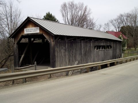
From Wikimedia Commons (7), the Library of Congress (1), Wikipedia, Wikidata and Wikipedia for famous people, U.S. Geological Survey historical maps, U.S. Census counts (via Wikipedia), the US Post Offices dataset (Blevins & Helbock), the USGS Geographic Names Information System and old county and town histories (Internet Archive). Archive images are copied here with their credits and licenses, shown on each photo’s page. Refreshed monthly.


 2015
 2014
 2011
 2009
 2007
 2004


