 II*
Cathedral · listed 1951Blackburn CathedralOn the list as Cathedral Church of St Mary the VirginPhoto: JohnArmagh · Public domain
 Cathedral Church of St Mary the Virgin · Photo: JohnArmagh · Public domain
B+History Grade
History of Blackburn · Historic England
81 listed buildings, 4 of them Grade II*
On the Historic England list, all of them stand inside Blackburn’s built-up area, 6.5 for every 10,000 residents. It also has 1 scheduled monument. 31% of its homes were built before 1919. We have photos of 8 of its listed buildings and 3 old views of the town. Blackburn grades B+ for history: #14 of 65 in Lancashire.
Listed buildings
81
6.5 per 10,000 residents
Grade I
0
exceptional interest
Grade II*
4
more than special interest
Scheduled monuments
1
2 registered parks & gardens
Homes built before 1919
31%
typical UK town 15%
In pictures
Blackburn in 13 photos and old views
Nearly every Grade I and II* building, photographed, and the town before 1950. Tap a photo to step through them full screen.
 Corporation ParkGrade II* park or garden
 Blackburn Railway StationGrade II listed
 Central Police Station and Court HouseGrade II listed
 Iron Structure at East End of Warehouses West of Navigation Bridge on BridgeGrade II listed
 Imperial MillGrade II listed+8See all photos
Photos from Wikimedia Commons and Geograph, copied to our own server, each credited to its photographer with its licence; names open the building’s page or its official list entry.
Through time
Blackburn from 1846 to 1889
3 old photos and postcards, in date order. All public domain, made before 1950.
 1846
 1868
 c. 1889
Public domain, from Wikimedia Commons, copied to our own server. Each credit opens the image’s page with its full description and history.
The map
Where Blackburn’s history is
Every Grade I and II* building, monument and historic park, over the age of each neighbourhood’s homes.
Grade II*Scheduled monumentPark or garden
Homes built before 1919, by neighbourhoodunder 10%10–25%25–50%50%+
22 of 74neighbourhoods have mostly pre-1919 homes; in the oldest, 97% were built before 1919.
Hover a dot for its name; tap one with a photo to open it.
81 listed buildings by grade
0 Grade I4 Grade II*77 Grade II
Historic England lists buildings in three grades: Grade I for buildings of exceptional interest (about 2.5% of all listed buildings), Grade II* for particularly important buildings of more than special interest (about 5.8%), and Grade II for buildings of special interest (about 91.7%). Listing protects the whole building, inside and out.
Every entry on the National Heritage List for England whose point lies inside the ONS 2022 built-up-area boundary. One list entry can cover a terrace or a group of buildings. Neighbourhood dots: the population-weighted centre of each Census 2021 output area, coloured by its neighbourhood’s (LSOA’s) share of homes built before 1919 (Valuation Office Agency, March 2025).
Grade II*
The 4 Grade II* listed buildings in Blackburn
Particularly important buildings of more than special interest. Every one is photographed. Each opens its own page, with the official list entry.
 II*
Church · listed 1974St Mark's ChurchOn the list as Church of St MarkPhoto: Steve Houldsworth · CC BY-SA 2.0
 II*
Church · listed 1974St Silas' ChurchOn the list as Church of St SilasPhoto: Alexander P Kapp · CC BY-SA 2.0
 II*
House · listed 1951Myles Wife HeyPhoto: Alexander P Kapp · CC BY-SA 2.0
What’s protected
Most of Blackburn’s listed buildings are homes
Every listed building sorted by what its list name says it is.
Houses, terraces & villas42
Public & civic buildings15
Walls, gates & bridges7
Churches, chapels & priories7
Inns, shops & warehouses6
Memorials, crosses & tombs4
42 entries (52%) are houses, terraces and villas. 7 are churches, chapels and priories.
Buildings are sorted by words in each entry’s name (church, gate, inn, memorial…): the list’s open data has no building type. An entry named only by its address counts as a house.
Grade II
77 Grade II listed buildings
Most listed buildings are in this grade, which covers buildings of special interest. Open any building to read its official list entry.
All 77 Grade II listed buildings, A to Z
A, B, C, D and E Warehouses of Entwistle and Oddy LimitedBank CottageBank House, Fountain and Statues of Orpheus and Eurydice in Front Garden of Bank HouseBarclays BankBarn Circa 30 Metres West of Earcroft FarmhouseBeardwood Old HallBlackburn Drill HallBlackburn MuseumBlackburn Railway StationBritish Waterways OfficeBrookside CottageCanal HouseCathedral Gateway at North West Corner of ChurchyardCentral Police Station and Court HouseChurch of ImmanuelChurch of St AlbanChurch of St John EvangelistCoach House to South East of St Stephens Conservative Club Curved Walling and Piers to East of St Stephens Conservative Club St Stephens Conservative ClubCollege of Technology and DesignConservatory at west end of parkDaisyfield Signal BoxEntrance Gateway and Flanking Lodges (At South Entrance)Entrance to Griffin ParkFernhurst CourtFormer Barn in Yard to South of Fernhurst CourtFormer Blackburn Fire Station including the drill yard wallFurther WilworthGriffin LodgeHoly Trinity ChurchImmanuel VicarageImperial MillIron Structure at East End of Warehouses West of Navigation Bridge on BridgeK6 Telephone Kiosk Opposite King Georges HallKing Georges HallKings CourtLeeds and Liverpool Canal Ewood AqueductLeeds and Liverpool Canal Hollin BridgeLivesey Hall Bridge, Number 94Lloyds Bank Old BankLower StockcloughNational Westminster BankNumbers 25 to 31A Victoria Street Including Number 10 James StreetPeel Fold FarmhouseRailings, Piers, Lampholders and Statue at East End of Cathedral ChurchyardRed Lion InnRevidge FoldSt Oswald's, Knuzden War MemorialStone Setts of RoadwayTextile MuseumThe Cotton ExchangeTown HallTurner's Almshouses and front garden wallsWar MemorialWoodlands1, Princes Street1-12, Mile End Row1-21, Richmond Terrace187, Redlam1AND 5-29, West View Place2 King Street2 and 4, France Street2-12, Springfield Street2-28, West View Place20, Church Street22-27, Richmond Terrace28 and 30, Church Street3 Princes Street34, Darwen Street35 and 37, King Street39 and 41, King Street4, King Street40-46, King Street42-46, Preston New Road43, King Street51 and 53 James Street53, King Street7 to 11 Springfield Street
Conservation areas
9 conservation areas cover 3.4% of Blackburn
Areas the council protects as a whole: demolition and changes to how buildings look need consent, and trees are protected.
Corporation Park63 ha
Revidge11 ha
Northgate 199410 ha
Griffin7 ha
Cathedral4 ha
Darwen Street 19944 ha
Richmond Terrace2 ha
Eanam Wharf2 ha
King Street 19942 ha
104 hain conservation areas, of 3,100 ha inside the built-up area.
The first, Northgate, Darwen Street and King Street, were designated in 1994; the newest, King Street, in 1994. 51 of the 81 listed buildings stand in one.
Historic England’s conservation areas layer, supplied by councils (incomplete in places, so a page fact, never graded). Hectares are the part of each area inside the built-up area.
How the list grew
40 of Blackburn’s 81 listed buildings were added in 1974
The year each building now on the list was first listed.
1974 · 401951 · 8
19501960197019801990200020102020
The first 8 entries were listed in 1951. 40 came in 1974, in the national resurvey of the 1970s and 80s. Only 5 have been added in the last 15 years.
Monuments & landscapes
Monuments, parks and gardens
Designations that overlap the town by a tenth of their area or half a hectare.
1 scheduled monument
Nationally important archaeological sites and monuments, protected by law; work on them needs consent from the Secretary of State, advised by Historic England.
2 registered parks and gardens
Corporation ParkGrade II*

Queen's Park, BlackburnGrade II
History Grade
Blackburn grades B+ for history
Protected heritage and the age of the town’s homes, against all UK towns.
Protected heritage, for its size and in all (90 points, 7 per 10,000 residents)More than 50% of UK towns
Homes built before 1919 (31%)More than 86% of UK towns
Two measures, each ranked against every UK town of 1,000 or more, with protected heritage counting twice as much as the age of homes. Protected heritage counts each listed building by its grade (Grade I three points, II* two, II one), each scheduled monument and battlefield two, and each registered park or garden by its grade; it is ranked both per 10,000 residents and as a total, so a village with one fine church doesn’t outrank a historic city. The second measure is the share of homes built before 1919, from the Valuation Office Agency’s council tax records. History is a character grade: it describes the town and isn’t part of the overall grade.
Homes by age
31% of Blackburn’s homes were built before 1919
Every home by when it was built, from council tax records, against England & Wales (the dark tick).
26%
Before 1900
5.7%
1900–18
5.7%
1919–29
7%
1930s
3.8%
1945–54
6.9%
1955–64
9.7%
1965–72
9.9%
1973–82
6.6%
1983–92
6.4%
1993–99
5.6%
2000–08
2%
2009–15
5.2%
2016–25
BlackburnEngland & Wales
26% of homes are Victorian or older, against 16% across England and Wales. The busiest period since was 1973–82, which added 9.9% of today’s homes.
Valuation Office Agency, council tax stock of properties by build period, 31 March 2025, for the neighbourhoods (LSOAs) that make up the town, split by where their residents live. Homes with no recorded build period (420 here) are left out; 1939–44 is not a period in the data.
Born here
90 notable people born in Blackburn before 1900
The 20 best known on one timeline, earliest first.
John Morley
A. N. Hornby
Joe Beverley
Fred Hargreaves
John Yates
James Brown
Herby Arthur
William Townley
Jack Southworth
John Barton
Edgar Chadwick
Jack Reynolds
Billy McOwen
John Garstang
Fred Blackburn
Bob Crompton
Harry Abbott
Kathleen Harrison
Margaret Bert
Jack Hacking
1800182518501875190019251950

John Morley1838–1923 · British statesman, writer and journalist (1838–1923)

John Garstang1876–1956 · British archaeologist (1876-1956)

Bob Crompton1879–1941 · English footballer (1879–1941)

William Townley1866–1950 · English football player and manager (1866 – 1950)

Edgar Chadwick1869–1942 · Association football player from England (1869–1942)

Jack Southworth1866–1956 · English footballer (1866-1956)
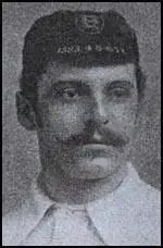
Herby Arthur1863–1930 · English footballer (1863-1930)

Jack Reynolds1869–1917 · Footballer (1869–1917)
Everyone born in Blackburn → Birthplaces from Wikidata; portraits from Wikimedia Commons.
Towns its size
How Blackburn compares with 89 towns its size
Places of 75,000–200,000 people outside London, by Grade I listed buildings.
Blackburn0
#78 of 89for listed buildings per resident (6 per 10,000). Bath, Shrewsbury and York lead.
78 have more. The typical town its size has 3.
Neighbours
Listed buildings in the places around Blackburn
| Town | People | Listed | Grade I | History |
|---|---|---|---|---|
| Blackburn | 124,958 | 81 | 0 | B+ |
| Myerscough Smithy | 2,409 | 5 | 1 | B− |
| Rishton | 6,653 | 1 | 0 | C |
| Darwen | 27,897 | 20 | 0 | B |
| Oswaldtwistle | 10,810 | 6 | 0 | C+ |
| Hoddlesden | 1,218 | 4 | 0 | B− |
| Langho | 1,723 | 1 | 0 | C− |
| Great Harwood | 11,022 | 8 | 0 | B− |
In brief
Blackburn in brief
More of Blackburn’s homes are old than in most places: 31% were built before 1919, against 15% in the typical UK town. All told, the list holds 81 listed buildings, including Blackburn Cathedral. Its older streets lie in 9 conservation areas, the first designated in 1994. Of the whole list, 52% are houses, terraces and villas.
John Morley (1838), John Garstang (1876) and Bob Crompton (1879) are among the 90 people born here before 1900. Most towns its size have more Grade I buildings: the typical one has 3. Beyond that, per resident it sits near the middle of UK towns; and it also has a scheduled monument.
Questions about Blackburn’s history
How many listed buildings are there in Blackburn?
Historic England lists 81 buildings inside Blackburn’s built-up area: 0 Grade I, 4 Grade II* and 77 Grade II.
Are there scheduled monuments in Blackburn?
Yes, 1 scheduled monument, including Part of Witton Old Hall medieval lordly residence 340m north east of Feniscliffe Bridge.
How many conservation areas are there in Blackburn?
9, covering about 104 hectares of the town. The largest are Corporation Park and Revidge.
When were Blackburn’s buildings listed?
The first in 1951; the most, 40, in 1974.
Are there old photos of Blackburn?
Yes: 3 public-domain photos and postcards from 1846 to 1889, all on this page.
Who was born in Blackburn?
Among people born before 1900: John Morley (1838), John Garstang (1876), Bob Crompton (1879), William Townley (1866) and Edgar Chadwick (1869).
How old are the homes in Blackburn?
31% of homes were built before 1919 and 44% before 1940, from the Valuation Office Agency’s council tax records (March 2025).
© Historic England 2026. Contains Ordnance Survey data © Crown copyright and database right 2026. The National Heritage List for England is the official, up-to-date register of all nationally protected historic buildings and sites in England; check an entry on Historic England’s website before relying on it.
Sources: Historic England, National Heritage List for England (listed buildings, scheduled monuments, registered parks and gardens, battlefields, World Heritage Sites), October 2026, inside the ONS 2022 built-up-area boundary · Valuation Office Agency, Council Tax: stock of properties by build period (31 March 2025) · TownRatings grades: our own summary of the data, ranked against UK towns only · Historic England conservation areas (supplied by local planning authorities; October 2026). All under the Open Government Licence v3.0.
Contains public sector information licensed under the Open Government Licence v3.0. Contains HM Land Registry data © Crown copyright and database right 2026. Contains OS data © Crown copyright and database right 2026 (ONS boundaries). Northern Ireland: Source: NISRA; contains Land & Property Services data and Ordnance Survey of Northern Ireland information, © Crown copyright, licensed under the Open Government Licence v3.0. Scotland: contains National Records of Scotland data, Registers of Scotland data and SEPA data, © Crown copyright / © SEPA 2025, licensed under the Open Government Licence v3.0.