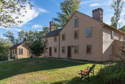
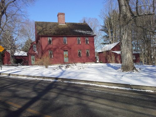
Smithfield’s post office opened in 1812, and 15% of its homes were built before 1940
More historic than 74% of U.S. towns · #32 of 38 in Rhode Island. What drives it
10 places in town are on the National Register, among them a historic district with 73 buildings. Below: 11 old photos and papers, maps from 1889 on, and the census since 1790.
The Smithfield post office opened in 1812, the earliest record of the town by name. Three smaller post offices, Georgiaville (1852), Stillwater (1877) and Esmond (1908), opened inside today’s town and later closed.
First census: 3,171 in 17902020 census: 22,118214 years
How historic is Smithfield?
B+
More historic than 74% of U.S. towns, on its age, its old homes and the National Register.
Founding year: the first Smithfield post office (Blevins & Helbock, CC0).The full story ↓
History grade
What drives Smithfield’s History grade
On its age, its old homes and the National Register, Smithfield is more historic than 74% of U.S. towns, #32 of 38 in Rhode Island. All 3 inputs are above most U.S. towns; its age ranks highest and its National Register listings lowest.
B+
HistoryA character grade: shown, never part of Smithfield’s overall grade.
Rhode Island towns list more on the Register than most of the country (a typical Rhode Island town has 94.7 per 10,000 residents, the U.S. 2.4), so Smithfield’s 40.5 sits below most of its state (24% of Rhode Island towns have fewer) while its 90 historic buildings outnumber those of 89% of U.S. towns.
How sure. Graded on any two of the three inputs instead, the letter would range from B to B+. The pre-1940 share is a Census survey estimate (±3.9 points). The founding year is the first post office, not a stated founding date.
Founding year: the first post office (other dates in Quick answers). Homes: Census ACS 2020–24. National Register: National Park Service, May 2026 list; each listing counted once (boundary changes and added documentation belong to their listing), and a historic district counts its contributing buildings. How TownRatings grades history →
What stands out about Smithfield’s past
Read from the archive, the National Register and the record. The page puts what stands out first.
63family graveyards and cemeteries inside Smithfield
Aaron Mowry LotAbial Mowry LotAbner Harris LotAlbert Windsor LotAlfred Smith LotAlonzo Thurbur LotAmbrose Eddy LotArnold and Polk LotArnold Brown LotAsel Phetteplace LotAtwill Sayles LotBarnes - Smith LotBenjamin Sayles LotBrown - Evens LotCaleb Newell LotCaptain Elijah Day LotColonel Abraham Winsor LotColonel John Angell LotCyrus Williams LotDaniel Mann LotDaniel Mowry LotDavid Mowry LotElisha Evens LotElisha Steere LotEmor Smith LotEphraim Whipple LotGeorge Smith LotGilbert Harris LotGreenville Cemetery First DivisionGreenville Cemetery Second DivisionHarris W Colwell LotJames Keech LotJames Loomis LotJehu Evens LotJob Angell LotJohn Angell LotJohn Grosse LotJohn S Appleby LotJonathan Barnes LotJoseph Farnum LotJoseph Mowry LotLenorel Hill LotLittle GreenvilleLuther - Angel LotMowry Sayles LotMowry Turner LotNathan Aldrich LotObadiah Smith LotPeter Ballou LotPeter Barnes LotRichard Sweet LotSamuel Windsor LotSimon Patt LotSmithfield Historical Cemetery 107Steere - Eddy LotStephen Appleby LotStephen B Winsor LotStephen Keech LotStephen Steere LotThomas Hawkesly LotWaterman Dexter LotWillard Smith LotWilliam Enches Lot
See all 63
Aaron Mowry Lot Cemetery · Abial Mowry Lot · Abner Harris Lot Cemetery · Albert Windsor Lot · Alfred Smith Lot Cemetery · Alonzo Thurbur Lot · Ambrose Eddy Lot · Arnold and Polk Lot · Arnold Brown Lot · Asel Phetteplace Lot Cemetery · Atwill Sayles Lot · Barnes - Smith Lot Cemetery · Benjamin Sayles Lot · Brown - Evens Lot Cemetery · Caleb Newell Lot Cemetery · Captain Elijah Day Lot · Colonel Abraham Winsor Lot Cemetery · Colonel John Angell Lot Cemetery · Cyrus Williams Lot Cemetery · Daniel Mann Lot Cemetery · Daniel Mowry Lot Cemetery · David Mowry Lot Cemetery · Elisha Evens Lot Cemetery · Elisha Steere Lot Cemetery · Emor Smith Lot Cemetery · Ephraim Whipple Lot · George Smith Lot Cemetery · Gilbert Harris Lot · Greenville Cemetery First Division · Greenville Cemetery Second Division · Harris W Colwell Lot Cemetery · James Keech Lot · James Loomis Lot Cemetery · Jehu Evens Lot Cemetery · Job Angell Lot Cemetery · John Angell Lot · John Grosse Lot Cemetery · John S Appleby Lot Cemetery · Jonathan Barnes Lot · Joseph Farnum Lot Cemetery · Joseph Mowry Lot Cemetery · Lenorel Hill Lot · Little Greenville Cemetery · Luther - Angel Lot · Mowry Sayles Lot Cemetery · Mowry Turner Lot Cemetery · Nathan Aldrich Lot · Obadiah Smith Lot Cemetery · Peter Ballou Lot · Peter Barnes Lot · Richard Sweet Lot Cemetery · Samuel Windsor Lot · Simon Patt Lot · Smithfield Historical Cemetery 107 · Steere - Eddy Lot Cemetery · Stephen Appleby Lot Cemetery · Stephen B Winsor Lot Cemetery · Stephen Keech Lot Cemetery · Stephen Steere Lot Cemetery · Thomas Hawkesly Lot · Waterman Dexter Lot Cemetery · Willard Smith Lot Cemetery · William Enches Lot Cemetery
US Post Offices dataset (Blevins & Helbock, CC0). Places and cemeteries from the USGS Geographic Names Information System (2021).
People over time
Smithfield, census by census
Lost two-thirds of its people between 1860 and 1900, then grew more than tenfold.
24 censuses, 1790–2020.
U.S. Census Bureau decennial counts, from the census table on Smithfield’s Wikipedia page.
The area comprising modern-day Smithfield was first settled in 1663 as a farming community by several British colonists, including John Steere. The area was originally within the boundaries of Providence until it was incorporated as a separate municipality by the General Assembly in February 1731. The first town meeting was held on March 17, 1731 at the home of Captain Richard Whitman located in modern-day Lincoln. Richard Sayles was elected as the first town clerk. John Arnold, Captain Joseph Mowry, Thomas Steere, John Mowry, Sam Aldrich and Benjamin Smith were elected as the first members of the town council. According to the town's official website, Smithfield was named after John Smith, a first settler of Providence, who was granted land by Roger Williams and was one of the original party of six men that formed original settlement of Providence Plantations.
Passages that mention Smithfield, cut from the printed page as they were published.
History of Providence County, Rhode Island1891 · page 200Read the page →
Read the text
THE town of Smithfield was originally a portion of the town of Providence. Why it has been called Smithfield has not been satisfactorily explained. It was incorporated February 26th, 1730-1, and was the largest town in the state but one in population.
Text read by machine from the scan; it may contain errors.
History of Providence County, Rhode Island1891Read the page →
Read the text
the same time cultivatinghis farm m the town of Smithfield, and met with success in both enterprises. His political career began in 1861, when he was elected a member of the town council of Smithfield, and served continuously until the division of the town in 1871, the last four years filling the office of president of that body. He was collector of taxes for the town from 1862 to 1871, and during the war of the rebellion was deputy collector of internal revenue, collecting from the territory of Smithfield alone the sum of $1,386,992.30,
Text read by machine from the scan; it may contain errors.
Scans and text from the Internet Archive. Books published in 1930 or earlier, which are in the public domain.
Timeline
Smithfield, 1800 to 2020
Woven from the archive, old maps, post office records, the National Register and the people born here.
Nothing in the archives for these yearsWeddings on Main Street, storms, parades, school pictures, the old store. If it’s in your family album, it belongs here.
The Smithfield post office opened in 1812, the earliest record of the town by name (U.S. post office records).
How does Smithfield rank for history?
Smithfield is more historic than 74% of U.S. towns, #32 of 38 in Rhode Island. The History grade combines the town’s founding era, the share of homes built before 1940 and its National Register listings. It’s a character grade, so it isn’t part of the overall grade. How it works.
What is on the National Register in Smithfield?
10 listings: 9 buildings, among them the Allenville Mill (listed 1972, the first), and 1 historic district, the Georgiaville Historic District, with 73 contributing buildings. 90 historic buildings in all.
How old are the homes in Smithfield?
15% of Smithfield’s homes were built before 1940 (Census estimate, ±3.9 points), against a typical 20% for a Rhode Island town; the median home was built in 1976.
Founding dates: Wikidata, Wikipedia, the U.S. post office records of Blevins & Helbock (CC0) and the Census. Homes by year built: Census ACS 2020–24. National Register of Historic Places: National Park Service (list of May 22, 2026). Old photos, postcards and papers: Wikimedia Commons, the Library of Congress and other public archives, credited on each item’s page. Maps: U.S. Geological Survey historical topographic maps (via Esri) and Sanborn fire-insurance maps (Library of Congress). History text and census tables: Wikipedia (CC BY-SA 4.0). Places that used to be: USGS Geographic Names Information System (2021).
From Wikimedia Commons (11), Wikidata (1), the National Register of Historic Places (10), Wikipedia, Wikidata and Wikipedia for famous people, U.S. Geological Survey historical maps, U.S. Census counts (via Wikipedia), the US Post Offices dataset (Blevins & Helbock), the USGS Geographic Names Information System and old county and town histories (Internet Archive). Archive images are copied here with their credits and licenses, shown on each photo’s page. Refreshed monthly.


 1933
 1933
 1933
 1933
 1933
 1968
 1968