Glocester dates to 1731, and 12% of its homes were built before 1940
More historic than 82% of U.S. towns · #23 of 38 in Rhode Island. What drives it
4 places in town are on the National Register, among them a historic district with 68 buildings. Below: 17 old photos and papers, maps from 1889 on, and the census since 1790.
Founding year: Wikidata. First post office: 1806.The full story ↓
History grade
What drives Glocester’s History grade
On its age, its old homes and the National Register, Glocester is more historic than 82% of U.S. towns, #23 of 38 in Rhode Island. All 3 inputs are above most U.S. towns; its age ranks highest and its share of homes from before 1940 lowest.
A−
HistoryA character grade: shown, never part of Glocester’s overall grade.
Rhode Island towns list more on the Register than most of the country (a typical Rhode Island town has 94.7 per 10,000 residents, the U.S. 2.4), so Glocester’s 73.4 sits near the middle of its state (37% of Rhode Island towns have fewer) while its 75 historic buildings outnumber those of 88% of U.S. towns.
NoteThe founding year comes from Wikidata alone; no second source gives 1731.
How sure. Graded on any two of the three inputs instead, the letter would range from B to A. The pre-1940 share is a Census survey estimate (±5.3 points).
Founding year: Wikidata (other dates in Quick answers). Homes: Census ACS 2020–24. National Register: National Park Service, May 2026 list; each listing counted once (boundary changes and added documentation belong to their listing), and a historic district counts its contributing buildings. How TownRatings grades history →
What stands out about Glocester’s past
Read from the archive, the National Register and the record. The page puts what stands out first.
Adden Shippee Lot · Albert Randall Cemetery · Alonzo Shippee Lot · Anthony Clemmons Lot · Asaph Wilder Burial Ground · Benjamin Medbery Lot · Captain Benjamin Hawkins Lot Cemetery · Captain James Reynolds Lot · Chepachet Cemetery Acotes Hill · Colonel Chad Brown Lot · Colonel Henry Wheeler Lot · Colonel Knight Lot · Colwell Lot · Coman - Bowen Lot · Cyrel Bowen Lot · Daniel Kimball Lot · Daniel Warner Lot · David Richmond Lot · Deacon Joshua Windsor Lot · Doctor Edmond Waldron Lot · Doctor Nathaniel Sweet Lot · Ebenezer Darling Lot · Enoch Steere Lot · Enoch Steere Lot · Esek Brown Lot · Evans - Barker Lot · Gardiner Buffington Lot · George Bowen Lot · Harmony Cemetery · Hopkins - Angell Lot · Irons - Steere Burying Ground · James Martin Lot · John Colwell Lot · John Gross Junior Lot · Major Thomas Mitchell Lot · Moses Aldrich Lot · Nelson Keach Lot Cemetery · Owen - Evans Lot · Paine Clemence Lot · Pardon Hunt Lot · Phetteplace - Keach Lot · Phillips Lot Cemetery · Place - Keach Lot · Public Cemetery · Reverend Charles Wade Lot · Salisbury Lot · Samuel Steere Lot · Silas Saunders Lot · Smith Lot · Turner - Cooke Lot · White - Chace Lot · Willard Wade Lot · William Coman Lot
US Post Offices dataset (Blevins & Helbock, CC0). Places and cemeteries from the USGS Geographic Names Information System (2021).
On the map
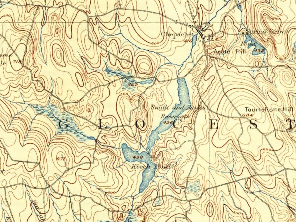
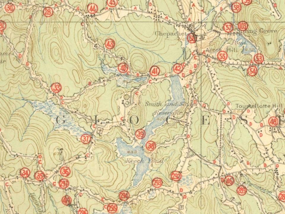
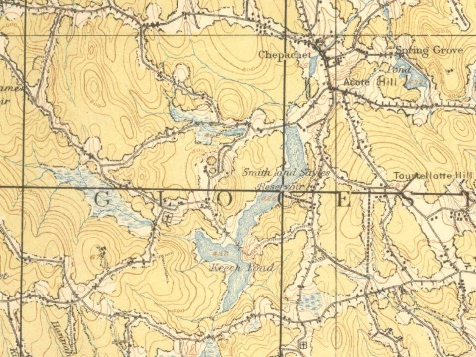
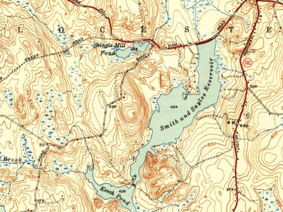
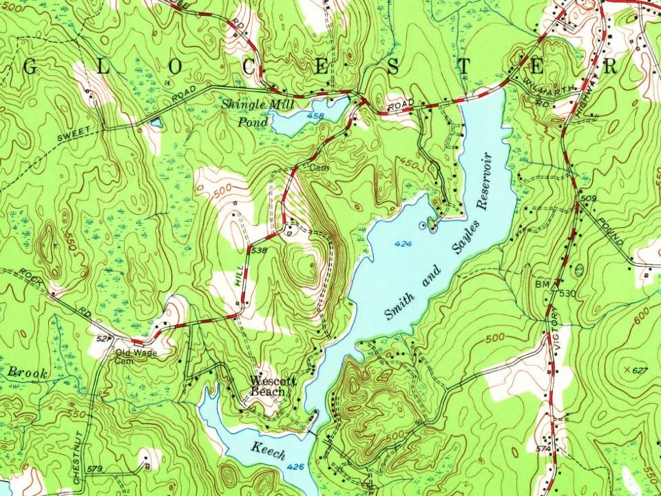
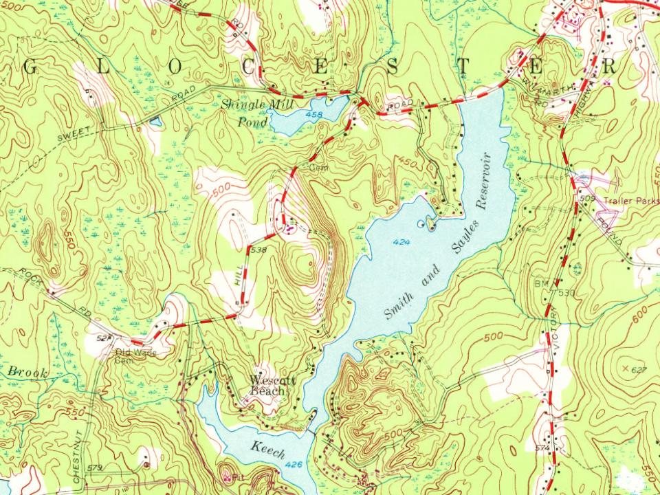
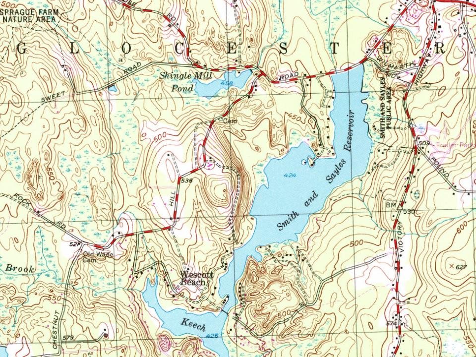
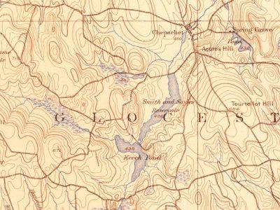
Glocester on the map, 1889 to 1999
Every edition of the U.S. Geological Survey’s map of Glocester. Tap a year, or press play to watch the town change.
1889Burrillville sheet · 1:62,500
U.S. Geological Survey historical topographic maps (public domain), via Esri’s collection of the scans. The red ring marks the center of Glocester.
Glocester, originally named Gloucester for Henry Stuart, Duke of Gloucester, was a part of the City of Providence until 1731, when it had become an independent town within the State of Rhode Island. Northern Glocester would be incorporated as the Town of Burrillville in 1806, whilst at the same time, the residents of Gloucester had voted to change the spelling of the town name from Gloucester to Glocester in order to differentiate it from the City of Gloucester, Massachusetts, holding the same meaning as Glocester is a historical and alternative variant of the word of Gloucester.
Passages that mention Glocester, cut from the printed page as they were published.
History of Providence County, Rhode Island1891 · page 549Read the page →
Read the text
"Sec. 3. And be it further enacted; That Messrs. Joshua Bicknell, Joseph Rice and Thomas Mann be and they are hereby appointed a committee to make an equal division of the poor now supported at the expense of the said town of Glocester between the two towns of Glocester and also of the debts due or owing and money belongingto the town of Glocester and the debts due from the said town which said division shall be settled and made in proportion to the last tax assessed in said town.
Text read by machine from the scan; it may contain errors.
History of Providence County, Rhode Island1891 · page 486Read the page →
Read the text
and Burrillville, in Rhode Island, meet, and are bounded, it being the northwest corner of the town of Smithfield; thence running southerly, on and with the west line of said town of Smithfield to a point being the northeast corner of the town of Glocester, where the northerly line of said Glocester and the southerly line of the town of Burrillville meet the westerly line of said Smithfield; thence running easterly to a point where the road leading from the Providence and Worcester road (so-called), by the house of Ephraim Sayles, crosses the Crook
Text read by machine from the scan; it may contain errors.
A brief history of the town of Glocester, Rhode Island1886 · page 40Read the page →
Read the text
Previous to the town of Glocester being set off from Providence, a road had been laid out from Providence village to Woodstock, passing through what are now the towns of North Providence, Johnston, Smithfield and Glocester to the road in Connecticut that leads to Woodstock. This road was a large country road, and much used. In 1788 so much of it had been taken by private persons that the travelling at some seasons had become very difficult. To repair said road, a
Text read by machine from the scan; it may contain errors.
Scans and text from the Internet Archive. Books published in 1930 or earlier, which are in the public domain.
Timeline
Glocester, 1731 to 2020
Woven from the archive, old maps, post office records, the National Register and the people born here.
In 1731, according to Wikidata. Glocester’s post office opened in 1806, and the first U.S. census counted 4,025 people here in 1790.
How does Glocester rank for history?
Glocester is more historic than 82% of U.S. towns, #23 of 38 in Rhode Island. The History grade combines the town’s founding era, the share of homes built before 1940 and its National Register listings. It’s a character grade, so it isn’t part of the overall grade. How it works.
What is on the National Register in Glocester?
4 listings: 2 buildings, 1 historic district, the Chepachet Village Historic District, with 68 contributing buildings, and 1 structure. 75 historic buildings in all.
How old are the homes in Glocester?
12% of Glocester’s homes were built before 1940 (Census estimate, ±5.3 points), against a typical 20% for a Rhode Island town; the median home was built in 1975.
Founding dates: Wikidata, Wikipedia, the U.S. post office records of Blevins & Helbock (CC0) and the Census. Homes by year built: Census ACS 2020–24. National Register of Historic Places: National Park Service (list of May 22, 2026). Old photos, postcards and papers: Wikimedia Commons, the Library of Congress and other public archives, credited on each item’s page. Maps: U.S. Geological Survey historical topographic maps (via Esri) and Sanborn fire-insurance maps (Library of Congress). History text and census tables: Wikipedia (CC BY-SA 4.0). Places that used to be: USGS Geographic Names Information System (2021).
From Wikimedia Commons (17), the Library of Congress (1), the National Register of Historic Places (4), Wikipedia, Wikidata and Wikipedia for famous people, U.S. Geological Survey historical maps, U.S. Census counts (via Wikipedia), the US Post Offices dataset (Blevins & Helbock), the USGS Geographic Names Information System and old county and town histories (Internet Archive). Archive images are copied here with their credits and licenses, shown on each photo’s page. Refreshed monthly.




 1808
 1808
 1808
 1808
 1808
 1808
 1808
 1808
 1808
 1808
 1808
 1808
 1808
 1808
 1808
 2008


