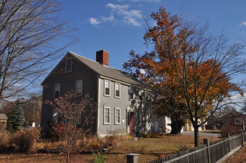
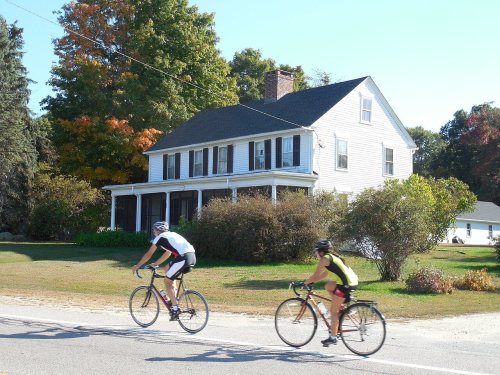
Johnston dates to 1636, and 14% of its homes were built before 1940
More historic than 77% of U.S. towns · #31 of 38 in Rhode Island. What drives it
11 places in town are on the National Register, among them a historic district with 14 buildings. Below: 12 old photos and papers, maps from 1889 on, and the census since 1790.
Founding year: Wikidata. First post office: 1876.The full story ↓
History grade
What drives Johnston’s History grade
On its age, its old homes and the National Register, Johnston is more historic than 77% of U.S. towns, #31 of 38 in Rhode Island. Its age holds the grade up; its National Register listings pull it down.
A−
HistoryA character grade: shown, never part of Johnston’s overall grade.
Rhode Island towns list more on the Register than most of the country (a typical Rhode Island town has 94.7 per 10,000 residents, the U.S. 2.4), so Johnston’s 11.1 sits below most of its state (5% of Rhode Island towns have fewer) while its 33 historic buildings outnumber those of 82% of U.S. towns.
NoteThe founding year comes from Wikidata alone; no second source gives 1636.
How sure. Graded on any two of the three inputs instead, the letter would range from B− to A−. The pre-1940 share is a Census survey estimate (±3.0 points).
Founding year: Wikidata (other dates in Quick answers). Homes: Census ACS 2020–24. National Register: National Park Service, May 2026 list; each listing counted once (boundary changes and added documentation belong to their listing), and a historic district counts its contributing buildings. How TownRatings grades history →
What stands out about Johnston’s past
Read from the archive, the National Register and the record. The page puts what stands out first.
69family graveyards and cemeteries inside Johnston
Alverson LotAsa Tourtellot LotAsahel Paine PlotBarnes - Staples LotBenjamin Kimball LotBenjamin Luther LotBenoni Mathewson LotCaleb Remington LotCaptain James Randall LotCaptain James Randall LotCaptain Reuben Mathewson PlotCedar LotCharles Waterman LotColonel Augustus Brown LotColonel Daniel Manton LotColonel Israel AngellColonel Peter Briggs LotDaniel Thornton LotDaniel Waterman LotDeacon James Olney LotDoctor Benjamin Belknap LotDoctor William Richardson LotEdward Hudson LotElder Stephen Sweet LotEphraim Winsor LotEthan Sprague LotFenner - Atwood LotGeorge Fenner LotGideon Brown LotGovernor Samuel Ward King LotHarris - Potter LotHarris Brown LotHarris Kelton LotHarry Smith LotHenry Fenner LotHighland Memorial ParkJames Colvin LotJonathan Thornton LotJoseph Blanchard LotJoseph Thornton LotMajor Valentine Sweet LotNathaniel K Devereaux LotNicholas Smith LotNoah Mathewson LotOlney Angell LotPardon Fenner LotPeter Randall LotPhilip Mathewson LotRemington Lot Johnston Historical Cemetery 31Resolved Waterman LotReverend Daniel A Jencks LotReverend Samuel Windsor LotRhodesRobert Thornton LotRobert Young LotRufus Sprague LotSilas Hall LotSimon Smith LotSolomon Thornton LotSquire Thurber LotSquire William Salisbury LotThomas Collins LotWaterman - Sheldon LotWelcome Johnson LotWelcome Sprague LotWilliam Steere LotWilliam W Steere LotWilliam Waterman PlotWoodlawn
See all 69
Alverson Lot · Asa Tourtellot Lot · Asahel Paine Plot · Barnes - Staples Lot · Benjamin Kimball Lot Cemetery · Benjamin Luther Lot · Benoni Mathewson Lot Cemetery · Caleb Remington Lot · Captain James Randall Lot · Captain James Randall Lot · Captain Reuben Mathewson Plot · Cedar Lot · Charles Waterman Lot · Colonel Augustus Brown Lot Cemetery · Colonel Daniel Manton Lot · Colonel Israel Angell Burial Ground · Colonel Peter Briggs Lot · Daniel Thornton Lot · Daniel Waterman Lot · Deacon James Olney Lot Cemetery · Doctor Benjamin Belknap Lot Cemetery · Doctor William Richardson Lot · Edward Hudson Lot Cemetery · Elder Stephen Sweet Lot · Ephraim Winsor Lot · Ethan Sprague Lot Cemetery · Fenner - Atwood Lot · George Fenner Lot · Gideon Brown Lot · Governor Samuel Ward King Lot · Harris - Potter Lot · Harris Brown Lot Cemetery · Harris Kelton Lot · Harry Smith Lot Cemetery · Henry Fenner Lot Cemetery · Highland Memorial Park Cemetery · James Colvin Lot Cemetery · Jonathan Thornton Lot Cemetery · Joseph Blanchard Lot · Joseph Thornton Lot · Major Valentine Sweet Lot Cemetery · Nathaniel K Devereaux Lot · Nicholas Smith Lot Cemetery · Noah Mathewson Lot · Olney Angell Lot Cemetery · Pardon Fenner Lot · Peter Randall Lot Cemetery · Philip Mathewson Lot · Remington Lot Johnston Historical Cemetery 31 · Resolved Waterman Lot · Reverend Daniel A Jencks Lot · Reverend Samuel Windsor Lot · Rhodes Cemetery · Robert Thornton Lot · Robert Young Lot · Rufus Sprague Lot Cemetery · Silas Hall Lot Cemetery · Simon Smith Lot Cemetery · Solomon Thornton Lot Cemetery · Squire Thurber Lot · Squire William Salisbury Lot Cemetery · Thomas Collins Lot Cemetery · Waterman - Sheldon Lot · Welcome Johnson Lot Cemetery · Welcome Sprague Lot Cemetery · William Steere Lot · William W Steere Lot · William Waterman Plot · Woodlawn Cemetery
US Post Offices dataset (Blevins & Helbock, CC0). Places and cemeteries from the USGS Geographic Names Information System (2021).
People over time
Johnston, census by census
Lost half of its people between 1890 and 1900, then grew 6-fold.
24 censuses, 1790–2020.
U.S. Census Bureau decennial counts, from the census table on Johnston’s Wikipedia page.
The area was first settled by English settlers in the seventeenth century as a farming community. In 1759 the town officially separated from Providence and was incorporated on March 6, 1759. Johnston was named for the current colonial attorney general, Augustus Johnston, who was later burned in effigy during the Stamp Act protests in 1765 and then fled Rhode Island as a Tory during the American Revolution in 1779. The first house of worship in Johnston opened when the Baptist Meeting House in Belknap was constructed in 1771. During the American Revolution Rhode Island's only gunpowder mill was constructed in Graniteville, and the town hosted American General John Sullivan for a dinner in 1779 upon his departure from Rhode Island to fight in New York. In 1790 the Belknap School, the first public school in the town, was founded. In 1791 the Providence and Norwich Turnpike (today's Plainfi…
Passages that mention Johnston, cut from the printed page as they were published.
History of Providence County, Rhode Island1891 · page 188Read the page →
Read the text
Mr. Charles H. Lawton has been superintendent since 1877. It has an average attendance of 54, and its library contains 250 volumes. A mission was established by this church in the neighboring town of Johnston, in 1877, in vSchool District No. 6, where it was held in the school house. A new chapel was built there in 1889. The Sunday school organized there in 1878, now numbers 41. Mr. George W.
Text read by machine from the scan; it may contain errors.
History of Providence County, Rhode Island1891 · page 529Read the page →
Read the text
Previous to the town of Glocester being set off from Providence, a road had been laid out from Providence village to Woodstock, passing through what are now. the towns of North Providence, Johnston, Smithfield and Glocester to the road in Connecticut that leads to Woodstock. This road was a large country road, and much used. In 1788 so much of it had been taken by private persons that the traveling at some seasons had become very difficult. To repair said road, a petition from the several towns was presented to the assembly, asking
Text read by machine from the scan; it may contain errors.
Scans and text from the Internet Archive. Books published in 1930 or earlier, which are in the public domain.
By decade
Johnston, decade by decade
3 decades in the archive, from the 1910s to the 1940s. Scroll each row; tap a photo for its story.
Nothing in the archives for these yearsWeddings on Main Street, storms, parades, school pictures, the old store. If it’s in your family album, it belongs here.
In 1636, according to Wikidata. Johnston’s post office opened in 1876, and the first U.S. census counted 1,320 people here in 1790.
How does Johnston rank for history?
Johnston is more historic than 77% of U.S. towns, #31 of 38 in Rhode Island. The History grade combines the town’s founding era, the share of homes built before 1940 and its National Register listings. It’s a character grade, so it isn’t part of the overall grade. How it works.
What is on the National Register in Johnston?
11 listings: 10 buildings and 1 historic district, the Brown Avenue Historic District, with 14 contributing buildings. 33 historic buildings in all.
How old are the homes in Johnston?
14% of Johnston’s homes were built before 1940 (Census estimate, ±3.0 points), against a typical 20% for a Rhode Island town; the median home was built in 1968.
Founding dates: Wikidata, Wikipedia, the U.S. post office records of Blevins & Helbock (CC0) and the Census. Homes by year built: Census ACS 2020–24. National Register of Historic Places: National Park Service (list of May 22, 2026). Old photos, postcards and papers: Wikimedia Commons, the Library of Congress and other public archives, credited on each item’s page. Maps: U.S. Geological Survey historical topographic maps (via Esri) and Sanborn fire-insurance maps (Library of Congress). History text and census tables: Wikipedia (CC BY-SA 4.0). Places that used to be: USGS Geographic Names Information System (2021).
From Wikimedia Commons (9), the Library of Congress (8), Wikidata (1), the National Register of Historic Places (11), Wikipedia, Wikidata and Wikipedia for famous people, U.S. Geological Survey historical maps, U.S. Census counts (via Wikipedia), the US Post Offices dataset (Blevins & Helbock), the USGS Geographic Names Information System and old county and town histories (Internet Archive). Archive images are copied here with their credits and licenses, shown on each photo’s page. Refreshed monthly.





 c. 1920
 1921
 1940
 1940
 1940
 1940
 1940
 1940
 1940
 2013
 2011
 2010
 2008
 2004