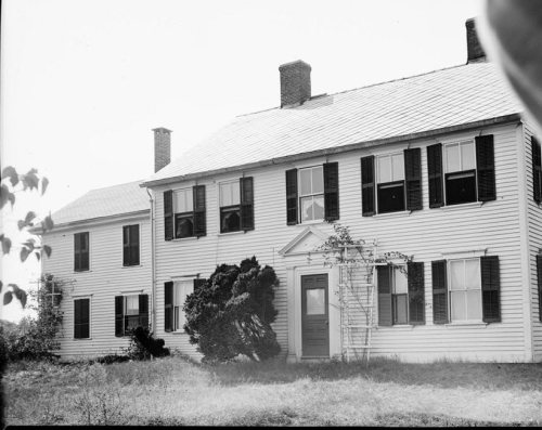
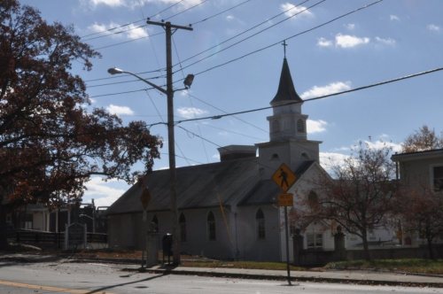
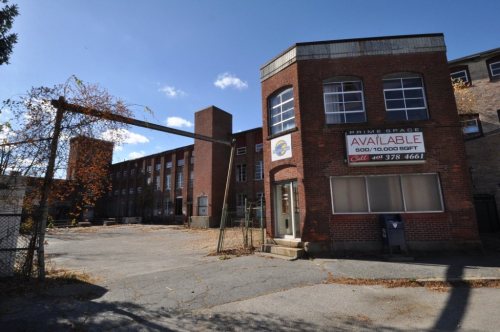
19% of North Providence’s homes were built before 1940
More historic than 67% of U.S. towns · #35 of 38 in Rhode Island. What drives it
9 places in town are on the National Register, among them two historic districts with 62 buildings between them. Below: 5 old photos and papers, maps from 1894 on, and the census since 1790.
On its age, its old homes and the National Register, North Providence is more historic than 67% of U.S. towns, #35 of 38 in Rhode Island. All 2 inputs are above most U.S. towns; its share of homes from before 1940 ranks highest and its National Register listings lowest.
B+
HistoryA character grade: shown, never part of North Providence’s overall grade.
Rhode Island towns list more on the Register than most of the country (a typical Rhode Island town has 94.7 per 10,000 residents, the U.S. 2.4), so North Providence’s 23.3 sits below most of its state (16% of Rhode Island towns have fewer) while its 80 historic buildings outnumber those of 88% of U.S. towns.
How sure. Graded on two of the three inputs, so a change in either one moves the letter more than it would with three. The pre-1940 share (±2.9 points) is firm at this size.
Founding year: our sources. Homes: Census ACS 2020–24. National Register: National Park Service, May 2026 list; each listing counted once (boundary changes and added documentation belong to their listing), and a historic district counts its contributing buildings. How TownRatings grades history →
What stands out about North Providence’s past
Read from the archive, the National Register and the record. The page puts what stands out first.
5cemeteries and burying grounds inside North Providence
Elisha Angell LotForest HillFranciscan Sisters Fruit HillIntervaleOliver Angell Lot
US Post Offices dataset (Blevins & Helbock, CC0). Places and cemeteries from the USGS Geographic Names Information System (2021).
People over time
North Providence, census by census
Lost two-thirds of its people between 1870 and 1880, then grew more than tenfold.
24 censuses, 1790–2020.
U.S. Census Bureau decennial counts, from the census table on North Providence’s Wikipedia page.
On the map
North Providence on the map, 1894 to 1996
Every edition of the U.S. Geological Survey’s map of North Providence. Tap a year, or press play to watch the town change.
1894Providence sheet · 1:62,500
U.S. Geological Survey historical topographic maps (public domain), via Esri’s collection of the scans. The red ring marks the center of North Providence.
Settled shortly after the arrival of Roger Williams in 1636, North Providence was incorporated as a town in 1765. The originally incorporated town area included sections of the present-day cities of Providence and Pawtucket. Early colonial settlers in North Providence built stone-ender houses, such as the Joseph Smith House (1705) at 109 Smithfield Road, which is now listed in the National Register of Historic Places. In 1793, the first fully mechanized cotton-spinning mill in the United States, Slater Mill, was founded by Samuel Slater on the banks of the Blackstone River in North Providence. In 1874, the eastern section of North Providence where Slater Mill is located became Pawtucket, resulting in a large population decrease.
Passages that mention North Providence, cut from the printed page as they were published.
Annals of Centerdale in the town of North Providence, Rhode Island1909 · page 183Read the page →
Read the text
THE town of North Providence, within whose limits is located the village of Centerdale, was at one time, or until 1765, a part of the territory of the town of Providence, which originally embraced nearly all of Providence county; but as the country became more thickly settled, desire for separate townships were manifest on all sides ; the farming districts believing they could more economically manage their local affairs if they were separated from
Text read by machine from the scan; it may contain errors.
Annals of Centerdale, in the town of North Providence, Rhode Island1909 · page 183Read the page →
Read the text
THE town of North Providence, within whose hmits is located the village of Centerdale. was at one time, or until 1765, a part of the territory of tlie town of Pn)\idence, which originally eml)raced nearly all of Providence countv; but as the country became more thickly settled, desire for separate townsliips were manifest on all sides; the farming districts believing they could more economicallv manage their local affairs if they were separated from
Text read by machine from the scan; it may contain errors.
History of Providence County, Rhode Island1891 · page 422Read the page →
Read the text
The boundaries have remained ever since, and now are those of the town (although a portion of the then town of North Providence has since been incorporated into the town of Pawtucket, so that this town now bounds on the south in part by North Providence and in part by Pawtucket). This gave Lincoln a territory of a triangular shape, covering about 15 square miles, with a population of 7,889 persons, and a valuation for state tax of $4,406,107. , The principal places of interest in the town are the following: —
Text read by machine from the scan; it may contain errors.
Annals of Centerdale in the town of North Providence, Rhode Island1909 · page 55Read the page →
Read the text
condition to lay rails upon it, and they also agreed to construct and operate a line upon Woonasquatucket avenue and Douglas avenue within a certain time named in the agreement, provided the town of North Providence would grant to the company the exclusive franchise of the streets for twenty years.
Text read by machine from the scan; it may contain errors.
Scans and text from the Internet Archive. Books published in 1930 or earlier, which are in the public domain.
Timeline
North Providence, 1824 to 2020
Woven from the archive, old maps, post office records, the National Register and the people born here.
Nothing in the archives for these yearsWeddings on Main Street, storms, parades, school pictures, the old store. If it’s in your family album, it belongs here.
North Providence is more historic than 67% of U.S. towns, #35 of 38 in Rhode Island. The History grade combines the town’s founding era, the share of homes built before 1940 and its National Register listings. It’s a character grade, so it isn’t part of the overall grade. How it works.
What is on the National Register in North Providence?
9 listings: 7 buildings and 2 historic districts, the Allendale Mill and the Greystone Historic District, with 62 contributing buildings. 80 historic buildings in all.
How old are the homes in North Providence?
19% of North Providence’s homes were built before 1940 (Census estimate, ±2.9 points), against a typical 20% for a Rhode Island town; the median home was built in 1970.
Founding dates: Wikidata, Wikipedia, the U.S. post office records of Blevins & Helbock (CC0) and the Census. Homes by year built: Census ACS 2020–24. National Register of Historic Places: National Park Service (list of May 22, 2026). Old photos, postcards and papers: Wikimedia Commons, the Library of Congress and other public archives, credited on each item’s page. Maps: U.S. Geological Survey historical topographic maps (via Esri) and Sanborn fire-insurance maps (Library of Congress). History text and census tables: Wikipedia (CC BY-SA 4.0). Places that used to be: USGS Geographic Names Information System (2021).
From Wikimedia Commons (5), Wikidata (1), the National Register of Historic Places (9), Wikipedia, Wikidata and Wikipedia for famous people, U.S. Geological Survey historical maps, U.S. Census counts (via Wikipedia), the US Post Offices dataset (Blevins & Helbock), the USGS Geographic Names Information System and old county and town histories (Internet Archive). Archive images are copied here with their credits and licenses, shown on each photo’s page. Refreshed monthly.


 1835
 1933