Foster dates to 1730, and 20% of its homes were built before 1940
More historic than 94% of U.S. towns · #10 of 38 in Rhode Island. What drives it
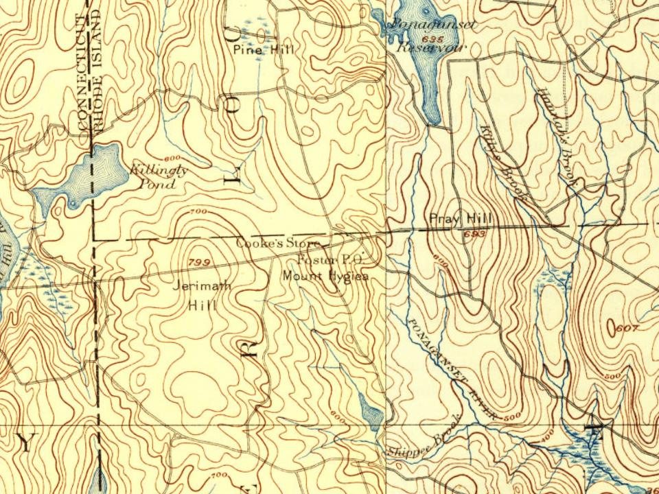
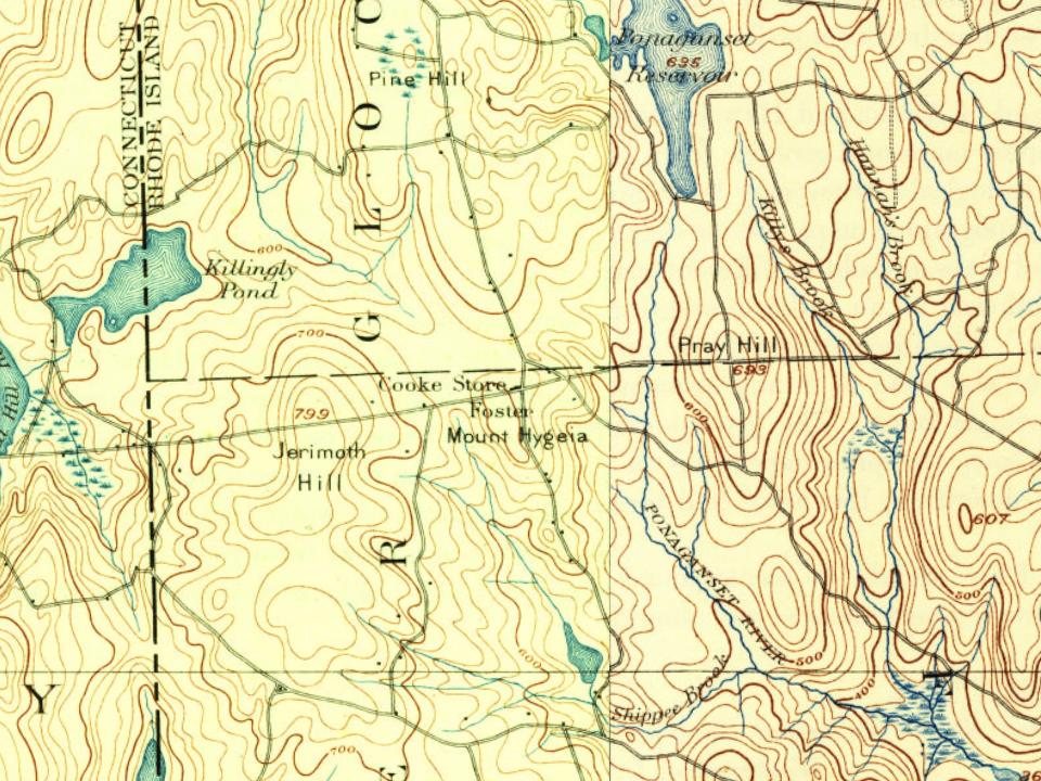
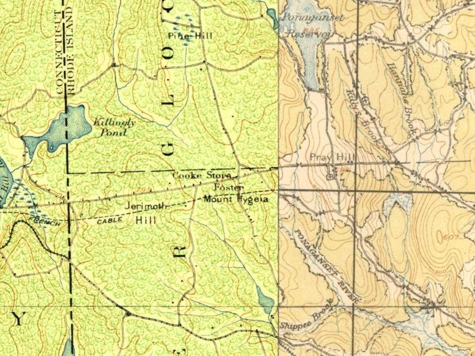
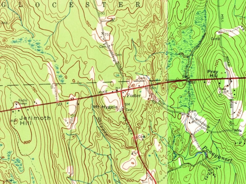
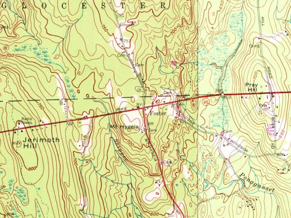
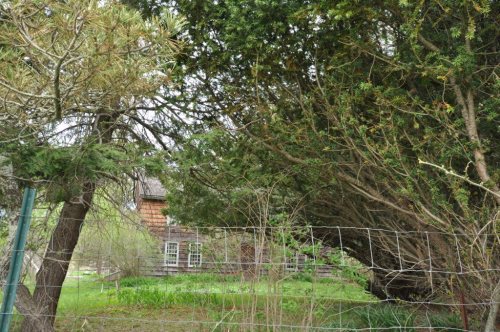
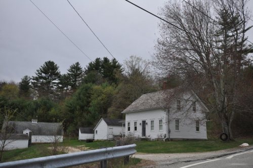
8 places in town are on the National Register, among them four historic districts with 85 buildings between them. Below: 2 old photos and papers, maps from 1889 on, and the census since 1790.
Founding year: Wikipedia. First post office: 1815.The full story ↓
History grade
What drives Foster’s History grade
On its age, its old homes and the National Register, Foster is more historic than 94% of U.S. towns, #10 of 38 in Rhode Island. All 3 inputs are above most U.S. towns; its age ranks highest and its share of homes from before 1940 lowest.
A
HistoryA character grade: shown, never part of Foster’s overall grade.
Rhode Island towns list more on the Register than most of the country (a typical Rhode Island town has 94.7 per 10,000 residents, the U.S. 2.4), so Foster’s 197 sits above most of its state (74% of Rhode Island towns have fewer) while its 89 historic buildings outnumber those of 89% of U.S. towns.
NoteThe founding year comes from Wikipedia alone; no second source gives 1730.
How sure. Graded on any two of the three inputs instead, the letter would range from A to A+. The pre-1940 share is a Census survey estimate (±6.1 points).
Founding year: Wikipedia (other dates in Quick answers). Homes: Census ACS 2020–24. National Register: National Park Service, May 2026 list; each listing counted once (boundary changes and added documentation belong to their listing), and a historic district counts its contributing buildings. How TownRatings grades history →
What stands out about Foster’s past
Read from the archive, the National Register and the record. The page puts what stands out first.
Angell - Eddy LotAseph Saunders LotBenjamin - Bennett LotBurgess - Round LotCaptain Isaac Hopkins LotCaptain Isaac Paine LotCaptain Nathaniel Harrington LotCaptain Ruben Lyons LotCarpenter - Bowen Lot - Rhode Island Historical Cemetery - Foster Number 93Carpenter - Howard LotCharles Phillips LotCharles Whidden LotClayvilleCole and Philips LotColonel Israel Phillips LotColonel James Whipple LotColonel Nathaniel Stone LotColonel William Davis LotColwell - Hopkins LotConstant Round LotDaniel Howard LotDaniel Howard LotDaniel Salsbury LotDeacon Augustus Sweet LotDoctor Thomas Carpenter Lot - Rhode Island Historical Cemetery - Foster Number 94Dorrance - Jencks LotDr Solomon Drowne LotElijah Paine LotFenner - Fry LotFriendsGeorge Bennett LotGeorge Howard LotGideon Burgess LotHarrington LotHopkins - Potter LotHopkins - Young LotHopkins LotHopkins LotHopkins Mills LotHorace Cole LotJohn Brown LotJohn Harrington LotJonathan Perkins LotJonathan Pray LotJonathan Tewgood LotJones - Hammon LotKeech - Windsor LotKimball Burgess LotLevi Randall LotLieutenant James Wells LotMoosup ValleyMorning Star ChurchNathaniel Bennett LotNathaniel PhillipsObadiah Easten LotOlney Goodspeed LotPardon - HoldenParis Simmons LotPhillips MemorialPlace - Battey LotPlace - Bennis LotPlace - Phillips LotReverend Isaac Blanchard LotRhode Island Historic Cemetery Foster 105Robert Shippee LotSamuel McGee LotSamuel Tillinghast LotSand HillSpears LotStephen Williams LotThe LineThomas Brayton LotThomas H Devaul LotThomas Hill LotTitus - Baker LotWalker - Randall LotWilliam Sanders LotWilliam Wood Lot
See all 78
Angell - Eddy Lot · Aseph Saunders Lot · Benjamin - Bennett Lot · Burgess - Round Lot · Captain Isaac Hopkins Lot · Captain Isaac Paine Lot · Captain Nathaniel Harrington Lot · Captain Ruben Lyons Lot Cemetery · Carpenter - Bowen Lot - Rhode Island Historical Cemetery - Foster Number 93 · Carpenter - Howard Lot · Charles Phillips Lot Cemetery · Charles Whidden Lot Cemetery · Clayville Cemetery · Cole and Philips Lot · Colonel Israel Phillips Lot · Colonel James Whipple Lot · Colonel Nathaniel Stone Lot Cemetery · Colonel William Davis Lot · Colwell - Hopkins Lot · Constant Round Lot Cemetery · Daniel Howard Lot · Daniel Howard Lot · Daniel Salsbury Lot · Deacon Augustus Sweet Lot Cemetery · Doctor Thomas Carpenter Lot - Rhode Island Historical Cemetery - Foster Number 94 · Dorrance - Jencks Lot · Dr Solomon Drowne Lot · Elijah Paine Lot · Fenner - Fry Lot · Friends Burying Ground · George Bennett Lot · George Howard Lot · Gideon Burgess Lot Cemetery · Harrington Lot · Hopkins - Potter Lot · Hopkins - Young Lot Cemetery · Hopkins Lot · Hopkins Lot Cemetery · Hopkins Mills Lot Cemetery · Horace Cole Lot · John Brown Lot · John Harrington Lot · Jonathan Perkins Lot · Jonathan Pray Lot · Jonathan Tewgood Lot · Jones - Hammon Lot · Keech - Windsor Lot · Kimball Burgess Lot · Levi Randall Lot · Lieutenant James Wells Lot · Moosup Valley Cemetery · Morning Star Church Cemetery · Nathaniel Bennett Lot · Nathaniel Phillips Cemetery · Obadiah Easten Lot · Olney Goodspeed Lot · Pardon - Holden Cemetery · Paris Simmons Lot · Phillips Memorial Cemetery · Place - Battey Lot · Place - Bennis Lot Cemetery · Place - Phillips Lot · Reverend Isaac Blanchard Lot · Rhode Island Historic Cemetery Foster 105 · Robert Shippee Lot Cemetery · Samuel McGee Lot · Samuel Tillinghast Lot · Sand Hill Cemetery · Spears Lot · Stephen Williams Lot Cemetery · The Line Cemetery · Thomas Brayton Lot · Thomas H Devaul Lot Cemetery · Thomas Hill Lot · Titus - Baker Lot · Walker - Randall Lot · William Sanders Lot Cemetery · William Wood Lot Cemetery
US Post Offices dataset (Blevins & Helbock, CC0). Places and cemeteries from the USGS Geographic Names Information System (2021).
Help out
Start Foster’s collection
The first neighbors to add old photos shape how Foster’s history is told.
Decades since 1900 with photos
00s10s20s30s40s50s60s70s80s90s
0 of 10 decades. The empty ones are waiting for someone’s album.
Foster was originally settled in the 17th century by British colonists as a farming community. In the year 1662, William Vaughan, Zachariah Rhodes, and Robert Wescott, purchased from the Indians a large tract of land called West Quanaug, bordering on Providence. The West Quanaug purchase included nearly the whole southern half of the town of Foster. The first English settler was allegedly Ezekiel Hopkins. Many settlers from Newport were active in the town in the 18th century. Shortly before the incorporation of the town, Foster's first church, a Calvinist Baptist congregation was founded. Shortly afterward, Six Principle Baptist and Free Will Baptist congregations were founded.
Passages that mention Foster, cut from the printed page as they were published.
History of Providence County, Rhode Island1891 · page 626Read the page →
Read the text
THE town of Foster is situated on the extreme western border of the county, some 15 miles from the city of Providence. It was incorporated with Scituate in 1780, forming the western section of that township up to 1781, when it was set off as a distinct and separate township. It is bounded on the north by Glocester, on the east by Scituate, on the south by Coventry and on the west by the towns of Killing-ly and Sterling in Connecticut. The town comprises about 50 square miles, having an average breadth from east to west of
Text read by machine from the scan; it may contain errors.
History of Isaac Howard of Foster, Rhode Island, and his descendants who have borne the name of Howard1901 · page 92Read the page →
Read the text
177. JOSEPH HOWARD was born in Foster, R. I., December 15, 1823; was a farm hand in early life; went on a whaling voyage to the Pacific, being gone about two years; returned to Foster and was employed at farming there and in the towns of Burrillville and Gloucester until the Civil War; then worked as a stone mason for several years, being employed in the erection of cotton factories and residing in Foster and at Clayville, R. I.; in 1871 purchased of Pardon T. Howard
Text read by machine from the scan; it may contain errors.
History of Providence County, Rhode Island1891 · page 629Read the page →
Read the text
Mount Hygeia was first settled by two of the most learned and distinguished men in the state. Theodore Foster and vSolomon Drowne are names not only intimately connected with the history of the town of Foster, but bear honorable place in the historical record of their native state. Senator Theodore Foster came from Brookfield, Mass., while yet in his teens, and graduated at Rhode Island College in 1770.
Text read by machine from the scan; it may contain errors.
History of Isaac Howard of Foster, Rhode Island, and his descendants who have borne the name of Howard1901Read the page →
Read the text
When 16 years of age he united with the Christian Church at Foster Center, and became one of its most active members. For several years before leaving Foster he served as church organist and as deacon. After taking up his residence in Providence he transferred his membersliip to the Broad Street Christian Church and became one of its deacons.
Text read by machine from the scan; it may contain errors.
Scans and text from the Internet Archive. Books published in 1930 or earlier, which are in the public domain.
Timeline
Foster, 1730 to 2010
Woven from the archive, old maps, post office records, the National Register and the people born here.
In 1730, according to Wikipedia’s history of the town. Foster’s post office opened in 1815, and the first U.S. census counted 2,268 people here in 1790.
How does Foster rank for history?
Foster is more historic than 94% of U.S. towns, #10 of 38 in Rhode Island. The History grade combines the town’s founding era, the share of homes built before 1940 and its National Register listings. It’s a character grade, so it isn’t part of the overall grade. How it works.
What is on the National Register in Foster?
8 listings: 3 buildings, among them the Capt. George Dorrance House (listed 1972, the first), and 4 historic districts with 85 contributing buildings. 89 historic buildings in all.
How old are the homes in Foster?
20% of Foster’s homes were built before 1940 (Census estimate, ±6.1 points), against a typical 20% for a Rhode Island town; the median home was built in 1975.
Founding dates: Wikidata, Wikipedia, the U.S. post office records of Blevins & Helbock (CC0) and the Census. Homes by year built: Census ACS 2020–24. National Register of Historic Places: National Park Service (list of May 22, 2026). Old photos, postcards and papers: Wikimedia Commons, the Library of Congress and other public archives, credited on each item’s page. Maps: U.S. Geological Survey historical topographic maps (via Esri) and Sanborn fire-insurance maps (Library of Congress). History text and census tables: Wikipedia (CC BY-SA 4.0). Places that used to be: USGS Geographic Names Information System (2021).
From Wikimedia Commons (6), the National Register of Historic Places (7), Wikipedia, Wikidata and Wikipedia for famous people, U.S. Geological Survey historical maps, U.S. Census counts (via Wikipedia), the US Post Offices dataset (Blevins & Helbock), the USGS Geographic Names Information System and old county and town histories (Internet Archive). Archive images are copied here with their credits and licenses, shown on each photo’s page. Refreshed monthly.


 c. 1860
 2012
 2010
 2008
 2008