Burrillville dates to 1662, and 27% of its homes were built before 1940
More historic than 92% of U.S. towns · #13 of 38 in Rhode Island. What drives it
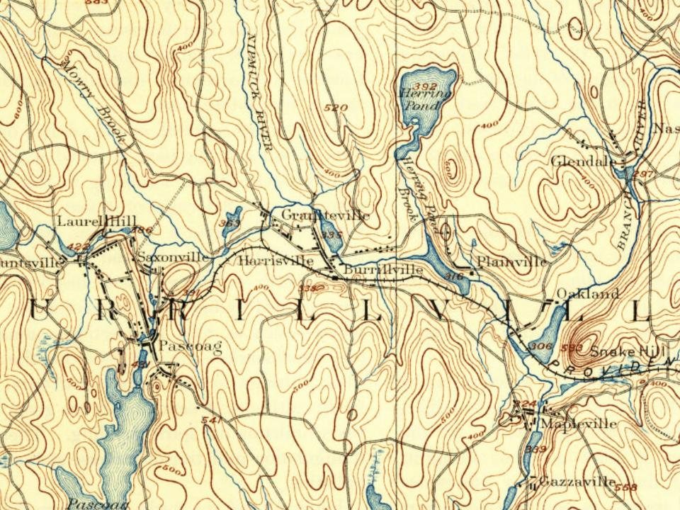
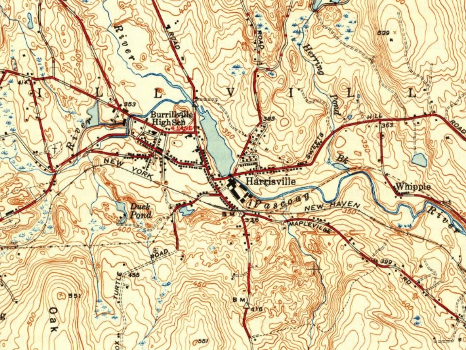
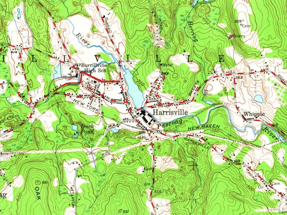
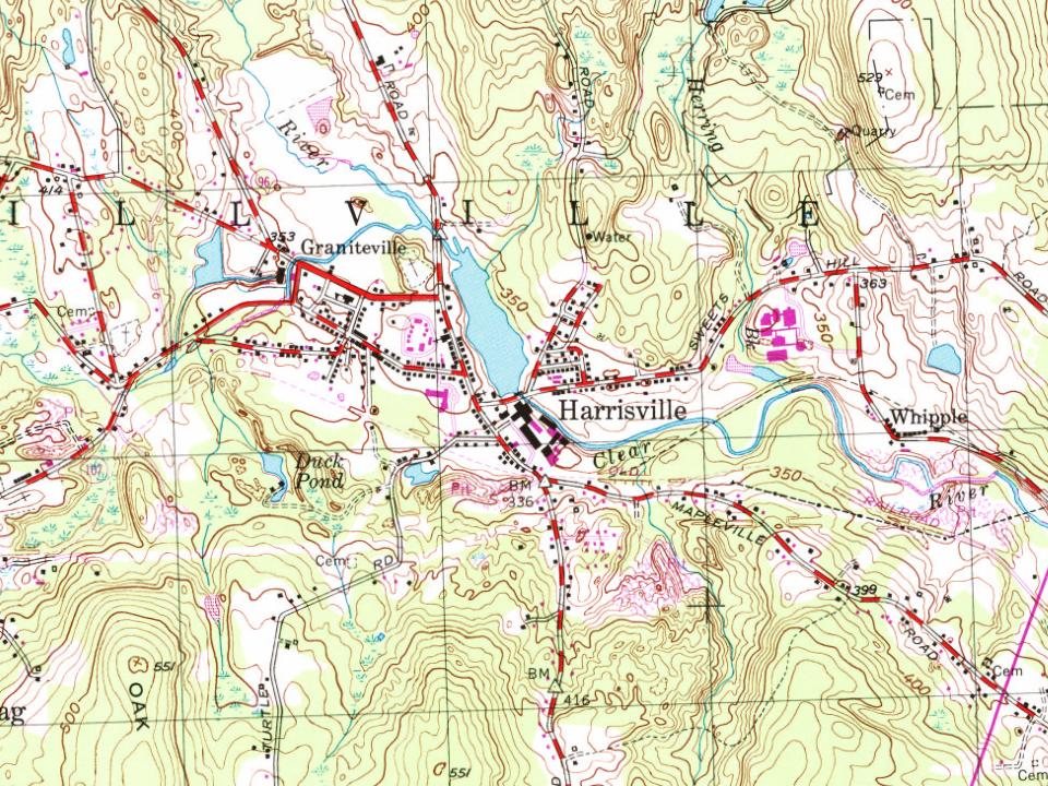
6 places in town are on the National Register, among them two historic districts with 265 buildings between them. Below: 1 old photo or paper, maps from 1889 on, and the census since 1810.
Founding year: Wikipedia. First post office: 1822.The full story ↓
History grade
What drives Burrillville’s History grade
On its age, its old homes and the National Register, Burrillville is more historic than 92% of U.S. towns, #13 of 38 in Rhode Island. All 2 inputs are above most U.S. towns; its share of homes from before 1940 ranks highest and its National Register listings lowest.
A
HistoryA character grade: shown, never part of Burrillville’s overall grade.
Rhode Island towns list more on the Register than most of the country (a typical Rhode Island town has 94.7 per 10,000 residents, the U.S. 2.4), so Burrillville’s 165 sits near the middle of its state (63% of Rhode Island towns have fewer) while its 271 historic buildings outnumber those of 95% of U.S. towns.
NoteThe founding year comes from Wikipedia alone; no second source gives 1662.
How sure. Graded on two of the three inputs, so a change in either one moves the letter more than it would with three. The pre-1940 share is a Census survey estimate (±4.4 points).
Founding year: Wikipedia (other dates in Quick answers). Homes: Census ACS 2020–24. National Register: National Park Service, May 2026 list; each listing counted once (boundary changes and added documentation belong to their listing), and a historic district counts its contributing buildings. How TownRatings grades history →
What stands out about Burrillville’s past
Read from the archive, the National Register and the record. The page puts what stands out first.
56family graveyards and cemeteries inside Burrillville
Albee - Paine LotAldrich - Thayer LotAmasa Esten LotAndrew Harris LotBallou - Buffum LotBrown - Millard LotCaptain John Smith LotCary - Ballou LotCharles S Smith LotClark Sherman LotCooke - Thayer LotCooper - Mowry LotDuty Smith LotEddy - Aldrich LotElder William Bowen LotFrank ProutyFriends LotGeorge Inman LotHarris - White - Darling LotHarrisvilleHicks - Smith LotIsrael Young LotJacob Walling LotJames Wilson LotJeremiah Mowry LotJohn Mathewson LotJohn White LotJoseph Esten LotLeonard Nason LotLippitt Eddy LotMarsh - Hopkins - PotterMount Saint CharlesNelson Payne LotOthniel Young LotOtis Bligh LotPaine - Phillips - Sayles LotPascoagPhetterplace Jones LotReverend Moab Paine LotRobbins - Lapham LotSaint Patrick'sSaint PatricksSaint Theresa'sSamuel Inman LotSamuel Lee LotSayles - Eddy LotSayles Cook LotSherman - Burlingame LotSilus Comstock LotSmith Aldrich LotSmith Paine LotTaft Baker LotWashington Logee LotWhipple LotYoung - White LotZebede Williams Lot
See all 56
Albee - Paine Lot · Aldrich - Thayer Lot Cemetery · Amasa Esten Lot · Andrew Harris Lot · Ballou - Buffum Lot · Brown - Millard Lot · Captain John Smith Lot · Cary - Ballou Lot · Charles S Smith Lot Cemetery · Clark Sherman Lot · Cooke - Thayer Lot · Cooper - Mowry Lot · Duty Smith Lot · Eddy - Aldrich Lot · Elder William Bowen Lot · Frank Prouty Cemetery · Friends Lot · George Inman Lot · Harris - White - Darling Lot · Harrisville Cemetery · Hicks - Smith Lot · Israel Young Lot Cemetery · Jacob Walling Lot Cemetery · James Wilson Lot Cemetery · Jeremiah Mowry Lot · John Mathewson Lot · John White Lot Cemetery · Joseph Esten Lot · Leonard Nason Lot Cemetery · Lippitt Eddy Lot Cemetery · Marsh - Hopkins - Potter Cemetery · Mount Saint Charles Cemetery · Nelson Payne Lot Cemetery · Othniel Young Lot Cemetery · Otis Bligh Lot · Paine - Phillips - Sayles Lot · Pascoag Cemetery · Phetterplace Jones Lot · Reverend Moab Paine Lot · Robbins - Lapham Lot Cemetery · Saint Patrick's Cemetery · Saint Patricks Cemetery · Saint Theresa's Cemetery · Samuel Inman Lot · Samuel Lee Lot Cemetery · Sayles - Eddy Lot · Sayles Cook Lot · Sherman - Burlingame Lot Cemetery · Silus Comstock Lot Cemetery · Smith Aldrich Lot Cemetery · Smith Paine Lot Cemetery · Taft Baker Lot · Washington Logee Lot Cemetery · Whipple Lot · Young - White Lot · Zebede Williams Lot
US Post Offices dataset (Blevins & Helbock, CC0). Places and cemeteries from the USGS Geographic Names Information System (2021).
Help out
Start Burrillville’s collection
The first neighbors to add old photos shape how Burrillville’s history is told.
Decades since 1900 with photos
00s10s20s30s40s50s60s70s80s90s
0 of 10 decades. The empty ones are waiting for someone’s album.
Burrillville was settled around 1662 by English colonists as part of Glocester, Rhode Island. John Smith and members of the Saulsbury family were among the earliest settlers. Samuel Willard treated many smallpox victims in South Uxbridge and Glocester (Burrillville). In 1806, Burrillville became a separate town and consisted of 60 square miles (160 km2) of land in the northwestern corner of Rhode Island, bordering Connecticut and Massachusetts. Boundary disputes with Massachusetts and Glocester reduced this land area by the mid-19th century. Joktan Putnam was the first town moderator.
Passages that mention Burrillville, cut from the printed page as they were published.
History of Providence County, Rhode Island1891Read the page →
Read the text
THE town of Burrillville is situated in the northwest corner of the state, about 20 miles northwest from the city of Providence. Previous to 1806 this territory was included in the town of Glocester, but in that year the tract comprising this township was set off and incorporated into a separate and distinct township. It derived its present name from the Honorable James Burrill, who was then attorney general of the state of Rhode Island. In consideration of this act Mr. Burrill presented the town with a set of books for the
Text read by machine from the scan; it may contain errors.
History of Providence County, Rhode Island1891 · page 486Read the page →
Read the text
within the following limits, to wit: beginning at a point on the state line between the states of Rhode Island and Massachusetts, being the point where the towns of Uxbridge, in Massachusetts, and Smithfield and Burrillville, in Rhode Island, meet, and are bounded, it being the northwest corner of the town of Smithfield; thence running southerly, on and with the west line of said town of Smithfield to a point being the northeast corner of the town of Glocester, where the northerly line of said Glocester and the southerly line of the town of Burrillville
Text read by machine from the scan; it may contain errors.
Scans and text from the Internet Archive. Books published in 1930 or earlier, which are in the public domain.
Timeline
Burrillville, 1662 to 1944
Woven from the archive, old maps, post office records, the National Register and the people born here.
In 1662, according to Wikipedia’s history of the town. Burrillville’s post office opened in 1822, and the census of 1810 counted 1,834 people here.
How does Burrillville rank for history?
Burrillville is more historic than 92% of U.S. towns, #13 of 38 in Rhode Island. The History grade combines the town’s founding era, the share of homes built before 1940 and its National Register listings. It’s a character grade, so it isn’t part of the overall grade. How it works.
What is on the National Register in Burrillville?
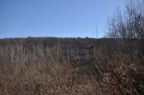
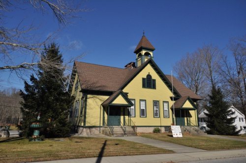
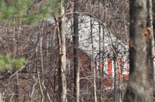
6 listings: 4 buildings and 2 historic districts, the Harrisville Historic District and the Oakland Historic District, with 265 contributing buildings. 271 historic buildings in all.
How old are the homes in Burrillville?
27% of Burrillville’s homes were built before 1940 (Census estimate, ±4.4 points), against a typical 20% for a Rhode Island town; the median home was built in 1970.
Founding dates: Wikidata, Wikipedia, the U.S. post office records of Blevins & Helbock (CC0) and the Census. Homes by year built: Census ACS 2020–24. National Register of Historic Places: National Park Service (list of May 22, 2026). Old photos, postcards and papers: Wikimedia Commons, the Library of Congress and other public archives, credited on each item’s page. Maps: U.S. Geological Survey historical topographic maps (via Esri) and Sanborn fire-insurance maps (Library of Congress). History text and census tables: Wikipedia (CC BY-SA 4.0). Places that used to be: USGS Geographic Names Information System (2021).
From Wikimedia Commons (4), the Library of Congress (1), Wikidata (4), the National Register of Historic Places (6), Wikipedia, Wikidata and Wikipedia for famous people, U.S. Geological Survey historical maps, U.S. Census counts (via Wikipedia), the US Post Offices dataset (Blevins & Helbock), the USGS Geographic Names Information System and old county and town histories (Internet Archive). Archive images are copied here with their credits and licenses, shown on each photo’s page. Refreshed monthly.






 2014
 2013
 2010
 2008