The Wales post office opened in 1821, the earliest record of the town by name. Another post office, Colegrove (1900), opened inside today’s town and later closed.
First census: 903 in 18202020 census: 3,009205 years
How historic is Wales?
B−
More historic than 51% of U.S. towns, on its age, its old homes and the National Register.
Founding year: the first Wales post office (Blevins & Helbock, CC0).The full story ↓
History grade
What drives Wales’ History grade
On its age, its old homes and the National Register, Wales is more historic than 51% of U.S. towns, #668 of 758 in New York. Its age holds the grade up; its National Register listings pull it down.
B−
HistoryA character grade: shown, never part of Wales’ overall grade.
New York towns list more on the Register than most of the country (a typical New York town has 12.3 per 10,000 residents, the U.S. 2.4), so Wales’ 0.0 sits below most of its state (10% of New York towns have fewer) while its 0 listings outnumber those of 23% of U.S. towns.
How sure. Graded on any two of the three inputs instead, the letter would range from C to B+. The pre-1940 share is a Census survey estimate (±6.1 points). The founding year is the first post office, not a stated founding date.
Founding year: the first post office (other dates in Quick answers). Homes: Census ACS 2020–24. National Register: National Park Service, May 2026 list; each listing counted once (boundary changes and added documentation belong to their listing), and a historic district counts its contributing buildings. How TownRatings grades history →
What stands out about Wales’ past
Read from the archive, the National Register and the record. The page puts what stands out first.
Originally a farming community, the town of Wales is documented through profiles of its churches, civic organizations, businesses, and individual citizens. Established in 1818, the town of 3,000 residents is located in a scenic area of Erie County amid woodlands and streams. Town boards over the years have been respectful of the residents' desire to maintain a small-town atmosphere and quality of life, and the transition to modern life has emphasized small, family-oriented businesses. Personal commitment and a spirit of volunteerism have prevailed in the community, as evidenced by its many interactive organizations.
The town is named because its hills and green fields reminded settlers of the nation of Wales.
Passages that mention Wales, cut from the printed page as they were published.
The historical works, containing The topography of Ireland and The history of the conquest of Ireland, tr. by Thomas Forrester1905 · page 483Read the page →
Read the text
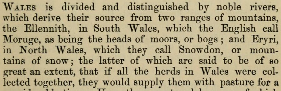
Wales is divided and distinguished by noble rivers, which derive their source from two ranges of mountains, the Ellennith, in South Wales, which the English call Moruge, as being the heads of moors, or bogs ; and Eryri, in North Wales, which they call Snowdon, or mountains of snow; the latter of which are said to be of so great an extent, that if all the herds in Wales were collected together, they would supply them with pasture for a
Text read by machine from the scan; it may contain errors.
The historical works, containing The topography of Ireland and The history of the conquest of Ireland, tr. by Thomas Forrester1905 · page 432Read the page →
Read the text
of Cardigan, is situated on the northern banks of the river Teivi, which discharges itself into the sea a few miles fi'om the town. When the Normans and Flemings spread themselves over the western coasts of Wales, they probably erected a fort to guard this river ; but the first mention of it in the Welsh Chronicle occurs in the year 1155, when prince Rhys built a castle at Aberdyfi, to protect his frontiers against the princes of North Wales. In the year 1157, Roger earl of Clare, having obtained a grant from king Henry of such lands in Wales as he
Text read by machine from the scan; it may contain errors.
A history of Wales from the earliest times to the Edwardian conquest1911 · page 83Read the page →
Read the text
the first importance in its bearing on the question of Roman influence in Wales. If, when the light of history once more discloses, at the beginning of the Middle Ages, the peoples of Cornwall, Wales and Strathclyde, they are found speaking not a Romance but a Celtic language, the conclusion seems inevitable that they had never ceased to do so, having escaped the influences which elsewhere in Western Europe made Latin universal. Efforts have been made to explain Welsh as a
Text read by machine from the scan; it may contain errors.
Scans and text from the Internet Archive. Books published in 1930 or earlier, which are in the public domain.
Timeline
Wales, 1821 to 2020
Woven from the archive, old maps, post office records, the National Register and the people born here.
Nothing in the archives for these yearsWeddings on Main Street, storms, parades, school pictures, the old store. If it’s in your family album, it belongs here.
The Wales post office opened in 1821, the earliest record of the town by name (U.S. post office records).
How does Wales rank for history?
Wales is more historic than 51% of U.S. towns, #668 of 758 in New York. The History grade combines the town’s founding era, the share of homes built before 1940 and its National Register listings. It’s a character grade, so it isn’t part of the overall grade. How it works.
How old are the homes in Wales?
15% of Wales’ homes were built before 1940 (Census estimate, ±6.1 points), against a typical 27% for a New York town; the median home was built in 1971.
Founding dates: Wikidata, Wikipedia, the U.S. post office records of Blevins & Helbock (CC0) and the Census. Homes by year built: Census ACS 2020–24. National Register of Historic Places: National Park Service (list of May 22, 2026). Old photos, postcards and papers: Wikimedia Commons, the Library of Congress and other public archives, credited on each item’s page. Maps: U.S. Geological Survey historical topographic maps (via Esri) and Sanborn fire-insurance maps (Library of Congress). History text and census tables: Wikipedia (CC BY-SA 4.0). Places that used to be: USGS Geographic Names Information System (2021).
From Wikimedia Commons (12), Wikipedia, Wikidata and Wikipedia for famous people, U.S. Geological Survey historical maps, U.S. Census counts (via Wikipedia), the US Post Offices dataset (Blevins & Helbock), the USGS Geographic Names Information System and old county and town histories (Internet Archive). Archive images are copied here with their credits and licenses, shown on each photo’s page. Refreshed monthly.




 1880
 1880
 1880
 1880
 2020
 2020
 2014
 2011
 2006
 2003
