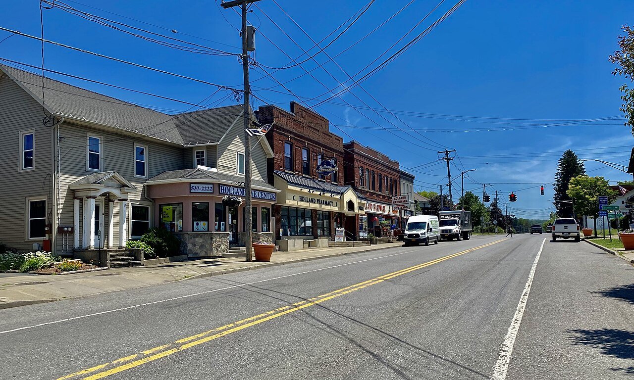
The story
Read it all →How Holland came to be
From Wikipedia’s history of Holland.
The town was first settled along its northern border, then called "Humphrey Valley", in 1807.
Text from Wikipedia, licensed CC BY-SA 4.0.
Each edition grades its towns against each other only.
More historic than 63% of U.S. towns · #584 of 758 in New York. What drives it
Below: 3 old photos and papers, maps from 1894 on, and the census since 1820.
Holland dates its founding to 1807 (Wikipedia’s history). The census first counted it in 1820.
More historic than 63% of U.S. towns, on its age, its old homes and the National Register.
On its age, its old homes and the National Register, Holland is more historic than 63% of U.S. towns, #584 of 758 in New York. Its share of homes from before 1940 holds the grade up; its National Register listings pull it down.
New York towns list more on the Register than most of the country (a typical New York town has 12.3 per 10,000 residents, the U.S. 2.4), so Holland’s 0.0 sits below most of its state (10% of New York towns have fewer) while its 0 listings outnumber those of 23% of U.S. towns.
Founding year: Wikipedia (other dates in Quick answers). Homes: Census ACS 2020–24. National Register: National Park Service, May 2026 list; each listing counted once (boundary changes and added documentation belong to their listing), and a historic district counts its contributing buildings. How TownRatings grades history →
Read from the archive, the National Register and the record. The page puts what stands out first.
The first neighbors to add old photos shape how Holland’s history is told.
Fire insurance maps drew every building, what it was made of and what it was used for, so insurers could price the risk of fire. Pick a year, then a sheet.
 1894Sheet 1 of 2
Sanborn Map Company, via the Library of Congress. Editions published in 1930 or earlier, which are in the public domain.
Woven from the archive, old maps, post office records, the National Register and the people born here.
 Born hereJames M. Humphrey is born here
 In the archiveA. C. Osborn.; Res. of A. C. Osborn, Holland, N.Y.; Planing Mill and Residence of Horace …
 On the mapFirst mapped by the U.S. Geological Survey
From Wikipedia’s history of Holland.
The town was first settled along its northern border, then called "Humphrey Valley", in 1807.
Text from Wikipedia, licensed CC BY-SA 4.0.
Passages that mention Holland, cut from the printed page as they were published.

illegal Trade in Dehnvar River, and to the Eastward that is in this Port, whereby the Merchants in those parts are able to undersell them, and they loose their Trade, and that this place will be impoverished, wliile the others grow Rich. — I have lately observed that one method taken to cover and conceal Illicit Trade from Holland (the most injurious to great Brittain of all in America) is by ships from Holland taking in a double Cargo, one part of which is entered and the duties paid in Brittain, the other part is pretended to be for some foreign Port and is accordingly Reported in the Ports of great Brittain ; and I am told that whole Cargoes have been thus carried into some of the New
Text read by machine from the scan; it may contain errors.
The Puritan of England followed, but after a considerable interval, his prototype in Holland. He borrowed from Holland many of the ideas and institutions which he attempted to introduce into England, and with which he succeeded in the United States. Although in each country he was the product of the Reformation, it was the Reformation engrafted on the past. It is therefore to their respective pasts that we must look if we would
Text read by machine from the scan; it may contain errors.
or foreign alliances, questions in which they were particularly interested, and as to which their support would be essential to the sovereign. Thus the treaty which the Count of Holland made with Edward I, of England in 1281 was guaranteed by the towns. Shortly afterwards, the towns of Holland, large and small, are seen sending their deputies to the assembly of the states, to consider questions of taxation ; but by th-e fif-
Text read by machine from the scan; it may contain errors.
the King's Officers in my Province to seize any goods they could find any Body attempting to introduce into my Government; I beleive some small seizures was made in Connecticut upon it, but much more in the Province of New York. Another method the Importers take is to stop at some of the Out ports of Britain (in their outward bound passage from Holland) and make a report and enter only half of their cargo, by which the King is defrauded of his Duty on the other half; In short My Lords, if some effectual means are not used, the greatest part of the commerce of the American Colonies will be withdrawn from the Mother Country, and be carryed to Holland.
Text read by machine from the scan; it may contain errors.Scans and text from the Internet Archive. Books published in 1930 or earlier, which are in the public domain.
One decade in the archive so far: the 1880s. Scroll each row; tap a photo for its story.
 2011FLT CT6 7.8a mi - 12 steps of 2 2x6x24s, 2x10 sides, …
 2011FLT CT6 7.8 mi - 5 double 4x4x30 steps
 2011FLT CT6 7.6a mi - 27 double 4x4x30 steps
 2011FLT CT6 7.6 mi - S side, 27 double 4x4x30 steps - 4 r…
 2011FLT CT6 7.6 mi - N side, 7 rock steps
 2011FLT CT6 7.0 mi - Puncheon over stream, 2x4x40 deck, 4…
 2011FLT CT6 6.3 mi - 2x10s on 4.4 sills, 12' long
 2011FLT CT6 6.2 mi - Puncheon, 2 1x6s on 4x4 sills, 8' lo…
 2011FLT CT6 6.1 mi - Puncheon, 2 1x6s on 4x4 sills, 8' lo…
 2011FLT CT6 6.0 mi - Puncheons, 2 1x6s on 1x6 sills, 33' …
 2011FLT CT6 4.5 mi - Bridge over ditch next to Warners Gu…
 2011FLT CT6 14.5 mi - S side, 4 long side supported switc…
 2011FLT CT6 14.5 mi - N side, 29 steps 4x4x24s, many side…
 2011FLT CT6 14.4 mi - 11 single 4x4 steps shown - 4 more
 2011FLT CT6 14.3 mi - Bridge, 2x4x32 deck, 10' long, 2 2x…
 2011FLT CT6 14.2 mi - Puncheon, 2 2x6x8', 2x6 sills, sand…
 2011FLT CT6 14.1 mi - Puncheon, 2x4x32 deck, 12' long, 2 …
 2011FLT CT6 13.2a mi - Art^ Olga Rosche sign
 2011FLT CT6 13.2 mi - Steel puncheon, 22 in wide and 13' …
 2011FLT CT6 13.1 mi - Two signs, Mabel James section and …
 2011FLT CT6 12.2 mi - Bridge, 2x4x32 deck, 12' long, 2 2x…
 2011FLT CT6 11.3a mi - 3 log steps
 2011FLT CT6 11.3 mi - 5 log steps
 2011FLT CT6 10.9 mi - 12 log steps
 2011FLT CT6 10.7 mi - Bridge, 2x4x32 deck, 16' long, 2 2x…
 2011FLT CT6 10.4 mi - Puncheon, 3 4x12 planks 8.5' long
 2006Erie-Holland
Every edition of the U.S. Geological Survey’s map of Holland. Tap a year, or press play to watch the town change.

U.S. Geological Survey historical topographic maps (public domain), via Esri’s collection of the scans. The red ring marks the center of Holland.
No then-and-now pairs yet. Take a photo from the same spot as an old one and they appear here side by side.

Find the spot, match the angle, and add your photo. It becomes the first then-and-now pair on Holland’s page.
Retake this view · +15Between 768 and 3,603 people in every census since 1820.
21 censuses, 1820–2020.
U.S. Census Bureau decennial counts, from the census table on Holland’s Wikipedia page.
Writers, athletes, leaders and more, ranked by how widely they’re known.
Holland’s post office has been open since 1822. Another post office, Protection, opened and closed inside today’s town.
US Post Offices dataset (Blevins & Helbock, CC0). Places and cemeteries from the USGS Geographic Names Information System (2021).
Each neighbor’s History grade, on the same three inputs.
In 1807, according to Wikipedia’s history of the town. Holland’s post office opened in 1822, and the census of 1820 counted 768 people here.
Holland is more historic than 63% of U.S. towns, #584 of 758 in New York. The History grade combines the town’s founding era, the share of homes built before 1940 and its National Register listings. It’s a character grade, so it isn’t part of the overall grade. How it works.
26% of Holland’s homes were built before 1940 (Census estimate, ±7.3 points), against a typical 27% for a New York town; the median home was built in 1969.
What the archives can’t tell you, neighbors can.
Founding dates: Wikidata, Wikipedia, the U.S. post office records of Blevins & Helbock (CC0) and the Census. Homes by year built: Census ACS 2020–24. National Register of Historic Places: National Park Service (list of May 22, 2026). Old photos, postcards and papers: Wikimedia Commons, the Library of Congress and other public archives, credited on each item’s page. Maps: U.S. Geological Survey historical topographic maps (via Esri) and Sanborn fire-insurance maps (Library of Congress). History text and census tables: Wikipedia (CC BY-SA 4.0). Places that used to be: USGS Geographic Names Information System (2021).
From Wikimedia Commons (30), Wikipedia, Wikidata and Wikipedia for famous people, U.S. Geological Survey historical maps, U.S. Census counts (via Wikipedia), the US Post Offices dataset (Blevins & Helbock), the USGS Geographic Names Information System, Sanborn fire insurance maps (Library of Congress) and old county and town histories (Internet Archive). Archive images are copied here with their credits and licenses, shown on each photo’s page. Refreshed monthly.
 1880
 1880

