Founding year: the first Buchanan post office (Blevins & Helbock, CC0). Wikidata: 1928.
History grade
What drives Buchanan’s History grade
On its age, its old homes and the National Register, Buchanan is more historic than 41% of U.S. towns, #702 of 758 in New York. Its share of homes from before 1940 holds the grade up; its National Register listings pull it down.
C+
HistoryA character grade: shown, never part of Buchanan’s overall grade.
New York towns list more on the Register than most of the country (a typical New York town has 12.3 per 10,000 residents, the U.S. 2.4), so Buchanan’s 0.0 sits below most of its state (10% of New York towns have fewer) while its 0 listings outnumber those of 23% of U.S. towns.
How sure. Graded on any two of the three inputs instead, the letter would range from D to B. The pre-1940 share is a Census survey estimate (±7.1 points). The founding year is the first post office, not a stated founding date; Wikidata gives 1928.
Founding year: the first post office (other dates in Quick answers). Homes: Census ACS 2020–24. National Register: National Park Service, May 2026 list; each listing counted once (boundary changes and added documentation belong to their listing), and a historic district counts its contributing buildings. How TownRatings grades history →
What stands out about Buchanan’s past
Read from the archive, the National Register and the record. The page puts what stands out first.
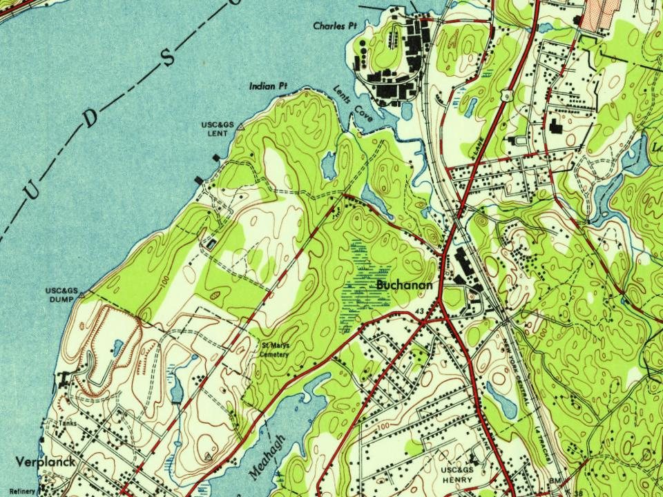
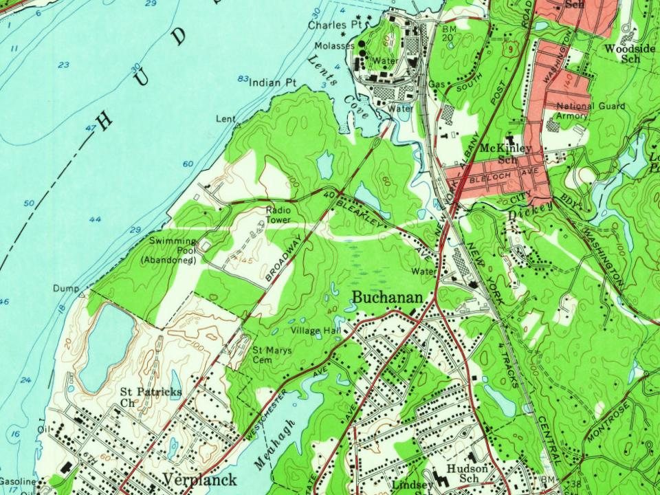
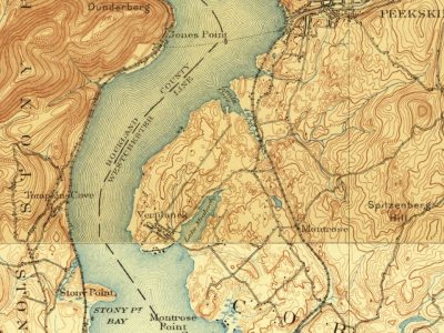
Every edition of the U.S. Geological Survey’s map of Buchanan. Tap a year, or press play to watch the town change.
1892West Point sheet · 1:62,500
U.S. Geological Survey historical topographic maps (public domain), via Esri’s collection of the scans. The red ring marks the center of Buchanan.
The story so far
Buchanan, in brief
Wikipedia doesn’t have a history of Buchanan yet. The photos, dates and memories neighbors add here are how it gets written.
Buchanan is a village located in the town of Cortlandt in Westchester County, New York, United States. The population was 2,302 as of the 2020 census. The now decommissioned Indian Point nuclear power facility is located in Buchanan. The 2000 Rockefeller Center Christmas tree also came from Buchanan. The 80-foot tall Norway spruce was donated by Bill and Frances Heady. Bill Heady planted the tree in 1950.
Its first post office opened in 1890. Between the 2010 and 2020 censuses its population grew from 2,230 to 2,302 (+3%).
Intro from Wikipedia. Population: U.S. Census Bureau.
From the old history books
What they wrote about Buchanan, 1893–1914
Passages that mention Buchanan, cut from the printed page as they were published.
History of Buchanan County, Iowa, and its people1914 · page 432Read the page →
Read the text
ward to the vicinity of Rockford, Illinois, where he worked at his trade and also became actively identified with the sheep industry, driving sheep overland, as there were then no railroads in that part of the country. On the 13th of September, 1852, he came to Buchanan county and purchased land in Hazleton township, which his sons cultivated. They were pioneers in raising shorthorn cattle and Chester White hogs and were extensively engaged in shipping hogs which were used for breeding purposes. Adam ^liller was a resident of Buchanan county at the time of his death. He served as a drum major in the War of 1812, going
Text read by machine from the scan; it may contain errors.
Portrait and biographical record of Buchanan and Clinton counties, Missouri1893 · page 336Read the page →
Read the text
As above stated, Mr. Boone came to Buchanan County for the purpose of making a permanent settlement in the fall of 1843. Upon the farm that he pre-empted he remained until 1868, devoting his attention to its cultivation and bringing it to a high state of improvement. Later he embarked in the milling business, and ten years afterward, in 1878, he formed his present partnership
Text read by machine from the scan; it may contain errors.
Portrait and biographical record of Buchanan and Clinton counties, Missouri1893 · page 600Read the page →
Read the text
In 1872, he of whom we write came to Buchanan County, where he taught school for a time and then hired out to work on a farm, lie was very industrious and economical and soon laid by a Sufficient sum to enable him to launch out in business for himself, and for the past ten years be has been engaged, in addition to farming, in buying and shipping grain from Kails Station. Kenmoor, De Kalb
Text read by machine from the scan; it may contain errors.
Scans and text from the Internet Archive. Books published in 1930 or earlier, which are in the public domain.
Timeline
Buchanan, 1892 to 1976
Woven from the archive, old maps, post office records, the National Register and the people born here.
Nothing in the archives for these yearsWeddings on Main Street, storms, parades, school pictures, the old store. If it’s in your family album, it belongs here.
The Buchanan post office opened in 1890, the earliest record of the town by name (U.S. post office records). Wikidata gives 1928.
How does Buchanan rank for history?
Buchanan is more historic than 41% of U.S. towns, #702 of 758 in New York. The History grade combines the town’s founding era, the share of homes built before 1940 and its National Register listings. It’s a character grade, so it isn’t part of the overall grade. How it works.
How old are the homes in Buchanan?
26% of Buchanan’s homes were built before 1940 (Census estimate, ±7.1 points), against a typical 27% for a New York town; the median home was built in 1959.
Founding dates: Wikidata, Wikipedia, the U.S. post office records of Blevins & Helbock (CC0) and the Census. Homes by year built: Census ACS 2020–24. National Register of Historic Places: National Park Service (list of May 22, 2026). Old photos, postcards and papers: Wikimedia Commons, the Library of Congress and other public archives, credited on each item’s page. Maps: U.S. Geological Survey historical topographic maps (via Esri) and Sanborn fire-insurance maps (Library of Congress). History text and census tables: Wikipedia (CC BY-SA 4.0). Places that used to be: USGS Geographic Names Information System (2021).
From Wikimedia Commons (7), Wikidata and Wikipedia for famous people, U.S. Geological Survey historical maps, U.S. Census counts (via Wikipedia) and old county and town histories (Internet Archive). Archive images are copied here with their credits and licenses, shown on each photo’s page. Refreshed monthly.





 1976
 1976
 2026
 2026
 2026
 2026
