Philipstown dates to 1715, and 29% of its homes were built before 1940
More historic than 98% of U.S. towns · #55 of 758 in New York. What drives it
39 places in town are on the National Register, among them the Manitoga, a National Historic Landmark, and eight historic districts with 306 buildings between them. Below: 2 old photos and papers, maps from 1892 on, and the census since 1820.
Founding year: Wikipedia. First post office: 1826.The full story ↓
History grade
What drives Philipstown’s History grade
On its age, its old homes and the National Register, Philipstown is more historic than 98% of U.S. towns, #55 of 758 in New York. All 2 inputs are above most U.S. towns; its National Register listings ranks highest and its share of homes from before 1940 lowest.
A+
HistoryA character grade: shown, never part of Philipstown’s overall grade.
New York towns list more on the Register than most of the country (a typical New York town has 12.3 per 10,000 residents, the U.S. 2.4), so Philipstown’s 403 sits above most of its state (89% of New York towns have fewer) while its 398 historic buildings outnumber those of 96% of U.S. towns.
NoteThe founding year comes from Wikipedia alone; no second source gives 1715.
How sure. Graded on two of the three inputs, so a change in either one moves the letter more than it would with three. The pre-1940 share is a Census survey estimate (±3.5 points).
Founding year: Wikipedia (other dates in Quick answers). Homes: Census ACS 2020–24. National Register: National Park Service, May 2026 list; each listing counted once (boundary changes and added documentation belong to their listing), and a historic district counts its contributing buildings. How TownRatings grades history →
What stands out about Philipstown’s past
Read from the archive, the National Register and the record. The page puts what stands out first.
National Park Service, National Register of Historic Places. Photos from Wikimedia Commons, credited on each place’s page.
Places that used to be
Lost post offices, old corners, places now gone and burying grounds
Philipstown had its own post office from 1829 to 1829. Three other post offices opened and closed inside today’s town.
Cold Spring
1826–today
Garrison
1829–today
Philipstown
1829–1829
Highlands Station
1874–1908
Nelsonville
1888–1960
Manitou
1908–1924
18201920today
Hamlets and corners on the map
Brookside Senior Citizen CooperativeCold SpringCold Spring Mobile Home ParkContinental VillageForsonvilleGarrisonGlenclyffeGraymoorManitouMcKeel CornersNelson CornersNelsonvilleNorth HighlandSouth Highland
Gone or out of use
West Point Foundrylocale
5cemeteries and burying grounds inside Philipstown
Cold SpringFriars Cemetery at GraymoorNelsonvilleNorth HighlandOld Cold Spring
US Post Offices dataset (Blevins & Helbock, CC0). Places and cemeteries from the USGS Geographic Names Information System (2021).
In 1697 Adolphus Philipse, a wealthy Province of New York landowner and merchant, purchased a tract from Dutch traders which received British Royal sanction as the Highland Patent. Comprising roughly 250 square miles, it extended approximately 13 miles along the eastern shore of the Hudson River, from Annsville Creek to the Fishkill Creek, and eastward some 20 or so miles to the border of the Colony of Connecticut.
Passages that mention Philipstown, cut from the printed page as they were published.
History of Putnam County, New York1886 · page 139Read the page →
Read the text
The Philipstown Turnpike Comi^any was incorporated bv an act passed April 14th, 1815. By this act, Samuel Gouverneur, Amos Belden, David Knapp, Samuel Townsend, John Haight and others were incorporated as a company, "for the purpose of making a good and sufBcient road from Cold Spring landing, in the town of Philipstown, and running from thence' the most direct and common route, in a northeasterly direction, by way of the ore bed, Milltown', Abel Peak's tavern*, and Joseph
Text read by machine from the scan; it may contain errors.
History of Putnam County, New York1886 · page 715Read the page →
Read the text
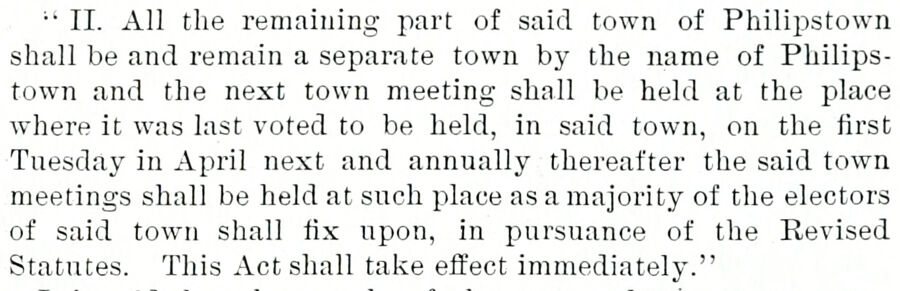
" II. All the remaining jiart of said town of Philipstown shall be and remain a separate town by the name of Philipstown and the next town meeting shall be held at the place where it was last voted to be held, in said town, on the first Tuesday in April next and annually thereafter the said town meetings shall be held at such place as a majority of the electors of said town shall fix upon, in pursuance of the Revised Statutes. This Act shall take effect immediately."
Text read by machine from the scan; it may contain errors.
part of October, 1777, after forts Clinton and Montgomery had been taken by Sir Henry Clinton. John Meeks was the first settler at this place. The first grist-mill in Philipstown was built at this place by Col. Beverly Robinson, about 1702, and stood a few rods east of where the paper-mill now stands, on the same stream. He also erected a saw-mill and fullingmill there. Gallows Hill lies to the south of it, in
Text read by machine from the scan; it may contain errors.
Scans and text from the Internet Archive. Books published in 1930 or earlier, which are in the public domain.
Timeline
Philipstown, 1715 to 2020
Woven from the archive, old maps, post office records, the National Register and the people born here.
In 1715, according to Wikipedia’s history of the town. Philipstown’s post office opened in 1826, and the census of 1820 counted 3,733 people here.
How does Philipstown rank for history?
Philipstown is more historic than 98% of U.S. towns, #55 of 758 in New York. The History grade combines the town’s founding era, the share of homes built before 1940 and its National Register listings. It’s a character grade, so it isn’t part of the overall grade. How it works.
What is on the National Register in Philipstown?
39 listings: 30 buildings, 8 historic districts with 306 contributing buildings, and 1 structure. 398 historic buildings in all.
How old are the homes in Philipstown?
29% of Philipstown’s homes were built before 1940 (Census estimate, ±3.5 points), against a typical 27% for a New York town; the median home was built in 1963.
Founding dates: Wikidata, Wikipedia, the U.S. post office records of Blevins & Helbock (CC0) and the Census. Homes by year built: Census ACS 2020–24. National Register of Historic Places: National Park Service (list of May 22, 2026). Old photos, postcards and papers: Wikimedia Commons, the Library of Congress and other public archives, credited on each item’s page. Maps: U.S. Geological Survey historical topographic maps (via Esri) and Sanborn fire-insurance maps (Library of Congress). History text and census tables: Wikipedia (CC BY-SA 4.0). Places that used to be: USGS Geographic Names Information System (2021).
From Wikimedia Commons (10), Wikidata (2), the National Register of Historic Places (39), Wikipedia, Wikidata and Wikipedia for famous people, U.S. Geological Survey historical maps, U.S. Census counts (via Wikipedia), the US Post Offices dataset (Blevins & Helbock), the USGS Geographic Names Information System and old county and town histories (Internet Archive). Archive images are copied here with their credits and licenses, shown on each photo’s page. Refreshed monthly.

 ★ Landmark


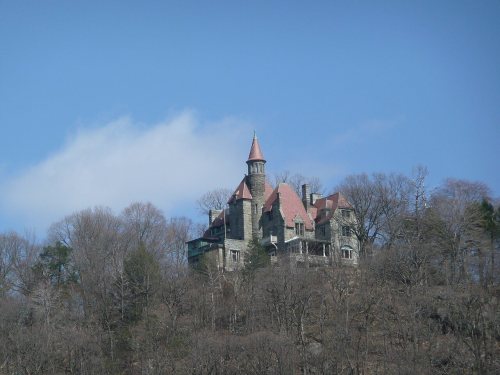




 2010
 2009
 2009
 2009
 2007
 2006
 2006
 2005


