Sterling’s post office opened in 1816, and 41% of its homes were built before 1940
More historic than 88% of U.S. towns · #304 of 758 in New York. What drives it
Its Register listings are the Sterling District No. 5 Schoolhouse, the Sterling Grist Mill Complex and the Cottage Farm. Below: 2 old photos and papers, maps from 1900 on, and the census since 1820.
The Sterling post office opened in 1816, the earliest record of the town by name. Six smaller post offices, North Sterling (1839), North Victory (1861) and Sterling Valley (1862), opened inside today’s town and later closed.
First census: 792 in 18202020 census: 3,221210 years
How historic is Sterling?
A
More historic than 88% of U.S. towns, on its age, its old homes and the National Register.
Founding year: the first Sterling post office (Blevins & Helbock, CC0).The full story ↓
History grade
What drives Sterling’s History grade
On its age, its old homes and the National Register, Sterling is more historic than 88% of U.S. towns, #304 of 758 in New York. All 3 inputs are above most U.S. towns; its share of homes from before 1940 ranks highest and its National Register listings lowest.
A
HistoryA character grade: shown, never part of Sterling’s overall grade.
New York towns list more on the Register than most of the country (a typical New York town has 12.3 per 10,000 residents, the U.S. 2.4), so Sterling’s 9.4 sits near the middle of its state (44% of New York towns have fewer) while its 3 listings outnumber those of 65% of U.S. towns.
How sure. Graded on any two of the three inputs instead, the letter would range from B+ to A. The pre-1940 share is a Census survey estimate (±7.9 points). The founding year is the first post office, not a stated founding date.
Founding year: the first post office (other dates in Quick answers). Homes: Census ACS 2020–24. National Register: National Park Service, May 2026 list; each listing counted once (boundary changes and added documentation belong to their listing), and a historic district counts its contributing buildings. How TownRatings grades history →
What stands out about Sterling’s past
Read from the archive, the National Register and the record. The page puts what stands out first.
Lost post offices, old corners, places now gone and burying grounds
Sterling’s post office has been open since 1816. Six other post offices opened and closed inside today’s town.
Sterling
1816–today
Martville
1831–today
North Sterling
1839–1903
Fair Haven
1852–today
North Victory
1861–1903
Sterling Valley
1862–1914
Sterling Station
1874–1948
North Fair Haven
1883–1933
Crockett
1898–1915
18101920today
Hamlets and corners on the map
CrockettsFair HavenFintches CornersGrant's Vacation Park Recreational Vehicle and Mobile Home ParkMartvilleMoon BeachNorth Fair HavenNorth SterlingNorth VictorySterling Valley
Gone or out of use
School Number 10schoolSchool Number 11schoolSchool Number 12schoolSchool Number 15schoolSchool Number 16schoolSchool Number 17schoolSchool Number 18schoolSchool Number 2schoolSchool Number 4schoolSchool Number 6schoolSchool Number 9school
4cemeteries and burying grounds inside Sterling
ForscuttMartvilleOveracreSpringbrook
US Post Offices dataset (Blevins & Helbock, CC0). Places and cemeteries from the USGS Geographic Names Information System (2021).
Help out
Start Sterling’s collection
The first neighbors to add old photos shape how Sterling’s history is told.
Decades since 1900 with photos
00s10s20s30s40s50s60s70s80s90s
1 of 10 decades. The empty ones are waiting for someone’s album.
The region was formerly part of the territory of the Onondaga, one of the original Five Nations of the Iroquois Confederacy. However, as allies of the British, who were defeated, they were forced to cede most of their lands in New York to the state after the Revolutionary War. This land was made part of the Central New York Military Tract, which was divided and granted as pay to veteran soldiers of the Revolution.
The first European-American settler, Pierre Dumas (also recorded as Peter DeMass), arrived in 1805. The Town of Sterling was formed in 1812 from the Town of Cato.
Passages that mention Sterling, cut from the printed page as they were published.
History of Cayuga County, New York1879 · page 254Read the page →
Read the text
Sterling Center, (Sterling p. o.,) is situated on Little Sodus Creek, in the central part of the town, and is two miles north-east of Sterling Junction, and one mile east of Sterling Valley station on the L. O. S. R. R. It has a population of 237, and contains three churches, (Baptist, M. E. and Reformed Presb.,) a union school, three stores, one hotel, one grist-mill, one tan-
Text read by machine from the scan; it may contain errors.
History of Cayuga County, New York1879 · page 37Read the page →
Read the text
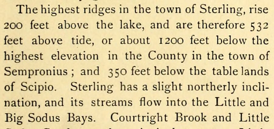
The highest ridges in the town of Sterling, rise 200 feet above the lake, and are therefore 532 feet above tide, or about 1200 feet below the highest elevation in the County in the town of Sempronius ; and 350 feet below the tablelands of Scipio. Sterling has a slight northerly inclination, and its streams flow into the Little and Big Sodus Bays. Courtright Brook and Little
Text read by machine from the scan; it may contain errors.
History of Cayuga County, New York1908 · page 442Read the page →
Read the text
Sodus Creek. It contains two churches, a district school, a hotel, two stores, a sawmill, a grist mill and sawmill combined, shoe shops, wagon shops, and blacksmith shops, and about one hundred and fifty inhabitants. Sterling Junction, North Sterling, and Sterling Valley station are small hamlets. SUMMER HILL.
Text read by machine from the scan; it may contain errors.
History of Cayuga County, New York1908 · page 441Read the page →
Read the text
Sterling Centre is situated on Little Sodus Creek, in the central part of the town, and is two miles northeast of Sterling Junction, and one mile east of Sterling Valley station. It has a population of about three hundred and contains three churches, a union
Text read by machine from the scan; it may contain errors.
Scans and text from the Internet Archive. Books published in 1930 or earlier, which are in the public domain.
Timeline
Sterling, 1783 to 1920
Woven from the archive, old maps, post office records, the National Register and the people born here.
Nothing in the archives for these yearsWeddings on Main Street, storms, parades, school pictures, the old store. If it’s in your family album, it belongs here.
The Sterling post office opened in 1816, the earliest record of the town by name (U.S. post office records).
How does Sterling rank for history?
Sterling is more historic than 88% of U.S. towns, #304 of 758 in New York. The History grade combines the town’s founding era, the share of homes built before 1940 and its National Register listings. It’s a character grade, so it isn’t part of the overall grade. How it works.
What is on the National Register in Sterling?
Three places: the Sterling District No. 5 Schoolhouse (listed 2002), the Sterling Grist Mill Complex (2002) and the Cottage Farm (2012).
How old are the homes in Sterling?
41% of Sterling’s homes were built before 1940 (Census estimate, ±7.9 points), against a typical 27% for a New York town; the median home was built in 1953.
Founding dates: Wikidata, Wikipedia, the U.S. post office records of Blevins & Helbock (CC0) and the Census. Homes by year built: Census ACS 2020–24. National Register of Historic Places: National Park Service (list of May 22, 2026). Old photos, postcards and papers: Wikimedia Commons, the Library of Congress and other public archives, credited on each item’s page. Maps: U.S. Geological Survey historical topographic maps (via Esri) and Sanborn fire-insurance maps (Library of Congress). History text and census tables: Wikipedia (CC BY-SA 4.0). Places that used to be: USGS Geographic Names Information System (2021).
From Wikimedia Commons (5), the National Register of Historic Places (3), Wikipedia, Wikidata and Wikipedia for famous people, U.S. Geological Survey historical maps, U.S. Census counts (via Wikipedia), the US Post Offices dataset (Blevins & Helbock), the USGS Geographic Names Information System and old county and town histories (Internet Archive). Archive images are copied here with their credits and licenses, shown on each photo’s page. Refreshed monthly.




 1904
 2022
 2016
 2016
