The village was permanently settled circa 1811 and was originally called "Jacksonville" after Andrew Jackson. The name was changed to "Red Creek" in approximately 1836.
The name change was attributed to the creek which passes through its entirety. Originally, Big Red and Little Red Creeks were believed to be named from the waters color, which was tainted from passing over iron ore that richly runs throughout the water bed.
Local lore explains the origin of the name Red Creek. At one time, a tannery occupied the spot on the north side of the falls. As part of the tanning process, dye was used to tan skins. Dye was disposed of in the pond which then flowed over the dam's falls, discoloring it red.
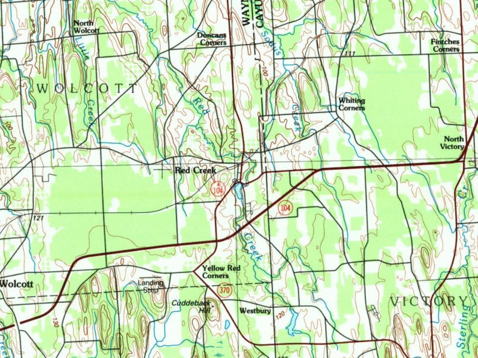
Every edition of the U.S. Geological Survey’s map of Red Creek. Tap a year, or press play to watch the town change.
1943Red Creek sheet · 1:31,680
U.S. Geological Survey historical topographic maps (public domain), via Esri’s collection of the scans. The red ring marks the center of Red Creek.
Every building
Red Creek, building by building, 1911–1917
Fire insurance maps drew every building, what it was made of and what it was used for, so insurers could price the risk of fire. Pick a year, then a sheet.
Founding dates: Wikidata, Wikipedia, the U.S. post office records of Blevins & Helbock (CC0) and the Census. Homes by year built: Census ACS 2020–24. National Register of Historic Places: National Park Service (list of May 22, 2026). Old photos, postcards and papers: Wikimedia Commons, the Library of Congress and other public archives, credited on each item’s page. Maps: U.S. Geological Survey historical topographic maps (via Esri) and Sanborn fire-insurance maps (Library of Congress). History text and census tables: Wikipedia (CC BY-SA 4.0). Places that used to be: USGS Geographic Names Information System (2021). How TownRatings grades history →
From Wikimedia Commons (1), Wikipedia, Wikidata and Wikipedia for famous people, U.S. Geological Survey historical maps, U.S. Census counts (via Wikipedia) and Sanborn fire insurance maps (Library of Congress). Archive images are copied here with their credits and licenses, shown on each photo’s page. Refreshed monthly.