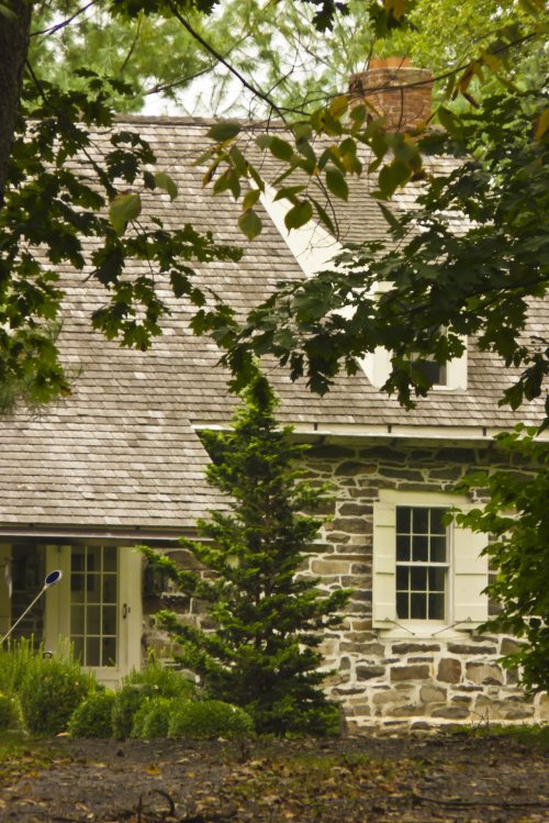
Rosendale dates to 1685, and 39% of its homes were built before 1940
More historic than 98% of U.S. towns · #61 of 758 in New York. What drives it
4 places in town are on the National Register, among them two historic districts with 22 buildings between them. Below: 6 old photos and papers, maps from 1887 on, and the census since 1850.
Founding year: Wikidata. First post office: 1827.The full story ↓
History grade
What drives Rosendale’s History grade
On its age, its old homes and the National Register, Rosendale is more historic than 98% of U.S. towns, #61 of 758 in New York. All 3 inputs are above most U.S. towns; its age ranks highest and its National Register listings lowest.
A+
HistoryA character grade: shown, never part of Rosendale’s overall grade.
New York towns list more on the Register than most of the country (a typical New York town has 12.3 per 10,000 residents, the U.S. 2.4), so Rosendale’s 43.5 sits above most of its state (67% of New York towns have fewer) while its 25 historic buildings outnumber those of 81% of U.S. towns.
NoteThe founding year comes from Wikidata alone; no second source gives 1685.
How sure. Graded on any two of the three inputs instead, the letter would range from A to A+. The pre-1940 share is a Census survey estimate (±6.7 points).
Founding year: Wikidata (other dates in Quick answers). Homes: Census ACS 2020–24. National Register: National Park Service, May 2026 list; each listing counted once (boundary changes and added documentation belong to their listing), and a historic district counts its contributing buildings. How TownRatings grades history →
What stands out about Rosendale’s past
Read from the archive, the National Register and the record. The page puts what stands out first.
Lost post offices, old corners, places now gone and burying grounds
Rosendale’s post office has been open since 1827. Four other post offices opened and closed inside today’s town.
Rosendale
1827–today
Creek Locks
1860–1954
Binnewater
1865–1953
Lefever Falls
1870–1912
Whiteport
1872–1909
Cottekill
1891–today
Bloomington
1897–today
Tillson
1898–today
18201920today
Hamlets and corners on the map
BinnewaterBloomingtonBrucevilleCottekillCreek Locks Mobile Home ParkCreeklocksHickorybushKallops CornersLawrencevilleLefever FallsMaple HillRivers Edge Cooperative Mobile Home ParkTillsonWashington Mobile Home ParkWhiteport
Gone or out of use
Creeklocks SchoolschoolDistrict School Number 5schoolHurley School Number 3schoolMaple Hill SchoolschoolRosendale Union Free SchoolschoolSaint Peter's SchoolschoolWhiteport Schoolschool
4cemeteries and burying grounds inside Rosendale
CoxingLefeverRosendale PlainsSaint Peters
US Post Offices dataset (Blevins & Helbock, CC0). Places and cemeteries from the USGS Geographic Names Information System (2021).
People over time
Rosendale, census by census
Lost two-thirds of its people between 1900 and 1920, then more than doubled.
18 censuses, 1850–2020.
U.S. Census Bureau decennial counts, from the census table on Rosendale’s Wikipedia page.
Timeline
Rosendale, 1685 to 2000
Woven from the archive, old maps, post office records, the National Register and the people born here.
At the time of the European settlement, the region was inhabited by the Lenapes, who were a member of the Algonquian peoples. The area which was eventually known as Rosendale is generally attributed to having been founded by Jacob Rutsen in 1680 from 600 acres purchased from the Lenapes straddling the Rondout Creek. Initially, the land was leased but Rutsen expanded his holdings and built a homestead, in which he resided from 1700 until his death in 1730. The Town of Rosendale was formed in 1844 from parts of the Towns of Hurley, Marbletown, and New Paltz.
Hamilton Child of Syracuse, New York published a "Gazetteer and Business Directory of Ulster County, N. Y." in 1872 that described the town.
Passages that mention Rosendale, cut from the printed page as they were published.
The history of Ulster County, New York1907 · page 479Read the page →
Read the text
The Friends’ Church at Butterville, in the town of New Paltz, was established in 1807, and in 1812 Friends’ meetings were organized at Rosendale Plains in the present town of Rosendale, and at Esopus, and in 1813 the Friends’ churches at Rosendale Plains and Esopus were erected.
Text read by machine from the scan; it may contain errors.
The history of Ulster County, New York1907 · page 355Read the page →
Read the text
In its early settlement the record of Rosendale is found in that of the three towns from which parts were taken for its creation. The names of a majority of its people can be recognized as being those families, who, in the early days, settled Hurley, Marbletown and New Paltz. The natural, and, in fact, the only logical inference, is, that the families whose names were originally recorded in those towns, and in later years appeared in Rosendale, had settled in those portions of the older organizations which were taken to form the new town of Rosendale. Reference
Text read by machine from the scan; it may contain errors.
History of Ulster County, New York, with illustrations and biographical sketches of its prominent men and pioneers1880Read the page →
Read the text
Second Action of Classis. — The committee appointed by the Classis of Ulster for the purpose of organizing a new Dutch Ilelormcd Church in Rosendale met in the Baptist church, in the village of Rosendale, on the 22d day of November, 1843. Present, Rev. Henry Ostrander, of Kaatsbaan ; Rev John H. Van Wagenen, of Kingston.
Text read by machine from the scan; it may contain errors.
History of Ulster County, New York, with illustrations and biographical sketches of its prominent men and pioneers1880Read the page →
Read the text
B. Gallagher, justice of the peace, and recorded May 20, 1869. The association have laid out a large cemetery near the village of Rosendale Plains. The grounds are level, of sandy soil, and considerable work has been done in laying out and beautifying them. Several very fine monuments have been erected.
Text read by machine from the scan; it may contain errors.
Scans and text from the Internet Archive. Books published in 1930 or earlier, which are in the public domain.
By decade
Rosendale, decade by decade
One decade in the archive so far: the 1870s. Scroll each row; tap a photo for its story.
Every edition of the U.S. Geological Survey’s map of Rosendale. Tap a year, or press play to watch the town change.
1901Rosendale sheet · 1:62,500
U.S. Geological Survey historical topographic maps (public domain), via Esri’s collection of the scans. The red ring marks the center of Rosendale.
Every building
Rosendale, building by building, 1887–1913
Fire insurance maps drew every building, what it was made of and what it was used for, so insurers could price the risk of fire. Pick a year, then a sheet.
In 1685, according to Wikidata. Rosendale’s post office opened in 1827, and the census of 1850 counted 2,418 people here.
How does Rosendale rank for history?
Rosendale is more historic than 98% of U.S. towns, #61 of 758 in New York. The History grade combines the town’s founding era, the share of homes built before 1940 and its National Register listings. It’s a character grade, so it isn’t part of the overall grade. How it works.
What is on the National Register in Rosendale?
4 listings: 2 buildings and 2 historic districts, the Binnewater Historic District and the Snyder Estate Natural Cement Historic District, with 22 contributing buildings. 25 historic buildings in all.
How old are the homes in Rosendale?
39% of Rosendale’s homes were built before 1940 (Census estimate, ±6.7 points), against a typical 27% for a New York town; the median home was built in 1955.
Founding dates: Wikidata, Wikipedia, the U.S. post office records of Blevins & Helbock (CC0) and the Census. Homes by year built: Census ACS 2020–24. National Register of Historic Places: National Park Service (list of May 22, 2026). Old photos, postcards and papers: Wikimedia Commons, the Library of Congress and other public archives, credited on each item’s page. Maps: U.S. Geological Survey historical topographic maps (via Esri) and Sanborn fire-insurance maps (Library of Congress). History text and census tables: Wikipedia (CC BY-SA 4.0). Places that used to be: USGS Geographic Names Information System (2021).
From Wikimedia Commons (6), the National Register of Historic Places (4), Wikipedia, U.S. Geological Survey historical maps, U.S. Census counts (via Wikipedia), the US Post Offices dataset (Blevins & Helbock), the USGS Geographic Names Information System, Sanborn fire insurance maps (Library of Congress) and old county and town histories (Internet Archive). Archive images are copied here with their credits and licenses, shown on each photo’s page. Refreshed monthly.


 c. 1870
 c. 1870
 c. 1870
 c. 1870
 c. 1870